
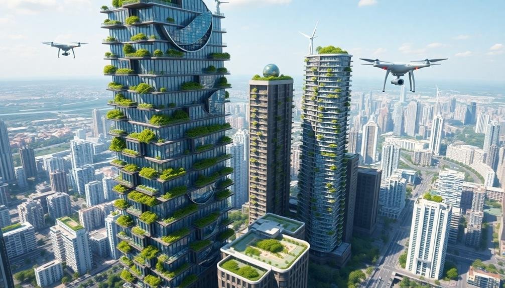
Drone technology is revolutionizing green building visualization, offering you a sky-high perspective that transforms sustainable design. You'll gain insights into site context, environmental impact, and energy efficiency through aerial imagery and thermal scans. Drones enable thorough site analysis, vegetation mapping, and solar panel optimization. They're essential for monitoring construction progress and showcasing completed projects. You can create immersive 3D models and time-lapse sequences to enhance client presentations and engagement. As drone applications in architecture continue to evolve, you'll have powerful tools for making informed design decisions and promoting sustainable practices. Discover how this aerial viewpoint can elevate your green building projects to new heights.
The Rise of Drone Architecture
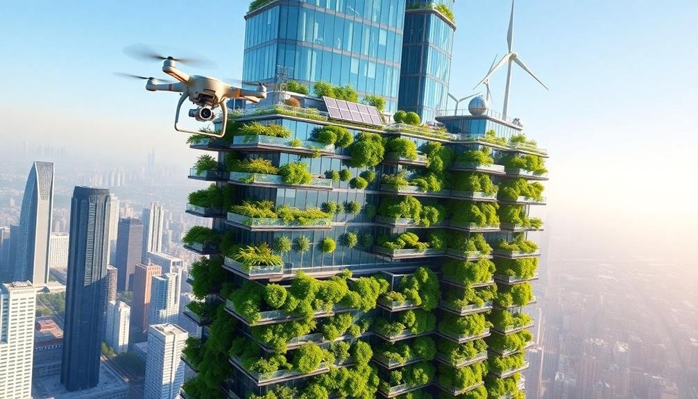
In recent years, drone technology has revolutionized architectural visualization and design. You'll find that drones offer unparalleled aerial perspectives, allowing you to capture stunning imagery and video of buildings and landscapes. These sky-high views provide invaluable insights into site context, environmental impact, and overall design aesthetics.
As an architect, you can now use drones to conduct site surveys more efficiently and accurately. You'll gather detailed topographical data, assess existing structures, and analyze surrounding vegetation with ease. This information helps you make informed decisions about building placement, orientation, and sustainable design features.
Drones also enable you to create immersive 3D models of your green building projects. By combining aerial imagery with photogrammetry software, you'll generate highly accurate digital twins of your designs. These models allow you to visualize and communicate your ideas more effectively to clients, stakeholders, and the public.
Moreover, you can use drones to monitor construction progress, inspect hard-to-reach areas, and assess the energy efficiency of completed buildings. This technology empowers you to guarantee that your green building designs are executed precisely and perform as intended throughout their lifecycle.
Aerial Perspectives in Green Design

You'll gain invaluable insights into green building design through aerial perspectives.
With drone technology, you can capture stunning views of rooftop gardens, assess urban heat island effects, and optimize solar panel placement.
These bird's-eye views offer a unique understanding of how your sustainable designs integrate with the surrounding environment, enhancing your ability to create eco-friendly urban spaces.
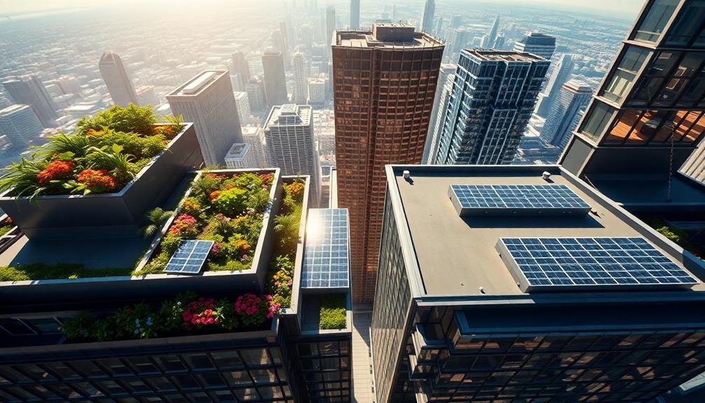
Drone-Captured Rooftop Gardens
How can architects gain a fresh perspective on green building design? Look to the skies. Drones offer an innovative way to capture and visualize rooftop gardens, providing a bird's-eye view that was previously difficult to obtain.
You'll find that drone technology allows you to survey large areas quickly and efficiently. With high-resolution cameras and 360-degree views, you can assess the layout, plant health, and overall integration of rooftop gardens into the building's design.
This aerial perspective helps you identify potential issues, such as drainage problems or uneven plant growth, that mightn't be apparent from ground level.
Drones also enable you to create stunning visual presentations for clients. You can showcase the full scope of a green roof project, demonstrating how it complements the surrounding urban landscape.
Time-lapse footage captured by drones can illustrate the garden's growth and seasonal changes, offering a dynamic representation of your sustainable design.
Moreover, you'll be able to monitor ongoing maintenance more effectively. Regular drone inspections can help you track the garden's progress, ensuring it continues to thrive and fulfill its eco-friendly purpose long after the initial design phase.
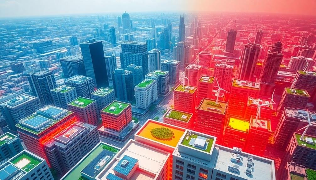
Urban Heat Island Mitigation
Soaring above cityscapes, architects can now visualize urban heat island mitigation strategies with unprecedented clarity.
You'll gain a bird's-eye view of heat-absorbing surfaces, allowing you to identify problem areas and plan effective solutions.
From this vantage point, you can assess the potential impact of green roofs, cool pavements, and urban forestry initiatives.
You'll spot opportunities to create interconnected green spaces that maximize cooling effects and improve air quality.
The aerial perspective helps you analyze building orientations and shadow patterns, enabling you to optimize natural cooling through strategic design.
You can also identify prime locations for reflective surfaces, such as light-colored roofs or walls, which bounce heat away from urban centers.
This view allows you to map out extensive cooling corridors throughout the city, integrating water features and vegetation to create a network of temperature-regulating spaces.
Solar Panel Placement Optimization
Aerial perspectives revolutionize solar panel placement enhancement for architects.
You'll gain invaluable insights into your building's solar potential by viewing it from above. Drone footage and 3D modeling software allow you to analyze roof angles, shading patterns, and surrounding structures that impact solar efficiency.
You can identify the most sun-exposed areas of your building's roof and facade, ensuring maximum energy generation. These bird's-eye views help you plan panel layouts that avoid obstructions like chimneys, vents, and HVAC units.
You'll also spot potential issues with nearby trees or neighboring buildings that could cast shadows on your panels.
By using aerial data, you're able to calculate the exact number of panels that'll fit on available surfaces and estimate energy output more accurately. This information guides your decisions on panel type, size, and orientation.
You can even simulate different panel arrangements to find the ideal configuration for your specific site.
Ultimately, aerial perspectives empower you to design more efficient and cost-effective solar systems, maximizing your building's renewable energy potential and reducing its carbon footprint.
Drones and Sustainable Site Analysis
You can leverage drones for thorough sustainable site analysis in green building projects.
With aerial land usage assessment, you'll gain valuable insights into the site's current conditions and potential for development.
Additionally, drones enable you to create detailed vegetation and biodiversity maps, and conduct thermal imaging surveys to identify energy efficiency opportunities before construction begins.
Aerial Land Usage Assessment
Drones have revolutionized the way architects assess land usage for sustainable site analysis. You can now gain an extensive aerial view of potential building sites, allowing for more accurate and efficient land use planning.
With drone technology, you're able to capture high-resolution images and create detailed 3D models of the terrain, vegetation, and existing structures.
These aerial assessments help you identify natural features like water bodies, slopes, and soil types that influence sustainable design decisions. You can easily spot areas prone to erosion, flooding, or other environmental risks.
Drones equipped with multispectral cameras enable you to analyze vegetation health, soil moisture, and thermal patterns, providing valuable data for green building strategies.
Vegetation and Biodiversity Mapping
Building on the aerial assessment capabilities, vegetation and biodiversity mapping takes sustainable site analysis to a new level. You'll gain invaluable insights into the existing ecosystem, helping you design buildings that harmonize with their surroundings.
By using drones equipped with multispectral cameras and advanced sensors, you can create detailed maps of plant species, habitats, and wildlife corridors.
These high-resolution maps will enable you to:
- Identify protected or endangered species habitats
- Assess the health and density of vegetation cover
- Locate potential green corridors for wildlife movement
- Determine areas suitable for green roofs or urban gardens
With this information, you'll make informed decisions about building placement, landscaping, and conservation efforts. You can minimize disruption to existing ecosystems and even enhance biodiversity through thoughtful design choices.
Thermal Imaging for Efficiency
With thermal imaging technology, drones elevate sustainable site analysis to new heights. You'll gain invaluable insights into your building's energy performance, identifying heat loss areas and inefficiencies that were previously invisible. These aerial thermal scans provide a thorough view of your structure's thermal envelope, allowing you to pinpoint specific areas for improvement.
You can use drone-captured thermal data to optimize insulation, HVAC systems, and window placement. This technology enables you to make data-driven decisions, greatly reducing energy consumption and improving overall building efficiency. You'll also be able to detect moisture issues and potential structural problems before they become costly repairs.
| Benefit | Impact | Emotion |
|---|---|---|
| Energy Savings | 20-30% reduction | Excitement |
| Problem Detection | Early intervention | Relief |
| Design Optimization | Enhanced performance | Confidence |
Capturing Eco-Friendly Building Elements

As architects embrace sustainable design, capturing eco-friendly building elements has become essential in green building visualization.
You'll need to effectively showcase these features to clients, stakeholders, and the public. By highlighting sustainable elements, you're not only demonstrating your commitment to the environment but also educating others about the benefits of green building practices.
To effectively capture eco-friendly building elements in your visualizations, consider the following techniques:
- Use color coding to emphasize sustainable features, such as green roofs, solar panels, or rainwater harvesting systems.
- Incorporate cutaway views to showcase internal eco-friendly systems like energy-efficient HVAC or recycled building materials.
- Create animated sequences that demonstrate how passive solar design or natural ventilation systems work throughout the day.
- Integrate infographics that quantify the environmental impact of specific green building elements.
Environmental Impact Assessment From Above
You'll gain valuable insights into a building's environmental performance through aerial energy efficiency analysis.
By examining structures from above, you can identify heat loss patterns, assess solar panel placement, and evaluate overall thermal performance.
Rooftop sustainability mapping allows you to visualize green roof systems, rainwater harvesting setups, and other eco-friendly features that contribute to a building's reduced environmental impact.
Aerial Energy Efficiency Analysis
Drones and satellite imagery have revolutionized how architects assess a building's energy efficiency from above. You can now gather essential data on thermal performance, solar potential, and overall energy consumption without ever setting foot on the property.
This aerial perspective offers an extensive view of a building's interaction with its environment, allowing you to make informed decisions about sustainable design strategies.
When conducting an aerial energy efficiency analysis, you'll focus on:
- Thermal imaging to identify heat loss areas
- Solar exposure mapping for ideal panel placement
- Vegetation cover assessment for natural cooling potential
- Roof reflectivity analysis to gauge heat absorption
Rooftop Sustainability Mapping
While aerial energy efficiency analysis provides valuable insights, rooftop sustainability mapping takes environmental assessment to the next level. This technique allows you to visualize and analyze various sustainability features on building rooftops from a bird's-eye view.
You'll be able to identify and assess green roofs, solar panel installations, rainwater harvesting systems, and other eco-friendly elements. By using high-resolution aerial imagery and advanced mapping software, you can create detailed sustainability maps that highlight the distribution and effectiveness of these features across multiple buildings or entire urban areas.
This mapping approach enables you to quantify the total area dedicated to sustainable practices, estimate potential energy generation from solar installations, and evaluate the impact of green roofs on urban heat island effects.
You'll also be able to identify missed opportunities for rooftop sustainability improvements and plan future green initiatives more effectively.
Sky-View Energy Efficiency Mapping
How can architects gain a thorough view of a building's energy efficiency from above? Sky-view energy efficiency mapping offers a detailed solution.
You'll use advanced thermal imaging and data visualization techniques to create a thorough, color-coded map of a building's energy performance from an aerial perspective.
This innovative approach allows you to:
- Identify heat loss hotspots in roofs and upper floors
- Detect inefficient HVAC systems and their impact on overall energy consumption
- Analyze the effectiveness of existing green roofs or solar panel installations
- Assess the potential for implementing new energy-saving features in underutilized spaces
By combining satellite imagery, drone footage, and 3D modeling software, you'll generate an accurate representation of a building's energy profile.
You can then use this data to make informed decisions about retrofitting existing structures or designing new, more efficient buildings.
Sky-view mapping also enables you to compare multiple buildings in an urban setting, identifying trends and patterns in energy usage across different architectural styles and construction periods.
This bird's-eye view of energy efficiency empowers you to create more sustainable, cost-effective designs that meet the growing demand for green buildings in modern cities.
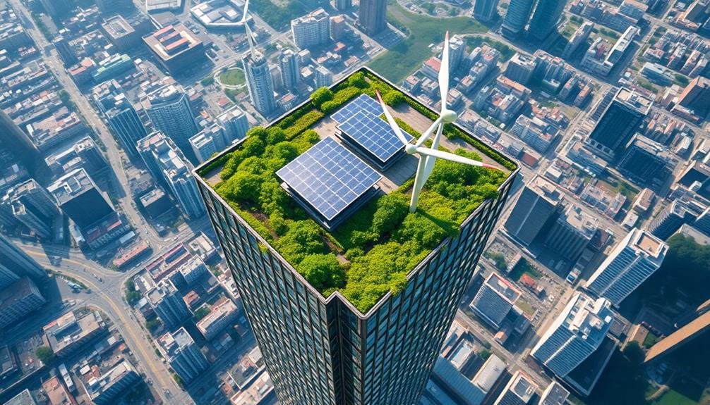
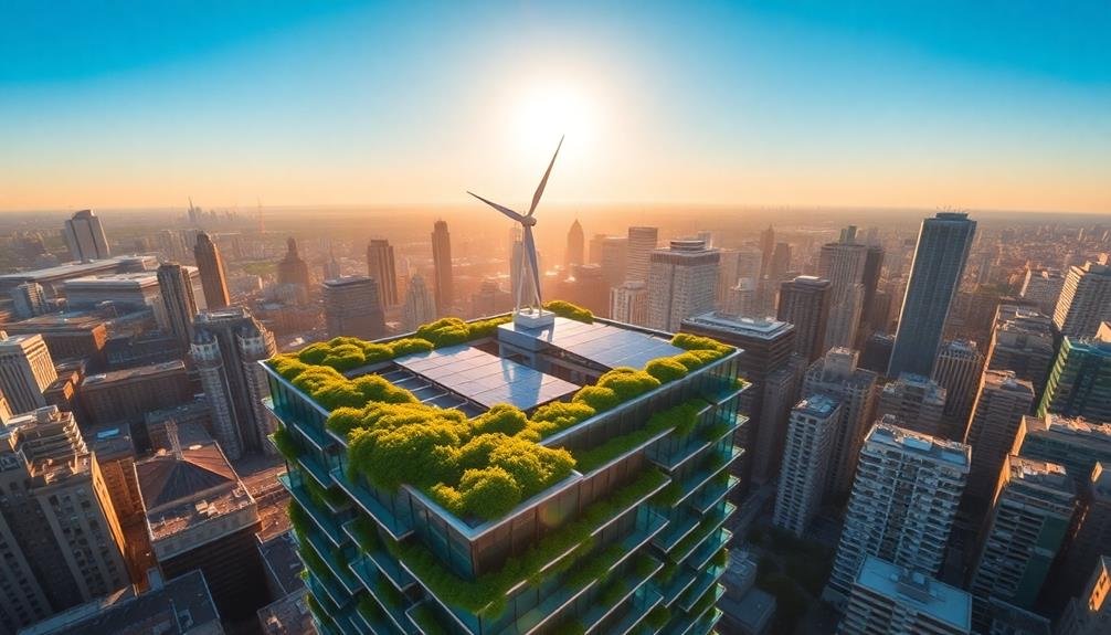
Rooftop Gardens and Solar Panels
Building on the insights gained from sky-view energy efficiency mapping, architects can take concrete steps to improve a structure's sustainability through rooftop gardens and solar panels.
You'll find that these additions not only enhance energy efficiency but also contribute to urban biodiversity and aesthetics.
When designing rooftop gardens, consider the weight-bearing capacity of the structure and incorporate proper waterproofing and drainage systems.
You can choose between intensive gardens with deep soil for larger plants or extensive gardens with shallow soil for smaller vegetation.
Don't forget to include native plant species to support local ecosystems.
For solar panels, you'll need to calculate the ideal angle and orientation to maximize energy production.
You can use specialized software to simulate sun paths and potential shading issues.
Consider integrating solar panels with the building's design, such as solar roof tiles or facade-integrated photovoltaics.
To visualize these elements effectively, use 3D modeling software to create detailed renderings.
You can showcase how rooftop gardens and solar panels blend with the overall building design and demonstrate their environmental benefits through infographics and energy production estimates.
Thermal Imaging for Green Buildings
Thermal imaging stands out as a powerful tool for architects in the domain of green building design. It allows you to visualize heat patterns and identify areas of energy inefficiency in buildings.
By using infrared cameras, you can detect temperature differences and pinpoint issues like poor insulation, air leaks, or thermal bridges. This technology enables you to make data-driven decisions to improve a building's energy performance and reduce its environmental impact.
When implementing thermal imaging in your green building projects, consider these key aspects:
- Timing: Conduct thermal scans during ideal conditions, such as early morning or evening, to maximize temperature differentials.
- Equipment: Invest in high-quality infrared cameras with appropriate resolution and sensitivity for accurate results.
- Analysis: Use specialized software to interpret thermal images and quantify energy losses.
- Integration: Incorporate thermal imaging data into your BIM models for thorough energy analysis.
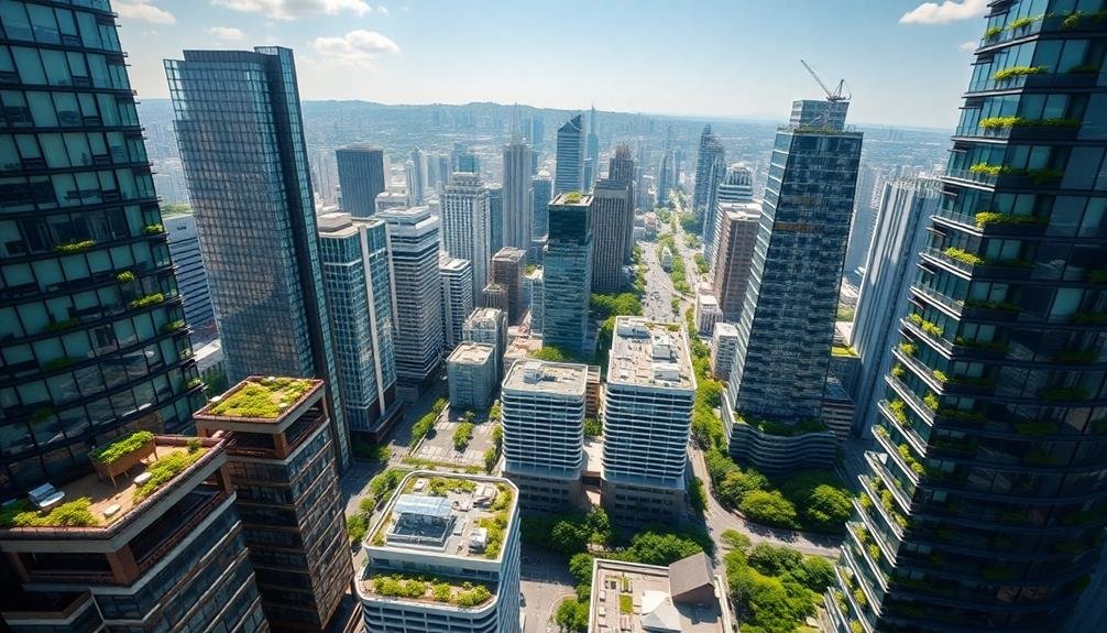
Urban Planning With Drone Insights

With the advent of drone technology, urban planning has taken a significant leap forward. You'll find that drones offer unique perspectives for architects and city planners, providing high-resolution aerial imagery and 3D mapping capabilities. These tools allow you to visualize entire neighborhoods, assess building layouts, and identify potential areas for green spaces or sustainable development.
When you're planning eco-friendly urban areas, drone insights can help you optimize solar panel placement by analyzing roof angles and sunlight exposure. You'll also be able to assess the heat island effect by capturing thermal images of different city zones. This data enables you to strategically plan green corridors and vegetation placement to mitigate urban heat.
Drones can assist you in monitoring construction progress, ensuring that green building practices are being followed. You'll have the ability to track changes in land use over time, helping you make informed decisions about future developments.
Documenting Green Construction Progress
As you move from planning to execution, documenting green construction progress becomes a key focus. Drones offer an unparalleled vantage point for capturing and tracking the evolution of your eco-friendly building projects.
You'll find these aerial tools invaluable for monitoring site changes, verifying sustainable material usage, and ensuring compliance with green building standards.
To effectively document green construction progress using drones, consider these key steps:
- Establish baseline imagery: Capture thorough aerial shots of the site before construction begins, providing a reference point for future comparisons.
- Schedule regular flights: Set up consistent drone surveys to track changes over time, aligning with key project milestones.
- Use specialized software: Employ advanced image processing and analysis tools to generate 3D models, measure volumes, and detect changes automatically.
- Create time-lapse sequences: Compile drone footage into compelling visual narratives that showcase the project's sustainable development.
Showcasing Completed Sustainable Projects
Celebrate your sustainable architectural achievements by showcasing completed green projects through immersive visualizations. Use cutting-edge technology to create virtual tours, interactive 3D models, and augmented reality experiences that highlight your building's eco-friendly features. These tools allow clients, stakeholders, and the public to explore your sustainable designs in detail, fostering appreciation for green architecture.
Develop a thorough portfolio that showcases your completed projects' environmental impact. Include metrics on energy efficiency, water conservation, and carbon footprint reduction. Create infographics and data visualizations to make these statistics easily digestible and impactful.
| Emotion | Visualization Technique | Impact |
|---|---|---|
| Awe | Aerial drone footage | High |
| Wonder | VR walkthrough | High |
| Pride | Before-and-after comparisons | Medium |
| Trust | Real-time energy monitoring | High |
| Inspiration | Time-lapse construction video | Medium |
Leverage social media and online platforms to share your sustainable project visualizations. Engage with your audience by hosting virtual events, webinars, or Q&A sessions to discuss your green building strategies. By effectively showcasing your completed sustainable projects, you'll inspire others, attract environmentally conscious clients, and contribute to the advancement of green architecture.
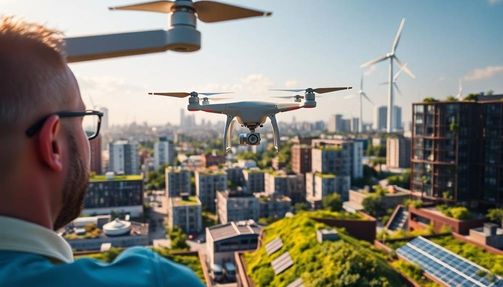
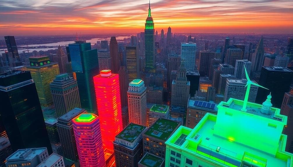
Client Presentations Using Aerial Footage
Aerial footage has revolutionized client presentations for green building projects. You'll find that incorporating drone-captured visuals into your pitch can markedly enhance your clients' understanding of sustainable design concepts.
These bird's-eye views provide a unique perspective that ground-level images simply can't match, allowing you to showcase the full scope of your eco-friendly architectural plans.
When using aerial footage in your presentations, consider these key benefits:
- Contextual understanding: Clients can see how the proposed green building fits into its surrounding environment.
- Scale visualization: Aerial views help clients grasp the true size and impact of sustainable features like green roofs or solar panel arrays.
- Site analysis: You can highlight topographical features, natural resources, and potential challenges that influence your sustainable design decisions.
- Progress tracking: For ongoing projects, regular aerial footage can demonstrate construction milestones and the gradual transformation of the site.
Future of Drone-Assisted Green Architecture
Drones are rapidly reshaping the future of green architecture. You'll soon see these aerial devices becoming indispensable tools for sustainable design and construction. They'll offer real-time environmental data, monitor building performance, and assist in maintenance tasks.
As an architect, you'll leverage drones for precise site analysis, capturing detailed topographical information and evaluating local microclimates. This data will inform your design decisions, helping you create buildings that harmonize with their surroundings and maximize energy efficiency.
Here's a glimpse of how drones will transform green architecture:
| Application | Benefits |
|---|---|
| Thermal imaging | Identify heat loss and improve insulation |
| Solar panel inspection | Optimize placement and maintenance |
| Vegetation mapping | Plan green roofs and urban gardens |
| Air quality monitoring | Evaluate and improve indoor environments |
| 3D modeling | Create accurate digital twins of projects |
You'll find drones enabling more accurate, efficient, and sustainable building practices. They'll streamline your workflow, reduce costs, and help you create greener, more environmentally responsive structures. Embrace this technology to stay ahead in the evolving field of sustainable architecture.
Frequently Asked Questions
How Do Architects Ensure Drone Safety During Urban Aerial Photography Missions?
You'll need to prioritize safety by obtaining proper permits, following local regulations, and using licensed pilots. Always maintain visual line of sight, avoid crowded areas, and equip your drone with obstacle avoidance technology and geofencing capabilities.
What Weather Conditions Are Optimal for Drone-Based Green Building Visualization?
You'll want calm, clear days for ideal drone-based green building visualization. Avoid strong winds, rain, or fog. Aim for early morning or late afternoon light to capture the best shadows and textures. Always check local weather forecasts.
Are There Specific Drone Models Recommended for Architectural Visualization Purposes?
You'll find several drones suitable for architectural visualization. Consider models like DJI's Phantom 4 Pro or Mavic 2 Pro for their high-quality cameras and stable flight. Autel's EVO II Pro also offers excellent 6K video capabilities for detailed imagery.
How Do Architects Integrate Drone Footage With 3D Modeling Software?
You'll import drone footage into your 3D modeling software as a background or reference. You can then overlay 3D elements, match camera angles, and create seamless integrations between real and virtual environments for stunning architectural visualizations.
What Legal Considerations Exist for Using Drones in Residential Area Visualizations?
You'll need to take into account privacy laws, obtain necessary permits, and follow FAA regulations. Don't fly over private property without permission. Be aware of local ordinances, and make certain you're operating within designated airspace. Always prioritize safety and respect.
In Summary
You're at the forefront of a green architecture revolution. As you embrace drone technology, you'll gain unparalleled insights into sustainable design. You'll capture stunning aerial views, analyze sites more effectively, and showcase eco-friendly elements with ease. Your presentations will wow clients, and you'll document green construction progress effortlessly. You're not just designing buildings; you're shaping the future of sustainable urban landscapes from a sky-high perspective. Keep soaring and innovating.
As educators and advocates for responsible drone use, we’re committed to sharing our knowledge and expertise with aspiring aerial photographers.


Leave a Reply