
To master drone waypoint mission planning, start by understanding the basics of waypoint placement and drone selection. Use high-quality mapping software to plot your course, and always conduct a thorough pre-flight site assessment. Optimize your waypoints for smooth shifts and efficient battery use, while implementing obstacle avoidance techniques. Consider weather conditions and lighting for the best results. Don't forget to comply with legal regulations and analyze your post-flight data. By following these expert tips, you'll enhance your mission's success and safety. Dive deeper into each aspect to truly elevate your drone operation skills.
Key Takeaways
- Optimize flight paths by minimizing altitude changes and sharp turns to conserve battery life and improve efficiency.
- Use high-resolution satellite imagery and terrain elevation data to plan accurate and safe waypoint missions.
- Factor in weather conditions, especially wind speed and direction, to ensure drone stability and data quality.
- Set appropriate camera settings for each waypoint, considering lighting conditions and mission objectives.
- Implement obstacle avoidance techniques, including sensor-based systems and geofencing, to enhance mission safety.
Understanding Waypoint Basics
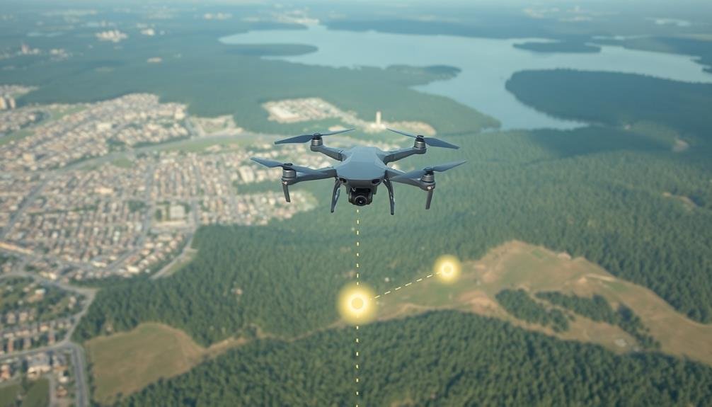
In drone mission planning, waypoints serve as the backbone of your flight path. They're specific geographic coordinates that guide your drone's route, defining where it should fly, what actions to perform, and when to execute them. Understanding waypoints is essential for crafting efficient and effective missions.
Waypoints aren't just about location; they also include altitude, speed, and hover time. You can program your drone to change its behavior at each waypoint, such as adjusting camera settings, altering flight speed, or initiating specific actions like taking photos or videos.
When planning your mission, consider the terrain, obstacles, and no-fly zones. Space your waypoints appropriately to guarantee smooth shifts and ideal coverage of your target area. Remember, too many waypoints can complicate your mission, while too few might result in missed areas or inefficient flight paths.
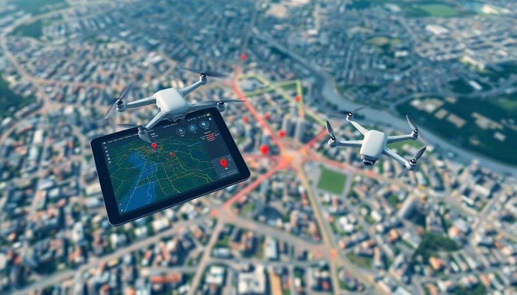
Most modern drone software allows you to set waypoints on a map interface, making planning intuitive. You can often import KML files or use existing maps to precisely place your waypoints.
Always review your waypoint mission before flying to confirm it meets your objectives and complies with local regulations.
Choosing the Right Drone

Now that you understand waypoint basics, selecting the appropriate drone for your mission is the next vital step. Consider the specific requirements of your waypoint mission when choosing a drone. Look for models with built-in GPS capabilities and waypoint navigation features. These are essential for accurate and efficient mission execution.
Evaluate the drone's flight time and range. Longer missions require extended battery life and greater transmission distances. Pay attention to the drone's payload capacity if you'll be carrying additional equipment like specialized cameras or sensors. Wind resistance is another important factor, especially for outdoor missions in varying weather conditions.
Don't overlook the importance of obstacle avoidance technology. Advanced drones with this feature can help prevent crashes during complex waypoint missions. Consider the drone's compatibility with mission planning software, as this will streamline your workflow. Some drones offer seamless integration with popular planning apps.
Lastly, assess the drone's camera quality if your mission involves aerial photography or videography. Higher resolution and adjustable gimbal systems will provide better results.
Mapping Software Essentials
Three key components form the foundation of effective drone waypoint mission planning: mapping software, flight control systems, and data analysis tools.
Let's focus on mapping software, a significant element in creating accurate and efficient flight paths for your drone missions.
When selecting mapping software for waypoint planning, consider these essential features:
- High-resolution satellite imagery
- Terrain elevation data integration
- Custom waypoint creation and editing
- Obstacle detection and avoidance capabilities
You'll want software that provides clear, up-to-date imagery of your target area. This enables you to identify potential hazards and plan ideal flight paths.
Look for programs that incorporate terrain elevation data, as this information is imperative for maintaining safe altitudes and avoiding collisions.
The ability to create and edit custom waypoints is essential. You should be able to easily set specific locations, altitudes, and actions for your drone to perform at each point.
Additionally, advanced obstacle detection features can help you avoid unforeseen barriers and guarantee smoother flights.
Pre-Flight Site Assessment

Before you launch your drone, it's essential to assess the terrain and identify potential obstacles in your flight area.
You'll need to take into account natural features like hills, trees, and bodies of water, as well as man-made structures such as buildings, power lines, and towers.
Additionally, evaluate the current weather conditions and lighting situation, as these factors can greatly impact your drone's performance and the quality of your mission data.
Terrain and Obstacles
Prior to launching your drone for a waypoint mission, conducting a thorough pre-flight site assessment is essential. A critical aspect of this assessment is evaluating the terrain and obstacles in your flight area. You'll need to identify potential hazards that could interfere with your drone's flight path or compromise its safety.
Start by examining topographical maps and satellite imagery of the area. Look for:
- Elevation changes
- Natural obstacles like trees, hills, or bodies of water
- Man-made structures such as buildings, towers, or power lines
- Temporary obstacles like construction sites or event setups
Next, conduct an on-site inspection to verify and update your findings. Pay close attention to the height and density of vegetation, which can affect GPS signal strength and visual line of sight.
Note any areas with electromagnetic interference, such as power stations or radio towers, which may disrupt your drone's controls.
Consider the time of day and weather conditions for your flight, as they can impact visibility and create shadows that might be mistaken for obstacles.
Always plan your waypoints with a generous buffer around known obstacles, ensuring your drone maintains a safe distance throughout its mission.
Weather and Lighting Conditions
During your pre-flight site assessment, you'll need to carefully evaluate weather and lighting conditions. Check local weather forecasts for wind speed, direction, and gusts. Strong winds can affect your drone's stability and battery life.
Be aware of precipitation, as rain or snow can damage your equipment and reduce visibility. Consider temperature extremes, which may impact battery performance and flight time. Humidity levels can affect sensors and camera lenses, potentially causing fogging or condensation.
Pay attention to air pressure changes, as they can influence your drone's altitude readings. Assess lighting conditions for ideal image capture. Bright sunlight can create harsh shadows and glare, while overcast skies provide softer, more even lighting.
Early morning or late afternoon light often yields the best results for aerial photography. Be mindful of sudden weather changes during your mission. Set up weather alerts on your phone and have a contingency plan for unexpected conditions.
Remember that weather can vary considerably with altitude, so factor this into your flight planning. Lastly, consider seasonal variations in daylight hours when scheduling your mission, especially in regions with extreme differences between summer and winter.
Optimal Waypoint Placement

Ideal waypoint placement is crucial for efficient drone mission planning. When setting waypoints, you'll want to take into account the drone's flight capabilities, battery life, and mission objectives. Start by mapping out the area and identifying key locations that need to be covered. Then, strategically place waypoints to create a logical and efficient flight path.
To optimize your waypoint placement, keep these tips in mind:
- Space waypoints evenly to maintain consistent flight speed and altitude
- Avoid sharp turns or abrupt changes in direction to conserve battery life
- Place waypoints at a safe distance from obstacles and restricted areas
- Take into account the drone's camera field of view when planning image capture points
Remember to factor in the drone's maximum flight time and plan for a safe return to the launch site.
If your mission requires multiple flights, divide the area into manageable sections and create separate flight plans for each.
Always double-check your waypoints before launching to verify they're accurately placed and aligned with your mission goals.
Flight Path Optimization

Once you've placed your waypoints, it's time to refine your flight path for maximum efficiency. Consider the drone's battery life, wind conditions, and mission objectives when enhancing your route. Aim to minimize unnecessary altitude changes and sharp turns, as these consume more energy.
Use flight planning software to analyze and improve your path. These tools can help you identify potential obstacles, calculate ideal speeds, and estimate flight duration. Don't forget to account for no-fly zones and local regulations when adjusting your route.
Here's a quick reference table for flight path enhancement:
| Consideration | Enhancement Technique |
|---|---|
| Battery Life | Minimize distance |
| Wind | Adjust altitude |
| Obstacles | Plan detours |
| Speed | Vary based on terrain |
| Camera Angles | Enhance for coverage |
Remember to test your enhanced flight path in a simulator before attempting it in the real world. This will help you identify any potential issues and make final adjustments. Always have a backup plan and emergency landing spots in case of unexpected events during the mission. By carefully enhancing your flight path, you'll maximize your drone's efficiency and increase the chances of a successful mission.
Camera Settings for Waypoints
When planning your drone's waypoint mission, you'll need to take into account ideal exposure settings for each waypoint.
You should adjust your camera's aperture, shutter speed, and ISO to match the lighting conditions at each location.
Additionally, you'll want to select appropriate focus modes for your mission, such as auto-focus for dynamic scenes or manual focus for consistent results across multiple waypoints.
Optimal Exposure for Waypoints
A drone's camera settings play an essential role in capturing high-quality images during waypoint missions. When it comes to ideal exposure for waypoints, you'll need to take into account several factors to guarantee consistently well-exposed shots throughout your flight.
To achieve ideal exposure for your waypoint mission, keep these key points in mind:
- Use aperture priority mode to maintain consistent depth of field
- Set ISO to the lowest possible value to minimize noise
- Adjust shutter speed to freeze motion or capture light trails
- Enable auto exposure bracketing for challenging lighting conditions
Start by evaluating the lighting conditions of your flight area. If you're flying in bright sunlight, you'll want to use a lower ISO and faster shutter speed to prevent overexposure.
For low-light situations, increase your ISO and slow down the shutter speed, but be cautious of motion blur.
Take into account the speed of your drone and the distance between waypoints when setting your shutter speed. A faster shutter speed will help freeze motion and reduce blur, especially if you're capturing images of moving subjects or flying at higher speeds.
Focus Modes for Missions
Precision is key when it comes to focus modes for drone waypoint missions. You'll need to choose the right focus mode to guarantee sharp, clear images throughout your flight. For most waypoint missions, autofocus (AF) is your best bet. It allows the camera to adjust focus automatically as you move between waypoints, guaranteeing consistent image quality.
However, there are times when manual focus (MF) might be necessary. If you're shooting in low-contrast environments or capturing subjects at a fixed distance, MF can provide more reliable results. You'll need to set the focus before takeoff and maintain a consistent altitude during the mission.
Some drones offer advanced focus modes like subject tracking or zone focusing. These can be particularly useful for dynamic subjects or complex scenes. Subject tracking keeps a specified object in focus as it moves, while zone focusing allows you to prioritize focus on a specific area of the frame.
Remember to test your chosen focus mode before the actual mission. Fly a practice run to guarantee your settings produce the desired results across all waypoints.
Altitude Considerations

Altitude plays an essential role in drone waypoint mission planning. When setting up your mission, you'll need to take into account various factors that influence the ideal flying height for your drone. These include local regulations, obstacles in the area, and the specific requirements of your mission.
To guarantee a successful mission, keep these altitude considerations in mind:
- Regulatory compliance: Check local laws and airspace restrictions to determine the maximum allowable altitude for your flight.
- Obstacle clearance: Factor in buildings, trees, and other structures that might interfere with your drone's path.
- Camera performance: Higher altitudes can capture wider areas but may sacrifice image detail, while lower altitudes provide more detailed shots but cover less ground.
- Battery life: Flying at higher altitudes can drain your battery faster due to increased wind resistance and colder temperatures.
You'll also need to decide between relative and absolute altitude settings. Relative altitude measures height from the takeoff point, while absolute altitude uses sea level as a reference.
Choose the most appropriate option based on your terrain and mission objectives. Remember to maintain a consistent altitude throughout your mission unless specific waypoints require changes for ideal results.
Battery Management Strategies

Effective battery management is crucial for successful drone waypoint missions. You'll need to accurately estimate your drone's flight time and plan accordingly. Start by knowing your battery's capacity and your drone's power consumption rate. Factor in variables like wind speed, payload weight, and flight speed, as these can greatly impact battery life.
Always begin your mission with a fully charged battery and monitor its level throughout the flight. Set up low battery alerts and plan for a safe return when the battery reaches 30% capacity. It's wise to include buffer time in your mission plan for unexpected situations.
Consider using intelligent flight modes that enhance power consumption. Some drones offer features like adaptive speed control, which adjusts velocity based on remaining battery life. If your mission requires extended flight time, explore options like battery swapping or using extended-life batteries.
Remember to account for temperature effects on battery performance. Cold weather can drastically reduce flight time, so you may need to adjust your mission parameters or use battery warmers in chilly conditions.
Regularly maintain and calibrate your batteries to guarantee peak performance and longevity.
Obstacle Avoidance Techniques
To guarantee safe drone operations, you'll need effective obstacle avoidance techniques.
Sensor-based detection systems use technologies like LiDAR or ultrasonic sensors to identify and navigate around potential hazards in real-time.
Additionally, you can implement geofencing and no-fly zones to pre-emptively restrict your drone from entering dangerous or prohibited areas during waypoint missions.
Sensor-Based Detection Systems
As drones navigate their waypoint missions, sensor-based detection systems play an essential role in obstacle avoidance. You'll find that these systems use various sensors to detect and analyze the drone's environment in real-time, allowing for quick adjustments to its flight path.
The most common sensors used in drone obstacle avoidance include:
- LiDAR (Light Detection and Ranging)
- Ultrasonic sensors
- Infrared sensors
- Optical flow sensors
Each of these sensors has its strengths and limitations. LiDAR offers high precision and long-range detection but can be expensive. Ultrasonic sensors are cost-effective and work well in close-range situations. Infrared sensors excel in low-light conditions, while optical flow sensors provide accurate position tracking.
To maximize the effectiveness of your drone's sensor-based detection system, you'll want to combine multiple sensor types. This multi-sensor approach creates a more thorough picture of the environment, improving obstacle detection and avoidance capabilities.
Additionally, you should regularly calibrate and maintain your sensors to guarantee peak performance. By implementing a robust sensor-based detection system, you'll greatly enhance your drone's ability to complete waypoint missions safely and efficiently.
Geofencing and No-Fly Zones
Beyond sensor-based detection, geofencing and no-fly zones are essential obstacle avoidance techniques in drone waypoint mission planning. Geofencing creates virtual boundaries that restrict your drone's movement, guaranteeing it doesn't enter prohibited areas. You'll need to program these boundaries into your flight plan, using GPS coordinates to define the perimeter.
When planning your mission, research local regulations and identify no-fly zones in your area. These might include airports, military bases, or sensitive infrastructure. Incorporate this information into your geofence settings to prevent accidental violations. Many drone manufacturers now include built-in geofencing capabilities, but you should always double-check and customize these settings for your specific mission.
Consider creating buffer zones around obstacles or restricted areas to add an extra layer of safety. This will help account for potential GPS inaccuracies or sudden wind gusts. You can also set up altitude restrictions to prevent your drone from flying too high in certain areas.
Remember that geofencing isn't foolproof. Always maintain visual line of sight and be prepared to take manual control if necessary. Regularly update your drone's firmware and geofencing database to guarantee you have the most current information on restricted areas.
Weather Factors in Planning

Weather conditions can make or break a drone mission. When planning your waypoint flight, you'll need to evaluate various meteorological factors that could impact your drone's performance and safety.
Wind speed and direction are essential elements to assess, as they can affect battery life, flight stability, and overall mission duration.
Temperature is another important factor. Extreme heat or cold can impact battery efficiency and potentially damage sensitive components.
You'll also want to check humidity levels, as high moisture content in the air can lead to condensation on your drone's electronics.
Always check these weather factors before your mission:
- Wind speed and direction
- Temperature range
- Precipitation forecast
- Cloud cover and visibility
Cloud cover and visibility are particularly important for maintaining visual line of sight with your drone, as required by many regulations.
Additionally, be aware of any approaching weather systems that could rapidly change conditions during your flight.
Remember to consult reliable weather sources and use specialized drone weather apps for the most accurate and relevant information.
Legal and Regulatory Compliance

Before launching your drone for a waypoint mission, you must assure compliance with all applicable laws and regulations. Research local, state, and federal drone laws to assure you're operating legally. Register your drone with the FAA if required, and obtain necessary certifications like the Part 107 license for commercial operations.
Check airspace restrictions using tools like the B4UFLY app or FAA's UAS Facility Maps. Obtain airspace authorizations when flying in controlled airspace. Be aware of temporary flight restrictions (TFRs) that may affect your mission area.
Respect privacy laws and avoid flying over private property without permission. Adhere to altitude limits, typically 400 feet AGL for recreational flights. Maintain visual line of sight with your drone unless you have a waiver.
Consider insurance requirements for your operations, especially for commercial flights. Keep detailed flight logs and maintenance records to demonstrate compliance.
Stay informed about changing regulations and update your practices accordingly.
Post-Flight Data Analysis
After completing your drone waypoint mission, post-flight data analysis is essential for extracting valuable insights and improving future operations.
Begin by downloading and organizing your flight data, including GPS coordinates, altitude readings, and sensor information. Use specialized software to visualize your flight path and identify any deviations from the planned route.
Analyze your collected imagery or sensor data to verify you've achieved your mission objectives. Look for any anomalies or areas that require further investigation.
Pay close attention to:
- Battery performance and power consumption
- Camera settings and image quality
- Environmental factors affecting flight stability
- Accuracy of waypoint navigation
Compare your results with previous missions to track improvements and identify recurring issues. Use this information to refine your mission planning process and optimize future flights.
Don't forget to document your findings and share them with your team.
Consider using machine learning algorithms to automate data analysis and detect patterns that mightn't be immediately apparent. This can help you uncover new insights and make data-driven decisions for future missions.
Regular post-flight analysis will help you continuously improve your drone operations and maximize the value of your waypoint missions.
Frequently Asked Questions
How Do I Handle Unexpected Wildlife Encounters During a Waypoint Mission?
When you encounter unexpected wildlife during a mission, immediately pause your flight. Assess the situation from a safe distance. If necessary, alter your flight path or abort the mission to avoid disturbing or endangering animals.
Can I Use Waypoint Missions for Indoor Mapping and Surveying?
You can use waypoint missions for indoor mapping and surveying, but you'll need specialized equipment. Use indoor positioning systems, obstacle avoidance sensors, and adjust your drone's settings for confined spaces. Always prioritize safety in enclosed environments.
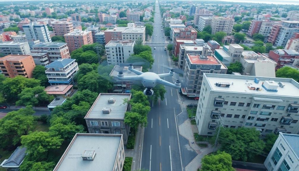
What Are the Best Practices for Waypoint Missions in Urban Environments?
When planning waypoint missions in urban areas, you'll want to prioritize safety. Avoid flying over people, maintain line of sight, respect privacy, and be aware of no-fly zones. Always check local regulations before launching your drone.
How Do I Synchronize Multiple Drones for Large-Scale Waypoint Missions?
To synchronize multiple drones for large-scale waypoint missions, you'll need a robust control system. Use a central command station, implement real-time communication protocols, and program coordinated flight paths. Verify each drone has precise timing and positioning capabilities.
Are There Specialized Waypoint Techniques for Search and Rescue Operations?
You'll want to use grid search patterns, spiral techniques, and contour mapping for search and rescue. Implement dynamic waypoints that adjust based on real-time data. Don't forget to integrate thermal imaging and obstacle avoidance for efficient operations.
In Summary
You've now got the tools to plan expert-level waypoint missions. Remember, success lies in thorough preparation, from choosing the right drone to analyzing post-flight data. Stay current with regulations, adapt to weather conditions, and prioritize safety. As you practice, you'll refine your skills in ideal waypoint placement and obstacle avoidance. Keep learning, stay patient, and you'll soon be executing complex drone missions with confidence and precision.
As educators and advocates for responsible drone use, we’re committed to sharing our knowledge and expertise with aspiring aerial photographers.


Leave a Reply