Revolutionize your event planning with cutting-edge venue mapping techniques. You'll optimize space and enhance attendee experience using 3D modeling with LiDAR drones, creating high-precision digital replicas. Implement interactive digital floor plans and augmented reality tours for seamless navigation. Employ aerial heat mapping and drone-based capacity analysis to monitor crowd dynamics. Capture stunning 360-degree panoramas and develop virtual reality walkthroughs for immersive previews. Use time-lapse aerial mapping to visualize venue changes, and leverage multi-spectral imaging for outdoor landscaping insights. These innovative approaches blend technology and creativity, streamlining logistics and elevating your event's success. Explore further to access the full potential of these game-changing strategies.
Key Takeaways
- Use LiDAR drones to create precise 3D models for virtual walkthroughs and accurate measurements of the venue.
- Implement interactive digital floor plans accessible on attendees' devices for real-time navigation and occupancy tracking.
- Utilize augmented reality for immersive venue tours, enabling virtual layout planning and on-site information overlays.
- Employ aerial heat mapping with drones to analyze crowd density and optimize event space utilization.
- Capture 360-degree panoramic images for comprehensive venue showcases without requiring on-site visits.
3D Modeling With Lidar Drones
Leveraging cutting-edge technology, 3D modeling with LiDAR drones has revolutionized event venue mapping. You'll find that these advanced drones equipped with Light Detection and Ranging (LiDAR) sensors offer unparalleled accuracy and detail in capturing your venue's layout.
As they fly over the space, they emit laser pulses that bounce off surfaces, creating a precise point cloud representation of the area. You can use this data to generate highly detailed 3D models of your event venue, allowing you to visualize and plan every aspect of your event with precision.
The models provide accurate measurements of distances, heights, and volumes, helping you optimize space utilization and seating arrangements. You'll also be able to identify potential obstacles or safety hazards that mightn't be apparent from ground-level observations.
These 3D models are invaluable for virtual walkthroughs, enabling you to showcase the venue to clients or stakeholders remotely. They're also useful for creating immersive VR experiences, letting attendees preview the space before the event.
With LiDAR drone mapping, you'll streamline your planning process and enhance the overall event experience.
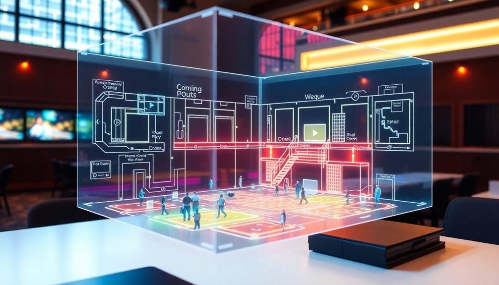
Interactive Digital Floor Plans
Interactive digital floor plans offer a game-changing approach to event venue mapping. With these tools, you'll create dynamic, user-friendly layouts that attendees can access on their devices. These plans allow users to zoom in, pan across, and interact with different areas of your venue.
To implement interactive floor plans, start by digitizing your venue's layout. Use CAD software or specialized event planning tools to create an accurate representation of the space.
Then, add interactive elements like clickable areas, pop-up information boxes, and customizable icons for key locations. You can enhance these plans with features like real-time occupancy tracking, wayfinding capabilities, and integration with event schedules.
This allows attendees to easily navigate the venue, find specific booths or sessions, and plan their itinerary efficiently.
Consider incorporating augmented reality (AR) elements into your digital floor plans. This technology enables users to point their devices at specific areas and see additional information or virtual overlays, creating an immersive experience.
Augmented Reality Venue Tours
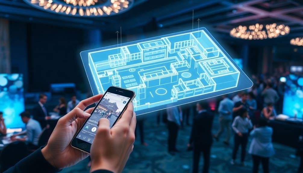
Augmented reality (AR) venue tours offer you a cutting-edge way to explore event spaces.
With interactive 3D visualizations, you'll see the venue come to life through your smartphone or AR glasses.
Real-time information overlays provide instant access to essential details about each area, enhancing your understanding of the space's layout and capabilities.
Interactive 3D Visualizations
A growing number of event planners are turning to interactive 3D visualizations and augmented reality (AR) venue tours to revolutionize how attendees experience and navigate event spaces.
These cutting-edge technologies offer immersive, detailed previews of event layouts, allowing you to explore venues virtually before setting foot on-site.
With interactive 3D visualizations, you'll be able to "walk through" the venue from your computer or mobile device. You can zoom in on specific areas, rotate views, and even test different layout configurations. This tool is invaluable for planning seating arrangements, booth placements, and traffic flow.
AR venue tours take this concept further by overlaying digital information onto the physical space. Using your smartphone or AR glasses, you'll see real-time directions, exhibitor information, and points of interest as you move through the venue.
This technology can help you locate specific booths, find amenities, and discover networking opportunities more efficiently.
Real-Time Information Overlays
Gone are the days of fumbling with paper maps or squinting at tiny screens to navigate event venues. Real-time information overlays using augmented reality (AR) are revolutionizing how you experience and interact with event spaces. By simply pointing your smartphone or wearing AR glasses, you'll see a wealth of dynamic information superimposed on your surroundings.
These overlays can provide instant updates on session locations, speaker changes, and crowd density. You'll never miss a beat as the venue comes alive with real-time data. Here's a glimpse of what you can expect:
| Feature | Benefit | Application |
|---|---|---|
| Wayfinding | Easy navigation | Directional arrows |
| Schedule updates | Stay informed | Pop-up notifications |
| Crowd management | Avoid congestion | Heat maps |
| Networking | Connect with others | Profile bubbles |
AR overlays also enhance accessibility, offering audio descriptions for visually impaired attendees and highlighting wheelchair-friendly routes. You can even interact with virtual exhibits or participate in gamified experiences throughout the venue. This technology not only streamlines your event experience but also opens up new possibilities for engagement and exploration.
Aerial Heat Mapping
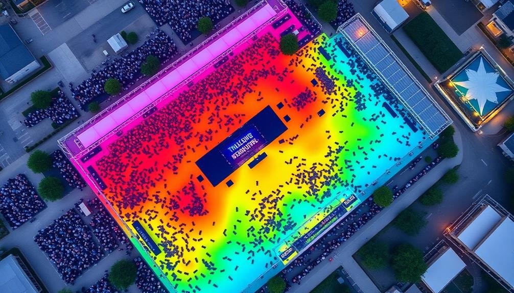
Thermal imaging takes aerial venue mapping to new heights. By using drones equipped with infrared cameras, you can create detailed heat maps of your event space. These maps reveal hotspots of activity, crowding, and temperature variations throughout the venue.
You'll gain valuable insights into attendee behavior and movement patterns. Identify areas where people congregate most, helping you optimize placement of amenities, food stations, and restrooms. You can also spot potential safety hazards, such as overheating equipment or electrical issues, before they become problems.
During the event, real-time heat mapping allows you to monitor crowd density and flow. You'll quickly spot bottlenecks or underutilized areas, enabling you to make immediate adjustments to improve attendee experience. This technology is particularly useful for large outdoor events, festivals, or multi-stage setups.
Post-event analysis of heat maps provides essential data for future planning. You'll see which areas were most popular, where queues formed, and how attendees moved through the space. This information helps you refine your layout, adjust staffing levels, and enhance overall event design for upcoming occasions.
360-Degree Panoramic Venue Captures
In light of technological advancements, 360-degree panoramic captures have revolutionized venue mapping. These immersive images provide an extensive view of your event space, allowing you to explore every nook and cranny from a single vantage point.
You'll be able to showcase your venue's layout, design, and ambiance to potential clients or team members without them setting foot on-site.
To create these captures, you'll need specialized equipment like a 360-degree camera or a DSLR with a panoramic head. Position the camera at strategic points throughout your venue, ensuring you capture all key areas.
Once you've taken the shots, use stitching software to merge them into a seamless panorama. The resulting interactive panoramas can be embedded on your website or shared via virtual tours.
You can enhance these captures by adding hotspots with additional information, such as room dimensions, capacity limits, or equipment specifications. This approach not only saves time during site visits but also helps clients visualize their events in your space.
Photogrammetry for Detailed Layouts
You can create high-precision 3D models of your event venue using photogrammetry techniques.
This method involves taking multiple overlapping photographs of the space and processing them with specialized software to generate a detailed digital replica.
The resulting 3D model captures intricate venue details, allowing you to explore and measure every aspect of the layout with remarkable accuracy.
High-Precision 3D Models
Numerous event planners are turning to high-precision 3D models for creating detailed venue layouts. These models offer an unprecedented level of accuracy and detail, allowing you to visualize and plan your event space with remarkable precision.
To create a high-precision 3D model, you'll need specialized equipment like laser scanners or advanced photogrammetry setups. These tools capture millions of data points, measuring every surface and object in the venue. The resulting point cloud is then processed into a detailed 3D mesh.
With your 3D model, you can explore virtual walkthroughs, test different layouts, and plan sight lines. You'll be able to measure distances, ceiling heights, and door widths with millimeter accuracy. This level of detail is invaluable for complex installations or when working with tight spaces.
You can also use the model for collaboration, sharing it with vendors, clients, and team members. They'll be able to explore the space virtually, reducing the need for on-site visits. Additionally, you can create stunning visualizations and renderings to showcase your event design concepts.
While creating high-precision 3D models requires an initial investment, the benefits in planning efficiency and accuracy can be substantial for large or recurring events.
Capturing Intricate Venue Details
Photogrammetry's power lies in its ability to capture intricate venue details with stunning accuracy. You can use this technique to create highly detailed 3D models of your event space by taking multiple overlapping photographs from various angles. These images are then processed using specialized software to generate a precise digital representation of the venue.
With photogrammetry, you'll be able to capture even the smallest details, such as architectural features, textures, and finishes. This level of precision is invaluable for event planning, as it allows you to visualize and measure every aspect of the space accurately. You can use the resulting 3D model to plan layouts, determine sight lines, and identify potential obstacles or challenges.
To get the best results, use a high-quality camera and guarantee consistent lighting throughout the venue. Take photos from multiple heights and angles, making sure there's sufficient overlap between images.
Once you've processed the photos, you'll have a detailed 3D model that you can manipulate and explore virtually, giving you unprecedented insight into your event space's nuances and possibilities.
Virtual Reality Venue Walkthroughs
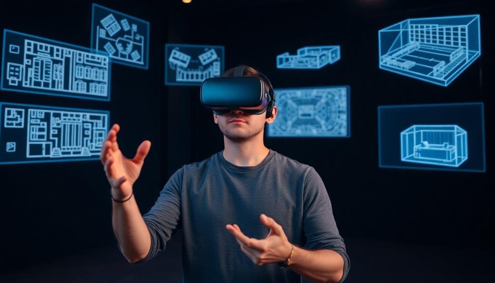
Virtual reality is stepping up the game in venue mapping. You can now create immersive 3D walkthroughs that allow event planners and attendees to explore your venue from anywhere in the world. By using VR technology, you'll provide a realistic and interactive experience that goes beyond traditional floor plans or photos.
To create a VR venue walkthrough, you'll need a 360-degree camera and VR software. Start by capturing panoramic images of key areas in your venue, including entrances, main halls, and breakout rooms.
Then, use VR software to stitch these images together and create a navigable 3D environment. You can enhance your VR walkthrough by adding interactive elements.
Include hotspots that provide information about specific areas or features when clicked. Incorporate audio descriptions to guide users through the space. You might even add customizable elements, allowing planners to experiment with different layouts or decor options within the virtual environment.
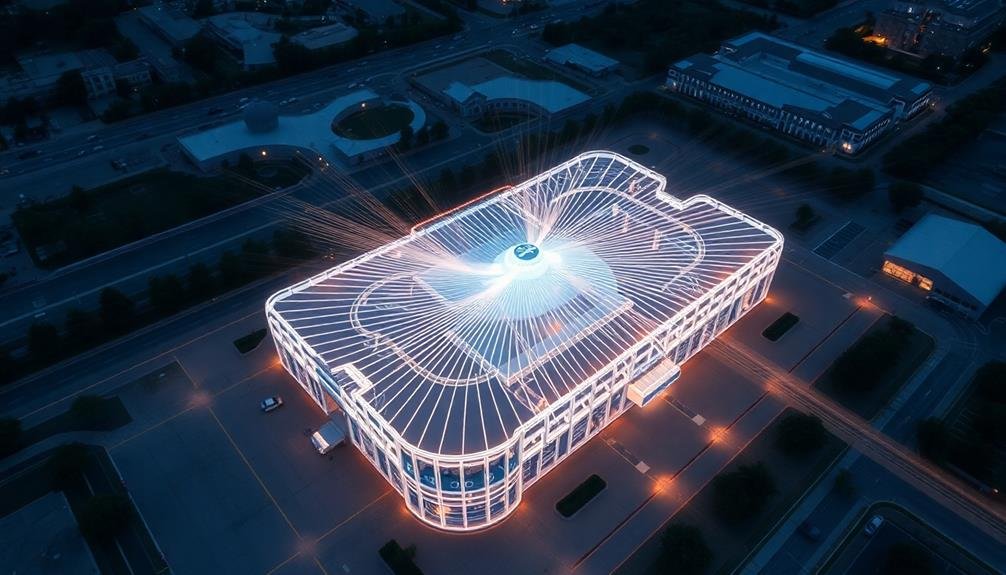
Time-Lapse Aerial Mapping
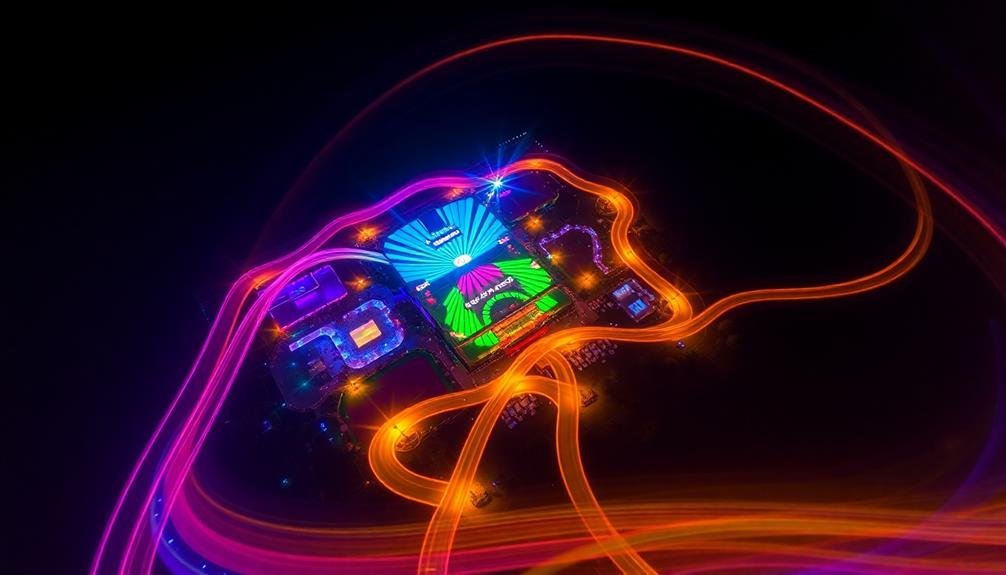
Time-lapse aerial mapping offers a dynamic way to showcase your venue's layout and surroundings. This innovative technique combines drone technology with time-lapse photography to create a detailed, bird's-eye view of your event space over time.
To implement this mapping method, you'll need to deploy a drone equipped with a high-quality camera. Program the drone to fly predetermined routes at regular intervals, capturing images of the venue and its environs.
These images are then stitched together to create a fluid, time-lapse video that demonstrates how your space transforms throughout the day or during event setup. This approach allows you to highlight key features like parking areas, entry points, and outdoor spaces.
It's particularly useful for large-scale venues or those with complex layouts. You can showcase how traffic flows, how lighting changes, and how the venue adapts to different event configurations.
Time-lapse aerial mapping also helps planners visualize crowd movement and identify potential bottlenecks. By providing this unique perspective, you'll give clients a better understanding of your venue's capabilities and help them plan more effectively.
Drone-Based Venue Capacity Analysis
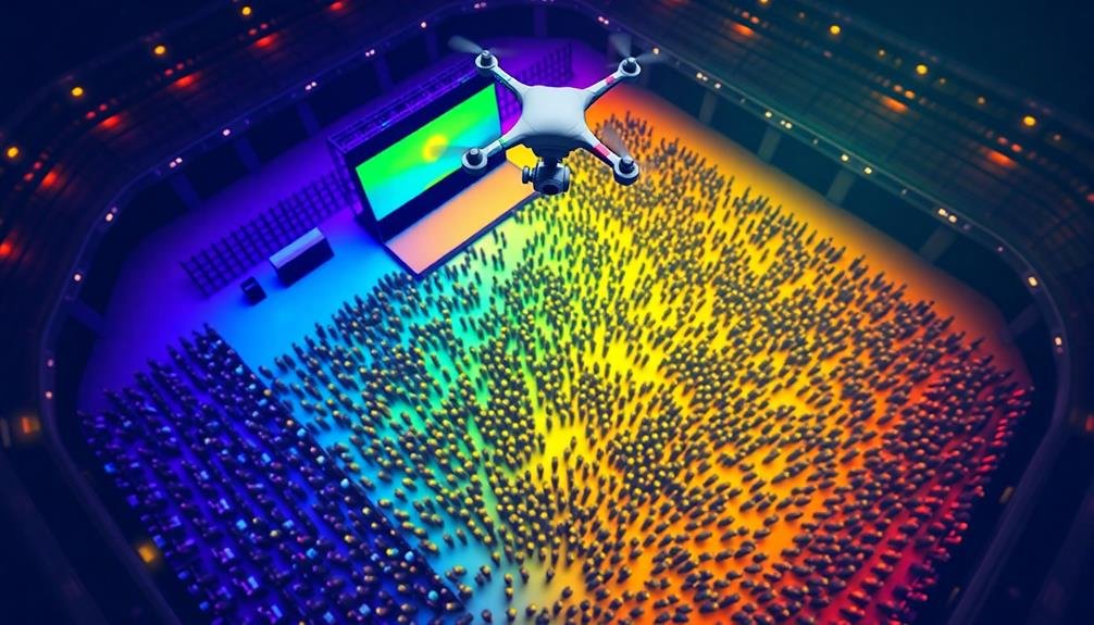
You'll find drone-based venue capacity analysis revolutionizing event planning and management.
With aerial crowd density estimation, you can accurately gauge attendee numbers and distribution across your venue.
Real-time occupancy monitoring allows for swift adjustments to guarantee safety and comfort, while 3D venue modeling provides an all-encompassing view of your space's layout and potential.
Aerial Crowd Density Estimation
Drones have taken off as a game-changing tool for event planners looking to map venue capacity accurately. With aerial crowd density estimation, you can get real-time insights into how your attendees are distributed across the venue. This technology uses advanced image processing algorithms to analyze drone footage and calculate the number of people in different areas.
You'll find this method particularly useful for large outdoor events, festivals, or sprawling indoor venues. By flying drones at regular intervals, you can track crowd movements and identify potential bottlenecks or underutilized spaces. This data helps you make informed decisions about resource allocation, security placement, and emergency response planning.
To implement aerial crowd density estimation, you'll need high-resolution cameras on your drones and specialized software to process the images. The system can provide heat maps showing areas of high concentration and estimate the total number of attendees.
You can also use this information to optimize traffic flow, adjust entertainment schedules, or relocate food and beverage stations. By leveraging this innovative mapping technique, you'll enhance safety, improve the attendee experience, and maximize your venue's potential.
Real-Time Occupancy Monitoring
Beyond static crowd density estimation, real-time occupancy monitoring takes venue mapping to the next level. You'll gain invaluable insights into crowd dynamics and movement patterns as they unfold. By employing drones equipped with advanced sensors and AI algorithms, you can track occupancy levels across different areas of your venue in real-time.
This technology allows you to:
| Benefits | Applications | Challenges |
|---|---|---|
| Enhance safety | Crowd flow optimization | Privacy concerns |
| Improve resource allocation | Emergency response | Technical limitations |
| Boost event experience | Capacity management | Data interpretation |
You'll be able to identify potential bottlenecks, overcrowded areas, and underutilized spaces instantly. This information empowers you to make quick decisions, such as opening additional entrances or redirecting attendees to less congested areas. You can also use this data to optimize staff deployment, ensuring adequate support where it's needed most.
Real-time occupancy monitoring isn't just about counting heads; it's about understanding the ebb and flow of your event. You'll be able to analyze dwell times in specific areas, track popular attractions, and even predict potential issues before they arise. This level of insight allows you to create a more dynamic, responsive, and enjoyable event experience for all attendees.
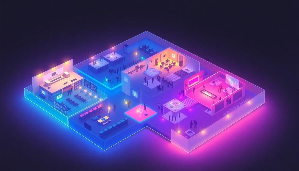
3D Venue Modeling
Building on the concept of real-time occupancy monitoring, 3D venue modeling takes aerial data collection to new heights. By employing drones equipped with advanced imaging technology, you can create highly detailed, three-dimensional models of your event space.
To implement this innovative mapping technique, you'll need to invest in a high-quality drone with LiDAR or photogrammetry capabilities. Fly the drone systematically over your venue, capturing overlapping images or point cloud data. This information is then processed using specialized software to generate a precise 3D model.
The resulting model offers numerous benefits for event planning and management. You'll gain accurate measurements of all spaces, including hard-to-reach areas. This data helps optimize layout designs, improve crowd flow, and maximize capacity.
You can also use the model for virtual walkthroughs, allowing stakeholders to explore the venue remotely. Additionally, 3D modeling enables you to simulate various event scenarios, testing different layouts and identifying potential bottlenecks.
This proactive approach enhances safety planning and guarantees a smoother event experience. By leveraging drone technology for 3D venue modeling, you'll have a powerful tool at your disposal for creating more efficient and engaging events.
Multi-Spectral Imaging for Landscaping
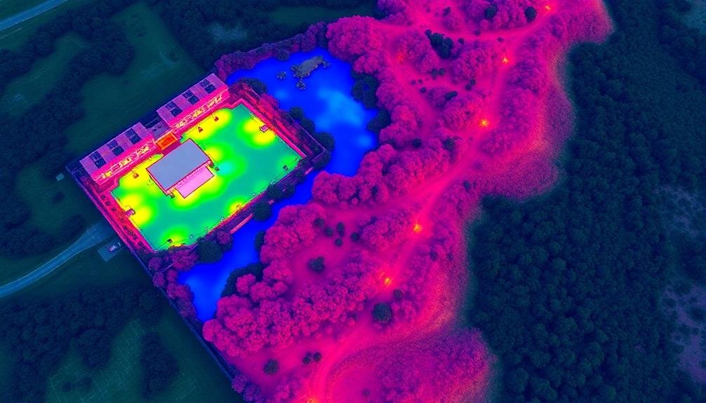
Leveraging cutting-edge technology, multi-spectral imaging offers event planners a revolutionary way to map and analyze venue landscapes. This technique captures data across various light spectrums, providing detailed insights into vegetation health, soil moisture, and terrain characteristics.
You'll find multi-spectral imaging particularly useful for outdoor events. It helps you identify the best areas for staging, seating, and activity zones based on ground conditions. You can also use it to assess the health of trees and plants, ensuring you're not placing structures near potentially hazardous vegetation.
Here's a quick overview of what multi-spectral imaging can reveal:
| Spectrum | Information Provided | Event Planning Use |
|---|---|---|
| Visible | True color imagery | Visual layout planning |
| Near-infrared | Vegetation health | Identifying safe areas |
| Thermal | Heat signatures | ideal placement of cooling stations |
Frequently Asked Questions
How Much Does It Cost to Implement These Innovative Mapping Techniques?
You'll find costs vary widely depending on the specific mapping technique you choose. Basic DIY options can be free, while high-tech solutions might run thousands. Consider your budget, event size, and desired features when making your decision.
What Software Is Required for Processing and Viewing the Mapping Data?
You'll need Geographic Information System (GIS) software like ArcGIS or QGIS for processing mapping data. For viewing, consider user-friendly options such as Google Earth or custom-built web applications. Mobile apps can also display venue maps effectively.
Are There Any Legal Restrictions on Using Drones for Venue Mapping?
You'll need to check local laws before using drones for venue mapping. Many areas have restrictions on drone use, including licensing requirements, no-fly zones, and privacy concerns. Always obtain necessary permits and follow regulations.
How Long Does It Typically Take to Create These Advanced Venue Maps?
You'll find that creating advanced venue maps can take anywhere from a few hours to several days. It depends on the venue's size, complexity, and the mapping method you're using. Don't forget to factor in post-processing time.
Can These Mapping Techniques Be Used for Both Indoor and Outdoor Venues?
You can absolutely use these mapping techniques for both indoor and outdoor venues. They're versatile and adaptable, allowing you to create detailed layouts of conference centers, stadiums, parks, or festival grounds with equal effectiveness and precision.
In Summary
You've now explored cutting-edge ways to map your event venue. From 3D modeling with drones to virtual reality walkthroughs, these innovative techniques will revolutionize how you plan and visualize your space. By embracing these technologies, you'll enhance attendee experience, optimize logistics, and impress clients. Don't be afraid to mix and match methods for the best results. Stay ahead of the curve and make your next event truly unforgettable with these advanced mapping solutions.
As educators and advocates for responsible drone use, we’re committed to sharing our knowledge and expertise with aspiring aerial photographers.


Leave a Reply