
Drone imagery has transformed how you can assess flood risks for urban planning. You'll get high-resolution, real-time data on flood extent, depth, and flow patterns, surpassing traditional methods in speed and accuracy. With drones, you can create detailed 3D models and elevation maps to identify flood-prone areas and assess infrastructure vulnerabilities. These tools integrate with GIS to produce thorough flood risk maps, informing better urban planning decisions and enhancing community resilience. You'll face challenges like regulations and data processing, but the benefits are substantial. As drone technology advances, it's opening new frontiers in flood risk management and urban planning. Discover how this cutting-edge approach is reshaping cities' futures.
Drone Technology for Flood Mapping

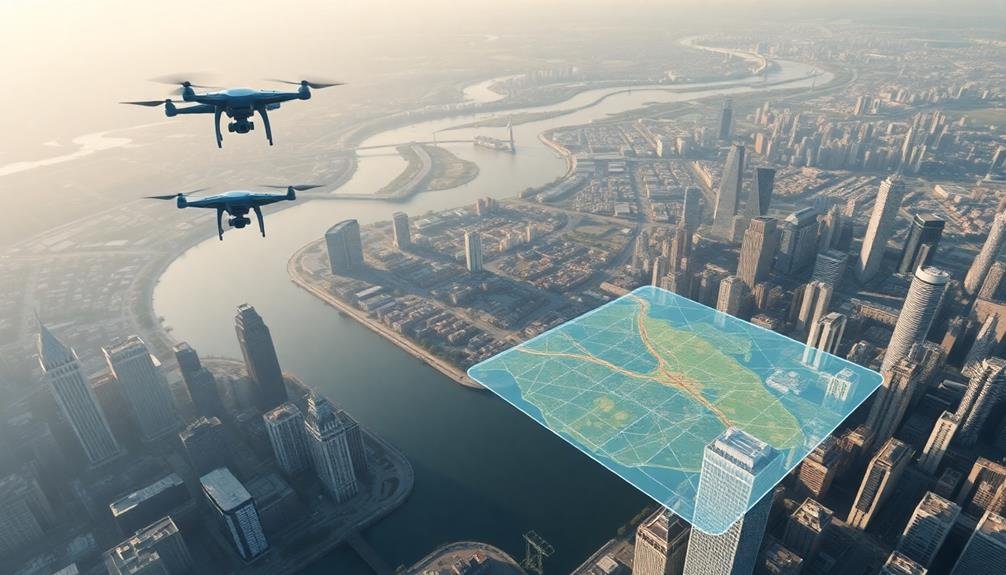
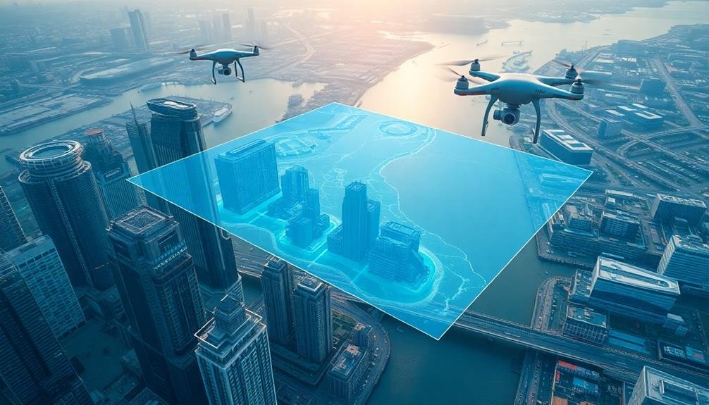
Drones have revolutionized flood mapping in urban areas. These unmanned aerial vehicles equipped with high-resolution cameras and sensors can quickly survey large areas, providing real-time data on flood extent, depth, and flow patterns.
You'll find that drones offer significant advantages over traditional flood mapping methods, including faster data collection, improved accuracy, and reduced risk to human surveyors.
When you're using drones for flood mapping, you'll capture detailed imagery that can be processed into 3D models and elevation maps. This data helps you identify flood-prone areas, assess infrastructure vulnerabilities, and plan mitigation strategies.
You can also use thermal cameras to detect water temperatures and identify potential contamination sources.
Drones' ability to access hard-to-reach areas makes them invaluable for monitoring flood events as they unfold. You'll be able to track water levels, assess damage to buildings and infrastructure, and guide emergency response efforts.
By integrating drone-captured data with GIS systems, you can create thorough flood risk maps that inform urban planning decisions and improve community resilience.
As drone technology continues to advance, you'll see even more sophisticated flood mapping capabilities emerge.
Aerial Data Collection Methods

When collecting aerial data for urban planning, you'll need to choose between fixed-wing and rotary drones, each with its own advantages.
Fixed-wing drones cover larger areas efficiently, while rotary drones excel at hovering and capturing detailed imagery of specific sites.
Your flight planning strategy will depend on your chosen drone type, project requirements, and local regulations, so it's essential to carefully consider these factors before launching your aerial survey.
Fixed-Wing vs. Rotary Drones
In the domain of aerial data collection for urban planning, two primary drone types compete for supremacy: fixed-wing and rotary. When you're evaluating flood risks, you'll need to choose between these options based on your specific requirements.
Fixed-wing drones resemble traditional aircraft and excel at covering large areas efficiently. They're ideal for mapping extensive urban zones or entire watersheds. These drones offer longer flight times and higher speeds, allowing you to collect data over vast territories in a single mission.
However, they require more space for takeoff and landing, which can be challenging in densely populated areas.
Rotary drones, including quadcopters and hexacopters, provide greater maneuverability and the ability to hover. They're perfect for detailed inspections of specific urban features or infrastructure.
You'll find them easier to operate in confined spaces and they can take off and land vertically. While they've shorter flight times and lower speeds compared to fixed-wing drones, rotary drones offer superior flexibility for capturing high-resolution imagery of particular points of interest in urban flood risk evaluation projects.
Flight Planning Strategies
Effective flight planning is the backbone of successful aerial data collection for urban flood risk assessment. You'll need to take into account several key factors when developing your flight strategy.
First, determine the ideal flight altitude based on the required ground sampling distance and the drone's camera specifications. Lower altitudes provide higher resolution but may require more flights to cover the area.
Next, plan your flight paths to guarantee complete coverage with sufficient overlap between images. Typically, you'll want 60-80% front overlap and 20-40% side overlap for accurate data stitching. Factor in obstacles like tall buildings or restricted airspace when designing your routes.
Choose the right time of day for your flights. Early morning or late afternoon often provide the best lighting conditions, minimizing shadows and glare. However, you may need to adjust based on local weather patterns and urban activity.
Think about using automated flight planning software to streamline the process and guarantee consistent results. These tools can help you refine flight paths, calculate battery requirements, and adhere to local regulations.
Don't forget to plan for contingencies like sudden weather changes or equipment malfunctions.
Image Processing Techniques

Image processing techniques form the backbone of drone-based urban planning analysis. Once you've captured aerial imagery, you'll need to apply various methods to extract valuable information.
Start with orthorectification, which corrects geometric distortions in your raw images, ensuring accurate measurements and spatial relationships.
Next, you'll want to perform image stitching to create seamless mosaics from multiple overlapping photos. This gives you a thorough view of the urban area.
Apply radiometric corrections to adjust for variations in lighting and atmospheric conditions, ensuring consistent color and brightness across your dataset.
For flood risk assessment, you'll find classification algorithms particularly useful. These can help you identify water bodies, impervious surfaces, and vegetation.
You can use supervised or unsupervised classification methods, depending on your data and objectives.
Don't forget to implement change detection algorithms to monitor urban development and environmental changes over time.
Flood Risk Analysis Tools

Drone imagery opens up a world of possibilities for flood risk analysis in urban planning. You'll find several powerful tools at your disposal to assess and mitigate flood risks using this high-resolution data.
Digital Elevation Models (DEMs) are essential for understanding topography and potential water flow paths. You can create accurate DEMs from drone imagery, allowing you to identify low-lying areas prone to flooding. Hydrological modeling software, such as HEC-RAS or TUFLOW, can then use these DEMs to simulate flood scenarios and predict inundation extents.
You'll also want to employ Geographic Information Systems (GIS) to overlay flood risk data with urban infrastructure maps. This combination helps you pinpoint vulnerable areas and plan accordingly.
Machine learning algorithms can analyze historical flood data and drone imagery to predict future flood patterns, enhancing your long-term planning capabilities.
Don't forget about 3D visualization tools. They'll help you communicate flood risks to stakeholders more effectively by creating immersive, easy-to-understand representations of potential flood scenarios.
These visualizations can be instrumental in garnering support for flood mitigation strategies and urban planning decisions.
Urban Planning Applications
You'll find drone imagery invaluable for identifying flood-prone areas in urban settings.
By analyzing high-resolution aerial data, you can pinpoint low-lying regions and potential water accumulation zones.
This information allows you to optimize evacuation routes, ensuring safer and more efficient emergency response plans for your city.
Identifying Flood-Prone Areas
In recent years, urban planners have increasingly turned to drone technology to identify flood-prone areas within cities. You'll find that drones equipped with high-resolution cameras and LiDAR sensors can capture detailed topographical data, revealing subtle variations in terrain that may contribute to flooding.
By analyzing drone imagery, you can create accurate digital elevation models (DEMs) of urban landscapes. These models help you pinpoint low-lying areas, natural depressions, and inadequate drainage systems that are susceptible to water accumulation during heavy rainfall or storm surges.
You'll also be able to assess the permeability of surfaces throughout the city. Drones can help you map impervious areas like concrete and asphalt, which increase runoff and exacerbate flooding risks. This information allows you to identify neighborhoods that may benefit from improved drainage infrastructure or the implementation of green spaces to absorb excess water.
Moreover, you can use drone imagery to monitor changes in flood-prone areas over time. By conducting regular surveys, you'll track urban development patterns and their impact on flood risks, enabling you to make informed decisions about future land use and zoning regulations.
Optimizing Evacuation Routes
Urban planners' use of drone imagery has revolutionized the optimization of evacuation routes in cities. You'll find that drones provide a bird's-eye view of your city's layout, allowing you to identify potential bottlenecks and hazards that might impede evacuation efforts during emergencies.
By analyzing high-resolution drone imagery, you can map out the most efficient escape routes, taking into account factors like road capacity, traffic patterns, and potential obstacles. You'll be able to locate alternative paths that aren't immediately obvious from ground level, such as pedestrian walkways or less-traveled roads that could serve as essential evacuation routes.
Drone footage also helps you assess the condition of bridges, overpasses, and other important infrastructure along potential evacuation routes. This information is crucial for determining which paths are safest and most reliable during a crisis. You can use this data to create detailed evacuation plans, designate assembly points, and strategically place emergency resources.
Moreover, you'll find that regularly updated drone imagery allows you to adapt your evacuation strategies as the urban landscape changes. This dynamic approach guarantees that your city's emergency response remains effective and up-to-date, potentially saving lives during disasters.
Challenges in Drone-Based Assessment

Despite its promise, drone-based assessment for urban planning faces several significant hurdles.
You'll need to overcome regulatory challenges, as many countries have strict laws governing drone usage in urban areas. You must obtain proper permits and adhere to flight restrictions, which can limit your ability to collect thorough data.
Weather conditions pose another obstacle. Wind, rain, and extreme temperatures can affect drone performance and image quality. You'll have to carefully plan flights around suitable weather windows, potentially delaying data collection.
Privacy concerns are also a major issue. As you capture high-resolution imagery of urban areas, you'll need to address residents' worries about surveillance and data protection. This may require implementing robust anonymization techniques and establishing clear data handling protocols.
Technical limitations can hinder your assessment efforts. Battery life constraints may restrict flight times, while payload capacity limits the types of sensors you can use.
You'll also face challenges in processing and analyzing the vast amounts of data collected, requiring significant computational resources and expertise in image analysis and machine learning.
Future of Flood Risk Management
Harnessing drone technology is poised to revolutionize flood risk management in urban areas. You'll see cities increasingly adopt drones for real-time monitoring and predictive modeling.
These aerial tools will enable you to create high-resolution 3D maps of flood-prone zones, helping you identify vulnerable infrastructure and potential water flow paths.
You'll witness the integration of drone data with AI and machine learning algorithms, enhancing your ability to forecast flood events with greater accuracy. This combination will allow you to develop more effective early warning systems and evacuation plans.
You'll also use drones for post-flood damage assessment, streamlining insurance claims and recovery efforts.
In the future, you'll deploy swarms of autonomous drones during flood events, providing continuous surveillance and guiding emergency responders.
You'll see drones equipped with sensors to measure water levels, flow rates, and contaminants in real-time. This data will prove invaluable for managing water resources and improving urban drainage systems.
As drone technology advances, you'll have unprecedented insights into flood dynamics, enabling you to design more resilient cities and implement proactive flood mitigation strategies.
Frequently Asked Questions
How Accurate Are Drone-Based Flood Risk Assessments Compared to Traditional Methods?
You'll find drone-based flood risk assessments are generally more accurate than traditional methods. They provide high-resolution, real-time data that's often more detailed and up-to-date. However, their accuracy can vary depending on environmental conditions and drone specifications.
What Are the Legal Requirements for Using Drones in Urban Flood Mapping?
You'll need to obtain a remote pilot certificate and register your drone with the FAA. Follow local regulations, respect privacy laws, and obtain necessary permits. Don't fly in restricted areas or during emergencies without authorization.
Can Drones Be Used for Real-Time Flood Monitoring During Extreme Weather Events?
Yes, you can use drones for real-time flood monitoring during extreme weather events. They'll provide you with up-to-date imagery and data, helping you assess flood progression, identify at-risk areas, and guide emergency response efforts more effectively.
How Does Drone Imagery Integrate With Existing Flood Prediction Models?
You'll find that drone imagery integrates seamlessly with existing flood prediction models. It provides high-resolution, real-time data that enhances model accuracy. You can use this data to update and refine predictions, improving overall flood risk assessment.
What Training Is Required for Urban Planners to Interpret Drone-Based Flood Risk Data?
You'll need training in GIS software, remote sensing techniques, and hydrological modeling. It's vital to learn drone data interpretation, flood risk assessment methodologies, and urban planning principles. Hands-on experience with real-world case studies is also essential.
In Summary
You've seen how drone imagery revolutionizes flood risk assessment for urban planning. It's a powerful tool that'll change how you map, analyze, and prepare for flood events. While there are challenges, the future's bright. You'll need to stay updated on regulations and tech advancements. As climate change increases flood risks, you'll find drone-based assessments invaluable. Embrace this technology to create more resilient, flood-ready cities for tomorrow.
As educators and advocates for responsible drone use, we’re committed to sharing our knowledge and expertise with aspiring aerial photographers.


Leave a Reply