
Sky-high mapping revolutionizes mining operations, offering you numerous benefits. It enhances safety by surveying hazardous areas without risking workers' lives. You'll get precise terrain data, improving site assessment and resource identification. It's cost-effective, reducing labor expenses while increasing accuracy. Data collection and processing are faster, covering vast areas quickly. You can monitor environmental impacts, manage stockpiles efficiently, and track progress in real-time. This aerial approach optimizes resource extraction planning, minimizing environmental impact and operational costs. By embracing sky-high mapping, you'll reveal a wealth of advantages that can transform your mining operations.
Key Takeaways
- Enhances safety by enabling surveying of dangerous areas without risking workers' lives.
- Provides highly accurate topographical data for precise site assessment and mineral deposit identification.
- Improves stockpile management through efficient volume measurement and frequent monitoring.
- Reduces costs and time for surveying large areas compared to traditional methods.
- Facilitates real-time progress tracking and optimization of mining operations.
Improved Safety for Mining Personnel
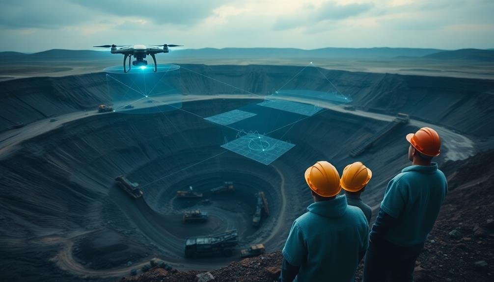
When it comes to mining operations, safety is paramount. Sky-high mapping technologies, such as drones and satellite imagery, offer a significant boost to personnel safety. You'll find that these tools allow you to survey dangerous or hard-to-reach areas without putting workers at risk. By using aerial mapping, you can identify potential hazards like unstable terrain, toxic gas pockets, or flooding risks before sending anyone into the field.
These technologies also help you create detailed, up-to-date maps of your mining site. You'll have access to accurate information about pit depths, stockpile volumes, and terrain changes, reducing the risk of accidents caused by outdated or inaccurate data. With real-time monitoring capabilities, you can quickly detect and respond to emerging safety threats.
Moreover, sky-high mapping enables better planning of escape routes and emergency response strategies. You'll be able to optimize the placement of safety equipment and design more effective evacuation procedures.
Enhanced Accuracy in Site Assessment

You'll achieve unparalleled precision in site assessment with sky-high mapping technology.
Your operations can benefit from accurate terrain elevation data and improved identification of geological features.
You'll also be able to measure stockpile volumes more efficiently, streamlining resource management and planning processes.
Precise Terrain Elevation Data
Precise terrain elevation data revolutionizes site assessment for mining operations. With sky-high mapping techniques, you'll gain access to highly accurate topographical information that's essential for planning and executing mining projects.
These advanced methods capture detailed elevation data, allowing you to identify potential challenges and opportunities in the terrain before breaking ground.
You'll be able to pinpoint areas with the most promising mineral deposits, optimize excavation plans, and design efficient transportation routes.
The precise data helps you calculate volumes of overburden and ore bodies more accurately, leading to better resource estimation and project feasibility assessments.
It also enables you to plan for water management, as you can easily identify natural drainage patterns and potential flood-prone areas.
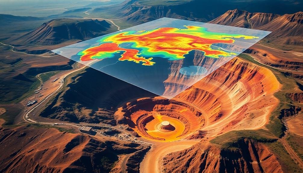
Identify Geological Features Accurately
Three key geological features become readily apparent with sky-high mapping techniques. You'll spot faults, fractures, and folds with unprecedented clarity, enabling you to make informed decisions about potential mining sites.
These advanced mapping methods provide a thorough view of the landscape, revealing subtle changes in topography and rock formations that might be missed by ground-based surveys.
Sky-high mapping helps you identify:
- Mineralization zones
- Structural controls on ore deposits
- Alteration halos around mineral deposits
- Lithological boundaries
- Surface expressions of deep-seated geological structures
By leveraging these aerial mapping technologies, you're better equipped to pinpoint areas of high mineral potential.
You'll save time and resources by focusing your exploration efforts on the most promising locations. The enhanced accuracy in site assessment allows you to develop more efficient mining plans, optimize resource allocation, and reduce environmental impact.
Moreover, you'll be able to detect and monitor geological hazards that could affect mining operations. This proactive approach to risk management guarantees safer working conditions and helps prevent costly disruptions.
With sky-high mapping, you're not just seeing the land from above; you're gaining a strategic advantage in your mining operations.
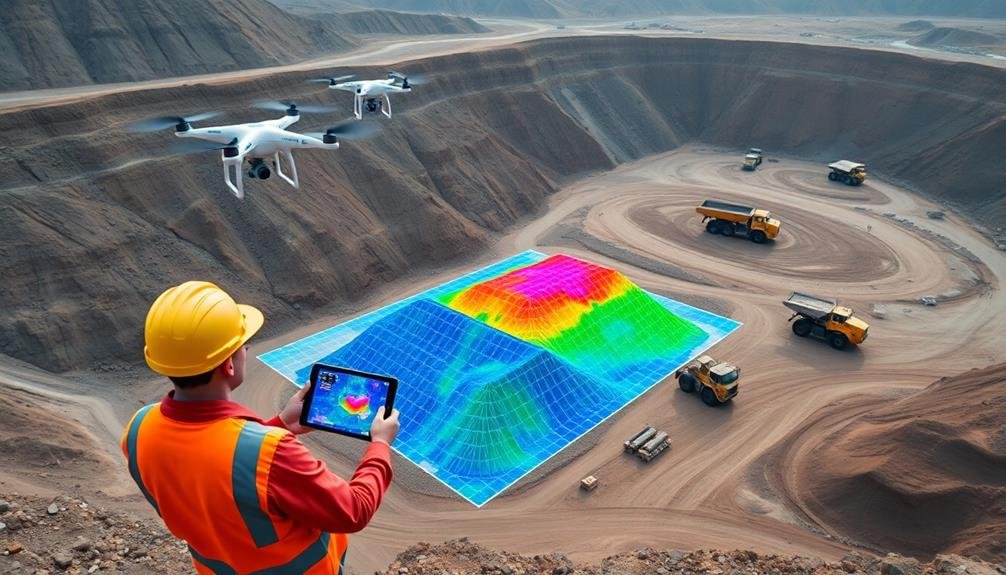
Measure Stockpile Volumes Efficiently
Measuring stockpile volumes accurately is a critical aspect of mining operations that sky-high mapping has revolutionized. You'll find that drone-based photogrammetry and LiDAR technology provide faster, safer, and more precise measurements than traditional ground-based methods. These aerial surveys can cover large areas quickly, reducing the time and labor required for volume calculations.
With sky-high mapping, you're able to:
- Generate high-resolution 3D models of stockpiles
- Calculate volumes with centimeter-level accuracy
- Monitor changes in stockpile sizes over time
The efficiency gains are substantial:
| Method | Time Required | Accuracy | Safety Risk |
|---|---|---|---|
| Manual | Days | Low | High |
| GPS | Hours | Moderate | Moderate |
| Drone | Minutes | High | Low |
Cost-Effective Surveying and Planning
Efficiency is the cornerstone of modern mining operations, and drone-based surveying has revolutionized the industry's approach to site planning. You'll find that aerial mapping provides a cost-effective solution for thorough site surveys, reducing the need for expensive ground-based teams and equipment.
With drones, you can quickly gather high-resolution data over large areas, enabling faster decision-making and more accurate planning.
By utilizing drone technology for surveying and planning, you'll benefit from:
- Reduced labor costs and increased safety
- Faster data collection and processing
- Higher accuracy and precision in measurements
- Ability to access hard-to-reach or dangerous areas
- Regular, consistent monitoring of site changes
You'll also appreciate the flexibility of drone-based surveying. Whether you need to plan new excavation sites, monitor ongoing operations, or assess environmental impacts, aerial mapping provides the data you need at a fraction of the cost of traditional methods.
With frequent, low-cost surveys, you can make informed decisions based on up-to-date information, optimizing your mining operations and maximizing profitability. Embrace this cutting-edge technology to stay competitive in the ever-evolving mining industry.
Faster Data Collection and Processing

How can drone technology revolutionize data collection and processing in mining operations? By utilizing drones equipped with advanced sensors and cameras, you'll considerably speed up the surveying process.
These aerial platforms can cover vast areas in a fraction of the time it takes traditional ground-based methods, allowing you to gather thorough data quickly and efficiently.
Drones capture high-resolution imagery and precise topographic information, which can be processed into detailed 3D models and orthomosaics.
With the help of artificial intelligence and machine learning algorithms, you can automate data analysis, identifying key features and potential extraction sites faster than ever before. This rapid processing enables you to make informed decisions and adapt your mining strategies in near real-time.
You'll also benefit from the ability to conduct frequent surveys, tracking changes in terrain and stockpiles with unprecedented accuracy.
This up-to-date information helps you optimize resource management, improve safety protocols, and enhance overall operational efficiency.
Environmental Impact Monitoring

With drone technology, you'll revolutionize environmental impact monitoring in mining operations. Drones equipped with high-resolution cameras and specialized sensors can capture detailed aerial imagery and data, allowing you to assess and track environmental changes more effectively than ever before.
You'll be able to monitor:
- Vegetation health and biodiversity
- Soil erosion and land degradation
- Water quality in nearby streams and rivers
- Air pollution and dust emissions
- Wildlife movements and habitat disturbances
These aerial surveys provide a thorough view of your mining site's ecological footprint, enabling you to identify potential issues quickly and implement mitigation strategies.
You'll detect subtle changes in vegetation cover, spot unauthorized land disturbances, and track the progress of rehabilitation efforts with unprecedented accuracy.
Volumetric Calculations and Stockpile Management
Drone technology is revolutionizing volumetric calculations and stockpile management in mining operations. You'll find that drones equipped with high-resolution cameras and LiDAR sensors can quickly and accurately survey large areas, generating detailed 3D models of stockpiles. This capability allows you to calculate volumes with unprecedented precision, eliminating the need for time-consuming manual measurements.
By using drone-based mapping, you can monitor your stockpiles more frequently, enabling better inventory control and reducing the risk of over or understocking. You'll be able to track material movement and detect any discrepancies or losses more efficiently. This improved oversight helps optimize your supply chain and production planning.
Moreover, drone surveys provide safer alternatives to traditional ground-based methods, especially when dealing with unstable or hazardous stockpiles. You can assess pile stability and identify potential safety risks without putting personnel in danger.
The data collected by drones also allows you to create digital twins of your stockpiles, facilitating remote monitoring and analysis. This technology empowers you to make more informed decisions about resource allocation, reducing waste and improving overall operational efficiency in your mining operations.
Real-Time Progress Tracking

You'll find that real-time progress tracking is one of the most valuable applications of drone technology in mining operations. With drones, you're able to monitor and assess the progress of your mining activities on a daily or even hourly basis. This level of oversight allows you to make informed decisions quickly, optimizing your operations and improving overall efficiency.
By utilizing drone-based mapping, you can:
- Identify bottlenecks in your mining processes
- Track excavation progress and compare it to project timelines
- Monitor material movement and equipment utilization
- Detect potential safety hazards or environmental concerns
- Assess the impact of weather conditions on site operations
Real-time progress tracking enables you to respond swiftly to any issues that arise, ensuring your mining project stays on schedule and within budget.
You'll have access to up-to-date, high-resolution imagery and 3D models of your site, allowing you to make data-driven decisions with confidence. This technology also facilitates better communication between teams, as everyone can access the same accurate, current information about the site's status.
Optimized Resource Extraction Planning

Harnessing the power of aerial mapping, optimized resource extraction planning revolutionizes the way you approach mining operations. You'll gain a thorough view of your site, allowing for precise identification of resource-rich areas and efficient planning of extraction routes.
With sky-high mapping, you'll optimize your mining strategy by:
- Identifying the most profitable extraction zones
- Planning the most efficient haul roads
- Minimizing environmental impact
- Reducing operational costs
Here's how aerial mapping compares to traditional methods:
| Aspect | Traditional Methods | Aerial Mapping |
|---|---|---|
| Coverage | Limited | Thorough |
| Accuracy | Moderate | High |
| Time | Slow | Rapid |
| Cost | High | Cost-effective |
Frequently Asked Questions
How Does Sky-High Mapping Integrate With Existing Mining Software Systems?
You'll find that sky-high mapping easily integrates with your existing mining software. It'll provide seamless data transfer, compatible file formats, and API connections. You can effortlessly incorporate aerial insights into your current operational systems for improved decision-making.
What Are the Legal Requirements for Using Drones in Mining Operations?
You'll need to obtain proper licenses and permits for drone operations in mining. Follow FAA regulations, respect airspace restrictions, and adhere to local laws. Don't forget to train operators and maintain safety protocols throughout your operations.
Can Sky-High Mapping Be Used for Underground Mining Operations?
You can't directly use sky-high mapping for underground mining, but it's still valuable. You'll use it to map surface features, which help you plan underground operations. It's also useful for monitoring surface impacts of underground mining.
How Often Should Sky-High Mapping Surveys Be Conducted for Optimal Results?
You should conduct sky-high mapping surveys regularly, typically every 3-6 months. However, the frequency depends on your specific mining operation, rate of change, and regulatory requirements. It's best to consult with experts for tailored recommendations.
What Specific Training Is Required for Personnel to Operate Sky-High Mapping Equipment?
You'll need specialized training in drone piloting, remote sensing, and data analysis. You should learn about flight regulations, equipment operation, and software use. It's essential to understand safety protocols and interpret aerial imagery effectively.
In Summary
You'll find sky-high mapping invaluable for your mining operations. It'll boost safety, accuracy, and efficiency while cutting costs. You can monitor environmental impact, manage stockpiles, and track progress in real-time. With faster data collection and processing, you'll optimize resource extraction planning. Don't overlook this powerful tool that's revolutionizing the mining industry. Embrace sky-high mapping to stay competitive and maximize your mining potential.
As educators and advocates for responsible drone use, we’re committed to sharing our knowledge and expertise with aspiring aerial photographers.


Leave a Reply