
Drone strategies greatly enhance mountain search and rescue operations. You'll find thermal imaging and night vision capabilities essential for detecting heat signatures in low-visibility conditions. Multi-drone swarm deployment covers larger areas efficiently, while AI-powered autonomous flight planning optimizes search patterns. High-altitude performance considerations guarantee drones function in challenging mountain environments. Advanced communication systems maintain connectivity in remote areas, and real-time data transmission keeps ground teams informed. Battery life optimization extends flight times, and integrating drones with ground search efforts maximizes overall effectiveness. These cutting-edge techniques are just the tip of the iceberg in revolutionizing mountain rescue operations.
Thermal Imaging for Heat Signatures
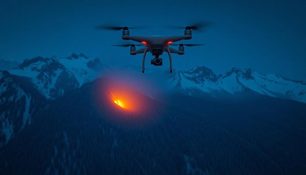
In the frigid wilderness, thermal imaging emerges as a game-changer for mountain search and rescue operations.
You'll find that drones equipped with thermal cameras can detect heat signatures of lost hikers or stranded climbers, even in low-visibility conditions or dense foliage.
These cameras work by sensing infrared radiation emitted by warm objects, allowing you to spot humans against cooler backgrounds.
You'll be able to cover vast, treacherous terrains quickly and efficiently, reducing search times and increasing the chances of survival for those in peril.
When you're using thermal imaging drones, focus on areas where missing persons are likely to seek shelter, such as rock overhangs or dense tree clusters.
You'll want to conduct searches during cooler parts of the day when the temperature contrast between humans and the environment is greatest.
Multi-Drone Swarm Deployment

You'll find that multi-drone swarm deployment greatly enhances mountain search and rescue operations.
By coordinating multiple drones, you can cover a larger area more efficiently, increasing the chances of locating missing persons quickly.
These swarms also collect more extensive data, providing rescuers with a fuller picture of the terrain and potential hazards they'll encounter during the mission.
Coordinated Area Coverage
Three key advantages make coordinated area coverage with multi-drone swarms invaluable for mountain search and rescue operations.
First, you'll achieve faster search times by dividing the area into grid sectors and assigning each drone a specific zone. This parallel processing approach allows you to cover more ground in less time, increasing the chances of locating missing persons quickly.
Second, you'll benefit from real-time data sharing among drones. As each UAV scans its assigned sector, it can relay information to the entire swarm, enabling dynamic adjustments to search patterns based on new findings or changing conditions. This collaborative approach enhances overall efficiency and adaptability.
Lastly, you'll improve search accuracy through redundancy and cross-verification. By programming drones to overlap slightly in their coverage areas, you create a system of checks and balances. Multiple drones can confirm potential sightings, reducing false positives and ensuring that no critical details are missed.
To implement coordinated area coverage effectively, you'll need to use advanced swarm algorithms, robust communication systems, and centralized control software.
These tools will help you optimize flight paths, manage battery life, and coordinate the efforts of your multi-drone team seamlessly.
Enhanced Data Collection
Multi-drone swarm deployment greatly enhances data collection capabilities in mountain search and rescue operations. You'll find that by utilizing multiple drones simultaneously, you can gather more thorough and diverse data in less time. This approach allows you to cover larger areas and collect various types of information concurrently.
Here's how swarm deployment enhances data collection:
| Data Type | Single Drone | Drone Swarm |
|---|---|---|
| Visual | Limited coverage | Wide-area surveillance |
| Thermal | Single perspective | Multiple heat signatures |
| Audio | Localized detection | Triangulation of sounds |
| Environmental | Point measurements | Distributed sensing |
With a drone swarm, you're able to capture high-resolution imagery, thermal data, audio signals, and environmental information from multiple vantage points. This multi-faceted approach greatly improves your chances of locating missing persons or identifying potential hazards.
You'll also benefit from real-time data integration, as the swarm can transmit information to a central command center for immediate analysis. This rapid processing allows you to make informed decisions quickly, potentially saving vital minutes in life-threatening situations. By leveraging swarm intelligence, you're not just collecting more data – you're collecting smarter data that can make all the difference in mountain rescue operations.
Autonomous Flight Path Planning

You'll find AI-powered route enhancement at the heart of effective autonomous flight path planning for mountain search and rescue drones.
These systems analyze terrain data, weather conditions, and search parameters to create the most efficient flight routes.
Ai-Powered Route Optimization
AI-powered route optimization frequently revolutionizes autonomous flight path planning for mountain search and rescue operations. You'll find that these advanced algorithms can analyze vast amounts of data to create the most efficient and effective flight paths for drones. They consider factors like terrain, weather conditions, and search patterns to maximize coverage and minimize search time.
When you're implementing AI-powered route optimization, you'll benefit from:
- Faster response times, potentially saving lives in critical situations
- More thorough coverage of search areas, leaving no stone unturned
- Reduced strain on human operators, allowing them to focus on decision-making
- Adaptability to changing conditions, ensuring peak performance throughout the mission
These systems can quickly adjust routes based on real-time data, such as new information about the missing person's last known location or sudden changes in weather patterns.
You'll also find that AI-powered optimization can coordinate multiple drones simultaneously, creating a seamless search network that covers more ground in less time. By leveraging machine learning algorithms, these systems continually improve their performance, learning from each mission to enhance future search operations.
Ultimately, AI-powered route optimization greatly increases the chances of successful rescues in challenging mountain environments.
Terrain-Adaptive Flight Patterns
Terrain-adaptive flight patterns soar to new heights in mountain search and rescue operations. You'll find these advanced flight algorithms revolutionizing how drones navigate complex mountainous environments. They enable your UAVs to automatically adjust their flight paths based on real-time terrain data, guaranteeing ideal coverage and safety.
When you implement terrain-adaptive flight patterns, your drones will dynamically alter their altitude, speed, and direction to match the landscape. They'll effortlessly weave through narrow valleys, climb steep ridges, and maintain a consistent distance from the ground, regardless of elevation changes. This adaptability greatly enhances search efficiency and reduces the risk of collisions.
You'll appreciate how these flight patterns integrate with onboard sensors, allowing drones to detect and avoid obstacles like trees, rock formations, and sudden cliffs. They'll also adjust for wind patterns unique to mountainous regions, maintaining stability in turbulent conditions.
High-Altitude Performance Considerations
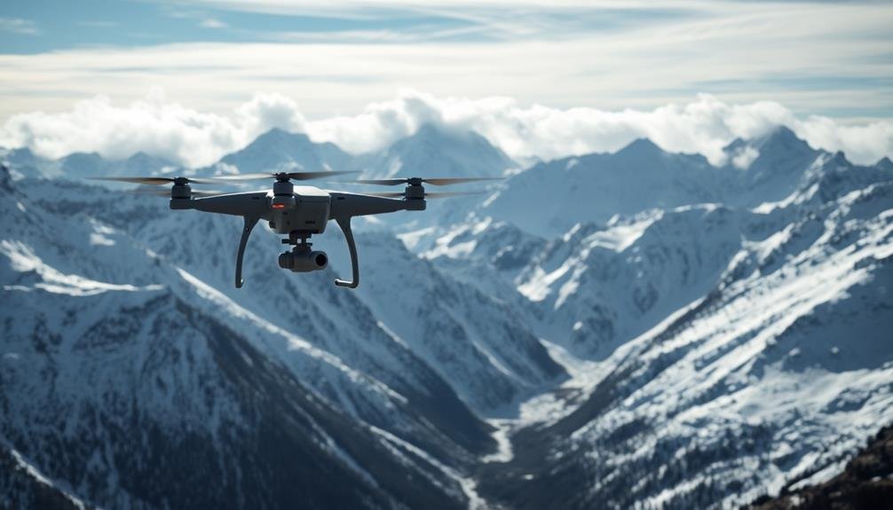
When operating drones in mountainous environments, high-altitude performance becomes a vital factor to take into account.
You'll need to take into account the reduced air density, which affects lift and propeller efficiency. To maintain peak performance, choose drones specifically designed for high-altitude operations, equipped with more powerful motors and larger propellers.
Battery life is another essential aspect. Cold temperatures at high altitudes can greatly reduce battery capacity, so you'll want to use batteries rated for low-temperature operations and carry extras.
Additionally, plan shorter flight times to compensate for increased power consumption.
Wind patterns in mountainous regions can be unpredictable and intense. Confirm your drone has robust stabilization systems and can handle strong gusts.
You may need to adjust your flight plans based on local weather conditions.
Reflect on these emotional impacts of high-altitude drone operations:
- Awe at the breathtaking views and vast landscapes
- Anxiety over potential equipment failure in remote areas
- Excitement about pushing the limits of technology
- Determination to save lives in challenging conditions
Communication Relay Systems

Three key components make up effective communication relay systems for mountain search and rescue drone operations.
First, you'll need long-range radio transmitters and receivers that can maintain a stable connection in challenging terrain. These should operate on multiple frequencies to guarantee redundancy and overcome potential interference.
Second, implement a mesh network system that allows drones to communicate with each other and relay information back to the base station. This extends your operational range and provides coverage in areas where direct communication might be impossible due to obstacles or distance.
Lastly, integrate satellite communication capabilities into your drones. This guarantees you can maintain contact even in the most remote locations where terrestrial networks are unavailable.
You'll want to equip your drones with high-gain antennas to boost signal strength and range. Consider using directional antennas at your base station to focus the signal towards the search area.
Don't forget to incorporate robust error correction and data compression techniques to maintain clear, efficient communication in adverse conditions.
Obstacle Avoidance in Rugged Terrain

You'll find obstacle avoidance essential when operating drones in rugged mountain terrain.
Lidar technology enables precise terrain mapping, while AI-powered collision detection systems constantly analyze the drone's surroundings.
These advanced features work in tandem to facilitate dynamic flight path adjustments, ensuring your drone navigates safely through challenging landscapes.
Lidar for Terrain Mapping
LiDAR technology has revolutionized terrain mapping for drone-based search and rescue operations in mountainous regions. By emitting laser pulses and measuring their return time, LiDAR sensors create highly accurate 3D maps of the surrounding terrain. This data enables you to navigate treacherous landscapes more safely and efficiently, improving your chances of locating missing persons.
When implementing LiDAR for terrain mapping in your drone strategy, consider these key benefits:
- Unparalleled accuracy: LiDAR can detect minute variations in elevation, helping you identify potential hazards or hiding spots that might be invisible to the naked eye.
- All-weather capability: Unlike traditional cameras, LiDAR can penetrate fog, smoke, and light precipitation, ensuring you don't lose valuable search time due to poor visibility.
- Night-time effectiveness: LiDAR doesn't rely on ambient light, allowing you to continue mapping and searching even in complete darkness.
- Real-time data processing: Modern LiDAR systems can generate terrain maps on-the-fly, providing you with up-to-date information as you navigate the search area.
Ai-Powered Collision Detection
Implementing AI-powered collision detection is essential for obstacle avoidance in rugged mountain terrain. You'll need to equip your drones with advanced sensors and machine learning algorithms to navigate safely through complex environments. These systems continuously scan the surroundings, identifying potential hazards like trees, cliffs, and rock formations.
To optimize your drone's collision avoidance capabilities, consider the following factors:
| Sensor Type | Advantages | Limitations |
|---|---|---|
| Stereo Cameras | Depth perception, cost-effective | Limited range, affected by lighting |
| Time-of-Flight | Accurate distance measurements | Higher power consumption |
| Ultrasonic | Works in low visibility | Short range, affected by wind |
You'll want to combine multiple sensor types for thorough coverage. Integrate this data with AI algorithms that can predict obstacle trajectories and make split-second decisions. Train your models on diverse mountain terrain datasets to improve performance in various conditions.
Don't forget to implement fail-safe protocols. If the AI detects an imminent collision it can't avoid, program your drone to hover in place or return to a safe altitude. Regularly update your collision detection software to incorporate the latest advancements in AI and sensor technology, ensuring your search and rescue drones remain cutting-edge and effective.
Dynamic Flight Path Adjustment
Dynamic flight path adjustment forms the backbone of effective obstacle avoidance in rugged terrain.
When you're operating drones in mountainous areas, you'll encounter numerous obstacles that require real-time navigation changes. Your drone must be capable of adapting its flight path on the fly, ensuring it can navigate through narrow valleys, around jutting rock formations, and over dense forest canopies.
To implement dynamic flight path adjustment, you'll need to integrate sophisticated algorithms that process data from multiple sensors.
These algorithms should continuously analyze the drone's surroundings and make split-second decisions to alter its course.
You'll want to prioritize:
- Rapid obstacle detection and classification
- Real-time trajectory planning and optimization
- Smooth and efficient evasive maneuvers
- Constant reassessment of the flight path
Weather-Resistant Drone Design

Harsh mountain environments demand drones that can withstand extreme conditions. You'll need to design your drones with weather-resistant features to guarantee they can operate effectively in challenging mountain terrain.
Start by choosing materials that can handle temperature fluctuations, such as carbon fiber or reinforced plastics. These materials offer durability without adding excessive weight.
Incorporate weatherproofing measures to protect sensitive electronics from moisture and dust. You should seal all openings and use waterproof connectors for added protection.
Consider adding a heating system to prevent battery failure in cold temperatures and to keep critical components functioning efficiently.
Your drone's propellers should be designed to handle strong winds and turbulence. Opt for larger, more robust propellers that can maintain stability in gusty conditions.
You'll also want to include advanced stabilization systems and wind-resistant flight modes to keep your drone steady during searches.
Don't forget about visibility. Equip your drone with high-visibility colors and powerful LED lights to guarantee it remains visible in fog, snow, or low-light conditions.
These features will help your search team track the drone's position and aid in locating missing persons.
Night Vision and Low-Light Operations
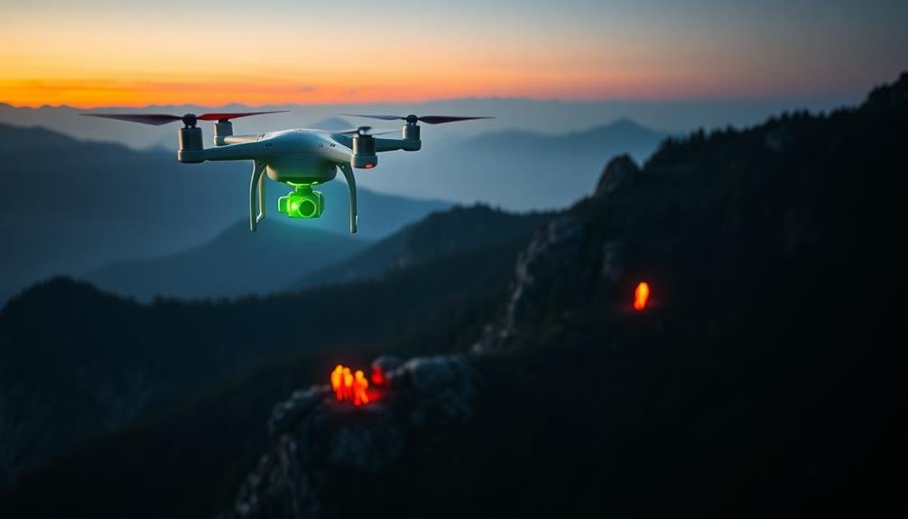
Equipped with advanced night vision technology, drones can greatly enhance mountain search and rescue operations in low-light conditions. You'll find that thermal imaging cameras and infrared sensors allow drones to detect heat signatures of missing persons, even in complete darkness.
These capabilities enable search teams to continue their efforts round the clock, markedly increasing the chances of a successful rescue.
When implementing night vision drones for mountain search and rescue, you should consider the following:
- High-resolution thermal cameras to capture detailed heat signatures
- Powerful infrared lights to illuminate the search area without disturbing wildlife
- Real-time video transmission systems for immediate analysis by ground teams
- Long-lasting batteries to guarantee extended flight times during critical nighttime operations
You'll need to train your operators to interpret thermal imagery effectively and navigate in low-light conditions.
It's essential to integrate night vision drone operations with other search methods for thorough coverage. By leveraging these advanced technologies, you'll dramatically improve your team's ability to locate and rescue individuals in challenging mountain environments, regardless of the time of day or lighting conditions.
Real-Time Data Transmission Techniques

Real-time data transmission is the backbone of effective drone operations in mountain search and rescue. You'll need to guarantee your drones are equipped with reliable communication systems that can transmit data over long distances and through challenging terrain.
Consider using a combination of cellular networks, satellite communication, and radio frequency links to maintain constant connectivity.
Implement a robust telemetry system that transmits essential flight data, including altitude, speed, battery life, and GPS coordinates. This information is vital for mission control to monitor the drone's status and make informed decisions.
Outfit your drones with high-quality cameras and thermal imaging sensors, and use video compression techniques to stream live footage back to base camp without compromising image quality.
Set up a mobile command center with powerful antennas and signal boosters to enhance reception in remote areas. Use mesh networking technology to create a web of interconnected drones that can relay data across vast distances.
Employ edge computing techniques to process and analyze data on the drone itself, reducing transmission loads and improving response times.
Battery Life Optimization Strategies

Battery life is a critical factor in mountain search and rescue drone operations. You'll need to implement effective strategies to maximize flight time and guarantee your drones can cover extensive search areas. Start by selecting high-capacity lithium-polymer batteries designed for extreme temperatures.
Enhance your drone's weight by removing non-essential components and using lightweight materials for any custom modifications.
To further extend battery life, consider these techniques:
- Use adaptive flight patterns that adjust based on terrain and wind conditions
- Implement energy-efficient sensors and cameras to reduce power consumption
- Utilize solar panels or mid-mission battery swaps for extended operations
- Employ AI-powered flight control systems to improve power usage in real-time
You can also leverage weather forecasts to plan missions during ideal conditions, reducing the strain on batteries caused by strong winds or extreme temperatures.
Additionally, consider using multiple drones in relay formations, allowing each unit to cover a specific area before returning to base for recharging. This approach guarantees continuous coverage while maximizing the efficiency of your battery resources.
Integration With Ground Search Teams

Effective integration between drone operations and ground search teams is essential for successful mountain search and rescue missions.
You'll need to establish clear communication channels between drone operators and ground teams. Use radio or satellite communication systems to relay real-time information and coordinate efforts. Develop a shared mapping system that allows both drone operators and ground searchers to mark areas of interest or completed search zones.
Train your ground teams to understand drone capabilities and limitations. This knowledge will help them make informed requests and interpret drone-collected data effectively.
Implement a system for rapid data transfer from drones to ground teams, enabling quick analysis of aerial imagery and thermal scans. Consider equipping ground teams with portable devices to receive and view drone footage in the field.
Coordinate search patterns between drones and ground teams to maximize coverage and avoid redundancy. Use drones to scout ahead and guide ground teams to promising areas or potential hazards.
Develop protocols for drones to drop supplies or communication devices to stranded individuals before ground teams arrive. Regularly conduct joint training exercises to improve collaboration and refine integration strategies between aerial and ground-based search efforts.
Frequently Asked Questions
How Do Drones Handle Wildlife Encounters During Search and Rescue Missions?
You'll program drones to avoid wildlife when possible. They'll use thermal imaging to detect animals, maintain safe distances, and reduce noise. If encounters are unavoidable, operators can guide drones to minimize stress on wildlife during missions.
What Legal Considerations Exist for Drone Use in Mountain Search Operations?
You'll need to contemplate airspace regulations, privacy laws, and search warrants. Don't forget to obtain necessary permits and certifications. Be aware of altitude restrictions and no-fly zones. Always prioritize safety and respect local regulations when operating drones.
Can Drones Be Used to Deliver Emergency Supplies to Stranded Individuals?
Yes, you can use drones to deliver emergency supplies to stranded individuals. They're efficient for transporting lightweight items like food, water, and first aid kits to remote locations quickly. You'll need to take into account payload capacity and flight range.
How Do Search Teams Train for Drone-Assisted Mountain Rescue Operations?
You'll train extensively for drone-assisted mountain rescues. You'll practice flight controls, mapping terrain, and spotting survivors. You'll learn to coordinate with ground teams, handle weather challenges, and master emergency supply drops. Regular simulations hone your skills.
What Role Do Drones Play in Post-Rescue Analysis and Mission Debriefing?
You'll find drones invaluable for post-rescue debriefing. They provide aerial footage to review mission tactics, identify areas for improvement, and analyze terrain challenges. You can use this data to refine future rescue strategies and training protocols.
In Summary
You've explored key drone strategies for mountain search and rescue. From thermal imaging to swarm deployment, you're now equipped with cutting-edge techniques. Remember, it's not just about the tech – it's how you integrate it with ground teams. As you implement these strategies, you'll enhance your ability to save lives in challenging terrain. Keep pushing the boundaries of what's possible, and you'll revolutionize mountain rescue operations.
As educators and advocates for responsible drone use, we’re committed to sharing our knowledge and expertise with aspiring aerial photographers.


Leave a Reply