Multispectral imaging offers you powerful insights for land surveys across five key applications. You'll assess vegetation health, analyzing chlorophyll content and water stress. It'll help you map soil composition, revealing organic matter and mineral levels. You can manage water resources by detecting quality changes and optimizing irrigation. In urban areas, you'll identify heat islands to mitigate temperature extremes. For archaeology, you'll discover hidden structures through soil and vegetation patterns. These applications transform your ability to analyze and manage land effectively, providing a wealth of data for informed decision-making. Explore further to reveal the full potential of this revolutionary technology.
Vegetation Health Assessment
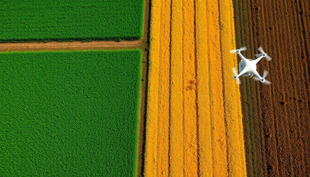
In recent years, multispectral imaging has revolutionized vegetation health assessment in land surveys. You'll find that this technology uses multiple spectral bands to capture data beyond what's visible to the human eye. By analyzing these various wavelengths, you can detect subtle changes in plant health, stress levels, and overall vigor.
When conducting a vegetation health assessment, you'll focus on key indicators such as chlorophyll content, water stress, and biomass. Multispectral sensors capture near-infrared (NIR) and red-edge bands, which are particularly sensitive to these factors. You'll use vegetation indices like NDVI (Normalized Difference Vegetation Index) to quantify plant health and productivity.
You can apply this technology to monitor crop health, detect disease outbreaks, and optimize irrigation practices. In forestry, you'll use it to assess tree health, identify areas of deforestation, and plan reforestation efforts.
Urban planners can benefit from multispectral imaging to evaluate green spaces and manage urban forests. By incorporating this advanced imaging technique into your land surveys, you'll gain valuable insights into ecosystem health and make more informed decisions regarding land management and conservation efforts.
Soil Composition Analysis

Moving from plant health to what lies beneath, soil composition analysis is another key application of multispectral imaging in land surveys. You'll find that multispectral sensors can detect various soil properties, including organic matter content, moisture levels, and mineral composition.
By capturing data across different wavelengths, you're able to create detailed soil maps that reveal vital information about the land's potential and limitations. You can use these insights to make informed decisions about crop selection, irrigation strategies, and fertilizer application.
For instance, you'll be able to identify areas with high salt content or low nutrient levels, allowing for targeted interventions. The technology also helps you detect soil erosion patterns and compaction issues, enabling proactive conservation measures.
Moreover, multispectral imaging allows you to monitor changes in soil composition over time. This temporal analysis is invaluable for evaluating the impact of land management practices and environmental factors on soil health.
Water Resource Management

Water resource management stands out as a vital application of multispectral imaging in land surveys. You'll find this technology invaluable for monitoring and evaluating water bodies, wetlands, and drainage patterns. By capturing data across multiple spectral bands, you can detect variations in water quality, depth, and turbidity that aren't visible to the naked eye.
You'll be able to identify algal blooms, sediment loads, and potential pollutants, enabling prompt interventions to maintain water health. Multispectral imaging also helps you map flood-prone areas and track changes in water levels over time. This information is essential for developing effective flood management strategies and predicting future water availability.
In agricultural settings, you can use multispectral data to optimize irrigation practices. By analyzing soil moisture content and crop health, you'll make informed decisions about water allocation, reducing waste and improving crop yields. You'll also detect leaks in irrigation systems and evaluate the efficiency of water distribution networks.
For urban planners, this technology aids in stormwater management and the identification of impervious surfaces that affect runoff. You'll gain valuable insights for designing sustainable drainage systems and mitigating urban flooding risks.
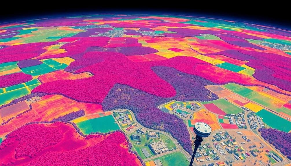
Urban Heat Island Detection

Urban heat islands pose significant challenges for city planners and environmental managers. Multispectral imaging offers a powerful tool to detect and analyze these phenomena. You'll find that thermal infrared bands are particularly useful for identifying areas of elevated surface temperatures within urban landscapes.
By using multispectral sensors, you can create detailed temperature maps that highlight hotspots and cooler zones across a city. This data allows you to pinpoint areas with insufficient green spaces, high-density building clusters, or heat-absorbing materials like asphalt and concrete.
You'll be able to track temperature variations throughout the day and across seasons, providing valuable insights into the urban heat island effect's temporal dynamics.
With this information, you can develop targeted strategies to mitigate urban heat. You'll be able to identify prime locations for green roof installations, tree planting initiatives, or the implementation of cool pavement technologies.
Multispectral imaging also enables you to monitor the effectiveness of these interventions over time, helping you refine your approach to urban heat island management. By leveraging this technology, you're better equipped to create more livable, sustainable urban environments.
Archaeological Site Identification
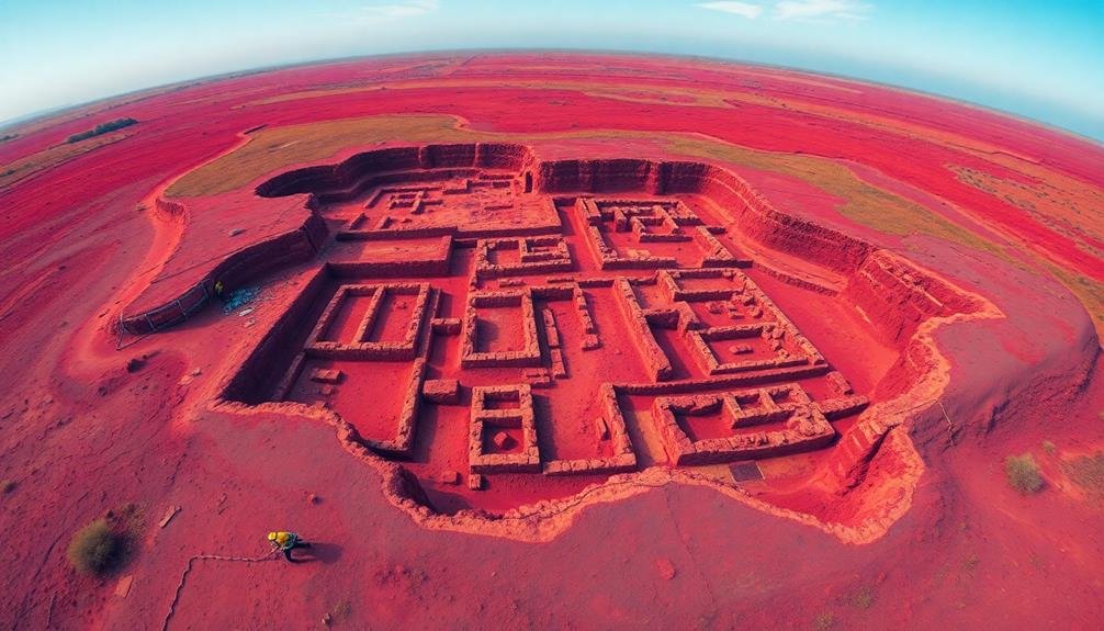
Archaeological site identification has been revolutionized by multispectral imaging techniques. You'll find that these advanced sensors can detect subtle changes in soil composition, vegetation patterns, and surface features that are invisible to the naked eye. By capturing data across multiple wavelengths of light, multispectral imaging reveals hidden structures, ancient pathways, and buried artifacts.
When you're surveying potential archaeological sites, you'll use near-infrared and thermal imaging to identify anomalies in soil moisture and temperature. These variations often indicate the presence of buried walls, foundations, or other man-made structures. You'll also analyze vegetation health indices to spot crop marks, which can signal underground features affecting plant growth.
Multispectral data allows you to create detailed maps of archaeological sites without invasive excavation. You'll combine this information with LiDAR and ground-penetrating radar data for a thorough understanding of the site's layout and composition.
Frequently Asked Questions
How Does Atmospheric Interference Affect Multispectral Imaging Accuracy?
Atmospheric interference can greatly impact your multispectral imaging accuracy. You'll find that gases, aerosols, and water vapor absorb or scatter light, altering spectral signatures. This can lead to distorted data and misinterpretation of surface features.
What Are the Cost Implications of Implementing Multispectral Imaging for Land Surveys?
You'll face significant upfront costs for equipment and software when implementing multispectral imaging for land surveys. However, you'll likely see long-term savings through increased efficiency, accuracy, and the ability to gather more extensive data.
Can Multispectral Imaging Be Combined With Other Remote Sensing Technologies?
Yes, you can combine multispectral imaging with other remote sensing technologies. You'll often see it used alongside LiDAR, thermal imaging, and hyperspectral sensors. This integration enhances data quality and provides more thorough insights for various applications.
How Frequently Should Multispectral Imaging Surveys Be Conducted for Optimal Results?
You'll want to conduct multispectral imaging surveys regularly, but frequency depends on your specific needs. Seasonal changes, rapid land development, or environmental monitoring might require monthly surveys, while other projects may only need annual updates.
What Are the Limitations of Multispectral Imaging in Extreme Weather Conditions?
You'll face limitations in extreme weather. Heavy rain or snow can obstruct sensors. High winds may cause image blurring. Extreme temperatures can affect equipment performance. Cloud cover can block certain wavelengths, reducing data quality and accuracy.
In Summary
You've now explored five powerful applications of multispectral imaging for land surveys. From evaluating vegetation health to uncovering hidden archaeological sites, this technology's giving you unprecedented insights. It's revolutionizing how you manage water resources, analyze soil composition, and even detect urban heat islands. By embracing these advanced imaging techniques, you'll gain a deeper understanding of landscapes and make more informed decisions in your land survey projects. Don't hesitate to leverage this game-changing technology.
As educators and advocates for responsible drone use, we’re committed to sharing our knowledge and expertise with aspiring aerial photographers.


Leave a Reply