After a catastrophe, smart resource distribution is essential. You'll need to conduct rapid aerial damage assessments and identify high-priority areas. Optimize delivery routes and track resources in real-time. Use drones for supply drops in hard-to-reach locations. Locate and rescue survivors quickly, while detecting environmental hazards. Coordinate multi-agency relief efforts effectively and allocate resources based on data-driven decisions. Don't forget to restore communication networks and use portable water analysis tools. These strategies will help you efficiently distribute aid and save lives. Discover more about each tip to maximize your disaster response effectiveness.
Rapid Aerial Damage Assessment

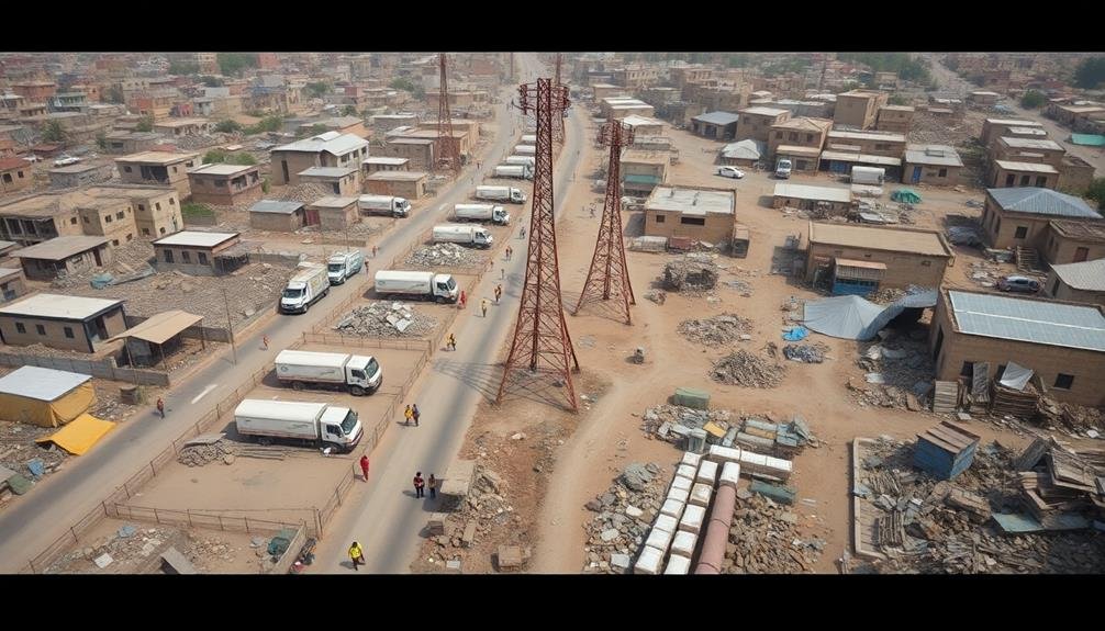
Soaring above devastated landscapes, drones and satellites provide essential data for rapid aerial damage assessment. You'll find these tools invaluable for quickly gauging the extent of destruction and identifying areas in urgent need of assistance. High-resolution imagery and thermal sensors help you detect structural damage, locate survivors, and assess infrastructure integrity.
To maximize efficiency, deploy a fleet of drones equipped with AI-powered image recognition software. This technology allows for real-time analysis of disaster zones, highlighting blocked roads, collapsed buildings, and potential hazards. You'll receive instant reports on the severity of damage across different areas, enabling you to prioritize resource allocation effectively.
Combine drone data with satellite imagery for a thorough overview. Satellites offer a broader perspective, helping you identify patterns of destruction and track the movement of displaced populations.
You'll also use this information to plan safe routes for emergency responders and aid convoys.
Identifying High-Priority Areas
You'll need to employ various damage assessment techniques to pinpoint areas requiring immediate attention after a catastrophe.
These methods can include satellite imagery analysis, drone surveys, and on-ground reports to evaluate the extent of destruction.
Combining this information with population density mapping will help you identify high-priority areas where resources can have the most significant impact on saving lives and mitigating suffering.
Damage Assessment Techniques
When disaster strikes, quickly identifying high-priority areas is essential for efficient resource allocation. To assess damage accurately, you'll need to employ various techniques.
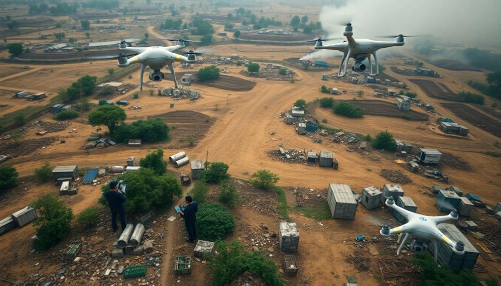
Start with aerial surveys using drones or helicopters to get a broad overview of affected areas. This method allows you to spot large-scale destruction and identify isolated communities.
Next, utilize satellite imagery to compare before-and-after pictures of the disaster zone. This technique helps you pinpoint specific areas of severe damage and track changes over time.
Don't forget to leverage social media and crowdsourced information. Residents often share real-time updates and photos, providing valuable on-the-ground insights.
Deploy rapid assessment teams to conduct ground surveys in accessible areas. These teams can provide detailed reports on infrastructure damage, population needs, and potential hazards.
Use mobile apps and GPS technology to collect and map data efficiently.
Population Density Mapping
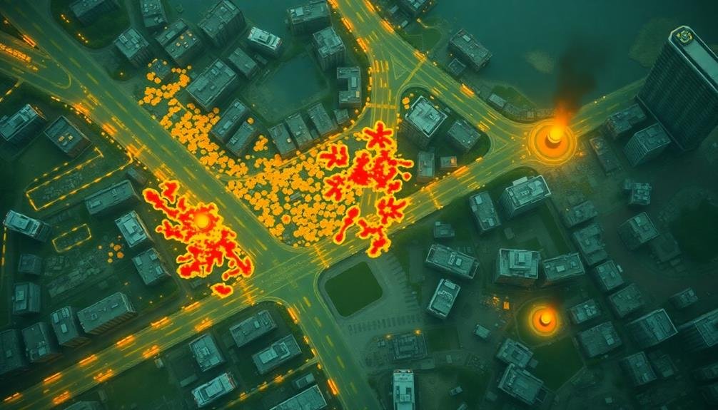
With damage assessment complete, the next step is identifying high-priority areas through population density mapping. This vital process helps you allocate resources efficiently by pinpointing areas with the highest concentration of affected individuals.
Start by gathering pre-disaster population data from census records, satellite imagery, and local government sources. Overlay this information with your damage assessment results to create a thorough map of impacted areas. Use GIS software to visualize the data and identify hotspots where large numbers of people are likely to need immediate assistance.
Don't rely solely on outdated information. Conduct rapid population estimates using drone surveys, mobile phone data, or social media activity to account for potential population shifts caused by the disaster. Pay special attention to vulnerable groups, such as the elderly, children, or those with disabilities, who may require prioritized aid.
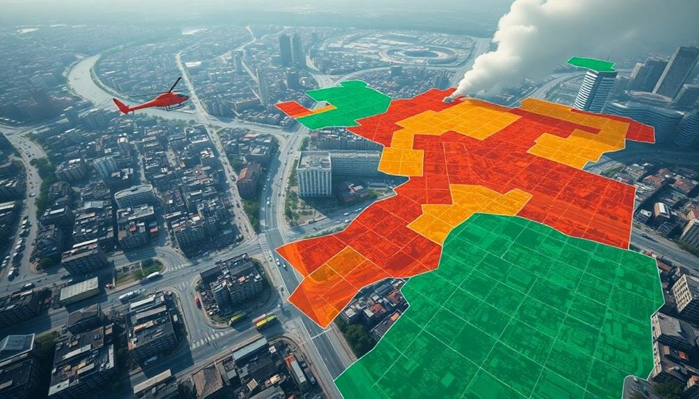
Create color-coded maps to easily distinguish between high, medium, and low-density areas. This visual representation will help you quickly identify where to concentrate your efforts.
Remember to update your population density maps regularly as the situation evolves and people potentially relocate to safer areas or emergency shelters.
Optimizing Delivery Routes
You'll need to start by mapping out priority areas to efficiently distribute resources.
Utilize real-time traffic updates to navigate around obstacles and congestion, ensuring the quickest possible delivery times.
Don't overlook alternative transport methods, such as drones or boats, which might provide faster access to hard-to-reach locations.
Mapping Priority Areas
In the wake of a catastrophe, optimizing delivery routes becomes essential for efficient resource distribution. To map priority areas effectively, you'll need to gather real-time data on population density, infrastructure damage, and resource scarcity. Use satellite imagery, drones, and on-the-ground reports to create an accurate picture of the affected region.
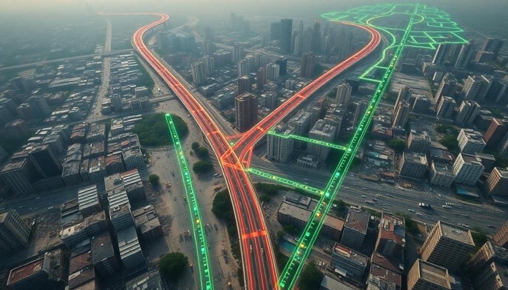
Identify critical locations such as hospitals, emergency shelters, and water treatment facilities. These should be your top priorities for resource allocation. Create a color-coded map highlighting areas of urgent need, moderate need, and low need. This visual representation will help you quickly assess where to direct your efforts.
Consider factors like road conditions, traffic congestion, and potential hazards when planning delivery routes. Utilize GPS technology and route optimization software to find the most efficient paths between priority areas.
Don't forget to account for changing conditions, as new information may alter your priorities. Regularly update your priority map as the situation evolves.
Establish clear communication channels with local authorities and relief organizations to guarantee everyone is working from the same information. By systematically mapping priority areas, you'll maximize the impact of your resource distribution efforts and help those in need more effectively.
Real-Time Traffic Updates
Real-time traffic updates are essential for optimizing delivery routes in disaster-stricken areas. You'll need to implement a system that continuously monitors road conditions, closures, and congestion.
Use GPS-enabled devices in your vehicles and integrate them with traffic monitoring software. This will allow you to receive instant updates on the best routes to take.
Collaborate with local authorities and emergency services to get access to their traffic data. They often have the most up-to-date information on road closures and newly cleared paths.
Consider using drones or satellite imagery to identify blocked roads or damaged infrastructure that mightn't be reported through traditional channels.
Encourage your drivers to report any obstacles or changes they encounter during their routes. This crowd-sourced information can be invaluable for updating your system in real-time.
Implement a communication network that allows drivers to share updates with each other and the central command.
Don't forget to factor in the time of day when planning routes. Traffic patterns can change rapidly in post-disaster scenarios, so what works in the morning mightn't be efficient in the afternoon.
Alternative Transport Methods
While optimizing delivery routes is essential, sometimes traditional road-based transportation isn't enough. You'll need to contemplate alternative transport methods to guarantee resources reach affected areas quickly and efficiently.
Explore the use of drones for small, urgent deliveries to hard-to-reach locations. These unmanned aerial vehicles can bypass damaged roads and deliver vital supplies like medicine or communication devices.
Think about helicopters for larger payloads or when speed is vital. They're ideal for transporting medical teams or heavy equipment to remote disaster zones.
In coastal areas, boats and amphibious vehicles can be invaluable for reaching flooded regions or isolated communities. Don't overlook the potential of off-road vehicles, which can navigate rough terrain and debris-strewn paths.
For longer distances, think about partnering with local railways if tracks are intact. Trains can transport massive quantities of supplies efficiently.
In extreme cases, you might need to employ airdrops for areas completely cut off from ground access. Remember to coordinate closely with local authorities and military personnel to guarantee these alternative methods are used safely and effectively.
Real-Time Resource Tracking
One of the most vital aspects of smart resource distribution after catastrophes is real-time resource tracking. You'll need to implement a system that allows you to monitor the movement and availability of supplies continuously. This facilitates quick decision-making and efficient allocation of resources where they're needed most.
To set up an effective real-time tracking system, consider these key components:
- GPS-enabled devices on vehicles and containers
- RFID tags on individual items and packages
- A centralized digital platform for data collection and analysis
You'll want to guarantee your tracking system is resilient and can function even with limited connectivity. Use satellite communication when cellular networks are down, and implement offline modes that sync data once connections are restored.
Real-time tracking helps you identify bottlenecks, predict shortages, and redirect resources on the fly. It also improves accountability and reduces the risk of theft or misuse.
Drone-Assisted Supply Drops
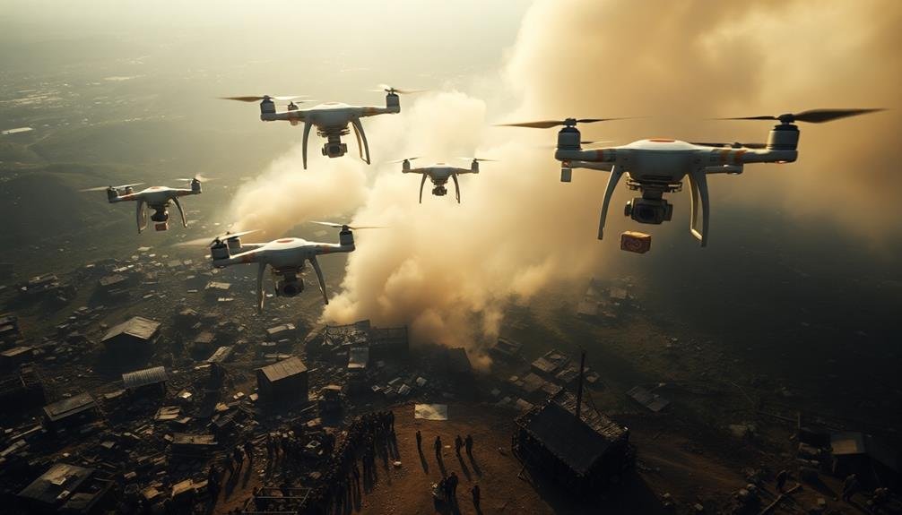
Drone-assisted supply drops offer a revolutionary approach to resource distribution in disaster-stricken areas. You can leverage these unmanned aerial vehicles to deliver essential supplies quickly and efficiently to hard-to-reach locations. By utilizing drones, you'll bypass damaged infrastructure and overcome geographical barriers that often hinder traditional relief efforts.
To maximize the effectiveness of drone-assisted supply drops, you should:
- Prioritize payload based on urgency and weight capacity
- Coordinate with ground teams for precise drop locations
- Use GPS tracking to guarantee accurate deliveries
- Implement real-time communication systems for updates
Here's a breakdown of drone capabilities and considerations:
| Drone Type | Payload Capacity | Range | Best Use Case |
|---|---|---|---|
| Multirotor | 2-5 kg | 5-10 km | Urban areas |
| Fixed-wing | 5-10 kg | 20-50 km | Rural regions |
| Hybrid VTOL | 10-20 kg | 50-100 km | Long-distance |
| Heavy-lift | 20+ kg | 10-30 km | Large supplies |
Communication Network Restoration

Restoring communication networks in the wake of a disaster is essential for coordinating relief efforts and ensuring the safety of affected populations.
You'll need to prioritize the reestablishment of key communication infrastructure to facilitate effective disaster response. Start by evaluating the damage to existing networks and identifying vital areas that require immediate attention.
Deploy mobile communication units to provide temporary coverage in affected regions. These units can serve as makeshift cell towers or Wi-Fi hotspots, allowing emergency responders and civilians to communicate.
You should also consider using satellite phones and portable radio systems as backup communication methods.
To expedite the restoration process, focus on:
- Repairing damaged cell towers and power lines
- Deploying temporary network equipment, such as COWs (Cells on Wheels)
- Establishing emergency communication centers in strategic locations
Work closely with local telecom providers and government agencies to coordinate efforts and share resources.
Remember that restoring communication networks isn't just about fixing infrastructure; it's about reconnecting communities and enabling efficient disaster response.
Survivor Location and Rescue

After restoring communication networks, the next vital step is locating and rescuing survivors. You'll need to prioritize your efforts and use available resources efficiently. Start by deploying search and rescue teams to high-priority areas, such as densely populated regions or locations with vulnerable populations.
Utilize various technologies and methods to locate survivors:
| Method | Description |
|---|---|
| Drones | Use for aerial surveillance |
| Thermal imaging | Detect body heat signatures |
| Acoustic sensors | Listen for sounds of life |
| Search dogs | Track scents in debris |
| Social media | Monitor for distress calls |
Once you've identified survivor locations, coordinate rescue efforts using a centralized command system. Prioritize rescues based on the severity of injuries and the stability of surrounding structures. Make sure rescuers are properly equipped with safety gear and tools for various scenarios, such as confined space rescues or water rescues.
Remember to document all rescue operations, including survivor information and medical needs. This data will be essential for ongoing relief efforts and reuniting families. As you conduct rescue operations, maintain clear communication channels with other emergency response teams to avoid duplication of efforts and guarantee efficient resource allocation.
Environmental Hazard Detection
You'll need to quickly assess environmental dangers after a catastrophe.
Rapid contaminant testing kits and portable water analysis tools can help you identify immediate threats to survivors' health.
Aerial surveillance technology offers a broader view, allowing you to spot potential hazards like chemical spills or unstable structures from above.
Rapid Contaminant Testing Kits
Environmental hazard detection kicks into high gear after a catastrophe with rapid contaminant testing kits. These portable devices allow you to quickly assess the safety of water, soil, and air in affected areas.
You'll need to prioritize testing locations based on population density and potential contamination sources.
When using rapid contaminant testing kits, remember these key points:
- Calibrate equipment before each use for accurate results
- Wear appropriate personal protective equipment (PPE) during sampling
- Document all test results, including time, date, and location
You'll find that these kits typically test for common pollutants like heavy metals, pesticides, and bacterial contaminants. They're designed for ease of use, providing results within minutes to hours, rather than days or weeks.
This quick turnaround enables you to make informed decisions about resource allocation and public safety measures.
Don't forget to train your team on proper kit usage and result interpretation. Regular practice drills will guarantee everyone's prepared when disaster strikes.
Aerial Surveillance Technology
Aerial surveillance technology frequently plays an essential role in environmental hazard detection following catastrophic events. You'll find that drones and satellites equipped with advanced sensors can quickly survey large areas, identifying potential threats that might be invisible from the ground.
These aerial systems often use multispectral and hyperspectral imaging to detect chemical spills, radiation leaks, or other hazardous materials. They can spot changes in vegetation that might indicate contamination or map the spread of wildfires in real-time.
You'll appreciate how thermal cameras can locate hotspots or trapped survivors, while LiDAR technology creates detailed 3D maps of affected areas.
When you're coordinating disaster response, you'll want to leverage data from these aerial platforms to make informed decisions. They can help you prioritize areas for evacuation, guide search and rescue efforts, and identify safe routes for emergency vehicles.
You'll also find this technology useful for monitoring the progress of cleanup efforts and evaluating long-term environmental impact.
Portable Water Analysis Tools
Numerous portable water analysis tools have become indispensable for rapid environmental hazard detection after catastrophes. These compact devices allow you to quickly assess water quality and identify potential contaminants in the field.
You'll find that these tools are vital for making informed decisions about resource distribution and public safety.
Modern portable water analysis kits typically include multiple testing capabilities, such as:
- pH meters to measure acidity or alkalinity
- Conductivity sensors to detect dissolved solids
- Colorimeters for analyzing chemical concentrations
You can use these tools to test for a wide range of pollutants, including heavy metals, bacteria, and chemical contaminants. By conducting on-site analysis, you'll save valuable time compared to sending samples to a laboratory.
When using portable water analysis tools, make sure you're familiar with proper sampling techniques and calibration procedures. Regular maintenance and accurate interpretation of results are fundamental for reliable data.
Remember to document your findings thoroughly, as this information will guide decision-making processes and help prioritize areas for immediate intervention.
Coordinating Multi-Agency Relief Efforts
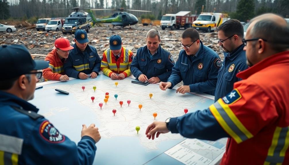
Collaboration is key when coordinating multi-agency relief efforts after a catastrophe. You'll need to establish clear communication channels between all involved organizations, including government agencies, NGOs, and local community groups.
Set up a centralized command center to oversee operations and make swift decisions.
Create a shared database of resources, skills, and personnel available from each agency. This will help you quickly identify gaps and allocate assets where they're most needed.
Implement a standardized reporting system to guarantee all agencies are using the same metrics and terminology.
Assign specific roles and responsibilities to each organization based on their expertise and capabilities. Avoid duplicating efforts by clearly defining geographical areas of operation for each agency.
Regularly hold coordination meetings to update all parties on progress, challenges, and changing priorities.
Develop a unified public communication strategy to provide consistent information to affected populations and media outlets.
Use technology like GPS tracking and real-time mapping to optimize resource distribution and avoid overlaps or underserved areas.
Data-Driven Resource Allocation
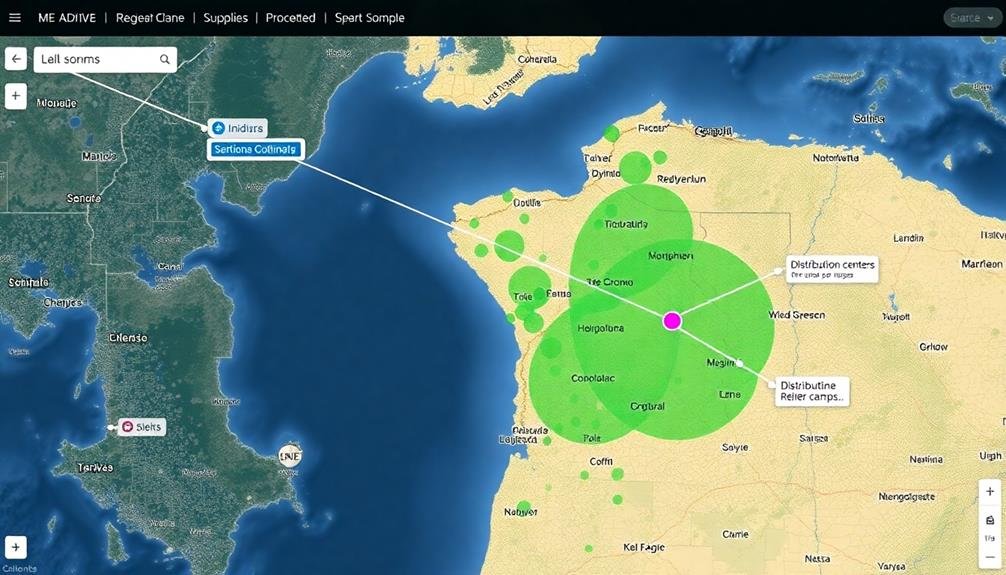
Data-driven resource allocation forms the backbone of effective disaster response. You'll need to leverage real-time data and predictive analytics to make informed decisions about where to send resources.
Start by establishing a centralized data hub that collects information from various sources, including satellite imagery, social media, and on-the-ground reports. This hub should process and analyze data quickly, providing actionable insights to decision-makers.
To optimize resource distribution, focus on:
- Prioritizing areas with the highest need based on population density, infrastructure damage, and vulnerability factors
- Identifying the most efficient transportation routes, considering road conditions and potential bottlenecks
- Tracking resource inventory in real-time to prevent shortages and oversupply
Implement machine learning algorithms to predict future needs and potential challenges. These predictions can help you proactively allocate resources and prevent secondary crises.
Don't forget to continuously update your data models with new information as the situation evolves. By embracing data-driven decision-making, you'll maximize the impact of your limited resources and guarantee that aid reaches those who need it most efficiently and effectively.
Frequently Asked Questions
How Can Local Communities Prepare for Resource Distribution Before a Catastrophe Occurs?
You can prepare by creating emergency stockpiles, establishing distribution centers, and developing a communication plan. Train volunteers, coordinate with local authorities, and conduct regular drills. Don't forget to update your plans and inventory periodically.
What Role Does Social Media Play in Resource Distribution During Disasters?
You'll find social media essential for resource distribution during disasters. It enables rapid information sharing, coordinates volunteer efforts, and connects those in need with available aid. You can use platforms to request help or offer assistance efficiently.
How Are Cultural Sensitivities Addressed When Distributing Resources in Diverse Communities?
You'll need to contemplate diverse customs, languages, and beliefs when distributing resources. Engage local leaders, use culturally appropriate communication methods, and respect dietary restrictions. Be flexible and adapt your approach to each community's unique needs.
What Measures Are Taken to Prevent Resource Hoarding or Black Market Activities?
You'll need to implement strict rationing, monitor distribution closely, and enforce penalties for hoarding. You should also establish a transparent allocation system, encourage community policing, and create incentives for reporting black market activities.
How Do Authorities Handle Resource Distribution for Undocumented Individuals in Affected Areas?
You'll find authorities often prioritize immediate aid over documentation. They'll typically distribute resources to all affected individuals, regardless of status. However, long-term assistance may require some form of identification or registration process.
In Summary
You've learned powerful strategies for smart resource distribution after catastrophes. By leveraging technology and data, you'll be better equipped to assess damage, prioritize needs, and deliver aid efficiently. Remember, it's not just about the resources you have, but how effectively you use them. Stay adaptable, coordinate with other agencies, and always put survivors first. With these tips, you're ready to make a real difference when disaster strikes.
As educators and advocates for responsible drone use, we’re committed to sharing our knowledge and expertise with aspiring aerial photographers.


Leave a Reply