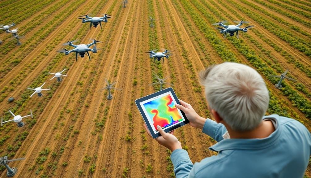
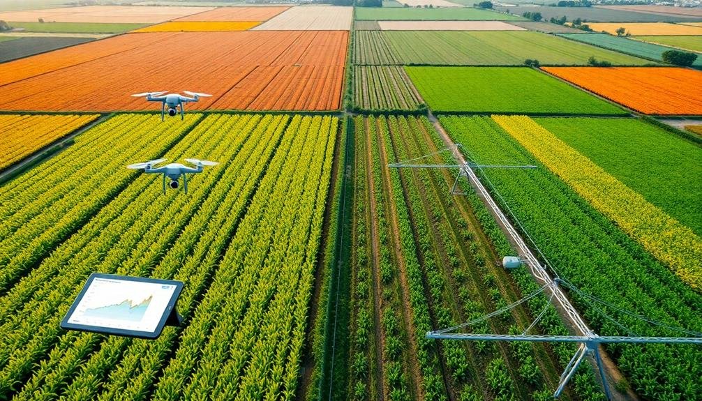
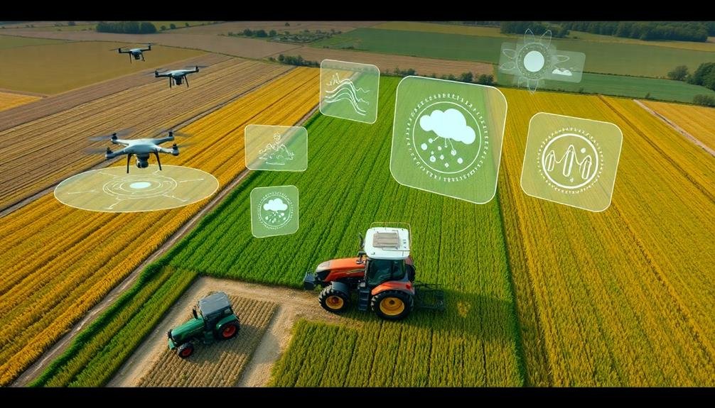
Precision tools are transforming smart farming surveys, giving you unprecedented insights into your fields. High-resolution multispectral cameras capture detailed crop health data, while LiDAR sensors create 3D maps for terrain analysis. Thermal imaging systems detect stress and irrigation issues, and hyperspectral technology spots diseases early. RTK GPS guarantees centimeter-level accuracy for precise applications. Automated flight planning software optimizes drone surveys, and AI-powered image analysis quickly processes the data. Cloud-based platforms centralize all this information, making it easily accessible. These cutting-edge tools work together to boost your yields and reduce waste. Explore further to reveal the full potential of smart farming technology.
High-Resolution Multispectral Cameras

Capturing detailed images across multiple light spectrums, high-resolution multispectral cameras have revolutionized precision agriculture. These advanced tools allow you to analyze crop health, soil conditions, and water stress with unprecedented accuracy. You'll be able to detect issues like nutrient deficiencies, pest infestations, and disease outbreaks before they're visible to the naked eye.
By mounting these cameras on drones or satellites, you can survey large areas quickly and efficiently. The data collected helps you make informed decisions about irrigation, fertilization, and pest management. You'll reduce input costs while maximizing yields and minimizing environmental impact.
These cameras capture information in visible light, near-infrared, and thermal spectrums. You can create detailed vegetation index maps, showing crop vigor and stress levels across your fields. This allows for targeted interventions and variable-rate applications of inputs.
With high-resolution multispectral imagery, you'll track crop development throughout the growing season. You can compare current conditions to historical data, helping you predict yields and optimize harvest timing. This technology empowers you to practice data-driven agriculture, leading to more sustainable and profitable farming operations.
LiDAR Sensors for 3D Mapping

LiDAR sensors are revolutionizing precision agriculture by enabling high-resolution 3D mapping of farmland.
You'll find these sensors invaluable for creating detailed terrain models, helping you identify areas prone to erosion or water pooling.
Additionally, LiDAR technology allows you to accurately measure crop heights across your fields, providing essential data for growth monitoring and yield estimation.
High-Resolution Terrain Modeling
High-resolution terrain modeling has revolutionized precision agriculture through the use of LiDAR sensors for 3D mapping. You'll find that these advanced tools create incredibly detailed digital elevation models of your farmland, allowing you to visualize and analyze topography with unprecedented accuracy.
LiDAR technology emits laser pulses that bounce off the ground and vegetation, measuring the time it takes for the light to return. This data is then processed to create a point cloud, which forms the basis of your high-resolution terrain model.
You can use this model to identify subtle variations in elevation, slope, and drainage patterns across your fields. With this precise information, you're able to optimize your farming practices.
You can plan more efficient irrigation systems, design better terracing for erosion control, and even create variable-rate application maps for fertilizers and pesticides. The high-resolution models also help you identify potential problem areas, such as water-logging or erosion-prone zones, before they become visible to the naked eye.
Crop Height Measurement
While terrain modeling provides a foundation for precision agriculture, LiDAR sensors also excel at measuring crop height with remarkable accuracy. You'll find these sensors mounted on drones, tractors, or even handheld devices, emitting laser pulses to create detailed 3D maps of your crops. As you survey your fields, LiDAR technology captures millions of data points, allowing you to track growth patterns and identify areas of concern.
Here's how LiDAR-based crop height measurement benefits your farming operations:
| Benefit | Description |
|---|---|
| Precision | Accuracy within 1-2 cm |
| Speed | Rapid data collection over large areas |
| Versatility | Works with various crop types |
| Consistency | Eliminates human error in measurements |
| Analysis | Enables growth trend tracking over time |
Thermal Imaging Systems
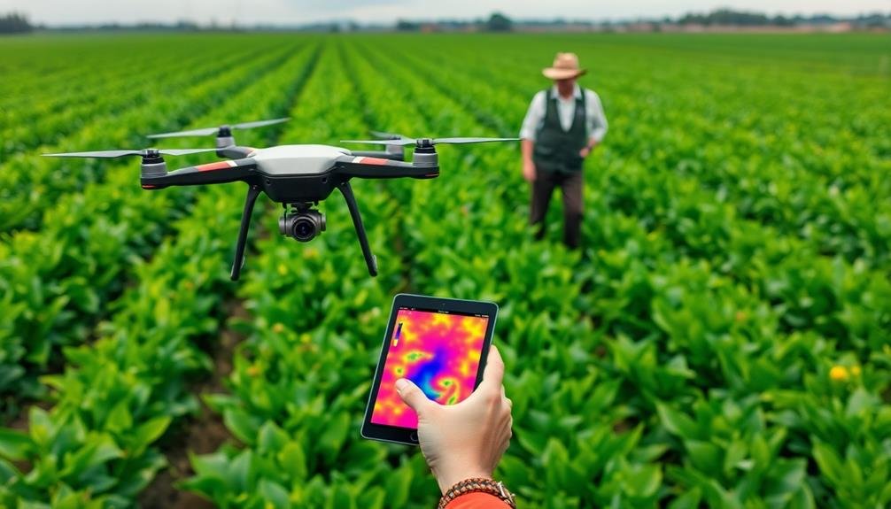
Thermal imaging systems can revolutionize your farm management by providing essential insights into crop health, irrigation efficiency, and pest detection.
You'll be able to spot stressed or diseased plants before visible symptoms appear, optimize water usage by identifying over- or under-irrigated areas, and locate pest infestations through temperature variations.
These advanced tools empower you to make data-driven decisions, ultimately improving crop yields and reducing resource waste.
Crop Health Monitoring
Advanced systems for monitoring crop health have revolutionized the way farmers assess their fields. You'll find that these tools provide real-time data on plant health, allowing for quick interventions and optimized resource allocation. By utilizing sensors, drones, and satellite imagery, you can detect early signs of stress, disease, or nutrient deficiencies in your crops.
These monitoring systems often integrate with your farm management software, giving you a thorough view of your fields' health. You'll be able to create precise treatment plans, targeting specific areas that need attention. This approach not only saves time and resources but also minimizes environmental impact by reducing unnecessary chemical applications.
Here's a breakdown of common crop health indicators and their monitoring methods:
| Indicator | Monitoring Method |
|---|---|
| Chlorophyll content | Multispectral imaging |
| Water stress | Thermal imaging |
| Nitrogen levels | Hyperspectral sensors |
| Disease presence | AI-powered image analysis |
| Pest infestations | Pheromone traps with IoT |
Irrigation Efficiency Assessment
Efficient water management is a cornerstone of smart farming, and thermal imaging systems have emerged as powerful tools for irrigation assessment. These systems use infrared cameras to detect temperature variations in crops, allowing you to identify areas of water stress or over-irrigation.
You'll find that thermal imaging can help you enhance your irrigation schedule by revealing which parts of your field need more or less water. By capturing thermal images at different times of day, you can track how water moves through your soil and plants, enabling you to make data-driven decisions about when and where to irrigate.
These systems also help you detect leaks or blockages in your irrigation equipment. You'll spot cooler areas that indicate excess water flow or warmer patches signaling insufficient irrigation. This information allows you to quickly address issues and maintain ideal water distribution across your fields.
Pest Detection Capabilities
How can thermal imaging systems revolutionize pest management in smart farming? These advanced tools allow you to detect pests and diseases before they become visible to the naked eye. By capturing infrared radiation emitted by plants and insects, thermal cameras create heat maps that highlight potential problem areas in your fields.
You'll spot temperature variations that indicate pest infestations or plant stress. Warmer areas might signify insect activity, while cooler spots could reveal fungal growth or water stress. This early detection enables you to take targeted action, applying pesticides or other treatments only where needed, saving time and resources.
Thermal imaging systems also help you monitor pest populations over time. You can track the spread of infestations and assess the effectiveness of your control measures. By integrating this technology with drones or automated ground vehicles, you'll cover large areas quickly and efficiently.
These systems work day or night, allowing for 24/7 monitoring of your crops. They're particularly useful for detecting nocturnal pests that might otherwise go unnoticed.
With thermal imaging, you'll stay ahead of pest problems, minimizing crop damage and maximizing yields.
RTK GPS for Precise Positioning

While traditional GPS systems offer accuracy within a few meters, RTK (Real-Time Kinematic) GPS takes precision to a whole new level. You'll find that RTK GPS can pinpoint locations with centimeter-level accuracy, making it an invaluable tool for smart farming surveys. This technology uses a fixed base station and mobile receivers to correct GPS signal errors in real-time.
With RTK GPS, you can create highly detailed field maps, precisely guide autonomous vehicles, and implement variable rate applications for seeds, fertilizers, and pesticides. You'll be able to optimize your field operations by reducing overlaps and skips, saving time, fuel, and resources.
The system also enables you to accurately track crop growth patterns and soil variations across your fields.
RTK GPS isn't limited to ground operations. You can use it to guide drones for aerial surveys, providing you with precise data for crop health analysis and yield estimation.
Hyperspectral Imaging Technology
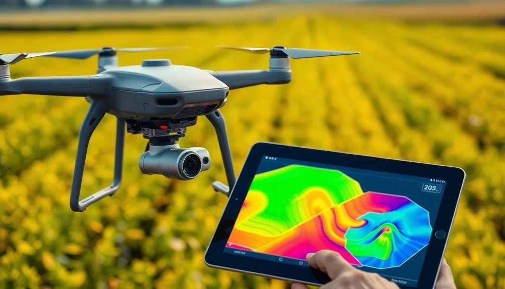
Peering beyond the visible spectrum, hyperspectral imaging technology offers farmers an unprecedented view of their crops' health and stress levels. This advanced tool captures and analyzes light reflectance across hundreds of narrow spectral bands, revealing information invisible to the naked eye.
You'll find hyperspectral imaging particularly useful for early detection of plant diseases, pest infestations, and nutrient deficiencies. It can identify subtle changes in crop physiology before visible symptoms appear, allowing you to take proactive measures. The technology also helps you assess crop maturity, predict yields, and optimize harvest timing.
When you're using hyperspectral imaging, you'll typically mount sensors on drones or satellites to survey large areas quickly. The data collected is processed using sophisticated algorithms to create detailed maps of your fields, highlighting areas that need attention.
You can use these insights to make precise decisions about irrigation, fertilization, and pest control. This targeted approach not only improves crop yields but also reduces resource waste and environmental impact.
As you integrate hyperspectral imaging into your farming practices, you'll find it's a powerful ally in achieving sustainable and efficient agriculture.
Automated Flight Planning Software
With the rise of drone technology in agriculture, automated flight planning software has become an essential tool for efficient farm management. You'll find this software invaluable for planning, executing, and analyzing your aerial surveys. It allows you to create precise flight paths, ensuring complete coverage of your fields while maximizing battery life and data collection.
You can set parameters like altitude, overlap, and camera settings to capture high-quality imagery for various applications. The software often integrates with your drone's GPS and obstacle avoidance systems, enhancing safety and accuracy during flights.
Here's what you can expect from automated flight planning software:
- Customizable flight patterns for different field shapes and sizes
- Real-time mission adjustments based on weather conditions
- Automatic calculation of ideal flight paths for maximum efficiency
- Integration with data processing tools for quick analysis
- Compliance with local airspace regulations and restrictions
After your flight, the software helps you process and analyze the collected data. You'll be able to generate detailed maps, identify problem areas, and make informed decisions about crop management.
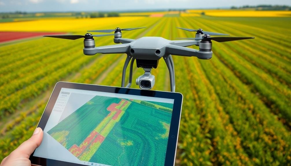
AI-Powered Image Analysis Tools
Once you've collected aerial imagery using automated flight planning software, AI-powered image analysis tools take center stage. These sophisticated tools use machine learning algorithms to process and interpret vast amounts of visual data quickly and accurately.
You'll find they can identify crop types, assess plant health, detect pest infestations, and estimate yield potential with remarkable precision.
AI-powered image analysis tools excel at pattern recognition, allowing you to spot anomalies in your fields that might escape the human eye. They can quantify crop stress levels, measure leaf area index, and even count individual plants.
You'll appreciate how these tools can generate detailed vegetation index maps, highlighting areas that need immediate attention.
Many of these tools integrate with other farm management systems, enabling you to make data-driven decisions in real-time. They can automatically generate prescription maps for variable rate applications of fertilizers or pesticides, optimizing resource use and reducing environmental impact.
As you become more familiar with these tools, you'll discover they're invaluable for monitoring crop development throughout the growing season and planning harvest operations efficiently.
Cloud-Based Data Management Platforms
Cloud-based data management platforms form the backbone of modern precision agriculture. These systems allow you to store, process, and analyze vast amounts of farm data from various sources. You'll have access to real-time information on crop health, soil conditions, weather patterns, and equipment performance, all in one centralized location.
By leveraging cloud-based platforms, you can:
- Integrate data from multiple sensors and devices
- Generate actionable insights through advanced analytics
- Collaborate with team members and share information securely
- Access your farm's data from anywhere, at any time
- Scale your data storage and processing capabilities as needed
These platforms enable you to make data-driven decisions quickly and efficiently. You'll be able to enhance resource allocation, predict crop yields, and identify potential issues before they become critical.
With user-friendly interfaces and customizable dashboards, you can easily visualize complex data sets and extract meaningful information.
Cloud-based data management also facilitates precision farming techniques like variable rate application and targeted pest management. By combining historical data with real-time observations, you can create highly accurate prescription maps for your fields, ensuring ideal input use and maximizing crop productivity.
Frequently Asked Questions
How Do Precision Tools Impact Crop Yields and Farm Profitability?
You'll see precision tools boost crop yields and farm profitability by optimizing resource use. They'll help you apply water, fertilizer, and pesticides more efficiently, reduce waste, and make data-driven decisions that maximize your harvest and profits.
What Training Is Required for Farmers to Use Smart Farming Technologies?
You'll need hands-on training with smart farming tech. Attend workshops, online courses, and manufacturer-led sessions to learn device operation, data interpretation, and software use. Practice in the field and seek ongoing support from ag-tech experts.
Are There Privacy Concerns Associated With Drone-Based Agricultural Surveys?
Yes, you'll face privacy concerns with drone-based agricultural surveys. They can capture images of neighboring properties, raising issues about data ownership and consent. You'll need to follow regulations and communicate clearly with nearby landowners to address these worries.
How Do Weather Conditions Affect the Accuracy of Smart Farming Surveys?
Weather conditions greatly impact your survey accuracy. You'll find that rain, wind, and cloud cover can interfere with drone flights and sensor readings. Extreme temperatures may also affect equipment performance, so you'll need to plan accordingly.
What Are the Initial Costs and Long-Term Savings of Implementing Precision Farming Tools?
You'll face significant upfront costs for precision farming tools like GPS-guided equipment and sensors. However, you'll see long-term savings through reduced input waste, improved yields, and more efficient resource use. It's an investment that pays off over time.
In Summary
You've explored a range of cutting-edge precision tools that are transforming smart farming surveys. From high-res multispectral cameras to AI-powered analysis, these technologies offer unprecedented insights into crop health and field conditions. As you integrate these tools into your farming practices, you'll boost efficiency and sustainability. Remember, the key is to combine these innovations effectively. Keep exploring new advancements, and you'll stay at the forefront of precision agriculture.
As educators and advocates for responsible drone use, we’re committed to sharing our knowledge and expertise with aspiring aerial photographers.


Leave a Reply