
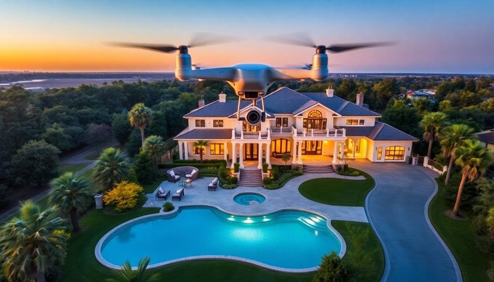
To capture jaw-dropping aerial real estate photos, choose the right time of day for ideal lighting. Master your drone's settings, including RAW format and low ISO. Plan your flight path carefully to showcase the property's best features. Highlight the location's unique attributes and surrounding landscape. Use leading lines and create depth in your composition to guide viewers' eyes. Don't forget to edit your photos for maximum impact, enhancing colors and details. Always guarantee legal compliance with FAA regulations and local laws. By following these tips, you'll elevate your real estate photography to new heights. The sky's the limit for what you can achieve with these techniques.
Key Takeaways
- Shoot during golden hour for warm, soft lighting that enhances property appeal and creates stunning visual effects.
- Master drone settings, using RAW format, low ISO, and fast shutter speed for crisp, high-quality images.
- Highlight unique features and capture multiple angles to showcase the property's standout elements and layout.
- Utilize leading lines and create depth in compositions to guide viewers' eyes and enhance visual interest.
- Edit photos professionally, adjusting exposure, contrast, and color balance to maximize impact and appeal to potential buyers.
Choose the Right Time

When it comes to aerial real estate photography, timing is everything. You'll want to capture your property in the best possible light, both literally and figuratively. The golden hour, which occurs shortly after sunrise or before sunset, offers warm, soft lighting that can transform an ordinary property into something spectacular. This magical time bathes everything in a golden glow, creating long shadows that add depth and dimension to your shots.
However, don't limit yourself to just the golden hour. Midday sun can work well for properties with vibrant colors or those near water, as it minimizes shadows and maximizes reflections. Overcast days can be ideal for capturing details without harsh shadows, especially for properties with lots of outdoor features.
Consider the property's surroundings and orientation when planning your shoot. If it's east-facing, morning light might be best. For west-facing properties, late afternoon could be preferable.
Also, think about seasonal changes. Lush summer foliage or autumn colors can add appeal, while a light dusting of snow can create a cozy winter wonderland effect. Always check the weather forecast and be prepared to reschedule if conditions aren't suitable.
Master Your Drone's Settings

Now that you've chosen the perfect time for your shoot, it's time to focus on your equipment. Mastering your drone's settings is essential for capturing stunning aerial real estate photos.
Start by setting your camera to RAW format, which allows for greater flexibility in post-processing. Adjust your ISO to the lowest possible setting to minimize noise, typically 100 or 200.
Set your aperture between f/4 and f/8 for a balance of sharpness and depth of field. Use a fast shutter speed, at least 1/500th of a second, to guarantee crisp images even with slight drone movement.
Enable your drone's obstacle avoidance features for safety, but be aware they may limit creative angles in tight spaces.
Experiment with different flight modes, such as tripod mode for stable shots or active track for smooth property flyovers. Utilize your drone's gimbal to its full potential, adjusting pitch and yaw for unique perspectives.
Finally, don't forget to calibrate your drone's compass and IMU before each flight to guarantee precise control and stable footage.
With these settings mastered, you'll be well-equipped to capture breathtaking aerial real estate photos that stand out from the competition.
Plan Your Flight Path

A well-planned flight path is crucial for capturing the best aerial real estate photos. Before you take off, scout the property and identify key features you want to highlight. Consider the sun's position and the best angles to showcase the home's architectural elements, landscaping, and surrounding area.
Map out a series of waypoints that'll guide your drone through the most effective route. Start with wide establishing shots, then move in closer for more detailed views. Plan to capture the property from multiple heights and angles to provide a thorough visual tour.
Don't forget to account for potential obstacles like trees, power lines, or neighboring structures. Verify your flight path complies with local regulations and respects privacy concerns.
Pre-program your flight path using your drone's app if possible. This allows for smoother, more consistent movements and helps you focus on composing the perfect shot. Remember to include time for both video sequences and still photos in your plan.
Lastly, always have a backup plan. Be prepared to adjust your flight path on the spot if lighting conditions change or unexpected obstacles arise.
Showcase the Property's Location

When showcasing a property's location through aerial photography, you'll want to capture more than just the building itself.
Highlight surrounding landmarks and capture neighborhood features to give potential buyers a sense of the area's amenities and character.
Be sure to clearly show the property boundaries, helping viewers understand the full extent of the land included with the listing.
Highlight Surrounding Landmarks
Aerial photography allows you to zoom out and capture the bigger picture, showcasing a property's location in relation to its surroundings. When highlighting surrounding landmarks, focus on features that add value to the property. Identify nearby parks, beaches, mountains, or cityscapes that enhance the area's appeal.
Capture iconic structures or natural formations visible from the property. These could include famous buildings, bridges, or geological features. If there's a notable skyline or waterfront view, make sure to showcase it prominently in your shots.
Don't forget to highlight proximity to desirable amenities like shopping centers, schools, or entertainment venues. Use different altitudes and angles to create a sense of scale and perspective. Show how the property fits into the broader neighborhood or landscape.
Capture images during golden hour for warm, inviting lighting that accentuates landmarks. If possible, take both daytime and nighttime shots to showcase the area's transformation after dark.
Remember to respect privacy laws and local regulations when photographing surrounding areas. Obtain necessary permits and avoid capturing identifiable individuals or private properties without consent.
Capture Neighborhood Features
Neighborhoods play an essential role in a property's appeal. When capturing aerial real estate photos, don't forget to showcase the surrounding area's features. Start by identifying key neighborhood amenities that potential buyers will find attractive. These might include parks, playgrounds, walking trails, or community centers.
As you plan your aerial shots, aim to capture these features in relation to the property you're showcasing. Try to frame the home with desirable neighborhood elements in the background or foreground. If there's a nearby lake, beach, or golf course, make sure to highlight these in your aerial photos.
Consider the time of day when shooting to capture the neighborhood at its best. Early morning or late afternoon light can create a warm, inviting atmosphere. Pay attention to seasonal changes too – lush green trees in summer or colorful foliage in fall can enhance the overall appeal.
Don't forget to capture the street layout and overall neighborhood design. Well-planned communities with tree-lined streets and attractive landscaping can be a significant selling point.
Show Property Boundaries
Clearly defining property boundaries in aerial real estate photos is a powerful way to showcase a home's true value. It helps potential buyers understand the full extent of the property they're considering and can highlight unique features that may not be apparent from ground-level photos.
When capturing aerial shots to showcase property boundaries, you'll want to fly your drone high enough to capture the entire plot while still maintaining enough detail to show off the home and its surroundings.
To effectively show property boundaries in your aerial photos:
- Use natural landmarks like tree lines, fences, or roads to emphasize property edges.
- Incorporate nearby streets or intersections to provide context and orientation.
- Highlight any unique property shapes or features, such as waterfront access or acreage.
- Capture angles that showcase the property's relationship to desirable nearby amenities.
Consider using editing software to subtly enhance property lines without compromising the photo's authenticity. You can add thin, semi-transparent lines or gentle shading to clarify boundaries.
Highlight Unique Features

Capturing a property's standout features is essential when taking aerial real estate photos. You'll want to showcase what makes the property unique and valuable from above. Focus on elements that aren't easily visible from ground level, such as expansive landscapes, waterfront views, or unusual architectural designs.
Use your drone to capture sweeping shots of large backyards, pools, or outdoor entertainment areas. Highlight proximity to desirable amenities like parks, beaches, or golf courses. If the property has a distinctive roof shape or layout, make sure to emphasize it in your aerial shots.
Consider the following unique features and how to best capture them:
| Feature | Angle | Time of Day |
|---|---|---|
| Pool | Overhead | Midday |
| Landscaping | 45-degree | Morning |
| Waterfront | Wide shot | Sunset |
| Acreage | High altitude | Afternoon |
When editing your photos, use subtle enhancements to make these features pop. Adjust contrast and saturation to make colors more vibrant, or use selective brightening to draw attention to specific areas. Remember, your goal is to showcase the property's best attributes and help potential buyers envision themselves living there.
Capture Multiple Angles
When capturing aerial real estate photos, you'll want to showcase the property's best features from various perspectives.
Take shots from different heights and angles to highlight the home's unique attributes and architectural details.
Don't forget to include wider shots that capture surrounding landscape views, giving potential buyers a thorough understanding of the property's location and setting.
Showcase Property's Best Features
In order to showcase a property's best features, you'll need to capture multiple angles from the air. This approach allows potential buyers to see the full scope of the property and its surroundings.
Focus on highlighting unique selling points, such as a sprawling backyard, a well-maintained pool, or proximity to desirable amenities.
When planning your shots, consider the property's layout and architectural style. Fly your drone at different heights and angles to capture the most flattering views.
Don't forget to showcase the property's relationship to its environment, including nearby parks, waterways, or city skylines.
To create impactful aerial real estate photos, try these techniques:
- Fly low and slow for dramatic approach shots that reveal the property gradually
- Capture sweeping panoramas to show the full extent of large properties or estates
- Use golden hour lighting to cast warm, inviting hues on the property's exterior
- Incorporate leading lines, such as driveways or fences, to draw the viewer's eye to the main subject
Highlight Surrounding Landscape Views
To truly showcase a property's appeal, you'll need to highlight the surrounding landscape views. Aerial photography offers a unique opportunity to capture the property's context within its environment. Start by identifying key features like mountains, lakes, beaches, or cityscapes that add value to the location.
Plan your shots to include these elements alongside the property. Fly your drone at different altitudes to experiment with various perspectives. Lower altitudes can emphasize the property's immediate surroundings, while higher shots reveal the broader landscape.
Consider the time of day and lighting conditions to enhance the natural beauty of the area. Don't limit yourself to a single angle. Capture views from multiple directions to give potential buyers a thorough understanding of the property's setting.
Include shots that showcase how the home is positioned to take advantage of scenic vistas or natural features. If the property has outdoor living spaces, highlight how they interact with the surrounding landscape.
Remember to comply with local drone regulations and respect privacy concerns when capturing these wider shots. By effectively highlighting the surrounding landscape views, you'll create compelling aerial photos that showcase the property's full potential and appeal to discerning buyers.
Use Leading Lines

Leading lines often serve as powerful compositional tools in aerial real estate photography. They guide the viewer's eye through the image, creating a sense of depth and drawing attention to key features of the property.
When you're capturing aerial shots, look for natural or man-made lines that can lead the viewer's gaze to the main subject.
You'll find leading lines in various elements of the landscape:
- Winding driveways that snake up to the house
- Long, straight fences that divide property lines
- Rows of trees or hedges leading to the entrance
- Shorelines that curve around waterfront properties
To effectively use leading lines, position your drone to capture these elements in a way that directs attention to the property.
You can fly at different angles to experiment with how the lines appear in your frame. Don't be afraid to adjust your altitude or distance to find the perfect composition.
Create Depth With Composition

To create depth in your aerial real estate photos, focus on balancing foreground and background elements.
You'll want to strategically position key features of the property in different planes of the image.
Utilize leading lines, such as driveways or landscaping, to draw the viewer's eye through the composition and enhance the sense of depth.
Foreground-Background Balance
A key aspect of compelling aerial real estate photography is achieving the perfect foreground-background balance. This technique creates depth and visual interest, drawing viewers into the image and highlighting the property's best features.
To master this balance, you'll need to carefully consider your drone's positioning and camera angle.
When composing your shot, aim to include elements in both the foreground and background that complement each other and tell a story about the property. This could mean capturing the home's exterior in the foreground while showcasing the surrounding landscape or neighborhood in the background.
To create stunning foreground-background balance, try these techniques:
- Use leading lines from the foreground to guide the eye towards the main subject
- Frame the property with natural elements like trees or water features
- Incorporate interesting textures or patterns in the foreground to add depth
- Experiment with different altitudes to find the ideal balance between foreground and background elements
Leading Lines Technique
Once you've mastered the foreground-background balance, it's time to explore the powerful leading lines technique. This composition method uses natural or artificial lines in your aerial shots to guide the viewer's eye through the image, creating a sense of depth and drawing attention to key features of the property.
Look for roads, fences, shorelines, or architectural elements that form strong lines in your frame. Position your drone to capture these lines leading towards the main subject, such as the house or a standout landscape feature. Experiment with different angles to find the most compelling composition.
Here's a quick reference for common leading lines in aerial real estate photography:
| Line Type | Examples | Effect |
|---|---|---|
| Straight | Roads, paths | Direct, powerful |
| Curved | Rivers, driveways | Gentle, natural flow |
| Diagonal | Fences, shadows | Dynamic, energetic |
| Converging | Tree lines, buildings | Depth, perspective |
| Radiating | Circular driveways | Focal point emphasis |
Edit for Maximum Impact

Post-production magic can transform your aerial real estate photos from good to spectacular. After capturing stunning aerial shots, it's time to enhance them through careful editing.
Focus on adjusting exposure, contrast, and color balance to make your images pop. Don't shy away from using HDR techniques to bring out details in both shadows and highlights, creating a more dynamic range that'll captivate potential buyers.
Crop your photos strategically to emphasize the property's best features and remove distracting elements. Pay attention to straightening horizons and correcting lens distortions for a polished look.
Consider using selective adjustments to draw attention to key areas of the property, such as the main house or unique landscaping features.
To create jaw-dropping aerial real estate photos, keep these editing tips in mind:
- Enhance vibrant blue skies and lush green lawns
- Sharpen architectural details to showcase craftsmanship
- Soften harsh shadows to maintain a welcoming atmosphere
- Add a subtle vignette to direct focus towards the property
Ensure Legal Compliance

While capturing stunning aerial shots is exciting, it's crucial to guarantee you're operating within legal boundaries. First, confirm you've obtained the necessary FAA certifications for commercial drone operations. You'll need a Part 107 license to fly drones for real estate photography legally. Familiarize yourself with local and state regulations, as they can vary by location.
Always respect privacy laws and property rights. Don't fly over private property without permission, and avoid capturing images of people without consent. Be mindful of restricted airspace, such as airports, military bases, and national parks. Use apps like B4UFLY to check airspace restrictions before each flight.
Adhere to FAA guidelines for drone operations, including maintaining visual line of sight, flying below 400 feet, and avoiding flying over people or moving vehicles. Register your drone with the FAA if it weighs more than 0.55 pounds. Keep your registration current and carry proof of registration during flights.
Obtain proper insurance coverage for your drone operations to protect yourself and your clients. Consider liability insurance specifically designed for commercial drone use.
Frequently Asked Questions
How Much Should I Charge for Aerial Real Estate Photography Services?
You should charge based on your experience, equipment, and local market rates. Start around $150-$300 per property. As you build your portfolio and reputation, you can increase your prices. Don't undervalue your services.
What Drone Models Are Best for Real Estate Photography?
You'll find the DJI Mavic 3, Autel EVO Lite+, and DJI Air 2S are top choices for real estate photography. They offer excellent image quality, long flight times, and user-friendly features. Consider your budget and specific needs when selecting.
How Do I Handle Difficult Weather Conditions During Aerial Shoots?
You'll need to adapt to weather challenges. Check forecasts, avoid high winds and rain, use filters for harsh sunlight, and consider rescheduling if conditions are unsafe. Always prioritize your drone's safety and image quality when shooting.
Can I Use AI to Enhance or Edit My Aerial Real Estate Photos?
You can use AI to enhance your aerial real estate photos. It's great for color correction, sharpening, and removing minor imperfections. However, don't rely on it entirely; your skill and artistic vision are still essential.
How Do I Market My Aerial Real Estate Photography Services Effectively?
You'll effectively market your aerial real estate photography by showcasing your best work online, networking with local realtors, offering competitive packages, leveraging social media, and creating a professional website. Don't forget to gather client testimonials and attend industry events.
In Summary
You've now got the tools to capture stunning aerial real estate photos. Remember, practice makes perfect, so don't be discouraged if your first attempts aren't masterpieces. Keep experimenting with angles, lighting, and composition. As you refine your skills, you'll create images that truly showcase properties in their best light. Stay up-to-date with drone regulations, and always prioritize safety. With these tips, you're ready to elevate your real estate photography game to new heights!
As educators and advocates for responsible drone use, we’re committed to sharing our knowledge and expertise with aspiring aerial photographers.


Leave a Reply