
Thermal imaging can reveal a wealth of information about ecosystem health. You'll see distinct temperature patterns in forests, wetlands, and grasslands that indicate biodiversity and resilience. It can detect environmental stressors like water pollution, algal blooms, and early signs of drought. You'll spot wildlife in hard-to-reach areas, aiding population monitoring and conservation efforts. Water resource issues become visible, from groundwater seepage to river health. Plant stress, diseases, and nutrient deficiencies show up as temperature variations in vegetation. These thermal insights offer a powerful tool for understanding and managing complex ecosystems. Dive deeper to uncover the full spectrum of possibilities.
Thermal Signatures of Healthy Ecosystems
In and around healthy ecosystems, thermal imaging reveals distinct patterns that indicate a well-functioning environment.
You'll notice that these thermal signatures often show a mosaic of temperatures, reflecting the diverse components of a thriving ecosystem.
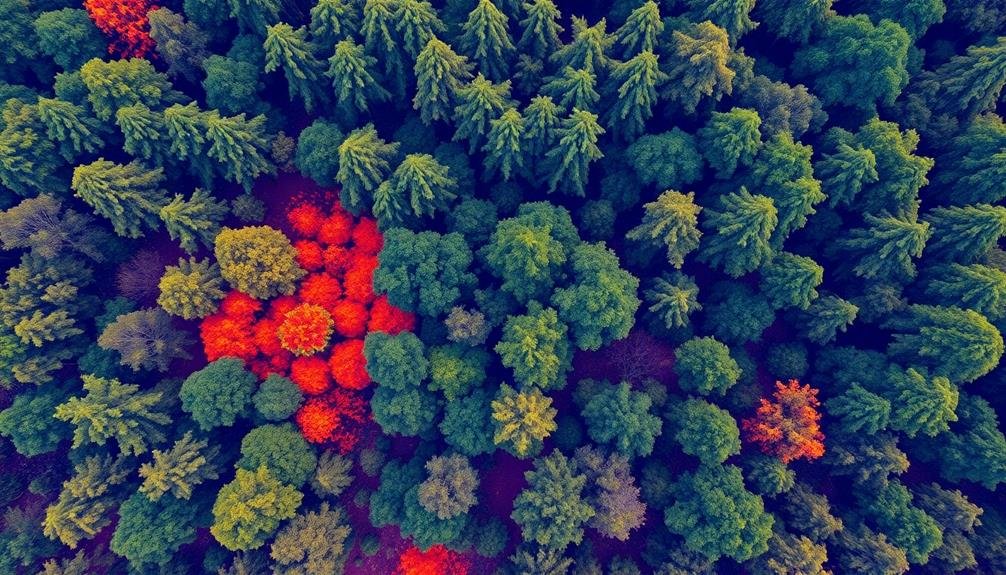
In forests, you'll see cooler canopies contrasting with warmer forest floors. This temperature gradient is essential for maintaining biodiversity and regulating local climate.
Healthy wetlands display a mix of cool water bodies and slightly warmer vegetated areas, which are crucial for water purification and wildlife habitat.
You'll observe that grasslands exhibit a patchwork of varying temperatures, indicating a mix of vegetation types and microclimates. This diversity supports a wide range of species and promotes ecosystem resilience.
In coastal areas, you'll detect the interplay between land and sea temperatures, which is fundamental for nutrient cycling and marine life.
Healthy coral reefs show a balance of cooler coral structures and warmer surrounding waters.
Detecting Environmental Stress Factors
Thermal imaging isn't just useful for identifying healthy ecosystems; it's also a powerful tool for spotting environmental stress factors. You can use this technology to detect various issues that might be affecting the health of an ecosystem.
For instance, thermal cameras can reveal areas of water pollution by identifying temperature differences in rivers and lakes. Warmer spots might indicate thermal pollution from industrial discharges or urban runoff. You'll also be able to spot algal blooms, which appear as warmer patches on the water's surface.
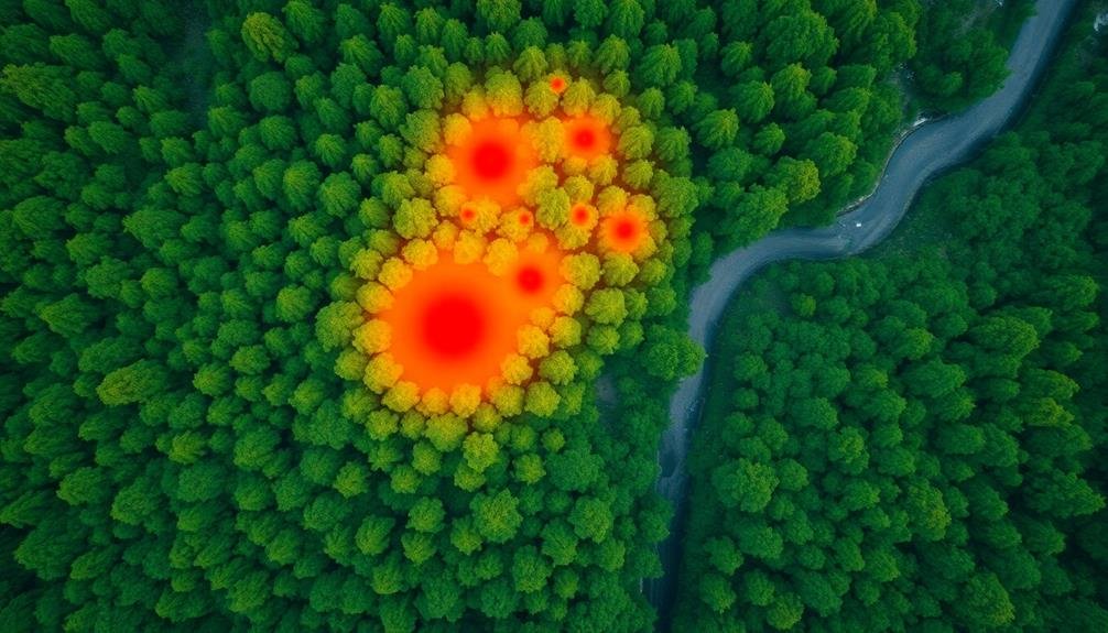
In forests, thermal imaging can help you detect early signs of drought stress in trees. Stressed vegetation often appears warmer than healthy plants due to reduced transpiration. You can also use this method to identify areas affected by pests or diseases, as infected plants may show different temperature patterns.
Thermal imaging is particularly useful for monitoring the impacts of climate change. You can track changes in permafrost thaw, glacier retreat, and shifts in vegetation patterns over time.
Wildlife Population Monitoring
Through thermal imaging, you can revolutionize wildlife population monitoring. This technology allows you to detect and count animals in various habitats, even in low-light conditions or dense vegetation.
You'll be able to conduct nocturnal surveys without disturbing wildlife, capturing accurate data on population sizes, distribution, and behavior.
Thermal cameras can help you identify different species based on their unique heat signatures. You'll spot warm-blooded animals easily against cooler backgrounds, making it possible to track elusive or endangered species.
This method is particularly useful for monitoring large areas or inaccessible terrain. You can use thermal imaging to study migration patterns, breeding behaviors, and habitat use.
By analyzing thermal data over time, you'll gain insights into population trends and ecosystem dynamics. This information is essential for conservation efforts and wildlife management decisions.
Moreover, you'll reduce human-wildlife conflicts by identifying animal movement corridors and hotspots. Thermal imaging enables you to detect poaching activities and enhance anti-poaching efforts.
You can also assess the impact of climate change on wildlife populations by monitoring changes in their thermal environments and adaptations.
Identifying Water Resource Issues
Four key water resource issues can be identified using thermal imaging technology.
First, you'll be able to detect water pollution by observing temperature differences between clean water and contaminated areas. Thermal cameras can reveal warm effluent discharges from industrial sites or sewage systems, helping you pinpoint pollution sources.
Second, you can identify groundwater seepage and springs. These appear as cooler spots in thermal images, allowing you to map underground water movement and locate potential water sources in arid regions.
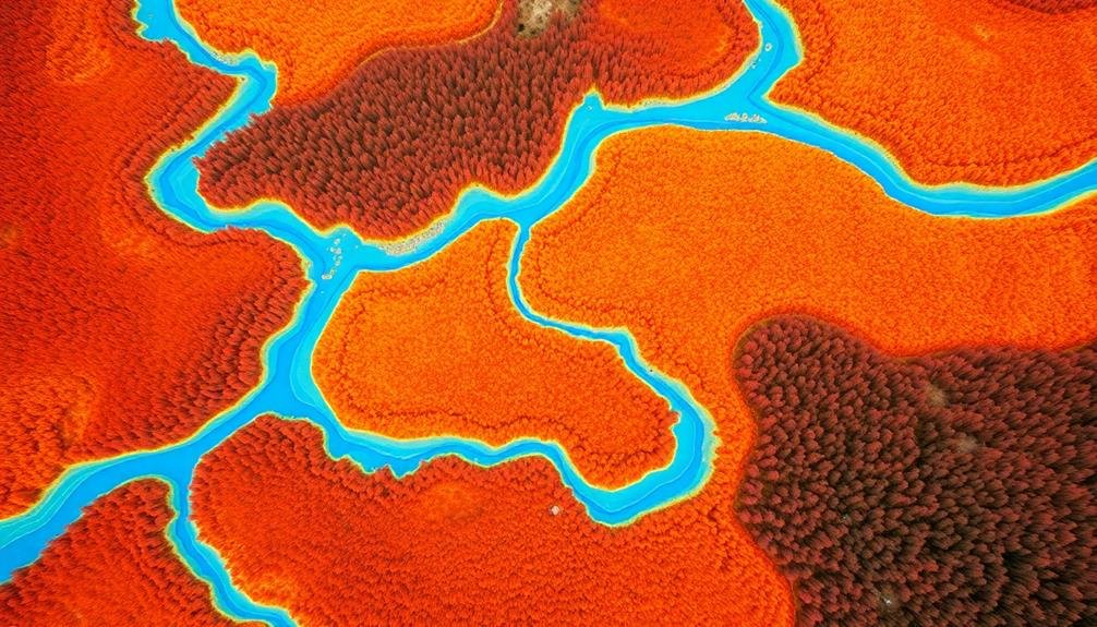
Third, thermal imaging helps you assess river and stream health. You'll spot thermal barriers caused by dams or industrial discharges, which can disrupt aquatic ecosystems and affect fish migration patterns.
Lastly, you can monitor wetland hydrology. Thermal cameras reveal temperature variations that indicate water depth, flow patterns, and evaporation rates in wetland areas. This information is essential for understanding wetland dynamics and preserving these critical ecosystems.
Vegetation Health Assessment
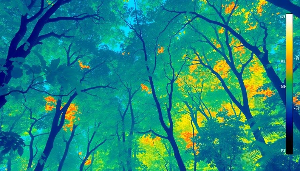
Moving from water to land, vegetation health assessment is another key application of thermal imaging in ecosystem monitoring. You'll find that thermal cameras can detect subtle temperature differences in plants, which often indicate their overall health and stress levels.
As plants undergo photosynthesis, they naturally cool themselves through transpiration. When a plant is stressed or diseased, this process is disrupted, causing temperature changes that you can observe with thermal imaging.
You can use this technology to identify areas of drought stress, pest infestations, or nutrient deficiencies across large areas of vegetation. It's particularly useful for early detection of problems before they become visible to the naked eye.
You'll be able to create thermal maps of forests, agricultural fields, or urban green spaces to pinpoint areas that need attention.
Thermal imaging also helps you assess the effectiveness of irrigation systems and fertilization practices. By comparing thermal signatures before and after interventions, you can determine if your management strategies are improving plant health.
This data-driven approach allows for more targeted and efficient ecosystem management, potentially reducing resource waste and environmental impact.
Frequently Asked Questions
How Expensive Are Thermal Imaging Cameras Used for Ecosystem Monitoring?
You'll find thermal imaging cameras for ecosystem monitoring range from $1,000 to $50,000. The price depends on resolution, sensitivity, and features. High-end models used by researchers can cost even more, reaching $100,000+.
Can Thermal Imaging Be Used to Detect Underground Mineral Deposits?
You can use thermal imaging to detect some underground mineral deposits. It's not foolproof, but it can identify temperature anomalies that might indicate certain minerals. It's often combined with other exploration techniques for better accuracy.
What Are the Limitations of Thermal Imaging in Cloudy or Rainy Conditions?
You'll find that thermal imaging's effectiveness is reduced in cloudy or rainy conditions. Water droplets and clouds can absorb or scatter infrared radiation, limiting the camera's ability to detect temperature differences accurately on the ground below.
How Does Thermal Imaging Technology Differ From Satellite Imagery for Ecosystem Analysis?
You'll find thermal imaging captures heat signatures, while satellite imagery provides broader visual data. Thermal's better for detecting animal activity and microclimate changes. Satellites excel at large-scale vegetation mapping and long-term land cover analysis.
Are There Any Potential Negative Impacts of Using Thermal Imaging on Wildlife?
You'll find that thermal imaging can potentially disturb wildlife. It may cause stress, alter behavior, or disrupt natural patterns. However, when used responsibly, these impacts are minimal compared to the valuable data you'll gather for conservation efforts.
In Summary
You've seen how thermal imaging can reveal essential insights about ecosystem health. It's a powerful tool that lets you detect environmental stressors, monitor wildlife, identify water issues, and assess vegetation health. By analyzing thermal signatures, you're able to spot problems early and take action to protect habitats. Don't underestimate the value of this technology – it's revolutionizing conservation efforts and giving you a clearer picture of our planet's ecological well-being.
As educators and advocates for responsible drone use, we’re committed to sharing our knowledge and expertise with aspiring aerial photographers.


Leave a Reply