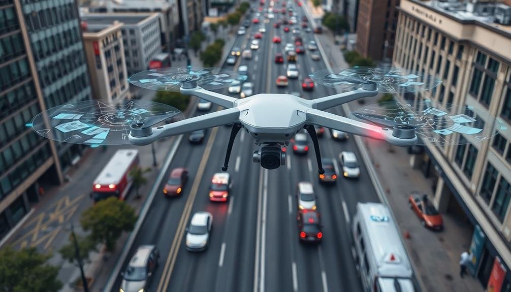
Drones are revolutionizing urban traffic flow analysis in seven key ways. You'll see real-time data collection providing instant insights, while aerial congestion mapping offers a thorough view of traffic patterns. They're enhancing intersection performance assessment and optimizing accident response times. Drones excel at managing event traffic and analyzing parking demand, helping cities adapt quickly to changing needs. Finally, they're supporting infrastructure planning with detailed aerial surveys. These innovations are transforming how cities understand and manage traffic flow, leading to smoother commutes and more efficient urban environments. Discover how these aerial marvels are reshaping your daily drive and city planning.
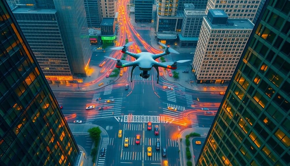
Real-Time Data Collection

Through the use of drones, real-time data collection for urban traffic flow analysis has become more efficient and extensive.
You'll find that drones equipped with high-resolution cameras and sensors can capture vast amounts of traffic data in a fraction of the time it takes traditional methods. These aerial vehicles hover above congested areas, intersections, and highways, providing a bird's-eye view of traffic patterns.
You can use drones to collect data on vehicle speeds, traffic density, and lane occupancy. They're also capable of identifying accidents, roadwork, and other disruptions that impact traffic flow.
With their ability to cover large areas quickly, drones offer a thorough overview of urban traffic situations.
You'll appreciate how drones can adapt to changing traffic conditions in real-time. They can be rapidly deployed to monitor sudden congestion or diverted to areas experiencing unexpected traffic surges.
This flexibility allows for more responsive traffic management strategies.
Aerial Congestion Mapping

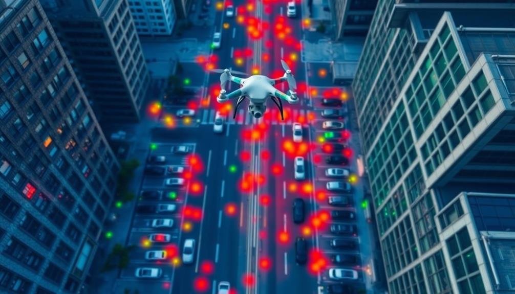
Aerial congestion mapping using drones offers you a bird's-eye view of urban traffic patterns.
You'll see real-time traffic visualization, allowing for immediate identification of congested areas and flow disruptions.
Real-Time Traffic Visualization
In recent years, real-time traffic visualization has revolutionized urban planning and traffic management. Drones equipped with high-resolution cameras and advanced sensors now offer unprecedented insights into traffic patterns and congestion hotspots.
You'll find that these aerial systems provide a bird's-eye view of entire city networks, allowing you to monitor and analyze traffic flow in real-time. This technology enables quick identification of accidents, roadblocks, and other disruptions, facilitating faster emergency response times.
Here's a comparison of traditional and drone-based traffic visualization methods:
| Feature | Traditional Methods | Drone-Based Visualization |
|---|---|---|
| Coverage | Limited | Extensive |
| Real-time updates | Delayed | Instant |
| Cost | High | Moderate |
| Accuracy | Variable | High |
| Adaptability | Low | High |
With drone-based visualization, you can quickly adjust traffic light timings, reroute vehicles, and implement dynamic lane management strategies. This data-driven approach markedly improves overall traffic efficiency and reduces commute times.
Moreover, you'll be able to share this real-time information with navigation apps and smart city platforms, empowering drivers to make informed decisions about their routes and travel times.
Identify Bottleneck Hotspots
Drones have revolutionized the identification of traffic bottlenecks through aerial congestion mapping. You'll find that these unmanned aerial vehicles provide a bird's-eye view of urban traffic patterns, allowing for quick and accurate detection of congestion hotspots.
With drones, you can capture high-resolution images and videos of traffic flow across entire city sections. This aerial perspective enables you to spot recurring bottlenecks that mightn't be apparent from ground-level observations. You'll be able to identify specific intersections, on-ramps, or road segments where traffic consistently slows down or comes to a standstill.
By analyzing drone-captured data, you can pinpoint the exact locations and times when bottlenecks form. This information is essential for urban planners and traffic engineers who need to develop targeted solutions.
You'll also be able to track how these hotspots evolve throughout the day, week, or season, providing valuable insights into traffic patterns.
Moreover, drones allow you to quickly assess the impact of temporary disruptions like construction work or accidents on traffic flow. This real-time information helps authorities make informed decisions about traffic management and rerouting strategies.
Intersection Performance Assessment

When analyzing urban traffic flow, evaluating intersection performance is essential for understanding overall traffic dynamics. With drones, you'll gain a thorough view of how intersections function during various times and conditions. You can observe traffic patterns, signal timings, and vehicle movements from multiple angles, allowing for a more accurate assessment.
Drones enable you to:
- Measure queue lengths and wait times at traffic lights
- Identify turning movement conflicts and near-miss incidents
- Assess pedestrian and cyclist behavior at crossings
- Monitor signal timing effectiveness and synchronization
- Detect illegal maneuvers and traffic violations
Here's how drone data compares to traditional methods:
| Aspect | Drone Analysis | Traditional Methods |
|---|---|---|
| Coverage | Thorough | Limited |
| Accuracy | High | Variable |
| Cost | Lower | Higher |
| Time Efficiency | Faster | Slower |
| Data Richness | Extensive | Basic |
Accident Response Optimization
Building on the insights gained from intersection performance assessment, accident response optimization emerges as a key area where drones can revolutionize urban traffic management.
When accidents occur, you'll find that drones can quickly provide a bird's-eye view of the scene, helping emergency responders assess the situation more effectively. They'll capture high-resolution images and videos, allowing for rapid analysis of the accident's impact on traffic flow.
You'll see drones deployed to guide traffic around accident sites, reducing congestion and preventing secondary incidents. They'll relay real-time information to traffic control centers, enabling swift adjustments to traffic light timings and road closures. This data will help you optimize detour routes and manage traffic more efficiently during these critical events.
Moreover, you'll benefit from drones' ability to deliver small medical supplies or equipment to accident scenes, potentially saving precious minutes in emergencies.
They'll also assist in documenting accident scenes for insurance and legal purposes, speeding up the clearing process. By incorporating drones into accident response protocols, you'll notably enhance urban traffic management, minimizing disruptions and improving overall safety.
Event Traffic Management

Large-scale events in urban areas often create significant traffic challenges. Drones offer a game-changing solution for event traffic management, allowing you to monitor and respond to congestion in real-time.
By deploying a fleet of drones, you can capture aerial footage of traffic patterns around event venues, parking areas, and major routes. These aerial views provide you with extensive data on vehicle flow, pedestrian movement, and bottlenecks.
You'll be able to identify potential problem areas before they escalate and adjust traffic signals, lane configurations, or parking strategies accordingly. Drones can also help you guide emergency vehicles through crowded streets more efficiently.
You can use drones to communicate with drivers directly, displaying messages on LED screens or broadcasting instructions to GPS navigation systems. This real-time communication allows you to redirect traffic, suggest alternative routes, or provide up-to-date parking information.
Parking Demand Analysis
As urban populations grow, efficient parking management becomes increasingly critical. Drones offer a powerful solution for analyzing parking demand and optimizing space utilization.
You'll find that these aerial vehicles can quickly survey large areas, providing real-time data on parking availability and usage patterns. By leveraging drone technology, you're able to identify peak parking times, underutilized spaces, and areas of high demand.
With drones, you can:
- Monitor multiple parking lots simultaneously
- Detect illegal parking and enforce regulations
- Assess the need for new parking facilities
- Guide drivers to available spaces through mobile apps
- Analyze long-term trends to inform urban planning decisions
Infrastructure Planning Support
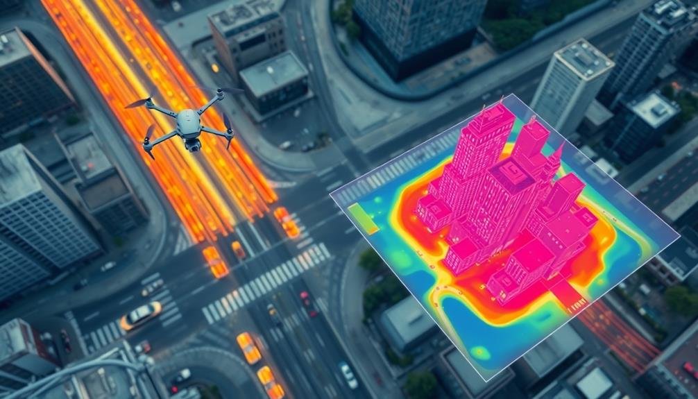
Drones revolutionize infrastructure planning by providing a bird's-eye view of urban landscapes. You'll find that these aerial devices capture high-resolution imagery and real-time data, enabling city planners to make informed decisions about future developments.
They offer a cost-effective alternative to traditional surveying methods, allowing you to assess large areas quickly and efficiently. You can use drones to identify potential sites for new roads, bridges, or public transportation routes.
They'll help you analyze existing infrastructure conditions, pinpointing areas that need repair or expansion. With thermal imaging cameras, you'll detect heat signatures that reveal hidden structural issues in buildings and roads.
Drones equipped with LiDAR technology create detailed 3D models of cityscapes, aiding in precise measurements and spatial analysis. You'll find these models invaluable when planning for urban growth and development.
They'll also help you assess the impact of proposed projects on surrounding areas, ensuring sustainable urban design.
Frequently Asked Questions
How Do Drones Handle Privacy Concerns When Monitoring Urban Traffic?
When you use drones for traffic monitoring, you'll need to address privacy concerns. You can blur license plates and faces, limit data retention, and follow strict guidelines. You'll also need to inform the public about your drone operations.
What Are the Regulatory Challenges for Using Drones in Traffic Analysis?
You'll face regulatory hurdles like airspace restrictions, licensing requirements, and privacy laws when using drones for traffic analysis. You'll need to comply with FAA regulations, obtain necessary permits, and address public concerns about surveillance.
Can Drones Be Integrated With Existing Traffic Management Systems?
Yes, you can integrate drones with existing traffic management systems. They'll provide real-time data, enhancing your traffic monitoring capabilities. You'll need to update your software and train staff to incorporate drone-collected information into your current operations.
How Do Weather Conditions Affect Drone-Based Traffic Flow Analysis?
Weather conditions considerably impact your drone-based traffic flow analysis. You'll face challenges with rain, snow, and strong winds. They'll affect visibility, flight stability, and data accuracy. You'll need to plan operations around favorable weather forecasts.
What Are the Cost Implications of Implementing Drone Technology for Traffic Monitoring?
You'll find that implementing drone technology for traffic monitoring can be costly upfront. You're looking at expenses for drones, software, training, and maintenance. However, you'll likely save money long-term compared to traditional methods.
In Summary
You've seen how drones are transforming urban traffic analysis. They're providing real-time data, mapping congestion, and evaluating intersections. You're benefiting from improved accident response and better event traffic management. Drones are helping analyze parking demands and support infrastructure planning. As this technology evolves, you'll experience smoother traffic flow, reduced congestion, and more efficient urban transportation systems. Embrace the drone revolution – it's reshaping your city's traffic landscape for the better.
As educators and advocates for responsible drone use, we’re committed to sharing our knowledge and expertise with aspiring aerial photographers.


Leave a Reply