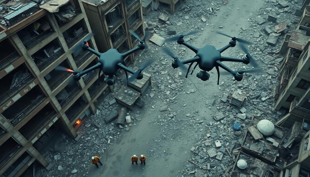
You'll find three cutting-edge UAV methods for locating disaster victims: thermal imaging, multi-spectral sensing, and AI-powered visual recognition. Thermal drones detect heat signatures, even in low visibility. Multi-spectral sensors spot subtle terrain changes indicating human presence. AI visual systems rapidly analyze video feeds to identify human shapes and movements. These technologies work together, enhancing detection rates and minimizing false positives. They're faster and more efficient than traditional search methods, covering large areas quickly and penetrating obstacles. By combining these advanced UAV techniques, search and rescue teams can dramatically improve their chances of finding and saving lives in disaster scenarios.
Thermal Imaging Drone Searches

In light of recent advancements, thermal imaging drone searches have become a game-changer for locating disaster victims. You'll find that these UAVs equipped with thermal cameras can detect heat signatures of survivors, even in challenging environments.
They're particularly effective at night or in areas with limited visibility, such as dense forests or smoke-filled disaster zones.
When you deploy thermal imaging drones, you'll be able to cover large areas quickly and efficiently. They can identify temperature differences as small as 0.1°C, allowing you to spot victims who might be hidden under debris or in hard-to-reach locations.
You'll need to take into account factors like flight altitude, camera resolution, and environmental conditions to optimize your search efforts.
To make the most of thermal imaging drones, you should combine them with other search methods. Use them for initial sweeps to identify potential locations of survivors, then follow up with ground teams or other specialized equipment.
You'll also want to guarantee your drone operators are well-trained in interpreting thermal images, as false positives can occur due to heat sources like animals or machinery.
Multi-Spectral Sensor Detection
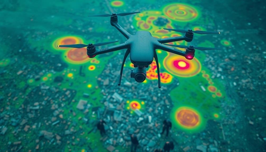
Beyond thermal imaging, multi-spectral sensor detection offers a powerful tool for locating disaster victims. You'll find that these sensors can capture data across multiple wavelengths of the electromagnetic spectrum, providing a more thorough view of the search area.
Multi-spectral sensors can detect subtle differences in vegetation, soil, and materials that might indicate human presence or disturbance. They're particularly useful in identifying recently disturbed earth, which could suggest buried victims or makeshift shelters. You can also use them to detect specific materials like clothing fabrics or common rescue equipment.
When you're conducting a search, multi-spectral data can be combined with other sensor inputs to create detailed, layered maps. This allows you to identify areas of interest more quickly and accurately.
You'll often find that multi-spectral sensors can penetrate certain obstacles like light vegetation or thin debris layers, revealing hidden victims.
To maximize effectiveness, you should use specialized software to analyze the multi-spectral data in real-time. This can help you identify anomalies and potential victim locations faster, guiding ground teams more efficiently and increasing the chances of successful rescues.
AI-Powered Visual Recognition Systems
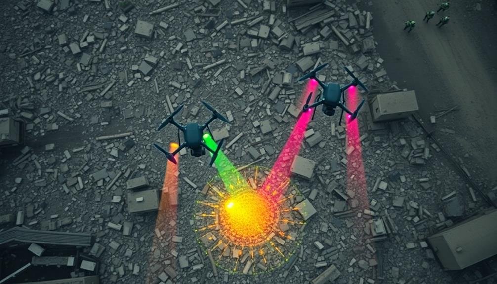
AI-powered visual recognition systems revolutionize UAV search and rescue operations. These advanced systems use deep learning algorithms to analyze real-time video feeds from drone cameras, enabling rapid identification of potential victims, debris patterns, and signs of life in disaster-stricken areas.
You'll find that these systems can detect human shapes, movement, and even specific clothing colors amidst complex terrain. They're trained on vast datasets of disaster scenarios, allowing them to distinguish between victims and other objects with high accuracy. The AI can also recognize distress signals, SOS messages, or makeshift shelters that might be invisible to the human eye at a distance.
As you deploy UAVs equipped with AI visual recognition, you'll benefit from their ability to process information much faster than human operators. This speed is essential in time-sensitive rescue missions. The system can automatically flag areas of interest, allowing ground teams to prioritize their efforts effectively.
It can also work in conjunction with thermal imaging and multi-spectral sensors, cross-referencing data to minimize false positives and enhance detection rates in challenging conditions like dense vegetation or partially collapsed structures.
Frequently Asked Questions
How Do Weather Conditions Affect UAV Search Operations?
Weather greatly impacts your UAV search operations. Wind can disrupt flight, rain affects visibility and sensors, and extreme temperatures impact battery life. You'll need to adjust flight plans and equipment for different conditions to guarantee effective searches.
What Are the Legal Considerations for Using Drones in Disaster Zones?
You'll need to contemplate privacy laws, airspace restrictions, and emergency waivers. Obtain proper licenses and permissions. Be aware of local regulations, no-fly zones, and altitude limits. Always prioritize safety and respect affected communities' rights.
How Long Can Search Drones Typically Stay Airborne?
You'll find search drones' flight times vary widely. Small consumer models may only last 20-30 minutes, while specialized search and rescue drones can stay airborne for several hours. Battery life, payload, and weather conditions affect endurance.
What Training Is Required for UAV Operators in Disaster Response?
You'll need specialized training in UAV operations, disaster response protocols, and first aid. You should complete courses on flight regulations, mission planning, and search techniques. Hands-on practice with various drone models is essential for proficiency.
How Do Rescue Teams Coordinate Multiple Drones During a Search Mission?
You'll coordinate multiple drones using a centralized command center. You're assigning specific search areas to each drone, monitoring their feeds simultaneously, and relaying information in real-time. You'll use software to prevent collisions and optimize coverage.
In Summary
You've now explored three cutting-edge UAV methods for finding disaster victims. Whether you're using thermal imaging to detect body heat, multi-spectral sensors to identify unique signatures, or AI-powered visual recognition to spot survivors, these technologies can drastically improve search and rescue efforts. By implementing these drone-based solutions, you'll increase your chances of locating victims quickly and efficiently. Remember, time is critical in disaster scenarios, and these UAV methods can make all the difference.
As educators and advocates for responsible drone use, we’re committed to sharing our knowledge and expertise with aspiring aerial photographers.


Leave a Reply