
To map city wildlife paths with imagery, start by choosing the right drone equipment with high-quality cameras and long battery life. Plan your flight paths strategically, considering urban layouts and wildlife hotspots. Process and analyze your captured imagery using specialized software to create detailed maps. Identify wildlife movement patterns by looking for recurring routes and areas of high activity. Finally, create actionable mapping reports that highlight key corridors and provide recommendations for wildlife-friendly urban planning. By following these tips, you'll be well-equipped to capture and understand urban wildlife movements. Dive deeper to reveal the full potential of this fascinating field.
Choose Appropriate Drone Equipment
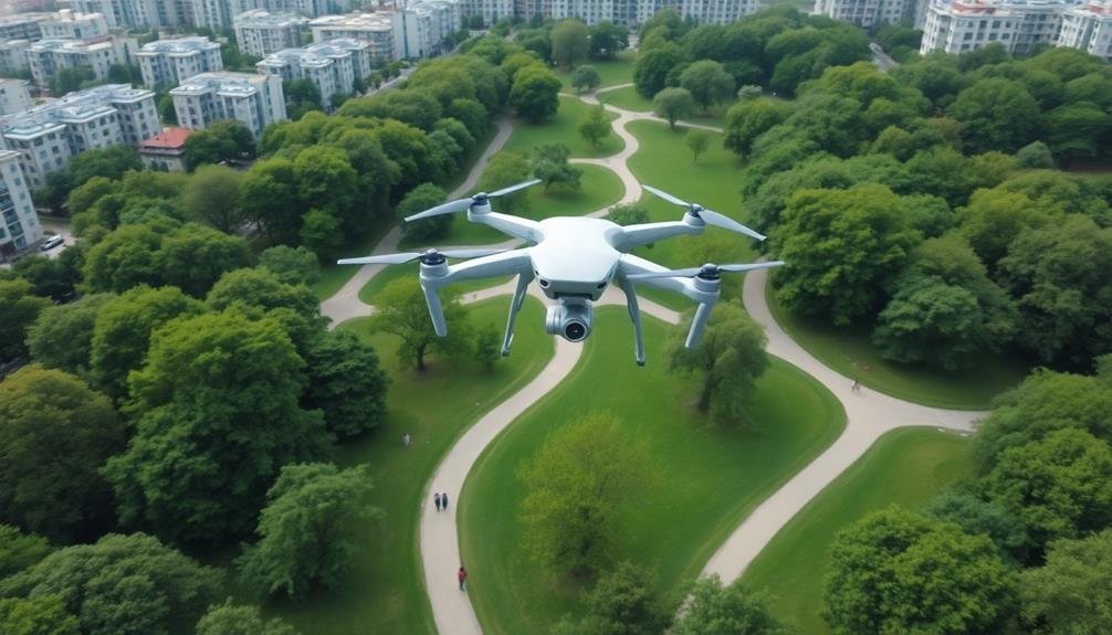
Precision is key when selecting the right drone for mapping wildlife paths in urban areas. You'll need a drone with high-quality imaging capabilities to capture clear, detailed footage of animal movements. Opt for a model with a 4K camera and a gimbal for stable shots.
Look for drones with long battery life, as you'll likely need extended flight times to cover larger areas. Consider the drone's noise level, as quieter models are less likely to disturb wildlife. Choose a drone with obstacle avoidance technology to navigate around buildings and trees safely.
GPS functionality is essential for accurate mapping and creating consistent flight paths. You'll also need a drone that's weather-resistant, as urban wildlife is active in various conditions. Select a model with adjustable flight speeds to accommodate different animals' movement patterns.
Don't forget about storage capacity – you'll need ample space for the imagery you'll collect. Lastly, make sure your chosen drone complies with local regulations for urban flight. Familiarize yourself with no-fly zones and obtain necessary permits before beginning your mapping project.
Plan Strategic Flight Paths

With your drone equipment selected, it's time to map out your flight paths. Consider the city's layout, wildlife hotspots, and potential obstacles when planning your routes. Aim for thorough coverage while minimizing disruption to both urban life and animal habitats. Use satellite imagery and topographical maps to identify green spaces, waterways, and other areas likely to attract wildlife.
Create a grid pattern over the city, ensuring your flight paths overlap slightly to avoid gaps in data collection. Factor in battery life and local regulations when determining flight duration and altitude. Plan for multiple flights if necessary to cover larger areas or capture data at different times of day.
When executing your flight plan, keep these key points in mind:
- Maintain line of sight with your drone at all times
- Avoid flying directly over people or vehicles
- Be prepared to adjust your route if unexpected obstacles or wildlife appear
Process and Analyze Imagery

Once you've completed your drone flights, it's time to process and analyze the collected imagery. Begin by transferring the raw data from your drone to a computer with sufficient processing power.
Use specialized software to stitch together individual images, creating a thorough orthomosaic map of the surveyed area.
Next, apply image enhancement techniques to improve clarity and contrast. This step will help you identify subtle features that might indicate wildlife activity.
Utilize remote sensing algorithms to classify different land cover types, such as vegetation, water bodies, and urban structures.
To detect wildlife paths, look for linear patterns in vegetation or soil that differ from surrounding areas. These may appear as narrow strips of trampled grass or worn dirt trails.
Pay close attention to areas near water sources, food-rich zones, and natural corridors like ravines or tree lines.
Employ machine learning models trained on known wildlife path data to automatically identify potential routes.
Cross-reference your findings with historical data and local wildlife reports to validate your observations.
Identify Wildlife Movement Patterns
After mapping wildlife paths, you'll need to analyze these routes to understand movement patterns. Look for recurring routes, frequent crossings, and areas of high activity.
Pay attention to seasonal variations, as wildlife behavior often changes throughout the year. You'll want to identify key corridors that animals use to move between habitats, as well as potential bottlenecks or barriers that might impede their movement.
To effectively identify wildlife movement patterns:
- Use temporal data to track changes over time, noting how patterns shift with seasons, weather, or urban development.
- Compare movement data with environmental factors like vegetation cover, water sources, and food availability to understand what's driving these patterns.
- Analyze the frequency and timing of movements to determine peak activity periods and potential human-wildlife conflict zones.
Create Actionable Mapping Reports
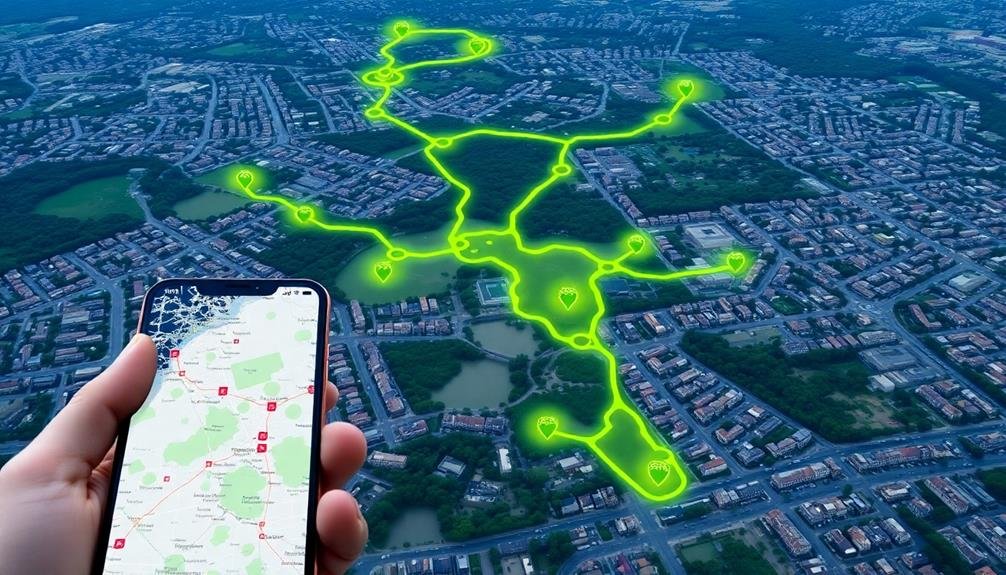
Actionable mapping reports are the key to translating your wildlife movement data into practical conservation strategies. To create these reports, start by compiling your collected data into clear, visually appealing maps. Use GIS software to overlay wildlife movement patterns onto city maps, highlighting key corridors and hotspots.
Include detailed analysis of the data, focusing on species-specific patterns, seasonal variations, and potential conflict areas with human activity. Identify critical habitats, feeding grounds, and breeding sites within the urban landscape. Don't forget to note any barriers or obstacles that impede wildlife movement.
In your report, provide specific recommendations for wildlife-friendly urban planning. Suggest locations for wildlife crossings, buffer zones, or habitat restoration projects. Include cost estimates and potential funding sources for these initiatives.
Make your report accessible to various stakeholders by using plain language and including an executive summary. Provide both short-term and long-term action plans, prioritizing the most urgent needs. Include success metrics and monitoring protocols to track the effectiveness of implemented strategies.
Remember to tailor your report to your audience, whether it's city planners, policymakers, or conservation groups. By creating thorough, actionable mapping reports, you'll increase the likelihood of your findings being translated into meaningful urban wildlife conservation efforts.
Frequently Asked Questions
How Can I Obtain Necessary Permits for Urban Wildlife Drone Surveys?
You'll need to contact your local wildlife and aviation authorities to obtain permits for urban drone surveys. Check city regulations, apply for necessary licenses, and make certain you're following all safety protocols and airspace restrictions.
What Time of Day Is Best for Capturing Wildlife Movement?
You'll capture the most wildlife movement during dawn and dusk. These twilight hours, known as crepuscular periods, are when many urban animals are most active. Early morning and late evening offer prime opportunities for observation.
How Do Seasonal Changes Affect Wildlife Path Mapping Accuracy?
You'll notice seasonal changes greatly impact wildlife path mapping accuracy. In winter, snow tracks reveal clear paths. Spring and fall migrations alter routes. Summer foliage can obscure movement. Always consider the season when analyzing your data.
Are There Ethical Considerations When Mapping Urban Wildlife Movements?
You should consider privacy concerns when mapping urban wildlife movements. Don't disclose sensitive locations that could lead to poaching or disturbance. Make certain your methods don't harm or stress animals. Always prioritize wildlife welfare over data collection.
Can This Technology Be Used to Track Specific Endangered Species?
You can use mapping technology to track endangered species. It's an effective tool for monitoring their movements, habitats, and population trends. However, you'll need to contemplate ethical implications and obtain proper permits for wildlife tracking.
In Summary
You're now equipped to map urban wildlife corridors effectively. By selecting the right drone gear, planning your flights strategically, and processing the imagery carefully, you'll uncover hidden animal pathways. As you identify movement patterns, you're contributing valuable data to conservation efforts. Don't forget to create clear, actionable reports that city planners and wildlife experts can use. Your work will help balance urban development with the preservation of essential wildlife habitats.
As educators and advocates for responsible drone use, we’re committed to sharing our knowledge and expertise with aspiring aerial photographers.


Leave a Reply