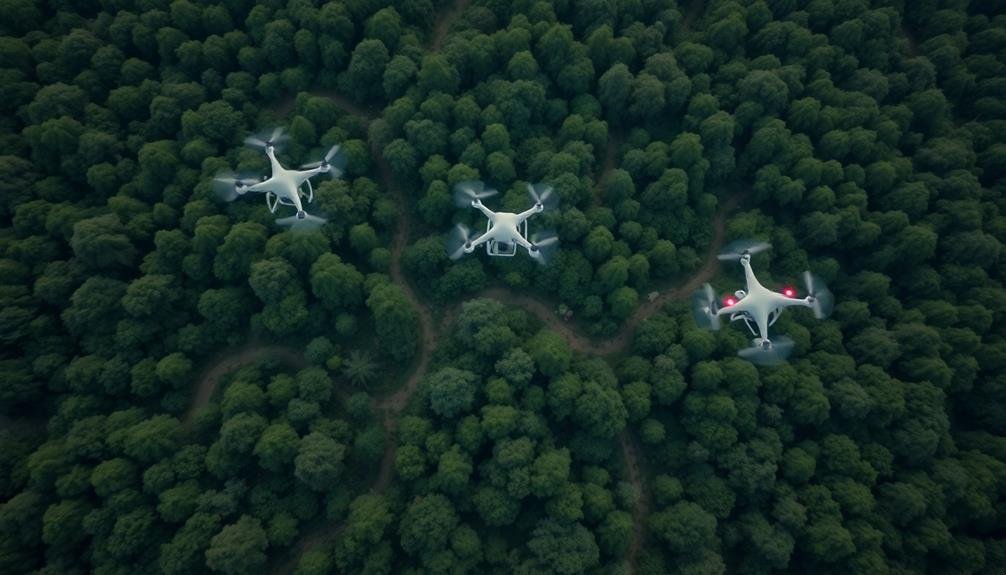
UAVs are transforming wildlife conservation by revolutionizing corridor tracking. These drones use high-resolution cameras, thermal imaging, and AI to map animal movements and habitats with unprecedented detail. You'll find that UAVs can cover vast areas efficiently, minimizing wildlife disturbance while providing real-time data on migration patterns and habitat connectivity. They're particularly useful for monitoring nocturnal species and hard-to-reach locations. By integrating UAV data with GIS, conservationists can analyze and visualize wildlife movements more effectively. This cost-effective technology is continuously evolving, promising even greater advances in wildlife monitoring and protection. Explore further to uncover how these flying sentinels are reshaping conservation efforts worldwide.
UAV Technology in Wildlife Conservation

Innovation in wildlife conservation has taken flight with the advent of Unmanned Aerial Vehicles (UAVs). These aerial drones have revolutionized how researchers and conservationists monitor and protect wildlife populations. You'll find UAVs equipped with high-resolution cameras, thermal imaging sensors, and GPS tracking systems, allowing for extensive data collection in previously inaccessible areas.
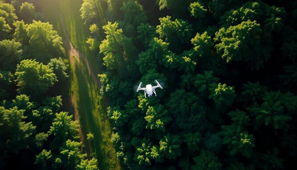
UAVs offer numerous advantages over traditional wildlife monitoring methods. They're less invasive, reducing stress on animals and minimizing human interference in their habitats. You can cover vast territories quickly and efficiently, capturing real-time data on animal movements, population densities, and habitat conditions.
UAVs also prove indispensable in anti-poaching efforts, providing aerial surveillance and rapid response capabilities.
In wildlife corridors, UAVs play an essential role in mapping and monitoring these significant pathways. You can use them to assess habitat connectivity, identify potential obstacles, and track animal migrations.
Mapping Wildlife Corridors From Above

You'll find that aerial imaging techniques form the foundation of mapping wildlife corridors from above.
Data analysis methods, including machine learning algorithms, help you process the vast amounts of visual information collected by UAVs.
When identifying corridors, you'll face challenges such as distinguishing animal paths from other natural features and accounting for seasonal variations in wildlife movement patterns.
Aerial Imaging Techniques
Three key aerial imaging techniques are revolutionizing wildlife corridor mapping from above. You'll find that thermal imaging, multispectral sensors, and LiDAR technology are at the forefront of this transformation.
Thermal imaging allows you to detect animals' body heat, making it easier to spot wildlife even in dense vegetation or at night.
Multispectral sensors capture data across various light wavelengths, helping you identify different plant species and assess habitat health.
LiDAR technology uses laser pulses to create detailed 3D maps of the terrain, revealing topographical features that influence animal movement.
When combined, these techniques provide a thorough view of wildlife corridors:
- Identify animal paths and frequently used routes
- Detect changes in vegetation cover over time
- Spot potential obstacles or barriers to animal movement
- Assess habitat connectivity and fragmentation
- Monitor seasonal variations in corridor usage
Data Analysis Methods
Cutting-edge data analysis methods are essential for transforming raw aerial imagery into actionable wildlife corridor maps. You'll need to employ advanced image processing techniques to extract meaningful information from your UAV-collected data.
Start by using computer vision algorithms to identify and classify different land cover types, such as forests, grasslands, and human-made structures.
Next, you'll want to apply machine learning models to detect and track animal movements across the landscape. These models can be trained to recognize specific species or general wildlife patterns. You can then use Geographic Information Systems (GIS) to overlay this data onto existing maps, creating a thorough view of wildlife corridors.
To analyze temporal changes, you'll need to implement time-series analysis techniques. These will help you identify trends in animal movement and habitat use over different seasons or years.
Don't forget to incorporate statistical methods to assess the significance of your findings and account for potential biases in your data collection.
Corridor Identification Challenges
Identifying wildlife corridors from aerial imagery presents several unique challenges. You'll need to navigate complex terrains, varying vegetation densities, and seasonal changes that can obscure animal pathways.
Additionally, different species use corridors in unique ways, making it difficult to create a one-size-fits-all approach to identification.
When you're analyzing UAV footage for corridor identification, you'll encounter these common obstacles:
- Distinguishing natural pathways from human-made trails
- Detecting subtle signs of animal movement in dense forests
- Accounting for seasonal variations in vegetation cover
- Differentiating between active corridors and historical routes
- Identifying corridors used by smaller or less visible species
To overcome these challenges, you'll need to combine advanced image processing techniques with expert knowledge of local ecosystems and animal behavior.
You might also consider using multiple data sources, such as thermal imaging or LiDAR, to supplement visual data. By integrating machine learning algorithms, you can improve your ability to detect patterns and anomalies that indicate wildlife movement.
Thermal Imaging for Nocturnal Species

You'll find thermal imaging invaluable for tracking nocturnal species in wildlife corridors.
This technology allows you to detect nighttime activity by identifying heat signatures of animals that would otherwise be invisible in the dark.
You can even spot camouflaged species that blend into their surroundings, as their body heat stands out against cooler backgrounds.
Nighttime Activity Detection
Darkness presents unique challenges in wildlife tracking, but thermal imaging technology offers a powerful solution for monitoring nocturnal species. You'll find that UAVs equipped with thermal cameras can detect animals' heat signatures, allowing for effective nighttime activity detection. This technology enables researchers to observe behaviors that were previously difficult to study.
When using thermal imaging for nighttime activity detection, you can expect to see:
- Glowing heat signatures of animals against cooler backgrounds
- Movement patterns of nocturnal species
- Interactions between different animals in the dark
- Nesting or denning sites revealed by concentrated heat signatures
- Hunting or foraging behaviors of predators
You'll notice that thermal imaging can distinguish between different species based on their size, shape, and heat output. This allows for accurate identification and population counts.
Additionally, you can track migration patterns and habitat use by nocturnal animals, providing valuable data for conservation efforts. By combining thermal imaging with other sensors, such as acoustic detectors, you'll gain a thorough understanding of nighttime wildlife activity in corridors. This information helps in designing effective conservation strategies and minimizing human-wildlife conflicts.
Heat Signature Identification
Heat signature identification takes thermal imaging to the next level in nocturnal species tracking. You'll find this technology particularly useful for detecting and monitoring animals that are active at night or in low-light conditions. By equipping UAVs with thermal cameras, you can capture detailed heat signatures of wildlife, allowing for accurate species identification and population counts.
These advanced thermal sensors can detect even subtle temperature differences, enabling you to distinguish between various animals based on their unique heat patterns. You'll be able to spot warm-blooded creatures against cooler backgrounds, making it easier to track their movements through wildlife corridors.
The technology is especially effective for locating elusive nocturnal species like bats, owls, and small mammals that might otherwise go undetected.
With heat signature identification, you can also gather valuable data on animal behavior, such as feeding patterns and mating rituals. This information helps conservationists better understand and protect endangered species.
Additionally, you'll be able to identify potential threats to wildlife, like poachers or invasive predators, by detecting their heat signatures within protected areas.
Camouflaged Species Detection
Revealing hidden wildlife becomes possible with thermal imaging technology for camouflaged species detection.
You'll find that thermal cameras on UAVs can identify animals that are otherwise invisible to the naked eye, especially during nighttime operations. These advanced sensors detect heat signatures emitted by animals, allowing researchers to locate and track elusive species in their natural habitats.
When you're using thermal imaging for camouflaged species detection, you'll encounter several advantages:
- Ability to spot well-camouflaged animals against complex backgrounds
- Enhanced detection of nocturnal species during their active hours
- Reduced disturbance to wildlife compared to ground-based surveys
- Improved safety for researchers working in challenging terrains
- Potential for identifying previously undiscovered species or populations
You'll notice that this technology is particularly useful for monitoring species that are difficult to track using traditional methods.
It's especially effective in dense forests, grasslands, and other environments where visual observation is limited. By incorporating thermal imaging into your UAV wildlife corridor tracking efforts, you'll gain valuable insights into animal movements, population dynamics, and habitat use patterns, ultimately contributing to more effective conservation strategies.
AI-Powered Animal Detection Systems

AI-powered animal detection systems have revolutionized wildlife tracking in UAV operations. These sophisticated algorithms analyze aerial imagery in real-time, identifying and classifying various animal species with remarkable accuracy. You'll find that these systems can detect animals even in challenging environments, such as dense forests or camouflaged habitats.
The AI models are trained on vast datasets of wildlife images, enabling them to recognize distinctive features, movement patterns, and thermal signatures. As you fly your UAV, the system processes the video feed, highlighting potential animal sightings and providing species information. This technology considerably reduces the time and effort required for manual wildlife surveys.
You'll appreciate how these AI systems can adapt to different ecosystems and seasons, adjusting their detection parameters accordingly. They're capable of distinguishing between similar species and can even identify individual animals based on unique markings.
The data collected by these systems is invaluable for conservation efforts, allowing you to track migration patterns, monitor population dynamics, and identify potential threats to wildlife corridors.
As you integrate AI-powered animal detection into your UAV operations, you'll unveil new possibilities for wildlife research and conservation management.
Minimizing Wildlife Disturbance With Drones

Three key strategies will help you minimize wildlife disturbance when using drones for tracking. First, opt for quiet drone models with low noise signatures.
Second, maintain a safe distance from animals, following species-specific guidelines.
Third, limit flight duration and frequency to reduce stress on wildlife.
When operating drones for wildlife corridor tracking, consider these best practices:
- Fly during times of day when animals are least active
- Use camouflaged or nature-inspired drone designs
- Employ indirect approach patterns, avoiding direct overhead flights
- Utilize high-resolution cameras to observe from greater distances
- Train operators in wildlife behavior and stress indicators
You'll need to balance data collection needs with animal welfare. Start with conservative flight plans and gradually increase proximity if animals show no signs of disturbance.
Monitor for behavioral changes like fleeing, hiding, or aggressive displays. If you notice stress responses, immediately increase your distance or end the flight.
Data Collection and Analysis Methods
Effective data collection and analysis form the backbone of successful UAV wildlife corridor tracking. You'll need to employ a variety of methods to gather thorough data. Start by equipping your UAVs with high-resolution cameras and thermal imaging sensors to capture visual and heat signatures of animals. Incorporate GPS tracking to map precise locations and movement patterns.
You should also use LiDAR technology to create detailed 3D models of the terrain, helping you understand habitat characteristics. Consider deploying acoustic sensors to record animal vocalizations, providing insights into species distribution and behavior.
Once you've collected the data, you'll need robust analysis tools. Utilize machine learning algorithms to automatically identify and classify species from images and videos. Implement GIS software to create detailed maps of wildlife movements and habitat use.
You can use statistical modeling to predict future corridor trends and identify potential bottlenecks or areas of concern.
Don't forget to integrate your UAV data with ground-based observations and existing wildlife databases. This thorough approach will give you a more complete picture of wildlife corridor dynamics, enabling more effective conservation strategies.
Tracking Migratory Patterns With UAVS

You'll find UAVs revolutionizing the way we map aerial migration routes.
These unmanned aircraft can cover vast distances, capturing high-resolution imagery and data on wildlife movements across seasons.
You're able to track multiple species simultaneously, gaining unprecedented insights into their migratory patterns and how they change over time.
Aerial Migration Route Mapping
Tracking migratory patterns with UAVs has revolutionized aerial migration route mapping. You'll find that drones equipped with high-resolution cameras and GPS tracking systems can now cover vast areas efficiently, providing researchers with unprecedented data on animal movements.
These aerial surveys allow you to:
- Identify previously unknown migration routes
- Monitor changes in habitat use over time
- Detect obstacles or threats along migration paths
- Assess the impact of climate change on migration patterns
- Gather data on population sizes and distribution
You'll appreciate how UAVs can access remote or dangerous areas that were once difficult to study. They're also less invasive than traditional tracking methods, reducing stress on wildlife.
By combining UAV imagery with satellite data and ground observations, you're able to create thorough maps of migration corridors.
This technology isn't just for birds; it's being used to track terrestrial animals like elephants and marine species like whales. You'll find that the data collected helps inform conservation strategies, urban planning, and policy decisions.
As UAV technology continues to advance, you can expect even more precise and detailed mapping of wildlife movements across the globe.
Seasonal Movement Data Collection
Drones have revolutionized the collection of seasonal movement data for migratory species. You'll find that UAVs equipped with high-resolution cameras and thermal imaging sensors can track animals across vast distances, providing unprecedented insights into their migration patterns.
With drones, you're able to observe wildlife in remote areas that were previously inaccessible or too dangerous for human researchers. You can now monitor seasonal movements of birds, mammals, and even marine life with minimal disturbance to their natural behaviors.
You'll appreciate how UAVs allow for more frequent data collection, enabling you to capture detailed information on departure times, flight paths, and stopover locations. This data helps you identify essential habitats and potential threats along migration routes.
By utilizing GPS-enabled drones, you're able to create accurate, real-time maps of animal movements. You can also integrate this data with other environmental factors, such as weather patterns and land-use changes, to better understand the complex dynamics of seasonal migrations.
With drone technology, you're now able to gather vital information that informs conservation strategies and helps protect endangered species throughout their migratory journeys.
Conservation Challenges Addressed by Drones

Conservation efforts face numerous challenges, but unmanned aerial vehicles (UAVs) are revolutionizing how we tackle these issues. Drones address key problems in wildlife monitoring and habitat protection, offering solutions that were once impractical or impossible.
You'll find that UAVs excel in areas where traditional methods fall short. They can:
- Cover vast, inaccessible terrains quickly
- Provide high-resolution imagery and data
- Minimize disturbance to wildlife
- Operate in dangerous or remote locations
- Reduce costs and manpower requirements
By utilizing drones, you're able to track animal movements more accurately, detect poaching activities in real-time, and assess habitat changes with unprecedented detail.
You'll also find that UAVs help in mapping wildlife corridors, which is essential for maintaining genetic diversity and ecosystem health.
Moreover, you can use drones to monitor the impacts of climate change on habitats, identify invasive species, and conduct population surveys with greater efficiency.
They're particularly useful in addressing the challenge of limited resources in conservation, allowing you to allocate funds and personnel more effectively.
With UAVs, you're better equipped to make data-driven decisions and implement targeted conservation strategies.
UAV Legal and Ethical Considerations

When implementing UAV technology for wildlife conservation, what legal and ethical considerations must you navigate?
First, you'll need to comply with local and national regulations governing drone use. This includes obtaining necessary permits, adhering to flight restrictions, and respecting no-fly zones. You must also consider privacy concerns, especially when flying near populated areas or private property.
Ethically, you're responsible for minimizing disturbance to wildlife. This means flying at appropriate altitudes and distances, avoiding sensitive nesting or breeding areas, and limiting flight duration. You'll need to balance data collection needs with animal welfare.
Data management presents another challenge. You must guarantee the secure storage and ethical use of collected information, particularly location data that could be exploited by poachers. Consider implementing data protection protocols and restricting access to sensitive information.
Additionally, you should engage with local communities and indigenous groups whose lands you may be surveying. Seek their consent and involve them in the conservation efforts when possible. This fosters goodwill and can provide valuable local knowledge to enhance your project's effectiveness.
Drone Deployment Strategies for Corridors
Effective deployment of UAVs is crucial for monitoring wildlife corridors. You'll need to take into account several factors when planning your drone strategy. First, map out the corridor's terrain and identify key observation points. Then, determine the ideal flight paths and altitudes for capturing thorough data.
Choose UAVs with the right capabilities for your specific needs. Reflect on:
- Flight duration
- Camera resolution
- Thermal imaging capabilities
- Obstacle avoidance systems
- Data transmission range
You'll want to establish a regular flight schedule that balances frequency with minimal wildlife disturbance. Time your flights to coincide with peak animal activity periods for the best results.
Implement a grid-based flight pattern to guarantee complete coverage of the corridor. Use automated flight planning software to maximize efficiency and repeatability.
Don't forget to factor in weather conditions and adjust your plans accordingly.
Train your pilots thoroughly in wildlife observation techniques and corridor-specific protocols. They should be able to identify target species and behaviors quickly.
Integrating UAV Data With GIS

The synergy between UAV-collected data and Geographic Information Systems (GIS) creates a powerful tool for wildlife corridor management.
You'll find that integrating UAV data with GIS enhances your ability to analyze and visualize complex spatial information about wildlife movements and habitat conditions.
To integrate UAV data with GIS, you'll need to process the raw imagery and sensor data collected by drones. This involves georeferencing, orthorectification, and mosaicking of aerial photos.
You'll then import this processed data into your GIS software, where you can overlay it with existing maps and datasets.
Once integrated, you can perform advanced spatial analyses. You'll be able to create detailed habitat maps, identify changes in vegetation cover, and track wildlife movements across corridors.
GIS tools allow you to quantify landscape metrics, assess habitat connectivity, and model potential impacts of environmental changes.
You'll also benefit from GIS's data management capabilities. It'll help you organize, store, and retrieve large volumes of UAV-collected data efficiently.
This integration enables you to create dynamic, interactive maps and reports that communicate complex ecological information to stakeholders and decision-makers effectively.
Cost-Effectiveness of Drone Monitoring

While integrating UAV data with GIS offers powerful analytical capabilities, it's important to take into account the financial aspects of drone monitoring. When compared to traditional wildlife tracking methods, drones can be considerably more cost-effective in the long run. You'll find that the initial investment in UAV technology is quickly offset by reduced labor costs and increased efficiency.
Consider these key factors when evaluating the cost-effectiveness of drone monitoring:
- Lower personnel requirements
- Reduced travel expenses
- Faster data collection
- Ability to cover larger areas
- Minimal disturbance to wildlife
You'll save on manpower as a single operator can control multiple drones, covering vast areas in a fraction of the time it would take a ground team. There's no need for expensive vehicles or fuel costs associated with traditional tracking methods.
Drones can access remote or dangerous areas safely, eliminating the need for specialized equipment or risk to human researchers. The high-quality data collected by UAVs also reduces the need for repeated surveys, further cutting costs.
As drone technology continues to advance, you'll find that the cost-benefit ratio of UAV wildlife monitoring becomes increasingly favorable for conservation efforts.
Future of UAV Wildlife Tracking

Rapidly evolving UAV technology promises exciting advancements in wildlife tracking. You'll soon see drones with longer flight times, enhanced sensors, and AI-powered image recognition. These improvements will allow for more thorough and accurate monitoring of wildlife corridors.
In the near future, you can expect UAVs to utilize real-time data processing and transmission, enabling immediate response to wildlife threats or changes in migration patterns. You'll also see increased integration with other technologies, such as satellite imagery and ground-based sensors, creating a thorough wildlife monitoring network.
Here's a glimpse of what's on the horizon:
| Technology | Application |
|---|---|
| Swarm drones | Wider coverage areas |
| Thermal imaging | Improved night tracking |
| Machine learning | Automated species identification |
| Silent propulsion | Reduced wildlife disturbance |
| Solar-powered UAVs | Extended flight durations |
As regulations evolve, you'll witness expanded use of autonomous drones for wildlife tracking. These advancements will revolutionize conservation efforts, providing unprecedented insights into animal behavior and habitat use. You can anticipate more effective wildlife corridor management and protection as a result of these technological leaps in UAV capabilities.
Frequently Asked Questions
How Do Researchers Train UAVS to Differentiate Between Animal Species?
You'll train UAVs to differentiate animal species by feeding them large datasets of animal images. They'll use machine learning algorithms to recognize unique features, patterns, and behaviors. You'll refine this through continuous testing and data updates.
What Battery Life Limitations Exist for Long-Term Wildlife Corridor Monitoring?
You'll face significant battery life limitations for long-term wildlife corridor monitoring. Most drones can only fly for 20-30 minutes before needing a recharge. You'll need to plan frequent battery swaps or consider fixed-wing models for extended flights.
Can UAVS Be Used to Track Aquatic Species in Marine Corridors?
Yes, you can use UAVs to track aquatic species in marine corridors. They're effective for monitoring surface-dwelling animals like whales and dolphins. You'll need waterproof drones with high-resolution cameras and possibly thermal imaging for underwater species.
How Do Weather Conditions Affect UAV Performance in Wildlife Tracking?
You'll find that weather greatly impacts UAV wildlife tracking. Wind can affect flight stability, rain may interfere with sensors, and extreme temperatures can limit battery life. Clear, calm days are ideal for peak performance and data collection.
Are There Collaborative Efforts Between Countries for Cross-Border Wildlife Corridor Monitoring?
You'll find that many countries collaborate on cross-border wildlife corridor monitoring. They're sharing data, resources, and expertise to track animal movements across boundaries. It's a growing trend in conservation efforts worldwide, enhancing wildlife protection on a larger scale.
In Summary
You're witnessing a revolution in wildlife conservation. UAVs are transforming how we track and protect animals in corridors. With thermal imaging, AI detection, and GIS integration, you'll see more efficient and less disruptive monitoring. As drone technology advances, you can expect even more precise data and cost-effective solutions. The future of wildlife tracking is in the air, and you're at the forefront of this exciting technological leap in conservation efforts.
As educators and advocates for responsible drone use, we’re committed to sharing our knowledge and expertise with aspiring aerial photographers.


Leave a Reply