You'll be amazed by these seven sky-high secrets revolutionizing animal migration tracking. Aerial mapping now provides thorough views of migration corridors, while thermal imaging reveals nocturnal movements. Drones equipped with AI count migrating populations with unprecedented accuracy. GPS technology has disclosed previously unknown routes, including the Arctic tern's astounding 70,000-kilometer journey. Scientists are monitoring climate change's effects on migration patterns in real-time. Cross-border tracking helps identify critical stopover sites and potential threats. Finally, drone data is transforming conservation strategies, informing habitat protection decisions. These cutting-edge techniques are just the beginning of unraveling nature's most spectacular journeys.
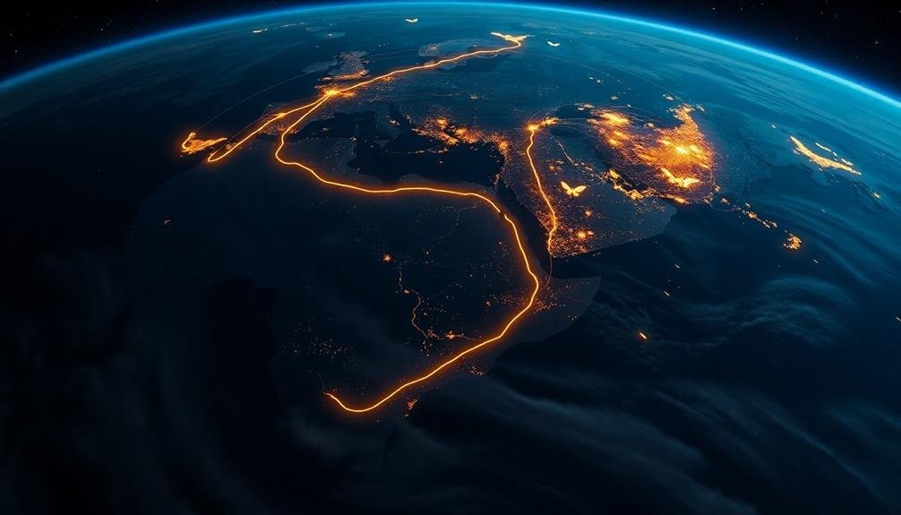
Aerial Mapping of Migration Corridors
Countless animal migration routes have been revealed through aerial mapping techniques. You'll find that researchers now use advanced technology like satellites, drones, and aircraft equipped with specialized sensors to track animal movements across vast landscapes. These tools allow scientists to collect data on migration patterns that were previously impossible to observe.
As you explore this field, you'll discover that aerial mapping provides a bird's-eye view of animal movements, helping identify essential corridors and stopover sites. It's particularly useful for studying species that travel long distances, such as birds, whales, and large terrestrial mammals. You can see how these methods have revolutionized our understanding of migration routes, revealing intricate networks of pathways that animals use year after year.
You'll notice that aerial mapping also helps identify potential obstacles or threats to migration, such as urban development or climate change impacts. This information is important for conservation efforts, allowing scientists and policymakers to design effective strategies to protect these crucial routes.
Thermal Imaging for Nocturnal Tracking
Darkness once concealed the mysteries of nocturnal animal migrations, but thermal imaging has revolutionized our ability to track these elusive journeys. You'll find that this technology detects heat signatures emitted by animals, allowing researchers to observe movements invisible to the naked eye.
With thermal cameras, you can now witness bats swooping through the night sky, following their intricate flight patterns as they migrate. You'll also spot nocturnal birds like owls and nightjars as they navigate under cover of darkness.
Even cold-blooded creatures like sea turtles can be tracked as they emerge from the ocean to nest on beaches.
You'll notice that thermal imaging isn't just about seeing animals; it's about understanding their behavior. You can observe how animals react to environmental changes, predators, or human disturbances during their nighttime travels.
This technology has opened up new avenues for conservation efforts, helping you identify critical habitats and migration routes that need protection.
As you explore the world of thermal imaging, you'll uncover previously hidden aspects of animal migration, shedding light on the secrets of the night.
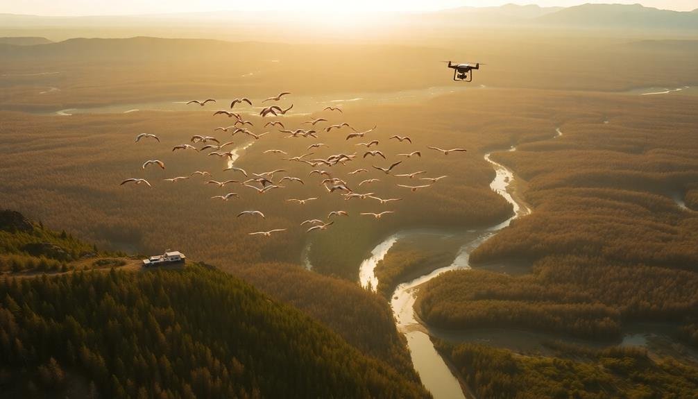
Drone-Based Population Counting Techniques

From high above the earth, drones have revolutionized how we count migrating animal populations. These unmanned aerial vehicles equipped with high-resolution cameras and advanced sensors allow you to gather data on vast herds or flocks with minimal disturbance to the animals.
You'll find that drone-based counting techniques offer several advantages over traditional methods. They provide a bird's-eye view, enabling you to spot animals hidden by vegetation or terrain. You can cover large areas quickly, reducing the time and resources needed for population surveys. The images captured can be analyzed using AI and machine learning algorithms, improving accuracy and consistency in animal identification and counting.
When you're using drones for population counting, you'll need to take into account factors like flight altitude, camera resolution, and species-specific behaviors. You'll also have to comply with local regulations governing drone use.
To maximize effectiveness, you might combine drone imagery with other data sources, such as GPS tracking or ground-based observations. This multi-faceted approach helps you build a thorough understanding of migration patterns and population dynamics, ultimately contributing to more effective conservation strategies.
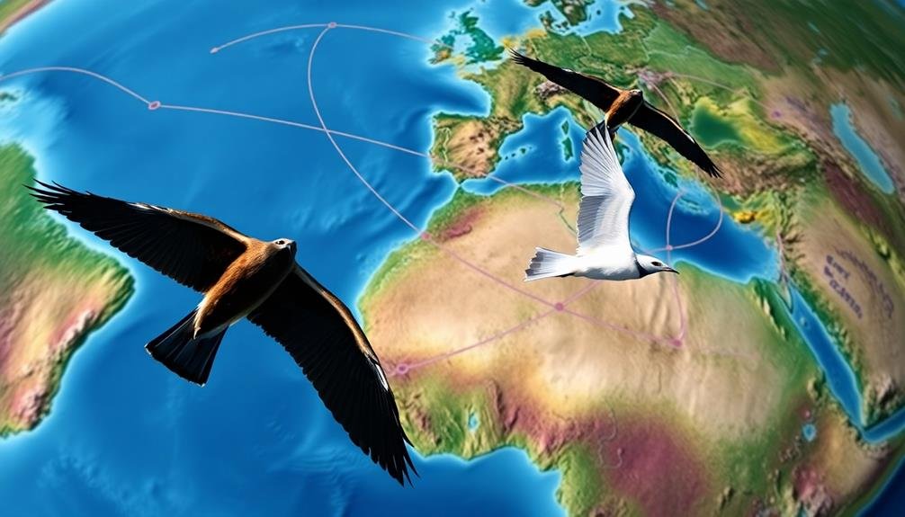
Identifying Previously Unknown Migration Routes

You'll find that recent breakthroughs in satellite tracking have revolutionized our ability to uncover hidden animal migration routes.
These advanced technologies allow you to follow individual animals across vast distances, revealing previously unknown pathways and stopover sites.
Additionally, you can now use DNA analysis techniques to trace genetic lineages and population movements, providing further insights into historical and contemporary migration patterns.
Satellite Tracking Breakthroughs
Satellite tracking technology has revolutionized our understanding of animal migration routes. You'll find that researchers now use tiny GPS devices attached to animals, allowing them to collect real-time data on their movements.
These trackers have disclosed previously unknown migration patterns, stopover sites, and wintering grounds for various species.
You'll be amazed at how this technology has disclosed surprising facts about animal journeys. For instance, Arctic terns have been found to fly over 70,000 kilometers annually, making the longest known animal migration. Satellite tracking has also shown that some bar-tailed godwits fly non-stop for nine days across the Pacific Ocean.
With this breakthrough, you can now witness how animals navigate complex landscapes and overcome obstacles. Scientists have discovered that sea turtles use Earth's magnetic field for guidance, while birds rely on visual landmarks and celestial cues.
The data from satellite tracking helps conservationists identify essential habitats and design protected areas along migration routes.
As you explore these findings, you'll realize how satellite tracking continues to reveal the mysteries of animal migration, providing vital information for wildlife conservation efforts worldwide.
DNA Analysis Techniques
While satellite tracking has revolutionized our understanding of animal movements, DNA analysis techniques have opened up a whole new dimension of discovery in migration research. You'll find that these methods allow scientists to identify previously unknown migration routes and patterns by examining genetic markers in animal populations.
By collecting DNA samples from different locations along potential migration paths, researchers can trace the genetic similarities between groups. This helps them piece together the routes animals take, even when direct observation isn't possible. You'll see how mitochondrial DNA analysis is particularly useful, as it's passed down maternally and mutates at a predictable rate.
You can also observe how scientists use genetic markers to determine the timing of migrations. By analyzing the genetic diversity within populations, they can estimate how recently different groups have separated or mixed. This information helps in reconstructing historical migration patterns and understanding how they've changed over time.
DNA analysis has revealed surprising connections between geographically distant populations, uncovering long-distance migrations that were previously unknown.
It's also helped identify important stopover sites and breeding grounds, essential for conservation efforts.
Monitoring Climate Change Effects
You'll find that climate change is altering animal migration routes in significant ways.
By tracking shifting migration patterns, scientists can gauge the immediate impacts of global warming on various species.
These observations allow researchers to measure how well different animals are adapting to changing environmental conditions, providing essential data for conservation efforts.
Shifting Migration Patterns
Climate change is reshaping the world's migration patterns, and scientists are racing to keep up. You'll find that many species are altering their traditional routes and timing in response to changing temperatures and weather patterns. Birds, for instance, are arriving at their breeding grounds earlier and departing later. Some are even skipping migration altogether, choosing to overwinter in warmer areas.
You'll notice that insects like monarch butterflies are shifting their ranges northward, while marine species are moving towards cooler waters. These changes aren't just curiosities; they're disrupting ecosystems and food chains. Predators may arrive too late to catch their usual prey, while plants might bloom before their pollinators appear.
As you observe these shifts, you'll see that they're not uniform. Some species adapt quickly, while others struggle to keep pace. This variability makes predicting and managing the impacts of climate change on migration even more challenging.
Scientists are using advanced tracking technologies and big data analysis to map these changes in real-time, helping conservationists and policymakers develop strategies to protect vulnerable species and habitats.
Species Adaptation Tracking
As scientists grapple with the effects of climate change on migration patterns, they've developed sophisticated methods for tracking species adaptations. You'll find that these techniques range from satellite tracking to DNA analysis, allowing researchers to monitor how animals adjust their routes and behaviors in response to environmental changes.
One of the most fascinating aspects of this research is the use of big data and machine learning algorithms. These tools help scientists predict future migration patterns based on current trends and climate projections. You'll be amazed at how accurately they can forecast shifts in animal movements years in advance.
Here's a quick overview of some key adaptation tracking methods:
| Method | Application | Advantages |
|---|---|---|
| GPS Tracking | Real-time monitoring | High precision |
| Isotope Analysis | Historical route mapping | Long-term data |
| Citizen Science | Large-scale data collection | Cost-effective |
Tracking Migratory Species Across Borders
While tracking migratory species across borders presents unique challenges, modern technology has revolutionized our ability to monitor animal movements. You'll find that satellite tracking, GPS tags, and cellular networks now allow researchers to follow animals in near real-time as they cross international boundaries.
These tools help you understand the complete extent of migration routes, identify critical stopover sites, and pinpoint potential threats along the way. You can now track birds flying thousands of miles, marine creatures maneuvering vast oceans, and terrestrial animals traversing continents.
However, you'll face hurdles when monitoring cross-border migrations. Different countries have varying regulations on wildlife tracking, data sharing, and research permits. You'll need to navigate these legal complexities and establish international collaborations to guarantee continuous monitoring.
Data sharing platforms and standardized protocols have emerged to address these challenges. They allow you to contribute to a global network of researchers, pooling information on migratory species.
This collaborative approach helps you build a thorough picture of animal movements, regardless of political boundaries, and inform conservation efforts across the animals' entire range.
Drone Data for Conservation Efforts
Drones have rapidly become invaluable tools in conservation efforts, especially for tracking migratory species. You'll find these aerial marvels capturing high-resolution images and videos of animals in their natural habitats, providing data that was once impossible to obtain. They're revolutionizing how we monitor wildlife populations, assess habitat health, and detect illegal activities like poaching.
You can use drones to track migration patterns with unprecedented accuracy. They'll help you map routes, identify stopover sites, and even count individual animals within large groups. Here's a quick overview of how drones are making a difference:
| Application | Benefit | Challenge |
|---|---|---|
| Aerial surveys | Covers large areas quickly | Weather limitations |
| Thermal imaging | Detects animals at night | Expensive equipment |
| Habitat mapping | Creates detailed 3D models | Data processing time |
| Anti-poaching | Monitors remote areas | Limited flight time |
You'll find that drone data is transforming conservation strategies. It's helping researchers and wildlife managers make informed decisions about habitat protection, resource allocation, and policy-making. With this technology, you're gaining unprecedented insights into the secret lives of migratory animals, paving the way for more effective conservation efforts worldwide.
Frequently Asked Questions
How Do Animals Navigate During Long-Distance Migrations?
You'll find animals use various methods to navigate. They rely on the sun, stars, and Earth's magnetic field. Some follow landmarks, while others use their sense of smell. Many species also have internal compasses and inherited genetic maps.
What Role Do Earth's Magnetic Fields Play in Animal Migration?
You'll find that Earth's magnetic fields are essential for animal migration. They serve as a natural compass, helping animals orient themselves and navigate vast distances. Many species can sense these fields, guiding their journeys with remarkable accuracy.
How Do Human Activities Impact Migration Patterns?
You'll find that human activities disrupt migration patterns through habitat destruction, light pollution, and climate change. You're altering animals' food sources, breeding grounds, and navigation cues. Your actions can confuse or block their traditional routes entirely.
Do All Individuals of a Species Follow the Same Migration Route?
You'll find that not all individuals of a species follow the same migration route. Some may take different paths due to factors like age, experience, or environmental conditions. It's a diverse journey for many species.
How Do Researchers Tag and Track Smaller Migratory Animals Like Insects?
You'll find researchers using tiny transmitters, micro-tags, and even radar to track small migratory animals. They'll attach lightweight devices to insects or use advanced technologies to monitor their movements across vast distances. It's amazing how they've adapted tracking methods!
In Summary
You've now glimpsed the cutting-edge techniques revolutionizing our understanding of animal migration. From aerial mapping to thermal imaging, these high-tech methods are revealing secrets hidden in the skies. As you've seen, drones and advanced tracking systems aren't just cool gadgets—they're essential tools for conservation. By embracing these innovations, you're joining a global effort to protect migratory species and their habitats. Keep looking up; there's still so much to discover!
As educators and advocates for responsible drone use, we’re committed to sharing our knowledge and expertise with aspiring aerial photographers.


Leave a Reply