UAVs are revolutionizing wildlife population surveys in five key ways. They expand aerial coverage, accessing vast areas and hard-to-reach locations quickly. By reducing human disturbance, UAVs capture animals in their natural state, preserving ecosystem integrity. Thermal imaging enables effective night surveys, improving accuracy in detecting nocturnal species. AI-powered image recognition automates species identification, enhancing efficiency and accuracy. Finally, UAVs offer cost-effective long-term monitoring, allowing for frequent surveys with minimal personnel. These innovations provide unprecedented insights into animal behavior and population dynamics, paving the way for more effective conservation strategies. Discover how these advancements are reshaping wildlife research and protection efforts.
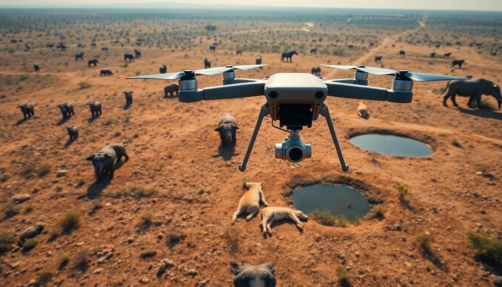
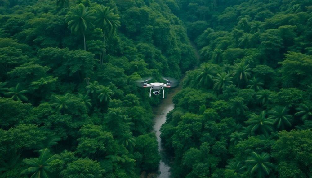
Aerial Coverage and Accessibility
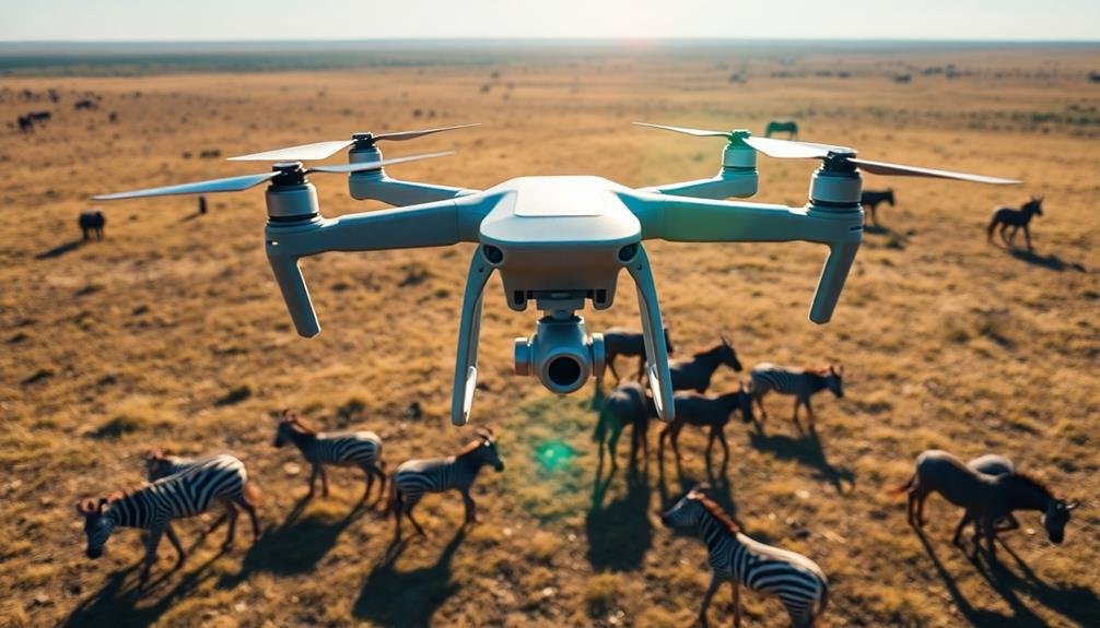
Unmanned aerial vehicles (UAVs) have revolutionized wildlife population surveys by dramatically expanding aerial coverage and improving accessibility to remote or challenging terrain. You'll find that UAVs can cover vast areas quickly and efficiently, reaching places that would be difficult or dangerous for human researchers to access on foot or by traditional aircraft.
These drones can fly at various altitudes and speeds, allowing you to adapt your survey methods to different habitats and species. You can easily program them to follow specific flight paths, ensuring consistent and repeatable coverage of your study area. This precision helps you gather more accurate data on animal populations and distributions.
UAVs also enable you to access previously inaccessible locations, such as dense forests, steep mountain slopes, or marshy wetlands. You'll no longer be limited by physical barriers or safety concerns that might've restricted traditional survey methods.
This expanded reach allows you to study wildlife in their natural habitats with minimal disturbance, providing valuable insights into animal behavior and ecosystem dynamics that were once out of reach.
Reduced Human Disturbance
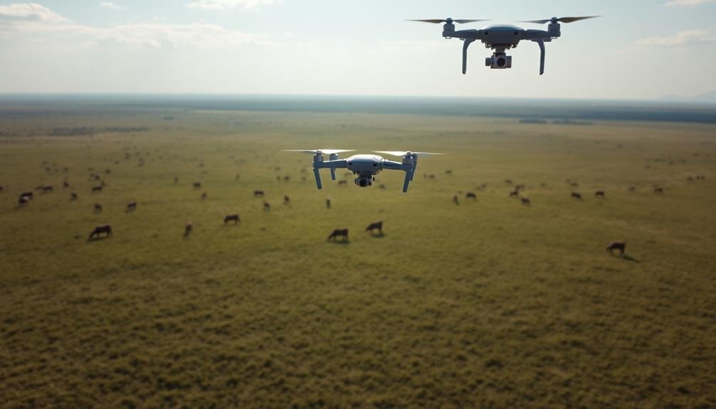
Offering a significant advantage, UAVs minimize human disturbance during wildlife surveys. You'll find that these unmanned aircraft can approach wildlife without causing the stress and behavioral changes often associated with human presence. This reduced disturbance leads to more accurate population counts and behavioral observations.
When you use UAVs, you're able to observe animals in their natural state, undisturbed by human scent, noise, or visual presence. This is particularly essential for studying shy or easily spooked species that might alter their behavior or flee when humans are nearby. UAVs can quietly hover or fly at a distance, capturing images and videos without alerting the animals to any unusual activity.
You'll also appreciate how UAVs can access sensitive habitats without causing physical damage. Unlike traditional ground surveys, drones don't create paths or disturb vegetation, preserving the ecosystem integrity.
This non-invasive approach is especially valuable in fragile environments or during breeding seasons when minimal disturbance is vital. By using UAVs, you're ensuring that your research methods don't negatively impact the very populations and habitats you're trying to study and protect.
Thermal Imaging for Night Surveys
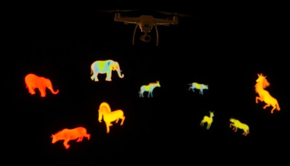
Thermal imaging technology has revolutionized night surveys with UAVs. You can now capture high-quality data on nocturnal wildlife populations without disturbing their natural behaviors. This technology detects heat signatures emitted by animals, allowing you to locate and count species that are typically elusive during daylight hours.
UAVs equipped with thermal cameras offer several advantages for nighttime wildlife surveys:
- Improved accuracy in detecting and counting animals
- Ability to survey large areas quickly and efficiently
- Reduced risk to researchers and minimal disturbance to wildlife
You'll find thermal imaging particularly useful for monitoring mammals, birds, and reptiles in various habitats. It's especially effective in dense forests or grasslands where visual detection is challenging. By using thermal imaging, you can identify animals based on their unique heat signatures, distinguishing between different species and even estimating their size.
When conducting night surveys with thermal-equipped UAVs, you'll need to take into account factors such as flight altitude, speed, and environmental conditions. Lower altitudes generally provide better resolution, but you must balance this with regulations and the risk of disturbing wildlife.
AI-Powered Animal Detection
Artificial intelligence has transformed the way you detect and count animals in UAV-based wildlife surveys. AI-powered image recognition software can now automatically identify and tally different species in aerial footage, dramatically reducing processing time and human error.
You'll find that these systems can distinguish between similar-looking animals and even detect partially obscured individuals. Machine learning algorithms improve with each survey, becoming more accurate at species identification and population estimates.
You can train these AI models on specific ecosystems, making them highly effective for your particular study area. The software can also flag unusual sightings or behaviors for human review, ensuring that important observations aren't missed.
Real-time processing capabilities allow you to make on-the-fly decisions during surveys, optimizing flight paths and data collection. You'll appreciate how AI can filter out false positives from non-animal objects, increasing the reliability of your counts.
In addition, these systems can analyze vast amounts of data quickly, enabling you to conduct more frequent and thorough surveys. By leveraging AI-powered animal detection, you'll gain unprecedented insights into wildlife populations, movements, and behaviors, revolutionizing conservation efforts and ecological research.
Cost-Effective Long-Term Monitoring

Long-term monitoring of wildlife populations has traditionally been an expensive and labor-intensive endeavor, but UAVs are changing that landscape. These aerial platforms offer a cost-effective solution for ongoing wildlife surveys, allowing researchers to gather data more frequently and efficiently than ever before.
You'll find that UAVs can greatly reduce the costs associated with long-term monitoring:
- Lower personnel requirements, as fewer field staff are needed
- Decreased transportation expenses, especially in remote areas
- Minimized disturbance to wildlife, leading to more accurate data
By incorporating UAVs into your monitoring strategy, you're able to conduct surveys more often, capturing seasonal variations and population trends with greater accuracy. This increased temporal resolution helps you detect changes in wildlife populations earlier, enabling quicker management responses.
You can also use UAVs to access hard-to-reach areas that were previously too dangerous or costly to survey regularly. This expanded coverage provides a more thorough understanding of wildlife distributions and habitat use.
With the ability to collect consistent, high-quality data over extended periods, UAVs are revolutionizing long-term ecological monitoring, offering unprecedented insights into wildlife population dynamics and conservation needs.
Frequently Asked Questions
What Training Is Required to Operate UAVS for Wildlife Surveys?
You'll need training in UAV piloting, wildlife biology, and data analysis. You should learn flight regulations, species identification, and survey methodologies. Hands-on practice with drones and specialized software for image processing is essential.
How Do Weather Conditions Affect UAV Performance in Wildlife Surveys?
Weather conditions greatly impact your UAV's performance during wildlife surveys. You'll face challenges like wind affecting stability, rain obscuring visibility, and extreme temperatures limiting flight time. Always check forecasts and adjust your plans accordingly.
Are There Legal Restrictions on Using UAVS for Wildlife Research?
Yes, you'll face legal restrictions when using UAVs for wildlife research. You'll need permits, must follow airspace regulations, and respect wildlife protection laws. Don't forget to check local and national rules before flying your drone.
Can UAVS Transmit Real-Time Data During Wildlife Population Surveys?
Yes, UAVs can transmit real-time data during wildlife surveys. You'll receive immediate information on animal counts, locations, and behavior. This allows you to make quick decisions and adjustments to your research strategy as you're conducting the survey.
How Do Researchers Ensure the Privacy of People Near Wildlife Survey Areas?
You'll find researchers prioritize privacy by blurring faces and license plates in images, restricting flight paths to avoid populated areas, and notifying local communities. They'll also follow strict data protection protocols when handling and storing information.
In Summary
You've seen how UAVs are transforming wildlife population surveys. They're expanding coverage, minimizing disturbance, and enabling night surveys with thermal imaging. You'll benefit from AI-powered animal detection and cost-effective long-term monitoring. As technology advances, you can expect even more innovative applications. Embrace these drone-based solutions to enhance your conservation efforts and gain deeper insights into wildlife populations. You're now equipped to revolutionize your approach to wildlife surveys.
As educators and advocates for responsible drone use, we’re committed to sharing our knowledge and expertise with aspiring aerial photographers.


Leave a Reply