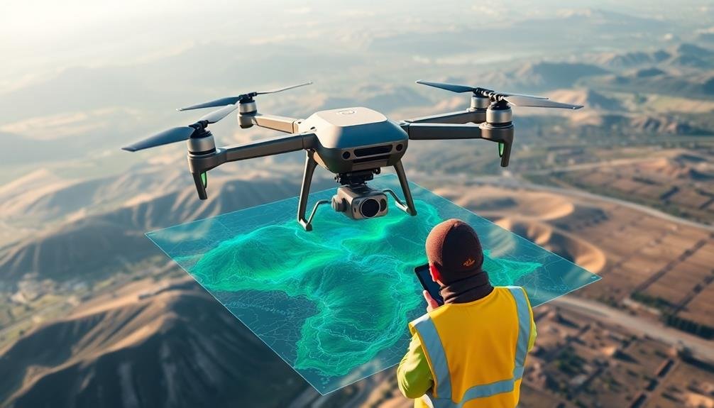
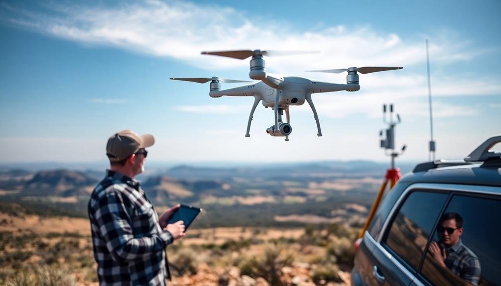
Modern land surveys employ cutting-edge technologies to enhance accuracy and efficiency. You'll find LiDAR scanning capturing millions of data points, while photogrammetry creates detailed 3D models. GPS-enabled equipment offers centimeter-level precision, and satellite imagery provides broad overviews of vast areas. Augmented reality visualization overlays digital models onto real-world views, improving on-site understanding. Mobile mapping systems integrate multiple technologies for thorough data collection, and thermal imaging reveals hidden temperature patterns. These high-tech solutions revolutionize how surveyors collect, analyze, and present land data. Discover how these innovations are transforming the field of land surveying and opening new possibilities for precision and insight.
Key Takeaways
- LiDAR scanning captures millions of data points, penetrates vegetation, and generates accurate 3D models for efficient land surveys.
- Photogrammetry creates detailed 3D models from overlapping photographs, enabling precise measurements and terrain analysis.
- GPS-enabled survey equipment provides centimeter-level accuracy with real-time kinematic technology for instant high-precision results.
- Mobile mapping systems integrate LiDAR, cameras, and GPS to collect comprehensive geospatial data quickly over large areas.
- Augmented reality visualization overlays digital models onto real-world views, improving on-site understanding and remote collaboration.
LiDAR Scanning Technology

LiDAR scanning technology has revolutionized land surveying with its unparalleled accuracy and efficiency. You'll find that LiDAR, which stands for Light Detection and Ranging, uses laser pulses to measure distances and create detailed 3D maps of landscapes and structures. It's capable of capturing millions of data points per second, providing a level of detail that traditional surveying methods can't match.
When you're using LiDAR for land surveys, you'll appreciate its ability to penetrate vegetation and capture ground features that might be obscured from aerial photography. This makes it invaluable for mapping forested areas, coastal regions, and urban environments.
You can mount LiDAR sensors on various platforms, including aircraft, vehicles, and tripods, allowing for versatile data collection.
The data you collect with LiDAR can be used to create highly accurate digital elevation models, contour maps, and 3D visualizations. You'll find this technology particularly useful for flood mapping, infrastructure planning, and environmental assessments.
With LiDAR, you can quickly survey large areas, reducing field time and increasing productivity. It's an essential tool for modern surveyors, offering precise measurements and extensive spatial data for informed decision-making.
Photogrammetry and 3D Modeling
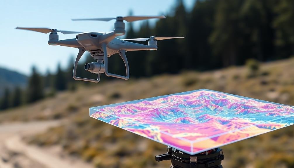
Another powerful tool in the surveyor's arsenal is photogrammetry, which complements LiDAR technology in creating accurate 3D models of landscapes and structures. This technique uses multiple overlapping photographs to reconstruct detailed 3D representations of objects and terrain.
You'll find that photogrammetry is particularly useful for capturing complex surfaces and textures that LiDAR might miss.
When you're working with photogrammetry, you'll typically use specialized software to process the images and generate 3D models. These models can be incredibly detailed, allowing you to:
- Measure distances and volumes with high precision
- Analyze terrain features and identify potential hazards
- Create virtual walkthroughs of sites for planning and presentation purposes
GPS-Enabled Survey Equipment
While photogrammetry excels in capturing visual details, GPS-enabled survey equipment brings unparalleled precision to positioning and mapping. You'll find that modern GPS survey tools can pinpoint locations with centimeter-level accuracy, revolutionizing land surveying practices.
These devices utilize signals from multiple satellites to triangulate precise positions. You'll typically work with GPS receivers, data collectors, and specialized software. The receivers capture raw satellite data, while the collectors process and store this information. You can then transfer the data to computers for further analysis and mapping.
Real-time kinematic (RTK) GPS technology has become a game-changer. It allows you to obtain high-precision results in real-time, greatly speeding up your survey work. You'll also appreciate the integration of GPS with other sensors like total stations, creating powerful multi-sensor systems.
When using GPS-enabled equipment, you'll need to evaluate factors like satellite visibility, atmospheric conditions, and multipath errors. However, advanced algorithms and augmentation systems help mitigate these challenges.
Satellite Imagery Analysis
Satellite imagery analysis has become an essential tool in modern land surveying. You'll find that it offers a bird's-eye view of vast areas, allowing you to gather vital data without setting foot on the terrain. By combining high-resolution satellite images with advanced software, you can extract valuable information about land features, vegetation, and even changes over time.
When you're working with satellite imagery analysis, you'll benefit from:
- Time and cost efficiency
- Access to remote or inaccessible areas
- Historical data comparison capabilities
You'll need to familiarize yourself with different types of satellite imagery, including optical, radar, and multispectral. Each type provides unique insights into the land you're surveying. Optical imagery gives you clear, visible light pictures, while radar can penetrate cloud cover and vegetation.
Multispectral imagery allows you to analyze specific wavelengths, revealing details about soil composition and plant health.
To make the most of satellite imagery analysis, you'll want to invest in powerful image processing software. These tools help you enhance image quality, perform classifications, and extract precise measurements.
You can also integrate this data with other surveying methods, like GPS and LiDAR, for thorough land assessments.
Augmented Reality Visualization

You'll find augmented reality (AR) revolutionizing land surveys through its ability to overlay digital terrain models onto real-world views.
As you walk the site, you can integrate real-time data, allowing for immediate updates and adjustments to your survey.
AR's interactive site planning capabilities enable you to visualize proposed structures or changes in the landscape, enhancing your decision-making process on the spot.
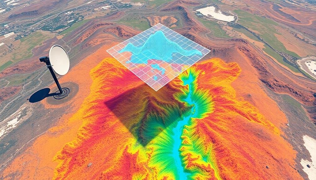
Overlaying Digital Terrain Models
Surveyors and engineers are revolutionizing land mapping with augmented reality (AR) visualization of digital terrain models. By overlaying digital terrain models onto real-world views, you'll gain a thorough understanding of the landscape's topography, geology, and features.
This technology allows you to see both the visible and hidden aspects of the terrain simultaneously, enhancing your ability to make informed decisions during land surveys.
Here's how overlaying digital terrain models can benefit your surveying projects:
- Improved accuracy: You'll detect discrepancies between the digital model and actual terrain, enabling real-time adjustments.
- Enhanced visualization: You can view subsurface features, utilities, and potential hazards that aren't visible to the naked eye.
- Efficient planning: You'll identify ideal routes, site locations, and potential obstacles before breaking ground.
Real-time Data Integration
Real-time data integration transforms augmented reality visualization into a dynamic, interactive experience for land surveyors. As you work in the field, you'll see digital information overlaid on your physical surroundings through AR glasses or mobile devices. This technology allows you to instantly access and visualize essential data, enhancing your decision-making capabilities.
You'll be able to view property boundaries, underground utilities, and topographical features in real-time as you move through the site. The system updates continuously, reflecting changes in the environment or new data inputs from team members. You can interact with these digital elements, manipulating 3D models or accessing detailed information with simple gestures or voice commands.
This integration streamlines your workflow, reducing errors and improving efficiency. You'll spot discrepancies between existing maps and current conditions immediately, allowing for quick adjustments.
The technology also facilitates remote collaboration, enabling you to share your augmented view with off-site experts for instant consultation. As you complete your survey, the system automatically compiles and processes data, generating reports and updating databases in real-time, ensuring that your findings are immediately available to stakeholders and decision-makers.
Interactive Site Planning
Interactive site planning takes augmented reality visualization to the next level, revolutionizing how you approach land survey projects. With this cutting-edge technology, you'll be able to overlay digital information onto the physical world, creating a seamless blend of reality and virtual elements. This allows you to visualize proposed structures, landscaping, and infrastructure in real-time, right on the site you're surveying.
You'll find that interactive site planning offers numerous benefits:
- Improved decision-making: You can instantly see how changes will impact the overall project, allowing for quicker and more informed choices.
- Enhanced collaboration: Team members and stakeholders can share a common visual understanding of the project, regardless of their location.
- Reduced errors and rework: By identifying potential issues early in the planning stage, you'll save time and resources in the long run.
As you use this technology, you'll be able to manipulate virtual objects, adjust parameters, and explore different scenarios in real-time. This level of interactivity enables you to fine-tune your designs and optimize land use with unprecedented precision.
You'll also find that client presentations become more engaging and persuasive when you can showcase proposed developments in a realistic, immersive environment.
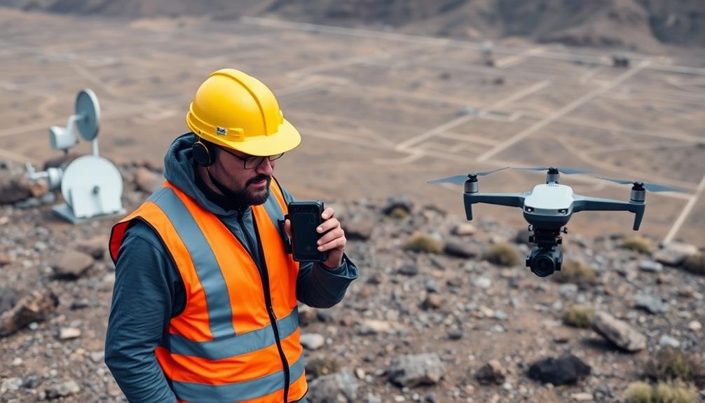
Mobile Mapping Systems
Mobile mapping systems have revolutionized the way land surveys are conducted. These advanced technologies allow you to collect vast amounts of geospatial data quickly and accurately while on the move.
You'll find that mobile mapping systems typically combine LiDAR sensors, high-resolution cameras, and GPS receivers mounted on vehicles or backpacks. As you navigate through a site, these systems capture detailed 3D point clouds, georeferenced imagery, and precise positioning data.
You can cover large areas in a fraction of the time it'd take using traditional survey methods. The collected data is then processed to create highly accurate digital maps, 3D models, and topographic representations.
You'll appreciate the versatility of mobile mapping systems, as they're useful for various applications. They're ideal for surveying roads, railways, and urban environments. You can also use them for asset management, infrastructure inspection, and even virtual reality simulations.
With the ability to integrate with GIS software, you'll find it easier to analyze and share your survey data. Mobile mapping systems have become an essential tool, offering you enhanced efficiency and thorough data collection capabilities for modern land surveying projects.
Thermal Imaging for Land Assessment
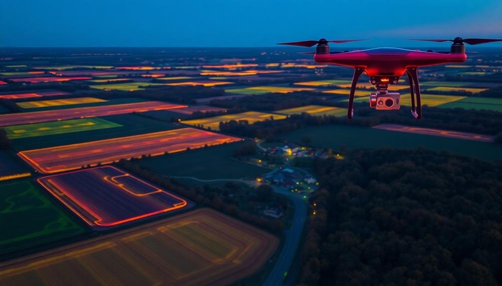
Thermal imaging technology has emerged as a powerful tool for land evaluation in modern surveying practices. You'll find that this innovative approach allows you to capture detailed temperature data across large areas quickly and efficiently.
By using thermal cameras mounted on drones or handheld devices, you can identify temperature variations that aren't visible to the naked eye.
Here's how thermal imaging can benefit your land evaluation:
- Detect underground water sources and leaks
- Identify areas of soil erosion or instability
- Evaluate vegetation health and stress levels
You'll appreciate how thermal imaging helps you pinpoint potential issues before they become major problems. It's particularly useful for evaluating large agricultural areas, where crop health monitoring is essential.
You can easily spot irrigation problems, pest infestations, or nutrient deficiencies by analyzing temperature patterns.
In urban planning, you'll find thermal imaging invaluable for identifying heat islands and energy inefficiencies in buildings. This data can inform decisions about green space allocation and building retrofits.
As you incorporate thermal imaging into your land evaluation toolkit, you'll discover its versatility in providing insights that traditional surveying methods can't match.
Frequently Asked Questions
How Much Do High-Tech Mapping Solutions Typically Cost for a Land Survey Project?
You'll find costs vary widely, depending on project size and complexity. For a typical land survey, you might spend anywhere from $2,000 to $20,000 or more. It's best to get quotes from multiple providers for accurate pricing.
What Training Is Required to Operate Advanced Mapping Technologies Effectively?
You'll need specialized training to operate advanced mapping tech effectively. You should learn GIS software, remote sensing techniques, and data analysis. It's also essential that you master drone piloting and LiDAR systems for thorough surveying skills.
How Accurate Are These Modern Mapping Techniques Compared to Traditional Methods?
You'll find modern mapping techniques are considerably more accurate than traditional methods. They can achieve sub-centimeter precision, reducing human error and capturing intricate details. You're able to collect data faster and with greater reliability.
Can High-Tech Mapping Solutions Be Integrated With Existing GIS Databases?
Yes, you can integrate high-tech mapping solutions with existing GIS databases. They're designed to be compatible, allowing you to seamlessly combine new data with your current systems. This integration enhances your analysis capabilities and improves overall efficiency.
What Are the Legal Implications of Using Drone Technology for Land Surveys?
You'll need to contemplate privacy laws, airspace regulations, and property rights when using drones for land surveys. Make sure you're licensed, insured, and compliant with local and federal laws to avoid legal issues.
In Summary
You've now seen the cutting-edge tools reshaping land surveying. From LiDAR to thermal imaging, these technologies offer unprecedented accuracy and efficiency. They'll transform how you collect, analyze, and visualize spatial data. As you embrace these innovations, you'll streamline your workflows and deliver more precise results. Don't hesitate to explore and integrate these solutions into your surveying practice. The future of land mapping is here, and it's more accessible than ever.
As educators and advocates for responsible drone use, we’re committed to sharing our knowledge and expertise with aspiring aerial photographers.


Leave a Reply