To find avalanche survivors with rescue drones, you'll need to equip your drone with advanced sensors and thermal imaging cameras. Start by mapping the avalanche area using GPS and aerial surveying techniques. Then, fly the drone in a systematic grid pattern, using thermal cameras to detect body heat signatures beneath the snow. Coordinate closely with ground rescue teams, sharing real-time data and location information. Overcome challenges like harsh weather and poor visibility by using drones designed for extreme conditions. Remember to keep batteries charged and systems calibrated. As drone technology advances, your chances of locating survivors quickly and efficiently will only improve.
Understanding Avalanche Rescue Drone Technology
Avalanche rescue drones have revolutionized search and rescue operations in snow-covered terrain. These unmanned aerial vehicles are equipped with advanced sensors and imaging technology specifically designed for locating survivors buried under snow.
You'll find that most avalanche rescue drones use thermal imaging cameras to detect body heat signatures beneath the snow's surface. They're also fitted with high-resolution optical cameras for visual inspection and GPS systems for precise location tracking. Some models incorporate ground-penetrating radar to detect objects or people buried deep in the snow.
The drones are typically lightweight and compact, allowing for quick deployment in challenging mountain environments. They can cover large areas quickly, reaching places that might be too dangerous or difficult for human rescuers to access immediately.
Many rescue drones are now equipped with artificial intelligence and machine learning algorithms. These features help analyze data in real-time, identifying potential survivor locations and reducing false positives. Some advanced models can even drop emergency supplies or communication devices to survivors while waiting for ground teams to arrive.
Understanding this technology is vital for rescue teams, as it greatly improves the chances of locating and saving avalanche victims within the critical "golden hour" after burial.
Preparing Drones for Avalanche Missions
Having understood the technology behind avalanche rescue drones, it's important to focus on their preparation for missions.
First, verify your drone's battery is fully charged and you have spare batteries on hand. Cold temperatures can drain power quickly, so keep batteries warm until use. Check all components for damage or wear, including propellers, motors, and sensors.
Next, calibrate your drone's GPS and compass systems for accurate navigation in mountainous terrain. Load up-to-date maps of the search area onto the drone's software. If your drone uses thermal imaging, adjust the camera settings to account for snow conditions and potential temperature differences between victims and surroundings.
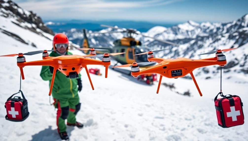
Equip your drone with any necessary rescue gear, such as deployable beacons or small supply packages.
Test all communication systems to verify a stable connection between the drone and ground control. Familiarize yourself with local aviation regulations and obtain any required permits for search and rescue operations.
Mapping the Avalanche Area
You'll begin mapping the avalanche area using aerial survey techniques to get an extensive view of the affected terrain.
Next, you'll employ GPS coordinate mapping to pinpoint precise locations of interest and potential survivor positions.
Aerial Survey Techniques
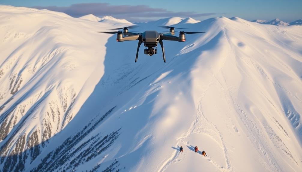
When time is of the essence, aerial survey techniques can be essential for mapping an avalanche area quickly and efficiently. Using drones equipped with high-resolution cameras and thermal imaging sensors, you'll be able to cover large areas in a short time.
Start by launching your drone and flying it in a grid pattern over the affected area. Maintain a consistent altitude to guarantee uniform image quality. As you survey, pay close attention to any irregularities in the snow's surface, such as protruding objects or unusual depressions.
Thermal imaging can be particularly useful, as it may detect heat signatures of buried survivors. Look for any hotspots that stand out against the colder snow background. Remember, time is critical, so don't spend too long analyzing the data mid-flight.
Once you've completed your initial sweep, use the collected data to create a detailed map of the avalanche zone. This map will help ground teams prioritize their search efforts and identify potential locations of survivors.
If possible, use software that can quickly stitch together the aerial images and overlay them with GPS coordinates for more precise navigation.
GPS Coordinate Mapping
GPS coordinate mapping is an important step in organizing and executing an effective avalanche search. You'll need to create a detailed map of the affected area using GPS coordinates to guide rescue efforts and guarantee no parts of the avalanche zone are overlooked.
Start by establishing a grid system over the avalanche area. Use your drone's GPS capabilities to mark key reference points and divide the terrain into manageable sections. As you fly your drone, record the coordinates of any visible signs of survivors, such as clothing, equipment, or disturbed snow patterns.
Next, input these coordinates into mapping software to create a thorough visual representation of the search area. This map will serve as an essential tool for coordinating ground teams and prioritizing high-probability locations for rescue efforts.
You'll want to regularly update the map as new information becomes available. Mark areas that have been searched, locations of found survivors, and any changes in terrain due to ongoing snow movement.
Terrain Analysis Software
After establishing GPS coordinates, terrain analysis software becomes an essential tool for mapping the avalanche area. This software processes data from various sources, including satellite imagery, aerial photographs, and digital elevation models, to create a detailed 3D representation of the affected terrain.
You'll use this software to identify key features like slopes, ridges, and potential debris fields. It'll help you pinpoint areas where survivors are most likely to be found, based on factors such as snow depth, terrain shape, and known avalanche paths. The software can also highlight dangerous zones that rescuers should avoid.
As you analyze the terrain, you'll be able to plan the most efficient search patterns for your rescue drones. Look for natural barriers or sheltered areas where survivors might've sought refuge. Pay attention to vegetation patterns and rock formations that could affect snow accumulation and flow.
The software will allow you to overlay weather data, helping you understand how wind and temperature may have influenced the avalanche's path. You can also input witness accounts or other relevant information to refine your search area.
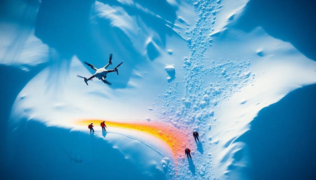
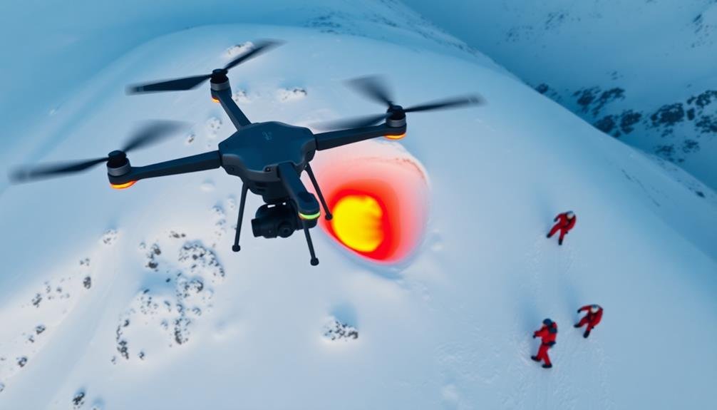
Detecting Heat Signatures and Movement
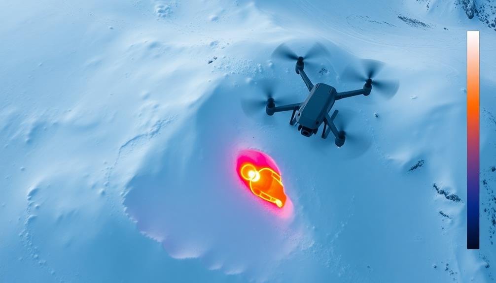
Detecting heat signatures and movement is essential in locating avalanche survivors quickly. Your rescue drone should be equipped with thermal imaging cameras and motion sensors to identify potential survivors buried under snow.
These technologies allow you to scan large areas efficiently, even in low visibility conditions.
Thermal imaging cameras detect infrared radiation emitted by warm objects, such as human bodies. They'll display heat signatures as colorful images on your drone's control screen, helping you pinpoint survivors' locations.
Look for concentrated areas of warmth that contrast with the surrounding cold snow.
Motion sensors can detect subtle movements beneath the snow's surface. They'll alert you to any shifts or vibrations that might indicate a survivor's presence.
Pay attention to areas where both heat signatures and movement are detected, as these are likely to be the most promising search locations.
You'll need to fly your drone in a systematic grid pattern over the avalanche area, maintaining a consistent altitude and speed.
This approach guarantees thorough coverage and increases your chances of detecting survivors.
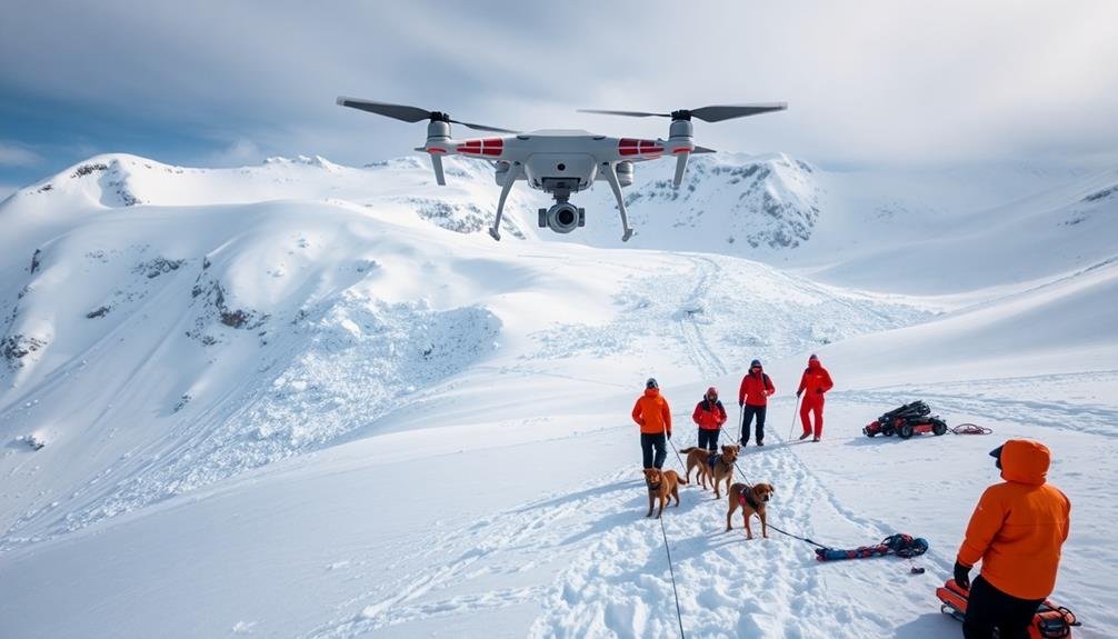
Coordinating With Ground Rescue Teams
You'll need to establish clear communication protocols with ground rescue teams to guarantee seamless coordination during avalanche rescue operations.
It's vital to implement efficient data sharing methods, allowing real-time updates on survivor locations and rescue progress.
Develop task division strategies that leverage the strengths of both aerial and ground teams, maximizing the chances of quickly locating and extracting survivors.
Communication Protocols
Effective communication protocols are essential when coordinating with ground rescue teams during an avalanche search.
You'll need to establish clear channels of communication between drone operators and ground teams to guarantee seamless information exchange. Use dedicated radio frequencies or secure mobile networks to maintain constant contact.
Develop a standardized set of codes and terminology to relay critical information quickly and accurately.
You should create shorthand for common situations, such as victim sightings, hazardous areas, or equipment needs. Train all team members in these protocols before deployment.
Implement a structured reporting system where drone operators provide regular updates on search progress, findings, and any obstacles encountered.
Ground teams should reciprocate with their status and any changes in the search area.
Designate a central command post to coordinate communication between multiple drone teams and ground units.
This hub should manage information flow, prioritize search areas, and make real-time decisions based on incoming data.
Establish backup communication methods in case primary systems fail.
Consider satellite phones, visual signals, or pre-arranged meeting points for face-to-face updates in challenging terrain or weather conditions.
Data Sharing Methods
Three key methods for sharing data between drone operators and ground rescue teams are vital for effective avalanche survivor searches.
First, real-time video streaming allows ground teams to see what the drone sees, enabling instant analysis and decision-making.
Second, GPS coordinate sharing pinpoints exact locations of potential survivors or debris fields.
Third, thermal imaging data transmission helps identify heat signatures beneath the snow.
To maximize the effectiveness of these data sharing methods, you'll need to:
- Use secure, high-bandwidth communication channels
- Implement redundant systems to prevent data loss
- Verify all team members are trained in interpreting drone data
- Establish clear protocols for data prioritization and dissemination
- Utilize cloud-based platforms for simultaneous access to information
When implementing these methods, it's imperative to have a designated data coordinator on the ground team.
This person will manage incoming information, interpret it quickly, and relay relevant details to search and rescue personnel.
They'll also provide feedback to drone operators, guiding them to areas of interest or requesting specific data collection.
Task Division Strategies
Coordinating drone operations with ground rescue teams requires clear task division strategies to maximize efficiency and minimize overlap.
You'll need to establish distinct roles for each group to guarantee a cohesive search effort. Assign drones to cover large, open areas and difficult-to-reach terrain, while ground teams focus on searching dense forest or areas with heavy debris.
Create a grid system to divide the search area, assigning specific sectors to drone operators and ground teams. This prevents duplicate efforts and guarantees complete coverage.
Use drones for initial rapid assessment, allowing them to identify potential survivor locations quickly. Ground teams can then follow up on these leads, conducting detailed searches in areas of interest.
Implement a communication protocol that allows real-time updates between drone operators and ground rescuers. This enables quick response to any findings and helps redirect resources as needed.
Designate a central command post to coordinate all activities and make strategic decisions based on incoming information from both air and ground teams.
Regularly reassess and adjust task division as the search progresses, taking into account changing conditions, new information, and team fatigue.
This flexible approach guarantees the most effective use of available resources throughout the rescue operation.
Overcoming Challenges in Harsh Conditions
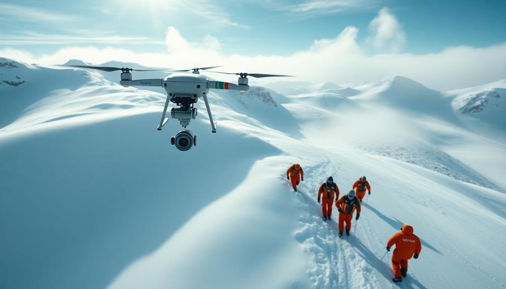
Searching for avalanche survivors presents unique challenges due to the harsh alpine environment. You'll need to overcome various obstacles to effectively deploy rescue drones in these conditions. Wind, cold temperatures, and low visibility can all impact drone performance and flight stability.
To navigate these challenges, consider the following:
- Use drones designed for extreme weather conditions
- Equip your drones with thermal imaging cameras for better detection
- Implement GPS-denied navigation systems for areas with poor satellite coverage
- Employ collision avoidance technology to prevent crashes in low-visibility situations
- Utilize extended-life batteries to compensate for reduced efficiency in cold temperatures
You'll need to adapt your search patterns to account for the terrain and weather conditions. Fly your drones in a grid pattern, focusing on areas where survivors are most likely to be found, such as natural shelters or depressions in the snow.
Be prepared to adjust your flight plans quickly as conditions change. Remember that time is critical in avalanche rescue operations, so you must balance thoroughness with speed.
Future Advancements in Drone Rescue
Rapidly evolving technology promises exciting advancements in drone-based avalanche rescue operations. You'll soon see drones equipped with more sophisticated sensors, including thermal imaging cameras and ground-penetrating radar. These improvements will enhance your ability to detect buried survivors, even in challenging conditions.
Artificial intelligence and machine learning algorithms will play an essential role in future rescue efforts. They'll help you analyze data faster and more accurately, reducing search times and increasing the chances of survival. You'll also benefit from improved communication systems, allowing for better coordination between drones and ground teams.
| Feature | Current | Future |
|---|---|---|
| Battery Life | 30 mins | 2+ hours |
| Payload Capacity | 2 kg | 10+ kg |
| AI Integration | Basic | Advanced |
Swarm technology will enable multiple drones to work together seamlessly, covering larger areas more efficiently. You'll be able to deploy these drone swarms quickly, markedly reducing response times. Additionally, future drones will likely carry essential supplies like food, water, and medical equipment, providing immediate assistance to survivors before rescue teams arrive. These advancements will revolutionize avalanche rescue operations, making them faster, safer, and more effective.
Frequently Asked Questions
How Much Does an Avalanche Rescue Drone Typically Cost?
You'll find avalanche rescue drones typically cost between $1,000 to $20,000. Prices vary based on features like thermal cameras, GPS, and flight time. High-end models with advanced search capabilities can exceed $50,000.
Can Rescue Drones Be Used at Night or in Low Visibility Conditions?
Yes, you can use rescue drones at night and in low visibility. They're equipped with thermal cameras and powerful lights. You'll find they're effective in these conditions, helping you locate survivors when traditional methods might fail.
What Is the Average Battery Life of an Avalanche Rescue Drone?
You'll find that avalanche rescue drone battery life varies widely. Most models last between 20-40 minutes, but some advanced drones can fly for up to an hour. It's essential to have spare batteries on hand.
Are There Specific Certifications Required to Operate Avalanche Rescue Drones?
You'll likely need specific certifications to operate avalanche rescue drones. Requirements vary by location, but often include remote pilot certification, avalanche safety training, and specialized drone operation courses. Check with local authorities for exact requirements in your area.
How Do Rescue Drones Communicate Their Findings to Ground Teams?
You'll find rescue drones typically communicate findings via real-time video feeds, GPS coordinates, and thermal imaging data. They'll transmit this information directly to ground teams' mobile devices or command centers, enabling swift and informed rescue operations.
In Summary
You've learned how rescue drones can be powerful tools in avalanche search and rescue. By leveraging advanced technology, you're now equipped to use drones effectively in these critical missions. Remember, proper preparation, coordination with ground teams, and adaptability in harsh conditions are key. As drone technology continues to advance, you'll have even more capabilities at your fingertips. Stay informed and trained to maximize your potential in saving lives during avalanche emergencies.
As educators and advocates for responsible drone use, we’re committed to sharing our knowledge and expertise with aspiring aerial photographers.


Leave a Reply