
Smart mapping techniques are revolutionizing modern farm management. You can use precision field boundary mapping for accurate land planning, crop health assessment mapping to monitor plant health, and soil moisture content mapping to optimize irrigation. Yield prediction mapping helps forecast production, while elevation and drainage mapping improves water management. Weed and pest infestation mapping enables targeted interventions, and variable rate application mapping optimizes resource use. These techniques empower you to make data-driven decisions, boost efficiency, and increase yields. Discover how these innovative tools can transform your farming operations and lead to sustainable success.
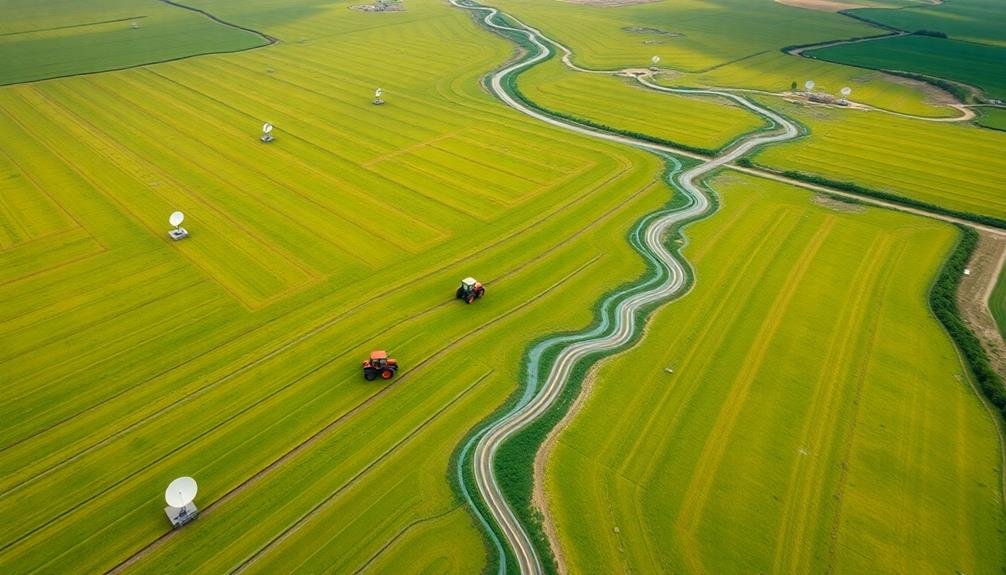
Precision Field Boundary Mapping
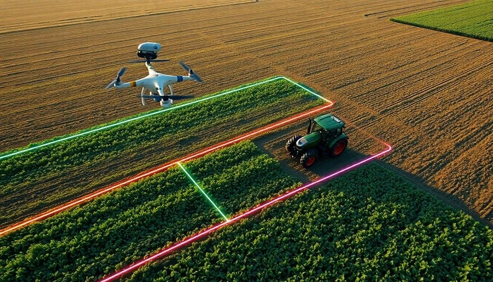
Precision field boundary mapping's importance in modern agriculture can't be overstated. It's an essential tool that allows you to accurately define the limits of your farmland, creating a digital representation of your fields. By using GPS technology and high-resolution satellite imagery, you'll obtain precise measurements of your property's boundaries, facilitating better land use planning and resource allocation.
With precise field boundaries, you can optimize your planting patterns, reduce overlaps and gaps in seeding or spraying, and minimize waste of inputs like fertilizers and pesticides. This level of accuracy also helps you comply with regulations and subsidy programs that require specific field measurements.
You'll find that precision boundary mapping integrates seamlessly with other smart farming technologies. It serves as the foundation for variable rate applications, yield mapping, and crop monitoring systems. By combining this data with soil samples and historical yield information, you can create detailed management zones within your fields, tailoring your approach to each area's specific needs.
Moreover, accurate field boundaries improve communication with contractors, making it easier to delegate tasks and guarantee proper coverage of your land during various farming operations.
Crop Health Assessment Mapping
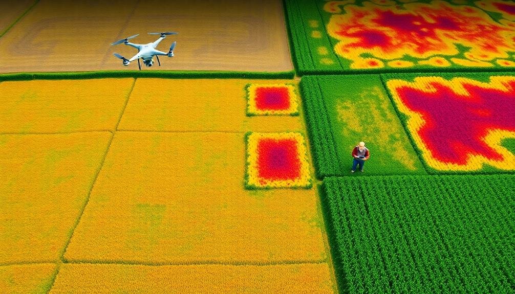
Vigilance in monitoring crop health is essential for maximizing yields and preventing losses. Crop health assessment mapping offers you a powerful tool to detect and address issues before they escalate. By utilizing remote sensing technologies, you'll gain valuable insights into your crops' condition across vast areas.
These maps provide a visual representation of your fields' health status, allowing you to identify problem areas quickly. You'll be able to spot nutrient deficiencies, pest infestations, and water stress with precision. This information enables you to make targeted interventions, reducing unnecessary treatments and optimizing resource allocation.
To interpret crop health maps effectively, familiarize yourself with common indicators:
| Indicator | Meaning | Action |
|---|---|---|
| NDVI | Vegetation density | Adjust fertilization |
| NDRE | Chlorophyll content | Address nutrient issues |
| Thermal imaging | Water stress | Optimize irrigation |
Soil Moisture Content Mapping
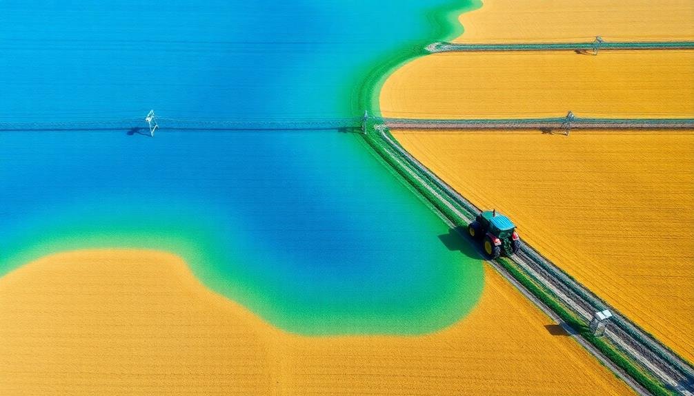
Maintaining ideal soil moisture levels is essential for crop success. With soil moisture content mapping, you'll gain valuable insights into your field's water distribution. This technique uses sensors and remote sensing technology to create detailed maps of soil moisture across your farmland.
You'll be able to identify areas that are too dry or oversaturated, allowing for targeted irrigation and drainage interventions. By utilizing soil moisture maps, you can optimize your water usage, reduce waste, and prevent crop stress due to drought or waterlogging.
These maps also help you plan your planting and harvesting schedules more effectively. You'll know which areas of your field are ready for seeding or harvesting based on their moisture levels.
Additionally, soil moisture content mapping can reveal underlying issues like compaction or poor drainage that may be affecting your crops' water uptake.
Yield Prediction Mapping
Yield prediction mapping is a game-changing tool for modern farmers. It allows you to forecast crop production across your fields before harvest, helping you make informed decisions about resource allocation and marketing strategies. By combining historical data, real-time sensors, and advanced algorithms, you can create detailed maps that estimate yield potential for different areas of your farm.
To effectively use yield prediction mapping, you'll need to:
- Collect and analyze historical yield data
- Integrate current field conditions
- Use satellite imagery and remote sensing
- Apply machine learning models
Here's a breakdown of key factors influencing yield prediction accuracy:
| Factor | Impact on Accuracy |
|---|---|
| Soil quality | High |
| Weather data | Very high |
| Crop type | Medium |
| Management practices | High |
Elevation and Drainage Mapping
Elevation and drainage mapping can help you pinpoint flood-prone areas on your farm, allowing for proactive measures to protect crops and soil.
You'll gain insights into natural water flow patterns, enabling better placement of drainage systems and water retention structures.
This knowledge empowers you to optimize water management, reducing erosion risks and improving overall farm productivity.
Identifying Flood-Prone Areas
Frequently, identifying flood-prone areas is essential for effective farm management. You'll need to combine elevation data with drainage patterns to pinpoint potential flood risks.
Start by analyzing your farm's topography using LiDAR or drone-based mapping. Look for low-lying areas, depressions, and natural basins where water might accumulate.
Next, assess your farm's drainage systems. Map out existing ditches, culverts, and tile drainage networks. Identify areas where water flow might be restricted or where drainage capacity is insufficient.
Don't forget to take into account factors like soil type and permeability, which affect water absorption rates.
Use historical flood data and rainfall records to validate your findings. Overlay this information with your elevation and drainage maps to create a thorough flood risk assessment.
You can then use GIS software to generate flood risk zones on your farm map.
With this information, you'll be better equipped to implement flood mitigation strategies. These might include improving drainage systems, creating water retention areas, or adjusting crop placement.
Optimizing Water Management
Proper water management is essential for maximizing farm productivity and sustainability. By utilizing smart mapping techniques, you can enhance your farm's water resources effectively. Elevation and drainage mapping provide vital insights into your land's topography, allowing you to make informed decisions about irrigation and water conservation.
With accurate elevation data, you'll identify natural water flow patterns and potential problem areas. This information helps you design efficient irrigation systems and implement water-saving strategies. You can:
- Create precision contour maps to guide water-efficient planting
- Identify ideal locations for water retention structures
- Plan drainage systems to prevent waterlogging and erosion
Smart mapping also enables you to monitor soil moisture levels across your fields. By integrating this data with weather forecasts, you can adjust your irrigation schedule to deliver water only when and where it's needed. This approach not only conserves water but also reduces energy costs associated with pumping and distribution.
Furthermore, you can use these mapping techniques to comply with water regulations and demonstrate responsible resource management. By enhancing water use, you'll improve crop yields, reduce environmental impact, and enhance your farm's overall sustainability.
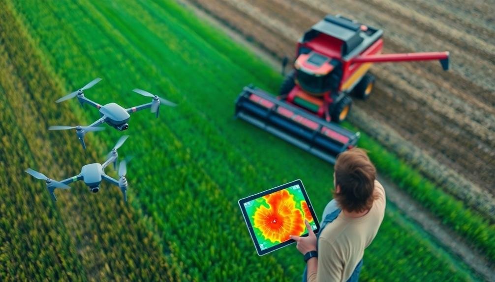
Weed and Pest Infestation Mapping
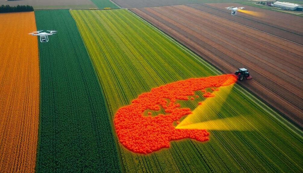
You'll find weed and pest infestation mapping essential for precision herbicide application, allowing targeted treatments that reduce costs and environmental impact.
Early detection methods, including drone surveys and ground sensors, can help you spot problems before they spread.
Precision Herbicide Application
Precision herbicide application through weed and pest infestation mapping has revolutionized the way farmers tackle crop protection. You'll find that this technology allows you to target specific areas of your fields, reducing overall herbicide use and minimizing environmental impact.
By utilizing drones, satellite imagery, and ground-based sensors, you can create detailed maps of weed distributions across your farmland.
These maps enable you to:
- Identify problem areas quickly and accurately
- Tailor herbicide application rates to specific zones
- Monitor the effectiveness of treatments over time
With this information, you're able to make data-driven decisions about when and where to apply herbicides. You'll save money on chemicals and reduce the risk of herbicide resistance developing in weed populations.
Additionally, you'll decrease the potential for crop damage and improve overall yield quality.
Precision herbicide application isn't just about reducing costs; it's about optimizing your farm's efficiency and sustainability.
Early Detection Methods
Early detection methods for weed and pest infestations are essential in modern farm management. By leveraging smart mapping techniques, you'll be able to identify and address potential issues before they become widespread problems.
These methods typically involve the use of high-resolution satellite imagery, drone surveys, and ground-based sensors to collect data on crop health and pest activity.
You'll find that multispectral and hyperspectral imaging can reveal subtle changes in plant health that may indicate pest or weed presence. Machine learning algorithms can analyze this data to identify patterns and anomalies, alerting you to potential infestations early on.
Ground-based sensors can monitor soil moisture, temperature, and other factors that may contribute to pest or weed growth.
Historical Infestation Patterns
Historical data plays an essential role in understanding and predicting weed and pest infestation patterns. By analyzing past occurrences, you'll gain valuable insights into recurring issues and potential problem areas on your farm. This information helps you develop targeted strategies for prevention and control, ultimately saving time and resources.
To effectively map historical infestation patterns, you'll need to:
- Collect and digitize past records of weed and pest outbreaks
- Integrate weather data and soil conditions from previous years
- Use GIS software to create layered maps showing infestation trends over time
By overlaying these historical maps with current field data, you can identify hotspots and anticipate where future infestations are likely to occur. This approach allows you to implement proactive measures, such as adjusting crop rotation plans or applying targeted treatments to high-risk areas.
Remember that historical patterns aren't always indicative of future events, especially with changing climate conditions. However, they provide a solid foundation for informed decision-making.
Regularly update your historical maps with new data to maintain their relevance and accuracy, ensuring you're always one step ahead in managing weed and pest infestations on your farm.
Variable Rate Application Mapping
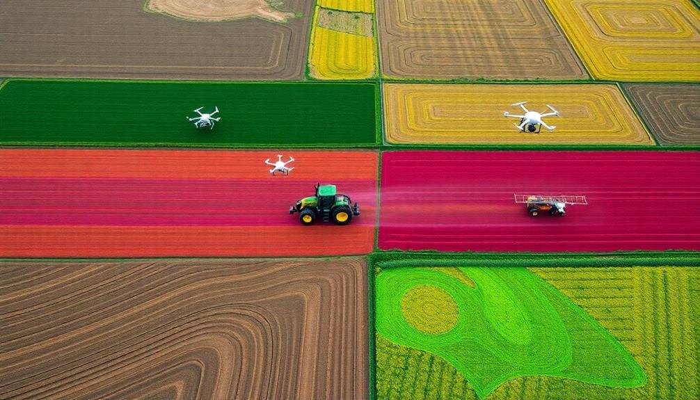
Variable rate application mapping revolutionizes farm management by tailoring input distribution based on field variability. This technique allows you to optimize resource use and maximize crop yields by applying inputs precisely where they're needed most.
To create these maps, you'll combine data from various sources, including soil tests, yield monitors, and remote sensing imagery. You'll then use specialized software to analyze this information and generate prescription maps for different inputs like fertilizers, pesticides, and water.
When implementing variable rate application, you'll need compatible equipment such as GPS-guided sprayers or seeders. These machines can read your prescription maps and automatically adjust application rates as they move across the field.
By using this approach, you'll reduce waste, lower costs, and minimize environmental impact. You'll apply more resources to high-potential areas and less to low-yielding spots, optimizing your overall farm productivity.
Remember to regularly update your maps as field conditions change. Continuous monitoring and refinement of your variable rate strategies will help you stay ahead of the curve in precision agriculture and maintain a competitive edge in your farming operations.
Frequently Asked Questions
How Much Does Implementing Smart Mapping Technology Typically Cost for a Farm?
You'll find costs vary widely, depending on your farm's size and needs. You're looking at $5,000 to $50,000 for basic systems, but it can reach $100,000+ for advanced setups. Don't forget ongoing subscription fees and maintenance costs.
What Training Is Required for Farm Staff to Use Smart Mapping Tools?
You'll need basic training in GPS technology, data interpretation, and software use. Most smart mapping tool providers offer on-site or online courses. Hands-on practice is essential, and you'll likely need ongoing support as you implement the system.
Can Smart Mapping Techniques Be Integrated With Existing Farm Management Software?
Yes, you can integrate smart mapping techniques with your existing farm management software. Many providers offer APIs or data export options, allowing you to seamlessly combine mapping data with your current systems for thorough farm management.
How Often Should Maps Be Updated for Optimal Farm Management Decisions?
You should update your farm maps regularly, ideally every season. However, it's essential to update them after significant changes like crop rotations, soil amendments, or weather events. This guarantees you're making decisions based on current data.
Are There Privacy Concerns Associated With Using Satellite Imagery for Farm Mapping?
Yes, you should be aware of privacy concerns when using satellite imagery for farm mapping. Your property and operations may be visible, potentially exposing sensitive information. It's important to understand data usage policies and safeguard your privacy rights.
In Summary
You've now explored seven powerful mapping techniques that can revolutionize your farm management. By implementing these smart mapping strategies, you'll gain invaluable insights into your fields, crops, and resources. You're equipped to make data-driven decisions, optimize your operations, and boost your farm's productivity. Don't hesitate to embrace these technologies; they're your key to staying competitive in modern agriculture. Start mapping smarter today and watch your farm thrive.
As educators and advocates for responsible drone use, we’re committed to sharing our knowledge and expertise with aspiring aerial photographers.


Leave a Reply