Drones are transforming forest management with their versatile capabilities. You can use them for aerial mapping, creating detailed 3D models of forest landscapes. They'll help you identify tree species, monitor forest health, and detect wildfires early. You'll find drones invaluable for planning reforestation efforts, evaluating wildlife habitats, and tracking soil erosion. They're also excellent for spotting invasive species and measuring forest carbon stocks. With high-resolution cameras, multispectral sensors, and LiDAR technology, drones offer cost-effective solutions for large-scale forest surveillance and data collection. These aerial tools are revolutionizing how you manage and protect forests, providing insights that were once difficult or impossible to obtain. Discover how drones can elevate your forest management strategies to new heights.
Aerial Forest Mapping
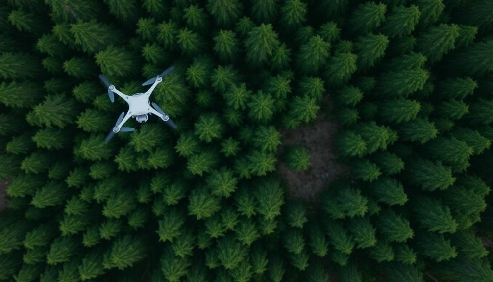
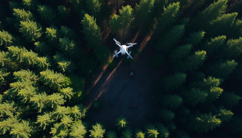
Soaring above the treetops, drones equipped with high-resolution cameras and sensors are revolutionizing forest mapping. These unmanned aerial vehicles provide a cost-effective and efficient alternative to traditional mapping methods. You'll find that drones can cover large areas quickly, capturing detailed imagery and data that would be challenging to obtain from the ground.
With drone technology, you can create accurate 3D models of forest landscapes, measure tree heights, and evaluate canopy density. You'll be able to identify individual tree species, detect diseased or stressed vegetation, and monitor changes in forest composition over time. This information is essential for forest managers to make informed decisions about resource allocation and conservation efforts.
You can also use drones to map hard-to-reach or dangerous areas, reducing the need for on-foot surveys. They're particularly useful for evaluating damage after natural disasters like fires or storms.
Tree Species Identification

You'll find that drones equipped with high-resolution cameras can capture detailed aerial images of forest canopies.
These images can be processed using machine learning algorithms to identify tree species based on their unique spectral signatures and physical characteristics.
Aerial Imaging Techniques
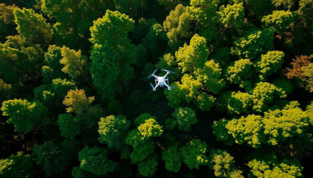
Aerial imaging techniques have revolutionized tree species identification in forest management. You'll find that drones equipped with high-resolution cameras and multispectral sensors can capture detailed images of forest canopies. These images allow you to distinguish between different tree species based on their unique spectral signatures and physical characteristics.
When you're using aerial imaging for species identification, you'll employ various techniques. Multispectral imaging captures data across different wavelengths, including visible light and near-infrared. This helps you detect subtle differences in leaf structure and chlorophyll content.
LiDAR (Light Detection and Ranging) technology creates 3D models of the forest, enabling you to analyze tree height, crown shape, and canopy structure. You'll also use thermal imaging to detect temperature variations between species, which can be particularly useful during drought conditions.
Machine learning algorithms process these diverse data sets, allowing you to identify and map tree species with high accuracy. By combining these aerial imaging techniques, you'll gain a thorough understanding of forest composition, helping you make informed decisions for sustainable forest management and conservation efforts.
Machine Learning Algorithms
Machine learning algorithms play a vital role in tree species identification using drone-captured data. These sophisticated tools can analyze vast amounts of aerial imagery and LiDAR data to accurately classify different tree species within a forest.
You'll find that convolutional neural networks (CNNs) are particularly effective for this task. They can detect intricate patterns in leaf shapes, branch structures, and canopy textures, allowing for precise species identification.
Random forest algorithms are also commonly used, as they can handle complex, multidimensional data and provide robust classifications.
To implement these algorithms, you'll need to train them on large datasets of labeled tree species images. Once trained, they can rapidly process new drone footage, providing you with detailed forest composition maps. This information is invaluable for forest management, as it helps you monitor biodiversity, track invasive species, and plan targeted conservation efforts.
Moreover, machine learning algorithms can detect signs of tree stress or disease, enabling early intervention. They can also estimate tree heights and crown diameters, giving you essential data for timber volume assessments and carbon sequestration calculations.
Canopy Structure Analysis
Building on the power of machine learning algorithms, canopy structure analysis takes tree species identification to new heights. With drones, you'll capture high-resolution imagery of forest canopies, revealing intricate details about tree structure, density, and health.
You'll use specialized cameras and sensors to collect data on leaf shape, branching patterns, and crown geometry. This information allows you to distinguish between different tree species with remarkable accuracy. You can even detect subtle variations within species, helping you identify hybrids or unique genetic variants.
By analyzing canopy structure, you'll gain insights into forest composition, biodiversity, and ecosystem health. You'll quickly map out the distribution of various tree species across large areas, identifying rare or invasive species that might be difficult to spot from the ground.
This technology also enables you to monitor changes in canopy structure over time. You'll track forest growth, detect signs of stress or disease, and assess the impact of environmental factors on tree health.
With this knowledge, you can make informed decisions about forest management, conservation efforts, and resource allocation.
Forest Health Monitoring

Over the past decade, drones have revolutionized forest health monitoring. You'll find that these aerial systems provide a cost-effective and efficient way to assess large forest areas quickly.
They're equipped with various sensors and cameras that can detect signs of disease, pest infestations, or environmental stress long before they're visible to the naked eye.
When you use drones for forest health monitoring, you'll benefit from:
- Early detection of tree diseases and pest outbreaks
- Identification of drought-stressed areas
- Monitoring of invasive species spread
- Assessment of storm damage and fire impacts
You'll appreciate how drones can capture high-resolution imagery and multispectral data, allowing you to analyze plant health through vegetation indices.
This technology enables you to identify problem areas quickly and allocate resources more effectively. You can also track changes over time by conducting regular drone surveys, helping you understand forest dynamics and make informed management decisions.
Wildfire Detection and Prevention
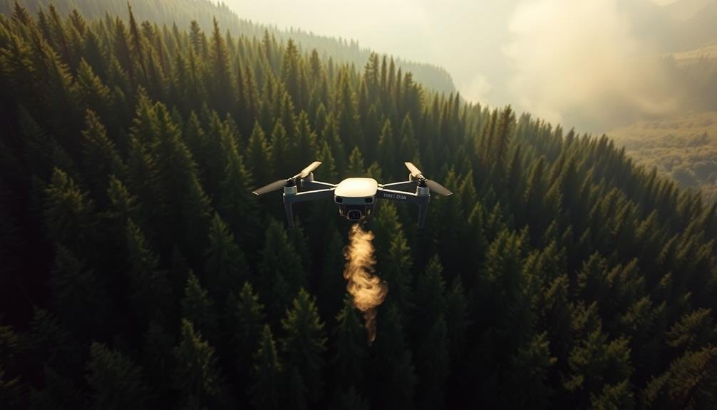
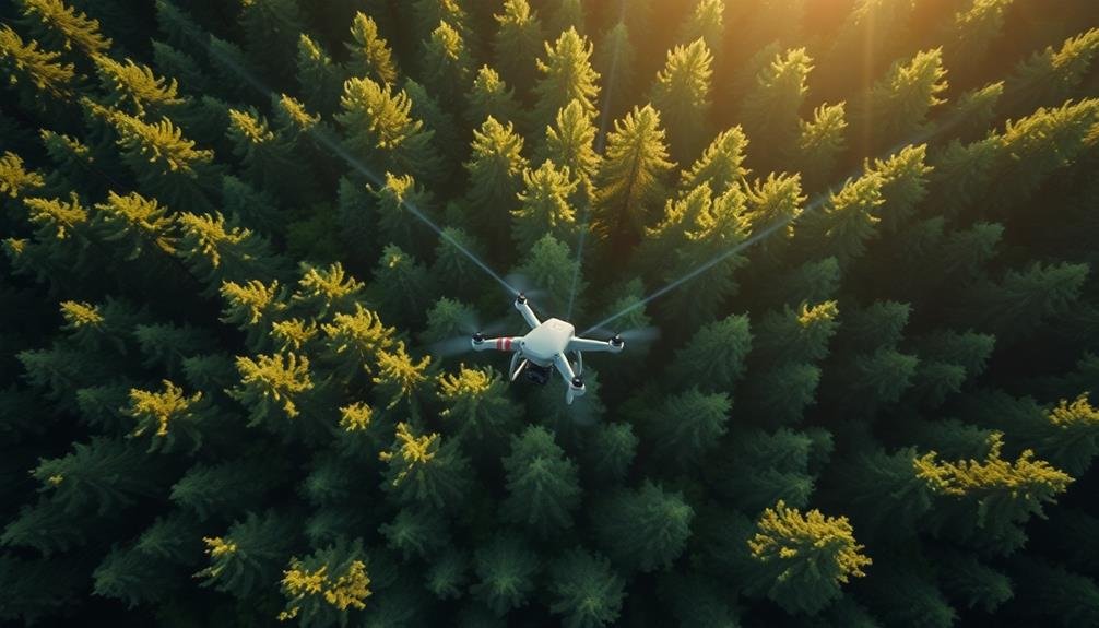
Deploying drones for wildfire detection and prevention has become a game-changer in forest management. You'll find that these unmanned aerial vehicles offer a cost-effective and efficient way to monitor vast forest areas for potential fire risks. They can quickly identify hot spots, detect smoke, and alert authorities before a small fire becomes uncontrollable.
Drones equipped with thermal imaging cameras and sensors can patrol forests day and night, providing real-time data on temperature anomalies and smoke presence. You'll appreciate how this early detection system allows for rapid response, potentially saving countless acres of forest and wildlife.
Here's a comparison of traditional methods vs. drone technology in wildfire management:
| Aspect | Traditional Methods | Drone Technology |
|---|---|---|
| Coverage | Limited | Extensive |
| Response Time | Slower | Rapid |
| Cost | Higher | Lower |
You can also use drones for preventive measures. They're excellent for mapping high-risk areas, identifying dry vegetation, and planning controlled burns. By utilizing drones, you'll be able to create more accurate fire prediction models and implement targeted prevention strategies, ultimately reducing the likelihood and impact of devastating wildfires.
Reforestation Planning
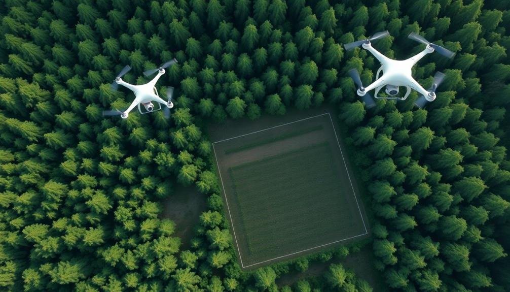
Reforestation planning has been revolutionized by the introduction of drones in forest management. You'll find that these aerial devices offer unparalleled advantages in mapping and analyzing areas for replanting. They provide high-resolution imagery and data that's essential for making informed decisions about where and how to reforest.
With drones, you can quickly survey large areas, identifying ideal planting locations and evaluating soil conditions. This technology allows you to:
- Create detailed 3D maps of the terrain
- Analyze soil moisture and composition
- Identify areas with the best sunlight exposure
- Detect potential obstacles or hazards for new plantings
By using drones, you'll save time and resources in the planning phase. They'll help you determine the most suitable tree species for each location and optimize planting patterns.
You can also monitor the progress of reforestation efforts over time, tracking growth rates and identifying areas that may need additional attention.
Drone technology isn't just improving the efficiency of reforestation planning; it's also enhancing the overall success rate of these vital environmental initiatives. You'll find that integrating drones into your forest management strategy is a game-changer for effective and sustainable reforestation.
Timber Volume Estimation

You'll find that drones equipped with LiDAR technology revolutionize timber volume estimation.
These aerial systems can quickly scan large forest areas, creating detailed 3D models of tree structures and canopy profiles.
Lidar Scanning Techniques
Lidar scanning techniques have revolutionized timber volume estimation in forest management. You'll find that drones equipped with lidar sensors can quickly and accurately map large forest areas, providing detailed 3D models of tree structures. These models allow you to calculate timber volume with unprecedented precision, saving time and resources compared to traditional ground-based methods.
When using lidar scanning techniques for forest management, you'll benefit from:
- High-resolution data capture: Lidar can penetrate dense canopies, giving you a complete picture of forest structure from the ground up.
- Efficient data collection: Drones can cover large areas quickly, reducing the time and manpower needed for surveys.
- Accurate measurements: Lidar provides precise height, diameter, and density measurements for individual trees.
- Versatile applications: The data can be used for various purposes beyond timber estimation, such as habitat assessment and fire risk analysis.
You'll find that lidar scanning techniques are particularly useful in challenging terrain where ground-based surveys are difficult or dangerous.
Automated Tree Counting
Automated tree counting represents a significant advancement in timber volume estimation. Using drones equipped with high-resolution cameras and advanced image processing algorithms, you can now quickly and accurately evaluate the number of trees in a given area. This technology allows you to cover large forest expanses in a fraction of the time it would take using traditional ground-based methods.
The process involves capturing aerial imagery of the forest canopy and using artificial intelligence to identify and count individual trees. You'll find that this method is particularly useful for estimating timber volume, evaluating forest health, and planning harvesting operations. It's especially valuable in dense or hard-to-reach areas where manual counting would be challenging or dangerous.
You can also combine automated tree counting with other drone-based technologies, such as LiDAR, to gather additional data on tree height, crown diameter, and species identification. This thorough approach provides you with a more detailed understanding of your forest's composition and value.
Illegal Logging Detection
In spite of increased conservation efforts, illegal logging remains a significant threat to forests worldwide. Drones can play an essential role in detecting and preventing these illicit activities. By utilizing advanced imaging technology and AI-powered analysis, drones can quickly scan large forest areas and identify signs of illegal logging that might go unnoticed by ground patrols.
You'll find that drones equipped with high-resolution cameras and thermal sensors can:
- Detect recent tree removals and forest clearings
- Identify unauthorized roads and access points
- Spot logging equipment and vehicles in restricted areas
- Monitor changes in forest density over time
These capabilities allow forest managers to respond rapidly to potential threats and gather evidence for law enforcement.
Drones can also operate at night or in challenging terrain, providing continuous surveillance that's difficult to achieve with traditional methods.
Wildlife Habitat Assessment
Beyond protecting forests from illegal activities, drones play a key role in evaluating and monitoring wildlife habitats. You can use these aerial devices to gather vital data about animal populations, their movements, and their interactions with the environment. Drones equipped with high-resolution cameras and thermal imaging sensors allow you to conduct non-invasive surveys of wildlife, even in hard-to-reach areas.
You'll find that drones are particularly useful for mapping and analyzing habitat quality. They can capture detailed imagery of vegetation cover, water sources, and landscape features that influence animal behavior. By analyzing this data, you can identify essential habitats, migration corridors, and potential threats to wildlife.
Drones also enable you to track changes in habitat conditions over time, helping you make informed decisions about conservation efforts. Moreover, you can use drones to monitor endangered species, detect poaching activities, and evaluate the impact of natural disasters on wildlife populations.
This technology allows you to collect data more frequently and efficiently than traditional ground-based methods, providing a more thorough understanding of ecosystem health and biodiversity.
Soil Erosion Monitoring

You'll find drones invaluable for soil erosion monitoring in forest management.
These aerial tools excel at detecting erosion patterns from above, allowing you to track sediment flow in real-time.
Additionally, you can quickly assess vegetation cover, which plays an essential role in preventing soil erosion and maintaining forest health.
Aerial Erosion Pattern Detection
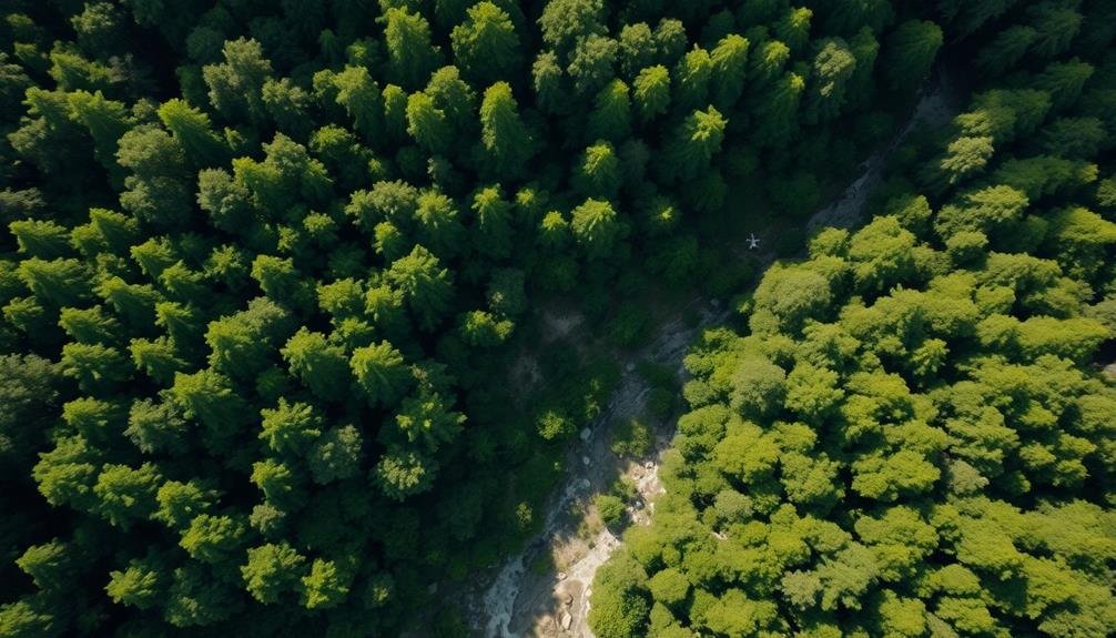
Detecting soil erosion patterns from above has become a game-changer in forest management. You'll find that drones equipped with high-resolution cameras and sensors can capture detailed aerial imagery of forest landscapes, revealing erosion patterns that aren't visible from the ground.
This technology allows you to identify areas of concern quickly and efficiently, saving time and resources in your forest management efforts.
When you're using drones for aerial erosion pattern detection, you'll be able to:
- Spot early signs of erosion before they become severe
- Map large areas of forest in a fraction of the time it would take on foot
- Create 3D models of the terrain to analyze slope and water flow
- Monitor changes in erosion patterns over time with repeat surveys
You'll find that this data is invaluable for developing targeted erosion control strategies.
By pinpointing problem areas, you can focus your efforts on the most critical locations, implementing measures like reforestation, terracing, or erosion barriers where they're needed most.
This precise approach guarantees you're making the most efficient use of your resources while effectively protecting the forest ecosystem.
Real-Time Sediment Flow Tracking
Real-time sediment flow tracking takes erosion monitoring to the next level. With drones equipped with high-resolution cameras and LiDAR sensors, you can now observe and measure sediment movement as it happens. This technology allows you to identify areas of active erosion, quantify soil loss, and assess the effectiveness of erosion control measures in real-time.
You'll be able to track sediment plumes in streams and rivers, helping you pinpoint the sources of erosion upstream. By combining this data with weather information, you can better understand how rainfall intensity and duration affect sediment transport in your forest ecosystem. This knowledge is essential for developing targeted erosion prevention strategies.
Drones can also help you monitor the impact of logging activities on sediment flow. You'll be able to quickly assess whether erosion control measures are working effectively during and after timber harvesting operations. This real-time feedback allows for immediate adjustments to minimize environmental impact.
Vegetation Cover Assessment
Drones equipped with multispectral cameras are revolutionizing vegetation cover assessment for soil erosion monitoring. You'll find these aerial tools invaluable for quickly and accurately mapping large forest areas, providing essential data on plant health and soil stability.
By using drones for vegetation cover assessment, you can:
- Detect early signs of erosion before they become visible to the naked eye
- Identify areas of sparse vegetation that are at higher risk of soil loss
- Monitor the effectiveness of erosion control measures over time
- Create high-resolution maps to guide targeted conservation efforts
You'll appreciate the efficiency of drone-based surveys compared to traditional ground-based methods. With multispectral imagery, you can analyze various vegetation indices, such as NDVI (Normalized Difference Vegetation Index), to assess plant density and health. This data helps you identify areas where soil may be exposed and vulnerable to erosion.
You can also use drone imagery to track changes in vegetation cover seasonally or after disturbances like wildfires or logging operations. This information is vital for implementing timely erosion control measures and evaluating the success of reforestation efforts.
Invasive Species Tracking

Invasive species wreak havoc on forest ecosystems, and tracking their spread has become an essential task for forest managers. Drones offer a powerful solution to this challenge, allowing you to monitor large areas efficiently and detect invasive plants or pests early on.
You can equip drones with high-resolution cameras and multispectral sensors to capture detailed imagery of the forest canopy. These images help you identify the unique spectral signatures of invasive species, distinguishing them from native vegetation. With regular drone surveys, you'll spot new infestations quickly and track their expansion over time.
Drones also enable you to access hard-to-reach areas, such as steep slopes or dense undergrowth, where invasive species often take hold. By combining drone data with GPS coordinates, you can create accurate maps of invasive species distribution, guiding targeted removal efforts and resource allocation.
Moreover, you can use drones to monitor the effectiveness of control measures. After treatment, you'll easily assess whether invasive species have been successfully eradicated or if follow-up interventions are necessary. This data-driven approach enhances your decision-making and improves the overall effectiveness of invasive species management in your forest.
Forest Carbon Stock Measurement
Accurate measurement of forest carbon stocks is essential for climate change mitigation efforts and sustainable forest management. Drones have revolutionized this process, offering a more efficient and cost-effective alternative to traditional ground-based surveys. You'll find that drone-based carbon stock assessments provide higher accuracy and cover larger areas in less time.
Drones equipped with LiDAR sensors and high-resolution cameras can capture detailed 3D models of forest canopies and structure. This data allows you to estimate biomass and carbon content with unprecedented precision. You'll also be able to monitor changes in forest carbon stocks over time, helping you track the impact of management practices and natural disturbances.
Here's how drones enhance forest carbon stock measurement:
- Improved spatial resolution and coverage
- Reduced field work and associated costs
- More frequent monitoring capabilities
- Integration with other remote sensing data for thorough analysis
Frequently Asked Questions
How Much Do Drones Cost for Forest Management Purposes?
You'll find drones for forest management range from $1,000 to $20,000. The cost depends on the drone's features, such as camera quality, flight time, and specialized sensors. Remember to factor in training and maintenance expenses too.
What Training Is Required to Operate Drones in Forestry?
You'll need to complete a drone pilot certification course and obtain a license. You should also learn forestry-specific drone operations, including flight planning, data collection, and image analysis. Hands-on training with forestry applications is essential.
Are There Regulations Limiting Drone Use in National Forests?
Yes, there are regulations for drone use in national forests. You'll need to follow FAA rules and specific forest service guidelines. You can't fly in wilderness areas or near wildlife. Always check local restrictions before flying.
Can Drones Operate Effectively in Dense Forest Canopies?
You'll find drones can operate in dense canopies, but there are challenges. They're limited by battery life, signal interference, and physical obstacles. You'll need specialized equipment and skilled pilots for effective forest drone operations.
How Do Weather Conditions Affect Drone Performance in Forest Management?
You'll find that weather greatly impacts drone performance in forests. Wind can destabilize flight, rain interferes with sensors, and extreme temperatures affect battery life. Fog and low visibility also limit a drone's effectiveness for aerial surveys.
In Summary
You've seen how drones are revolutionizing forest management. They're not just high-tech toys; they're powerful tools for mapping, monitoring, and protecting our forests. From spotting wildfires to tracking wildlife, drones offer unparalleled insights. They'll help you plan reforestation, measure carbon stocks, and combat invasive species more efficiently than ever before. As technology advances, you can expect drones to play an even bigger role in preserving and managing our precious forest ecosystems.
As educators and advocates for responsible drone use, we’re committed to sharing our knowledge and expertise with aspiring aerial photographers.


Leave a Reply