
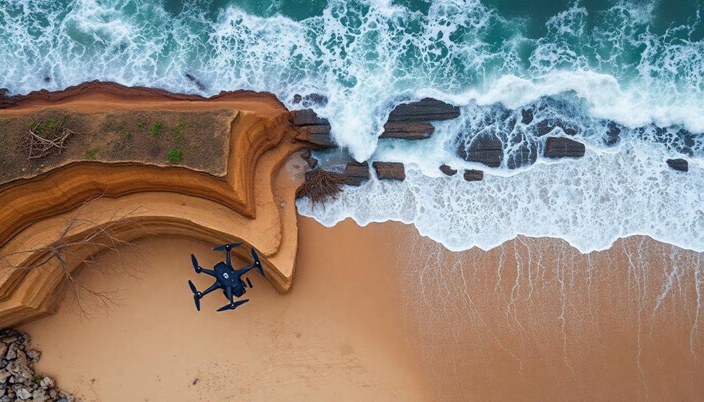
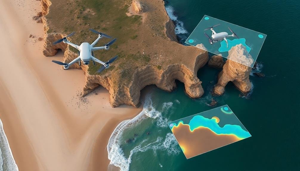
You'll find unmanned aircraft revolutionizing coastal erosion monitoring. Drones offer high-resolution imagery and frequent, cost-effective surveys that outperform traditional methods. They enable real-time detection of shoreline changes, helping identify erosion hotspots and assess storm impacts quickly. With drones, you can gather detailed data on vegetation cover, sediment distribution, and habitat loss. This technology supports better coastal development planning, disaster risk reduction, and environmental impact assessments. By using unmanned aircraft, you'll get an extensive view of erosion patterns, allowing for more informed coastal management decisions. Exploring this innovative approach can reveal new possibilities for protecting our shorelines.
Defining Coastal Erosion
Coastal erosion is a natural process that's been reshaping our shorelines for millennia. It occurs when waves, currents, and wind wear away land along the coast, causing shorelines to recede. You'll notice this phenomenon as beaches shrink, cliffs crumble, and coastal infrastructure becomes threatened.
While erosion is natural, human activities can accelerate it. Construction near shorelines, removal of vegetation, and climate change-induced sea-level rise all contribute to increased erosion rates. You'll find that some areas experience more rapid erosion than others, depending on factors like geology, wave energy, and local weather patterns.
Understanding coastal erosion is vital for managing coastal areas effectively. You need to take into account both short-term events, like storms that cause sudden changes, and long-term trends that gradually reshape the coast.
By monitoring erosion, you can predict future shoreline positions, assess risks to coastal communities, and plan appropriate adaptation strategies.
Coastal erosion isn't just about losing land; it impacts ecosystems, property values, and local economies. As you study this process, you'll gain insights into the dynamic nature of our coastlines and the challenges we face in preserving them.
Importance of Coastal Monitoring

Coastal monitoring plays an essential role in evaluating environmental impacts, guiding coastal development planning, and reducing disaster risks.
You'll find that regular observation of shoreline changes helps identify vulnerable areas and informs decision-making for coastal management strategies.
Environmental Impact Assessment
Researchers and environmental agencies recognize the vital importance of coastal monitoring for evaluating environmental impacts. When you use unmanned aircraft for coastal erosion monitoring, you're able to assess these impacts more efficiently and accurately.
You'll gather high-resolution data on shoreline changes, vegetation loss, and habitat destruction. This information is essential for understanding how human activities and natural processes affect coastal ecosystems.
With drone-based monitoring, you can track the effects of sea-level rise, storm surges, and extreme weather events on coastal areas. You'll identify vulnerable spots and assess the effectiveness of existing protection measures. This data helps you make informed decisions about coastal management strategies and conservation efforts.
You'll also be able to monitor the impact of coastal development projects, such as construction, dredging, or beach nourishment. By comparing pre- and post-project imagery, you can evaluate their environmental consequences and guarantee compliance with regulations.
Additionally, you'll detect pollution sources, oil spills, and marine debris, enabling rapid response and mitigation efforts. Ultimately, using unmanned aircraft for environmental impact assessment provides you with valuable insights to protect and preserve coastal ecosystems.
Coastal Development Planning
Three key aspects of coastal development planning rely heavily on accurate monitoring data.
First, you'll need to determine setback lines, which dictate how far inland structures must be built to avoid future erosion risks. Unmanned aircraft surveys provide precise shoreline positions and erosion rates, allowing you to establish these lines with confidence.
Second, you'll use the data to assess the viability of proposed coastal protection measures. By analyzing high-resolution imagery and 3D models, you can evaluate the potential effectiveness of seawalls, groynes, or beach nourishment projects before committing resources.
Lastly, you'll incorporate erosion trends into long-term urban planning. Drone-collected data helps you identify areas at risk of future inundation, allowing you to plan infrastructure and zoning accordingly.
You can also use this information to develop evacuation routes and emergency response strategies for coastal communities.
Disaster Risk Reduction
Numerous coastal communities face increasing threats from natural disasters, making accurate erosion monitoring essential for disaster risk reduction. By using unmanned aircraft for coastal monitoring, you'll gain valuable insights that can help mitigate potential risks and protect vulnerable areas.
These aerial surveys provide high-resolution data on shoreline changes, allowing you to identify erosion hotspots and predict future trends.
With this information, you can develop targeted disaster risk reduction strategies, such as:
- Implementing early warning systems for storm surges and flooding
- Designing resilient infrastructure to withstand coastal hazards
- Planning strategic retreat from high-risk areas
- Enhancing natural barriers like dunes and wetlands
- Educating communities about evacuation procedures
Unmanned aircraft monitoring enables you to track the effectiveness of these measures over time. You'll be able to assess the impact of interventions and make data-driven decisions to improve your disaster risk reduction efforts.
Traditional Monitoring Methods

How have coastal researchers traditionally monitored shoreline changes? They've relied on a combination of ground-based and remote sensing techniques.
You'll find that field surveys using GPS and total station equipment have been common, allowing researchers to measure beach profiles and collect precise elevation data. These methods provide accurate results but are labor-intensive and time-consuming.
Aerial photography has long been a staple in coastal monitoring. You'd typically see researchers analyzing historical aerial images to track changes over time.
Satellite imagery has also played a significant role, offering a broader perspective on coastal dynamics. However, both these methods can be limited by weather conditions and image resolution.
LiDAR (Light Detection and Ranging) technology has become increasingly popular for coastal mapping. You'll find it used in both ground-based and airborne systems, providing detailed 3D models of the coastline.
While highly accurate, LiDAR surveys can be expensive and may not be feasible for frequent monitoring.
Video monitoring systems have also been employed, giving you continuous observations of shoreline changes. These fixed cameras capture images at regular intervals, allowing for analysis of short-term and long-term coastal processes.
Unmanned Aircraft Technology

Emerging as a game-changer in coastal research, unmanned aircraft technology offers new possibilities for monitoring shoreline changes. You'll find that drones and other unmanned aerial vehicles (UAVs) provide high-resolution imagery and data collection capabilities that weren't previously possible with traditional methods.
These aircraft can be equipped with various sensors, including LiDAR, multispectral cameras, and thermal imaging devices, allowing you to capture detailed information about coastal landscapes.
UAVs enable you to conduct surveys more frequently and at a lower cost than manned aircraft or satellite imagery. You can easily deploy them in hard-to-reach areas or during adverse weather conditions, making them ideal for monitoring dynamic coastal environments.
With the ability to fly at low altitudes and capture data from multiple angles, you'll get a thorough view of erosion patterns and coastal changes over time.
Key advantages of unmanned aircraft technology include:
- Increased data resolution and accuracy
- Flexible and rapid deployment
- Cost-effective monitoring solutions
- Safe operation in hazardous coastal areas
- Real-time data collection and processing
Benefits of Drone Monitoring

You'll find that drone monitoring offers significant advantages for coastal erosion studies.
With unmanned aircraft, you can collect data at a fraction of the cost of traditional methods, allowing for more extensive coverage of coastal areas.
You're also able to increase the frequency of surveys, capturing changes in shoreline conditions more rapidly and accurately.
Cost-Effective Data Collection
In light of traditional coastal monitoring methods, drone technology offers a remarkably cost-effective alternative for data collection.
You'll find that drones notably reduce the need for expensive equipment and large teams of surveyors. With a single drone and operator, you can cover vast coastal areas in a fraction of the time it would take using traditional methods.
Drones allow you to collect high-resolution imagery and data at a much lower cost per square kilometer compared to manned aircraft or satellite imagery. You'll also save on fuel costs and reduce your carbon footprint. The initial investment in drone technology quickly pays off as you'll be able to conduct more frequent surveys without breaking the bank.
Here's why drone-based coastal erosion monitoring is cost-effective:
- Lower equipment and personnel costs
- Reduced time spent in the field
- Ability to survey hard-to-reach areas safely
- Frequent data collection without notable additional expense
- Scalable operations to fit various budgets and project sizes
Increased Survey Frequency
Drone technology enables a substantial increase in coastal survey frequency, revolutionizing erosion monitoring practices. You'll find that drones allow for more regular data collection, providing a clearer picture of erosion rates and patterns. This increased frequency helps you detect changes quickly, enabling faster response times to potential threats.
With drones, you're no longer limited by the constraints of traditional surveying methods. You can conduct surveys weekly or even daily, weather permitting. This high-frequency monitoring allows you to:
| Benefit | Impact | Example |
|---|---|---|
| Detect subtle changes | Improved accuracy | Identifying small-scale erosion events |
| Track seasonal variations | Better understanding of processes | Monitoring beach profiles through different seasons |
| Respond to extreme events | Rapid evaluation capabilities | Evaluating damage after storms or hurricanes |
Data Collection and Analysis
As unmanned aircraft systems (UAS) survey coastal areas, they collect vast amounts of data essential for monitoring erosion. You'll find that these systems capture high-resolution imagery and topographic information, allowing for precise measurements of coastal changes over time.
The data collected by UAS is typically more detailed and accurate than traditional survey methods, giving you a thorough view of erosion patterns.
When analyzing the data, you'll use specialized software to process and interpret the information. This software can generate 3D models, calculate volumetric changes, and identify areas of significant erosion or accretion.
You'll be able to track shoreline positions, measure cliff retreat rates, and assess the effectiveness of coastal protection measures.
The data collection and analysis process offers several advantages:
- Rapid data acquisition and processing
- Ability to survey hard-to-reach or dangerous areas
- Cost-effective compared to traditional survey methods
- Flexibility to adjust survey parameters as needed
- Integration with other data sources for thorough analysis
Cost-Effectiveness of Drone Surveys
While the data collection capabilities of UAS are impressive, their cost-effectiveness truly sets them apart in coastal erosion monitoring. You'll find that drone surveys offer significant savings compared to traditional methods like manned aircraft or ground-based surveys. They require less personnel, fuel, and maintenance, reducing operational costs dramatically.
You can deploy drones more frequently, allowing for timely data collection without breaking the bank. This increased temporal resolution is essential for tracking rapid coastal changes. You'll also appreciate the flexibility drones offer; you can easily adjust survey schedules or areas based on immediate needs or environmental conditions.
When you factor in the high-quality data drones provide, the cost-benefit ratio becomes even more attractive. You're getting detailed, accurate information at a fraction of the price of conventional methods. This efficiency allows you to allocate resources to other aspects of coastal management or expand your monitoring efforts.
Moreover, as drone technology advances, you'll see costs continue to decrease while capabilities improve. This trend guarantees that UAS-based coastal erosion monitoring will become increasingly cost-effective in the long run.
Real-Time Coastal Change Detection
Using drones for real-time coastal change detection offers you unprecedented speed in data collection.
You'll be able to map shoreline changes dynamically, capturing shifts as they occur. This rapid acquisition allows you to identify potential hazards immediately, enhancing your ability to respond to coastal threats quickly and effectively.
Rapid Data Acquisition
Unmanned aircraft systems (UAS) have revolutionized our ability to detect coastal changes in real-time. These systems allow you to gather data quickly and efficiently, covering large areas in a fraction of the time it would take using traditional methods.
You'll find that UAS can capture high-resolution imagery and topographic data, even in challenging coastal environments.
With UAS, you're able to conduct rapid data acquisition missions, providing up-to-date information on coastal erosion and accretion processes. This speed is essential for monitoring dynamic coastal areas, where conditions can change rapidly due to storms, tides, and human activities.
You'll appreciate the flexibility of UAS, as they can be deployed at short notice and in various weather conditions.
The rapid data acquisition capabilities of UAS offer several advantages:
- Reduced field time and associated costs
- Increased frequency of data collection
- Ability to capture data in hard-to-reach or dangerous areas
- Minimal disturbance to sensitive coastal ecosystems
- Quick turnaround for data processing and analysis
Dynamic Shoreline Mapping
The rapid data acquisition capabilities of UAS set the stage for dynamic shoreline mapping and real-time coastal change detection. You'll be able to track shoreline changes as they happen, providing invaluable data for coastal management and erosion control efforts. With UAS, you can capture high-resolution imagery and create accurate, up-to-date maps of coastal areas in a fraction of the time it'd take using traditional methods.
Here's a comparison of UAS vs. traditional methods for shoreline mapping:
| Aspect | UAS | Traditional Methods |
|---|---|---|
| Speed | Rapid | Slow |
| Frequency | High | Low |
| Cost | Low | High |
| Accuracy | High | Moderate |
| Flexibility | High | Low |
You'll benefit from the ability to monitor coastal changes frequently, allowing you to identify erosion hotspots and implement timely interventions. UAS technology enables you to track sediment transport, assess the impact of storms, and evaluate the effectiveness of coastal protection measures. By leveraging this dynamic mapping capability, you'll enhance your understanding of coastal processes and improve your decision-making in coastal management strategies.
Immediate Hazard Identification
While coastal erosion often occurs gradually, sudden changes can pose immediate threats to coastal communities and infrastructure. Unmanned aircraft systems (UAS) provide a powerful tool for identifying these immediate hazards.
You'll find that UAS can quickly survey large coastal areas, capturing high-resolution imagery and data to detect sudden changes in shoreline position, cliff stability, or sediment movement.
With UAS, you're able to:
- Rapidly assess storm damage and flooding impacts
- Identify newly formed sinkholes or landslides
- Detect unexpected erosion hotspots
- Monitor vulnerable infrastructure at risk
- Track debris accumulation and movement
Environmental Impact Assessment

Frequently, environmental impact assessments play a significant role in coastal erosion monitoring projects using unmanned aircraft. You'll find these assessments essential for understanding how erosion affects local ecosystems, wildlife habitats, and plant communities.
By using drones, you can gather high-resolution imagery and data to track changes in vegetation cover, sediment distribution, and shoreline morphology over time. You'll be able to identify areas where erosion is causing habitat loss or fragmentation, potentially threatening endangered species or disrupting important breeding grounds.
Unmanned aircraft allow you to access hard-to-reach areas and collect data without disturbing sensitive environments. This non-invasive approach helps you assess the impact of erosion on water quality, including increased turbidity and sedimentation in coastal waters.
Moreover, you can use drone-collected data to evaluate the effectiveness of erosion mitigation measures, such as beach nourishment or the construction of seawalls. This information helps you make informed decisions about future coastal management strategies and conservation efforts.
Future of Coastal Management
Three key trends are shaping the future of coastal management with unmanned aircraft technology. First, you'll see increased integration of AI and machine learning algorithms to analyze coastal data more efficiently.
Second, expect more sophisticated sensors and imaging technologies that can capture even subtle changes in coastal landscapes.
Third, there'll be a shift towards real-time monitoring and early warning systems for coastal hazards.
As unmanned aircraft evolve, you'll witness their growing role in coastal management. They'll become indispensable tools for decision-makers, providing vital data for sustainable coastal development and protection strategies.
You can anticipate more collaborative efforts between researchers, policymakers, and local communities to leverage this technology effectively.
The future of coastal management with unmanned aircraft will likely include:
- Predictive modeling of coastal erosion patterns
- Automated beach nourishment planning
- Rapid response capabilities for post-storm assessments
- Integration with satellite and ground-based monitoring systems
- Enhanced public engagement through immersive visualization tools
Frequently Asked Questions
How Do Weather Conditions Affect Drone-Based Coastal Erosion Monitoring?
Weather conditions greatly impact your drone-based coastal erosion monitoring. High winds can disrupt flight stability, while rain affects visibility and sensor accuracy. You'll need to plan flights carefully, considering forecasts to guarantee safe and effective data collection.
What Skills Are Required to Operate Drones for Coastal Erosion Surveys?
You'll need piloting skills to fly drones safely and legally. Knowledge of coastal processes, surveying techniques, and data analysis is essential. You should also be familiar with mapping software and have good problem-solving abilities for field operations.
Are There Legal Restrictions on Using Drones for Coastal Monitoring?
Yes, there are legal restrictions on using drones for coastal monitoring. You'll need to comply with aviation regulations, obtain necessary permits, and respect privacy laws. Don't fly in restricted airspace or near sensitive areas without authorization.
How Do Drones Compare to Satellite Imagery for Coastal Erosion Assessment?
You'll find drones offer higher resolution imagery and more flexible, on-demand monitoring compared to satellites. They're cheaper and can capture detailed data in specific areas, but satellites cover larger regions more efficiently for long-term tracking.
Can Drones Be Used to Monitor Underwater Coastal Erosion Processes?
You can use drones to monitor underwater coastal erosion processes. They're equipped with sonar and underwater cameras, allowing you to capture detailed imagery and data beneath the surface. However, you'll need specialized waterproof drones for this task.
In Summary
You've seen how unmanned aircraft revolutionize coastal erosion monitoring. They're cost-effective, provide real-time data, and offer minimal environmental impact. As you look to the future of coastal management, drones will play an essential role. They'll help you detect changes faster, assess environmental impacts more accurately, and make informed decisions to protect our coastlines. Embrace this technology to stay ahead of erosion threats and preserve our shores for generations to come.
As educators and advocates for responsible drone use, we’re committed to sharing our knowledge and expertise with aspiring aerial photographers.


Leave a Reply