
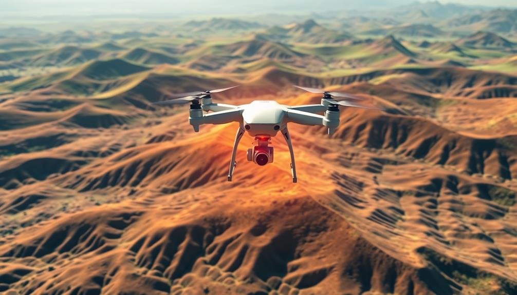
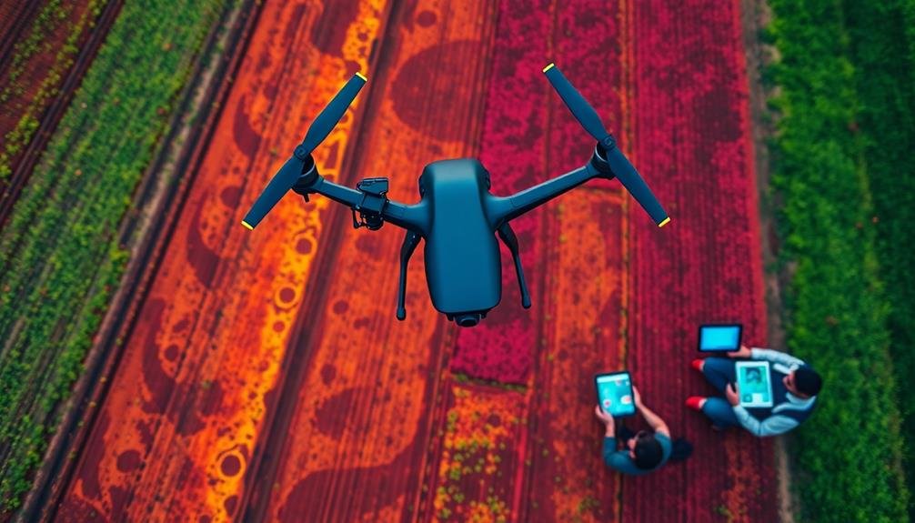
You can now monitor soil erosion with cutting-edge technology that provides unprecedented accuracy and efficiency. Lidar scanning from drones creates high-resolution 3D maps, while multispectral imaging detects vegetation health and soil composition changes. Thermal mapping reveals soil temperature variations linked to erosion patterns. Photogrammetry generates detailed 3D terrain models for analysis. Hyperspectral analysis captures intricate land cover data, and AI-powered algorithms recognize erosion patterns automatically. Time-lapse drone imagery comparison allows you to track changes over time. These advanced techniques offer powerful tools for identifying, quantifying, and predicting soil erosion. Exploring each method will reveal even more potential for effective land management.
Lidar Scanning From Drones
Lidar scanning from drones has revolutionized soil erosion monitoring. This advanced technique allows you to capture high-resolution 3D maps of soil surfaces with unprecedented accuracy. By mounting a lidar sensor on a drone, you can quickly survey large areas and detect even minor changes in soil elevation.
You'll find that lidar drones emit laser pulses that bounce off the ground, measuring the time it takes for the light to return. This data is then used to create detailed digital elevation models (DEMs). These models enable you to identify erosion hotspots, quantify soil loss, and track changes over time.
One of the key advantages of using lidar drones is their ability to penetrate vegetation cover, providing accurate ground measurements even in densely forested areas. You can also combine lidar data with other sensors, such as multispectral cameras, to assess soil composition and vegetation health.
To use this technique effectively, you'll need to plan your flight paths carefully, ensuring ideal coverage and resolution. You'll also need to process the raw lidar data using specialized software to generate usable DEMs and erosion maps.
Multispectral Imaging for Erosion Detection
Multispectral imaging technology enables you to assess vegetation health, analyze soil composition, and detect topographic changes related to erosion.
You'll gain valuable insights into plant stress levels and ground cover density through near-infrared and visible light spectrum analysis.
Vegetation Health Assessment
Through the lens of multispectral imaging, vegetation health assessment offers a powerful tool for detecting soil erosion. You'll find that this technique allows you to analyze plant vigor and density, which are closely linked to soil stability.
By examining various spectral bands, you can identify areas of stressed or sparse vegetation, often indicative of erosion-prone zones.
You'll use vegetation indices like NDVI (Normalized Difference Vegetation Index) to quantify plant health. These indices combine data from different spectral bands, typically red and near-infrared, to provide a numerical representation of vegetation condition. Areas with low NDVI values may signal potential erosion hotspots.
You can also detect changes in vegetation patterns over time, which helps you identify gradual erosion processes. By comparing multispectral images from different dates, you'll spot areas where vegetation cover has decreased, potentially due to soil loss.
Furthermore, you'll analyze leaf chlorophyll content and canopy structure using specific spectral bands. This information helps you assess overall ecosystem health and resilience to erosion.
Soil Composition Analysis
You'll find that soil composition analysis using multispectral imaging is an essential technique for detecting erosion. This method employs sensors that capture light reflected from soil surfaces across various wavelengths, including visible and infrared spectra. By analyzing these spectral signatures, you can identify changes in soil properties that indicate erosion.
Multispectral imaging allows you to detect variations in soil moisture, organic matter content, and mineral composition. These factors are vital indicators of soil health and stability. For instance, areas with reduced organic matter or altered mineral content may be more susceptible to erosion. You'll be able to spot these vulnerable zones before visible signs of erosion appear.
To implement this technique, you'll use specialized cameras mounted on drones or satellites. The collected data is then processed using advanced algorithms to create detailed soil composition maps. These maps highlight areas of concern, enabling you to take targeted action to prevent further erosion.
You'll also be able to monitor the effectiveness of erosion control measures over time by comparing successive multispectral images. This technology provides a powerful tool for early detection and ongoing management of soil erosion.
Topographic Change Detection
Building on the foundation of soil composition analysis, topographic change detection takes multispectral imaging a step further. You'll use this technique to monitor changes in the land's surface over time, identifying areas prone to erosion or already experiencing soil loss.
Multispectral sensors capture data across various wavelengths of light, including visible and infrared spectra. You'll collect these images periodically, typically using drones or satellites. By comparing sequential images, you can detect even subtle changes in elevation, slope, and surface texture.
To implement this method, you'll need specialized software to process and analyze the multispectral data. These programs can generate digital elevation models (DEMs) and highlight areas where soil loss is occurring. You'll also use algorithms to quantify the volume of soil eroded between imaging sessions.
The advantage of topographic change detection is its ability to cover large areas quickly and non-invasively. You can monitor hard-to-reach locations and identify erosion hotspots before they become severe.
This technique allows you to prioritize conservation efforts and assess the effectiveness of erosion control measures over time.
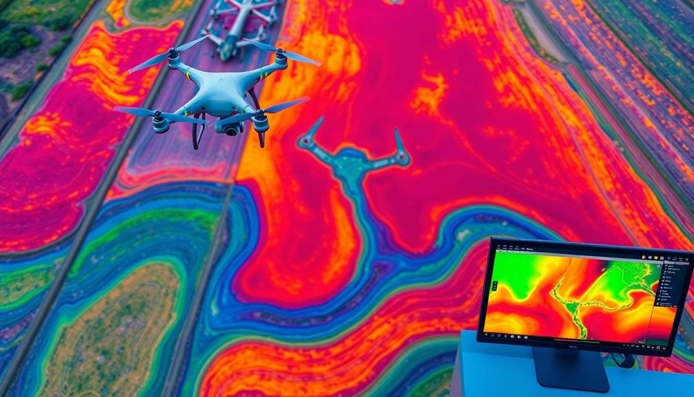
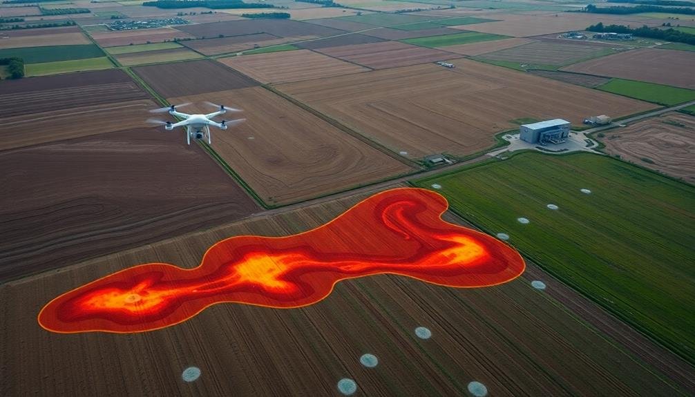
Thermal Mapping of Soil Conditions
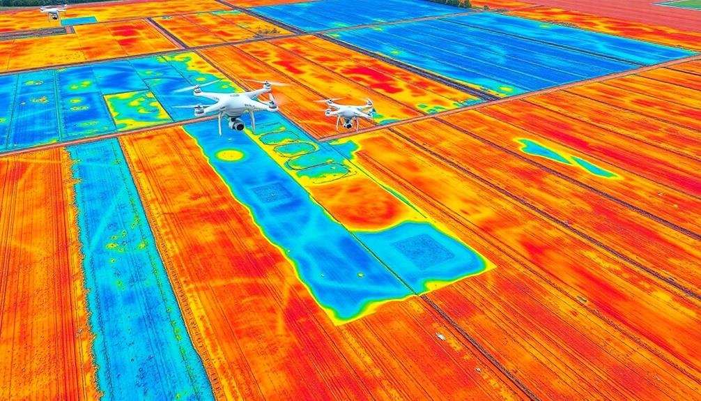
Thermal mapping has emerged as a powerful tool in soil erosion monitoring. By using infrared sensors, you can detect variations in soil temperature, which often correlate with changes in soil moisture, composition, and erosion patterns. This technique allows you to identify areas of potential erosion risk before visible signs appear.
You'll find that thermal mapping is particularly useful for large-scale assessments. Drones equipped with thermal cameras can cover vast areas quickly, providing high-resolution data on soil conditions. The temperature differences you observe can indicate areas of water accumulation, soil compaction, or vegetation loss – all factors that contribute to erosion.
When you're interpreting thermal maps, look for anomalies in temperature patterns. Cooler areas might suggest higher moisture content or denser vegetation, while warmer spots could indicate bare soil or areas prone to erosion.
You can combine this data with other monitoring techniques to create an extensive picture of soil health and erosion risk.
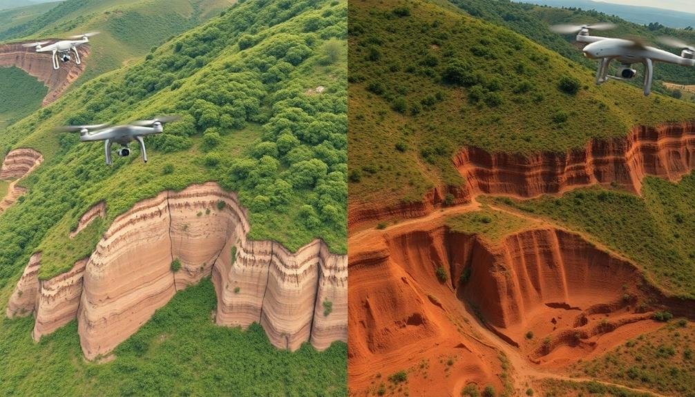
Photogrammetry for 3D Terrain Modeling
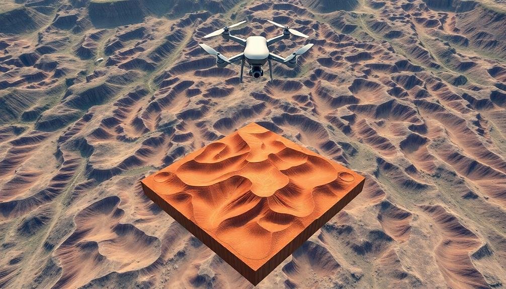
You'll find photogrammetry invaluable for creating detailed 3D terrain models to monitor soil erosion.
Start by capturing high-resolution aerial imagery using drones or aircraft, then process the overlapping images to generate dense point cloud data.
From this data, you can create accurate digital elevation models (DEMs) that reveal subtle changes in terrain over time.
Aerial Imagery Capture Techniques
Aerial imagery capture techniques have revolutionized soil erosion monitoring through photogrammetry for 3D terrain modeling. You'll find that these methods provide high-resolution data for accurate analysis of soil loss and landscape changes over time.
To capture aerial imagery for soil erosion monitoring, you'll typically use:
- Unmanned Aerial Vehicles (UAVs) or drones
- Manned aircraft with specialized cameras
- Satellite-based remote sensing platforms
When using drones, you'll need to plan your flight path carefully, ensuring proper overlap between images for effective 3D reconstruction. You'll want to take into account factors like flight altitude, camera settings, and weather conditions to optimize image quality.
For manned aircraft, you'll often employ LiDAR (Light Detection and Ranging) technology alongside traditional cameras. This combination allows you to create highly detailed digital elevation models (DEMs) and orthophotos.
Satellite imagery, while covering larger areas, often has lower resolution. However, it's useful for monitoring long-term changes and inaccessible regions. You'll need to account for atmospheric corrections and georeferencing when processing satellite data.
Point Cloud Data Processing
Once you've captured aerial imagery, the next step is processing the data to create accurate 3D terrain models. This is where point cloud data processing comes in. You'll use photogrammetry software to stitch together your aerial images and generate a dense point cloud. Each point in this cloud represents a specific location in 3D space, containing information about its position and color.
To process your point cloud data, you'll need to clean and filter it first. Remove any outliers or noise that might skew your results. Next, you'll classify the points based on their characteristics, separating ground points from vegetation or structures. This classification is essential for creating an accurate digital terrain model (DTM).
Once you've refined your point cloud, you can generate a mesh or surface model. This 3D representation of the terrain allows you to visualize changes in elevation and identify areas of erosion.
You can also create contour maps, slope maps, and calculate volumetric changes over time. By comparing models from different dates, you'll be able to quantify soil loss and track erosion patterns with high precision.
Digital Elevation Model Creation
Building on the point cloud data, digital elevation models (DEMs) serve as the foundation for advanced soil erosion analysis. You'll use photogrammetry techniques to create these 3D terrain models, which provide a detailed representation of the land surface.
By processing overlapping aerial images or LiDAR data, you can generate high-resolution DEMs that capture even subtle changes in topography.
To create a DEM, you'll follow these key steps:
- Align and orient the images or point cloud data
- Generate a dense point cloud through image matching algorithms
- Interpolate the points to create a continuous surface model
- Apply filters and corrections to improve accuracy
The resulting DEM allows you to visualize and quantify soil erosion patterns over time. You can use it to calculate slope, aspect, and curvature, which are essential factors in predicting erosion risk.
Hyperspectral Analysis of Land Cover
Numerous soil erosion monitoring techniques have emerged in recent years, with hyperspectral analysis of land cover standing out as a powerful tool. This advanced method uses sensors to capture hundreds of narrow spectral bands across the electromagnetic spectrum, providing detailed information about soil and vegetation properties.
You'll find that hyperspectral analysis can detect subtle changes in land cover that might indicate erosion processes. It allows you to identify specific soil types, moisture content, and organic matter levels, which are vital factors in erosion risk assessment. By analyzing the unique spectral signatures of different land cover types, you can map areas prone to erosion and track changes over time.
The high spectral resolution of hyperspectral data enables you to distinguish between healthy and stressed vegetation, bare soil, and various soil conditions. This information is invaluable for identifying areas where soil erosion may be occurring or is likely to occur.
You can use this data to create detailed land cover maps, monitor vegetation health, and detect early signs of soil degradation. Integrating hyperspectral analysis with other monitoring techniques provides an extensive approach to soil erosion assessment and management.
AI-Powered Erosion Pattern Recognition
AI-powered erosion pattern recognition represents a significant advancement in soil erosion monitoring techniques. This cutting-edge approach leverages machine learning algorithms to analyze satellite imagery, drone footage, and ground-based sensor data.
By processing vast amounts of visual information, AI systems can identify subtle changes in landscape features that might indicate erosion.
You'll find that AI-powered erosion pattern recognition offers several key advantages:
- Rapid detection of erosion hotspots
- Accurate prediction of future erosion trends
- Automated analysis of large geographical areas
These systems can detect various erosion patterns, including sheet, rill, and gully erosion, with remarkable accuracy. They're also capable of distinguishing between natural and human-induced erosion processes.
As you implement AI-powered erosion monitoring, you'll need to train the system using labeled datasets of known erosion patterns. This process improves the AI's ability to recognize new instances of erosion across diverse landscapes.
Over time, the system's accuracy will increase, allowing for more precise and timely interventions.
Time-Lapse Drone Imagery Comparison
How can you track soil erosion over time with pinpoint accuracy? Time-lapse drone imagery comparison offers a powerful solution.
You'll use drones equipped with high-resolution cameras to capture detailed images of the same area at regular intervals. These images, when compared, reveal even subtle changes in the landscape.
To implement this technique, you'll first establish a flight plan for your drone, ensuring consistent coverage. You'll capture images at set intervals, typically ranging from weekly to monthly, depending on the erosion rate.
Advanced software then processes these images, aligning them precisely and highlighting areas of change.
You'll be able to quantify soil loss by analyzing the differences in surface elevation between images. This method also allows you to identify erosion patterns, such as rill or gully formation.
By overlaying weather data, you can correlate erosion events with specific rainfall or wind patterns. Time-lapse drone imagery comparison not only provides visual evidence of erosion but also generates data for predictive modeling.
This technique's strength lies in its ability to cover large areas efficiently while offering detailed, measurable results.
Frequently Asked Questions
How Does Weather Affect the Accuracy of High-Tech Soil Erosion Monitoring Techniques?
Weather can considerably impact your soil erosion monitoring accuracy. Rain, wind, and extreme temperatures can interfere with sensors, disrupt satellite imagery, and alter soil conditions. You'll need to account for these factors when interpreting your data.
What Are the Costs Associated With Implementing These Advanced Monitoring Systems?
You'll find costs vary widely. You're looking at expenses for equipment, software, training, and maintenance. Don't forget ongoing data management and analysis. It's pricey, but you'll get precise, real-time data for better decision-making.
How Often Should These High-Tech Monitoring Techniques Be Performed for Optimal Results?
You'll want to perform high-tech monitoring techniques regularly, typically monthly or quarterly. However, you should adjust the frequency based on your specific site conditions, erosion risk factors, and project goals. Don't forget to monitor after major weather events.
Can These Technologies Be Integrated With Existing Soil Conservation Management Practices?
You can definitely integrate these technologies with existing soil conservation practices. They'll enhance your monitoring capabilities, providing real-time data and precise insights. This integration allows you to make more informed decisions and implement targeted conservation strategies more effectively.
What Training Is Required for Personnel to Effectively Use These Monitoring Techniques?
You'll need specialized training to use these monitoring techniques effectively. Learn about remote sensing, GIS, data analysis, and equipment operation. You should also understand soil science basics and erosion processes. Ongoing professional development's essential to stay current.
In Summary
You've now explored cutting-edge methods for monitoring soil erosion. By leveraging these high-tech techniques, you'll gain unprecedented insights into land degradation. Whether you're using drones, AI, or advanced imaging, you're equipped to detect and track erosion with precision. Remember, early identification is key to preventing further damage. As technology evolves, you'll have even more powerful tools at your disposal. Stay proactive in your erosion monitoring efforts to protect our valuable soil resources.
As educators and advocates for responsible drone use, we’re committed to sharing our knowledge and expertise with aspiring aerial photographers.


Leave a Reply