
To plan evacuation routes with UAV technology, you'll need to deploy drones equipped with high-resolution cameras and sensors. Start by mapping affected areas and evaluating potential hazards. Use UAVs to gather real-time data on population density, infrastructure damage, and traffic congestion. Analyze this information to identify ideal evacuation routes and potential bottlenecks. Integrate the data with ground control stations and AI-powered processing systems for dynamic route adjustments. Make sure you comply with FAA regulations and local emergency response protocols. Train personnel in UAV operations and emergency procedures. By leveraging this cutting-edge technology, you'll create more efficient and adaptable evacuation plans for various disaster scenarios.
Understanding UAV Technology for Evacuations

Three key components make up UAV technology for evacuation planning: the unmanned aerial vehicles themselves, ground control stations, and data processing systems.
UAVs, commonly known as drones, are equipped with high-resolution cameras and sensors to capture real-time imagery and data of the area. You'll find various types of UAVs, including fixed-wing and multi-rotor models, each suited for different terrain and weather conditions.
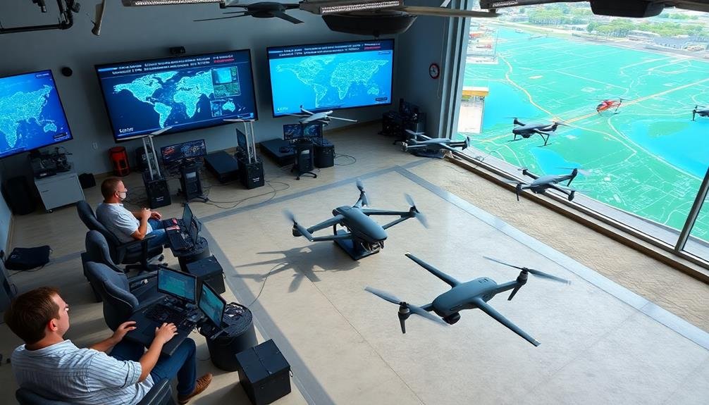
Ground control stations are your command centers, where you'll operate the UAVs remotely and receive live feeds. These stations typically consist of computers, monitors, and control interfaces that allow you to plan flight paths, monitor UAV status, and analyze incoming data.
Data processing systems are essential for turning raw UAV-collected information into actionable insights. You'll use specialized software to stitch together aerial images, create 3D maps, and identify potential hazards or bottlenecks along evacuation routes.
These systems often incorporate artificial intelligence and machine learning algorithms to quickly process large amounts of data and provide real-time recommendations for ideal evacuation planning.
Assessing Disaster Scenarios

When evaluating disaster scenarios, you'll need to start by identifying potential hazards that could impact your area.
Next, you'll want to map the affected areas using UAV technology to gain a thorough view of the situation.
Identifying Potential Hazards
Numerous potential hazards must be evaluated when planning evacuation routes with UAV technology. You'll need to identify both natural and man-made threats that could impede safe evacuation.
Use UAVs to survey the area and look for geological hazards like landslides, sinkholes, or unstable terrain. Pay close attention to flood-prone areas, active fault lines, and regions susceptible to wildfires.
Don't overlook infrastructure-related dangers. Inspect bridges, tunnels, and overpasses for structural integrity. Look for potential bottlenecks in road networks that could slow evacuation efforts. Identify hazardous material storage facilities, power plants, or industrial sites that might pose additional risks during a disaster.
Use UAV thermal imaging to detect hidden heat sources or gas leaks. Map out areas with limited cellular coverage or poor radio communication. Locate potential shelter sites and assembly points along evacuation routes. Identify alternative routes in case primary paths become blocked.
Remember to assess the time of day, weather conditions, and seasonal factors that might affect hazard visibility or severity.
Mapping Affected Areas
Once you've identified potential hazards, it's time to map out the affected areas and evaluate various disaster scenarios. UAV technology enables you to create highly detailed, real-time maps of the impacted regions.
Use your drones to capture aerial imagery and generate 3D models of the terrain, buildings, and infrastructure. These maps will help you visualize potential evacuation routes and identify any obstacles or bottlenecks.
Overlay population density data onto your maps to prioritize areas with the highest concentration of people. Consider different disaster scenarios, such as flooding, wildfires, or earthquakes, and map out how they might affect various parts of the region.
Use your UAV-generated maps to simulate different evacuation scenarios. This will allow you to test the effectiveness of various routes and identify potential chokepoints or areas prone to congestion.
Pay close attention to critical infrastructure like bridges, tunnels, and major intersections that could become problematic during an evacuation. By thoroughly mapping affected areas and evaluating multiple disaster scenarios, you'll be better equipped to develop effective evacuation plans that can adapt to changing conditions and save lives.
Estimating Population Impact
Accurately estimating the population impact of various disaster scenarios is essential for effective evacuation planning. UAV technology can help you gather vital data to assess how different emergencies might affect local communities. By analyzing aerial footage and sensor data, you'll be able to identify high-risk areas and determine the number of people potentially affected.
Use your UAVs to collect information on population density, infrastructure vulnerabilities, and natural hazards. This data will enable you to create detailed impact assessments for various disaster scenarios. Consider factors such as:
| Scenario | Population Affected | Critical Infrastructure |
|---|---|---|
| Flooding | 10,000 – 50,000 | Bridges, Power Plants |
| Wildfire | 5,000 – 25,000 | Residential Areas, Schools |
| Earthquake | 25,000 – 100,000 | Hospitals, Roads |
| Hurricane | 50,000 – 200,000 | Ports, Airports |
Mapping Potential Evacuation Routes
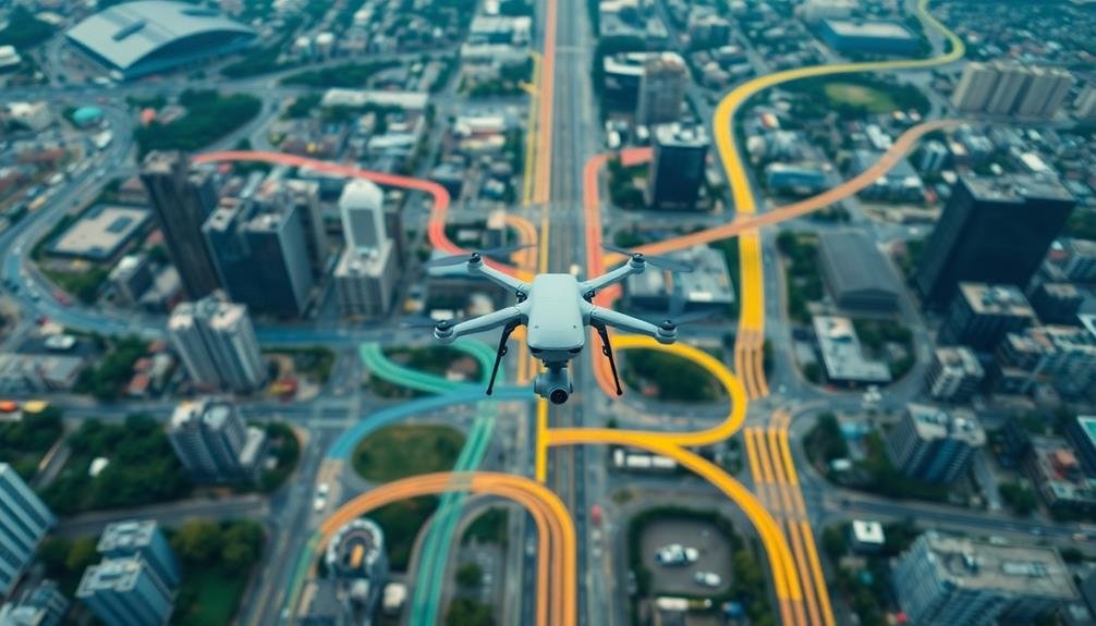
You'll start by using UAVs to collect thorough aerial imagery of potential evacuation routes.
Next, you'll employ digital terrain analysis to assess the suitability and safety of these routes under various disaster scenarios.
Aerial Imagery Data Collection
Aerial imagery data collection for mapping potential evacuation routes begins with deploying UAVs equipped with high-resolution cameras.
You'll need to plan flight paths that cover the entire area of interest, ensuring overlap between images for accurate stitching later. Consider flying at different altitudes to capture both wide-area views and detailed ground features.
As you collect data, focus on key elements like road networks, bridges, and potential bottlenecks. You'll want to capture images of alternative routes, including secondary roads and paths that mightn't be immediately obvious from ground level.
Don't forget to document potential hazards along these routes, such as flood-prone areas or unstable terrain. Use GPS-enabled UAVs to geotag each image, making it easier to create precise maps later.
You'll also want to collect data at different times of day and in various weather conditions to understand how these factors might affect evacuation routes.
Once you've gathered the aerial imagery, you'll process it using specialized software to create orthomosaic maps and 3D models.
These will provide an all-encompassing view of the area, allowing you to identify the most efficient and safest evacuation routes.
Digital Terrain Analysis
Digital terrain analysis forms the backbone of mapping potential evacuation routes. Using the aerial imagery collected by UAVs, you'll process this data to create detailed digital elevation models (DEMs) and 3D terrain maps. These models provide essential information about the landscape's topography, including elevation changes, slopes, and terrain features.
You'll use specialized GIS software to analyze the DEMs and identify potential evacuation routes. Look for paths with minimal obstacles, gentle slopes, and wide enough to accommodate emergency vehicles. Consider natural barriers like rivers, steep cliffs, or dense forests that could impede movement.
You'll also need to factor in man-made structures such as roads, bridges, and buildings. As you analyze the terrain, you'll create a network of possible routes, ranking them based on accessibility, safety, and efficiency.
Don't forget to include alternative paths in case primary routes become blocked. You'll also identify potential bottlenecks, hazardous areas, and safe zones along these routes. This thorough digital terrain analysis will serve as the foundation for your evacuation planning, ensuring you've considered all geographical factors that could impact the safe movement of people during an emergency.
Route Optimization Algorithms
Once you've analyzed the terrain and identified potential routes, it's time to employ route optimization algorithms. These powerful tools help you determine the most efficient evacuation paths based on various factors.
You'll need to input data collected from UAV surveys, including terrain features, population density, and potential hazards.
Route optimization algorithms consider multiple variables simultaneously, such as:
- Distance and travel time
- Road capacity and potential bottlenecks
- Safety factors, including hazard proximity
- Accessibility for different types of vehicles
By processing this information, the algorithms generate ideal evacuation routes that balance speed, safety, and efficiency. You can adjust parameters to prioritize certain factors based on the specific emergency scenario you're planning for.
It's essential to run multiple simulations with different variables to create a thorough set of evacuation plans. This approach guarantees you're prepared for various scenarios and can quickly adapt to changing conditions during an actual emergency.
Remember to regularly update your route optimization models with new data from UAV surveys and changes in infrastructure. This ongoing process will help maintain the effectiveness of your evacuation plans over time.
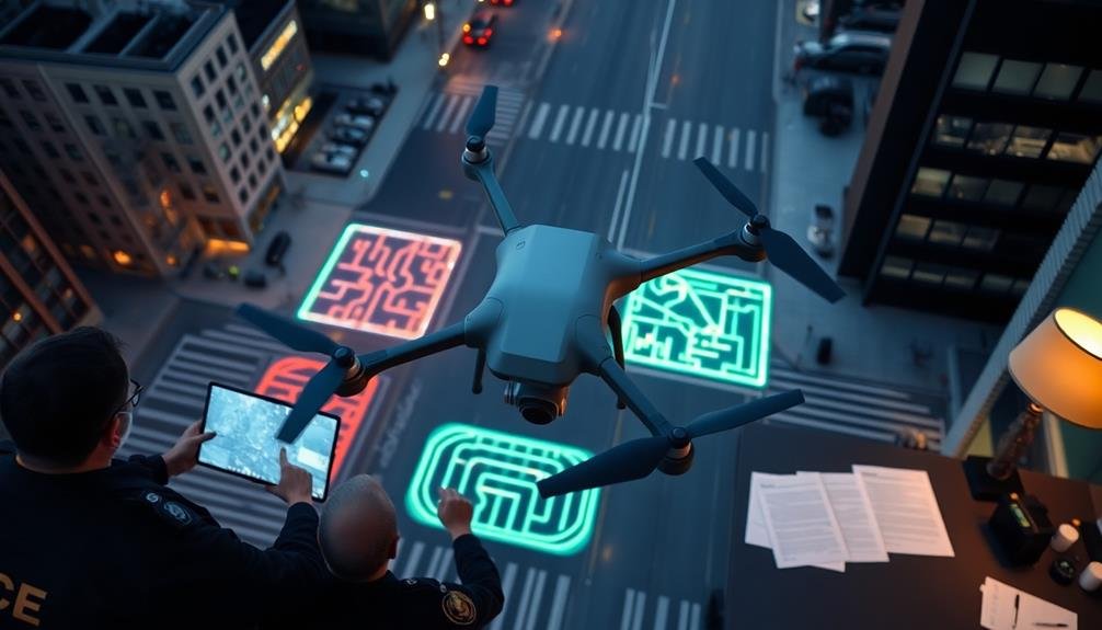
Integrating Real-Time Data

Real-time data integration is essential for effective evacuation planning with UAV technology. You'll need to incorporate live information from various sources to guarantee your evacuation routes remain up-to-date and safe.
Start by establishing a reliable data feed from your UAVs, which can provide aerial imagery and video of current conditions. Connect this feed to your central command center, where you can analyze and interpret the information quickly.
Integrate additional data sources, such as traffic cameras, weather reports, and emergency service updates. This thorough approach will give you a more accurate picture of the situation on the ground.
Use software that can process and visualize this data in real-time, allowing you to make informed decisions rapidly.
Set up automated alerts for significant changes in road conditions, weather patterns, or population movements. These alerts will help you adjust evacuation routes on the fly, ensuring the safety of those being evacuated.
Don't forget to establish a backup communication system in case of network failures. By integrating real-time data effectively, you'll create a dynamic and responsive evacuation plan that can adapt to changing circumstances quickly and efficiently.
Identifying Bottlenecks and Hazards

With real-time data at your fingertips, you'll be well-equipped to spot potential issues along evacuation routes. UAV technology allows you to identify bottlenecks and hazards that might impede safe evacuation. You can quickly pinpoint areas of congestion, road damage, or environmental threats that could slow down or endanger evacuees.
Use your UAV's high-resolution imagery and sensors to detect:
- Traffic congestion points
- Damaged infrastructure (bridges, roads, buildings)
- Natural obstacles (fallen trees, landslides, flooded areas)
- Potential secondary hazards (gas leaks, fires, unstable structures)
Once you've identified these issues, you can adjust your evacuation plans accordingly. Reroute traffic away from bottlenecks, establish alternative paths around hazards, and prioritize clearing obstructions.
You'll also be able to deploy resources more effectively, sending emergency personnel to critical areas first.
Don't forget to continually monitor these trouble spots throughout the evacuation process. Conditions can change rapidly, especially in disaster scenarios.
Optimizing Route Efficiency

You'll need to employ shortest path algorithms to determine the most efficient evacuation routes.
Integrating real-time traffic analysis allows you to adapt routes dynamically as conditions change.
Developing multiple exit strategies guarantees flexibility and redundancy in your evacuation plan, increasing the chances of a successful operation.
Shortest Path Algorithms
Shortest path algorithms play an essential role in enhancing evacuation route efficiency when using UAV technology. These algorithms help you determine the fastest and safest paths for evacuees to reach designated safe zones.
By implementing these algorithms in your UAV-based evacuation planning system, you'll markedly improve the overall effectiveness of your routes.
When selecting a shortest path algorithm for your evacuation planning, consider the following options:
- Dijkstra's Algorithm: Ideal for finding the shortest path between a single source and all other nodes in the network.
- A* Search Algorithm: Efficient for finding the best path between two specific points, using heuristics to guide the search.
- Floyd-Warshall Algorithm: Useful for finding the shortest paths between all pairs of nodes in the network.
- Bellman-Ford Algorithm: Capable of handling negative edge weights and detecting negative cycles in the graph.
You'll need to choose the most appropriate algorithm based on your specific evacuation scenario and computational resources.
Implement the selected algorithm within your UAV's navigation system to process real-time data and continuously update evacuation routes. This approach guarantees that evacuees are always directed along the most efficient and safest paths, even as conditions change during the emergency.
Real-Time Traffic Analysis
Real-time traffic analysis forms the backbone of optimizing evacuation route efficiency with UAV technology.
By leveraging UAVs equipped with high-resolution cameras and advanced sensors, you can gather up-to-the-minute data on traffic flow, congestion points, and road conditions. This information is essential for making informed decisions about evacuation routes and adjusting them as needed.
To implement real-time traffic analysis, you'll need to:
- Deploy a fleet of UAVs to cover the entire evacuation area
- Use AI-powered image recognition software to identify vehicles, pedestrians, and obstacles
- Analyze traffic patterns and speeds to detect bottlenecks and slowdowns
- Integrate this data with your shortest path algorithms to dynamically update routes
By continuously monitoring traffic conditions, you can quickly identify and respond to unexpected events such as accidents, road closures, or sudden influxes of evacuees.
This allows you to reroute traffic away from problem areas and towards clearer paths, greatly reducing evacuation times and potentially saving lives.
Remember to communicate these real-time updates to evacuees through mobile apps, emergency broadcast systems, and digital road signs to guarantee everyone has access to the most current information.
Multiple Exit Strategies
Flexibility is key when planning evacuation routes using UAV technology. By incorporating multiple exit strategies, you'll guarantee that evacuees have various options to reach safety, even if certain routes become compromised.
UAVs can help you identify and assess multiple evacuation paths, allowing you to create a thorough plan that adapts to changing conditions.
When developing multiple exit strategies, consider the following:
- Primary routes: Establish main evacuation paths that can accommodate high traffic volumes
- Secondary routes: Identify alternative paths to alleviate congestion on primary routes
- Emergency detours: Plan for unexpected obstacles by mapping potential detours
- Assembly points: Designate safe locations where evacuees can gather before continuing their journey
Use UAVs to regularly monitor and update these routes, guaranteeing they remain viable options during an emergency.
By analyzing real-time data from drones, you can quickly identify blocked roads, hazards, or congestion points. This information allows you to make informed decisions about which routes to prioritize or redirect traffic as needed.
Communicating Routes to Authorities

Once you've determined the ideal evacuation routes using UAV technology, it's crucial to communicate this information effectively to the relevant authorities.
Start by creating detailed maps and reports that showcase the UAV-gathered data, highlighting safe routes, potential obstacles, and areas of concern. Include high-resolution images and video footage to provide a thorough view of the terrain.
Next, set up a secure digital platform to share this information with emergency responders, local government officials, and other relevant parties. Make sure the platform allows for real-time updates and easy access during crisis situations.
You'll want to organize briefing sessions to walk authorities through the evacuation plans, explaining the rationale behind each route and addressing any questions or concerns.
Don't forget to establish a clear chain of communication for ongoing updates. As conditions change, you may need to adjust routes quickly.
Implement a system for rapid dissemination of new information, such as a dedicated emergency communication channel or a mobile app for instant notifications.
Implementing Dynamic Route Adjustments

You'll need to implement dynamic route adjustments to guarantee the most efficient evacuation.
Use real-time obstacle detection from UAVs to identify and avoid unexpected hazards or blockages along planned routes.
Adaptive traffic flow management will help you redistribute evacuees based on current conditions, preventing bottlenecks and optimizing the overall evacuation process.
Real-Time Obstacle Detection
Equipped with advanced sensors and real-time data processing capabilities, UAVs can continuously scan the environment for potential obstacles during evacuation operations.
This real-time obstacle detection allows for immediate adjustments to evacuation routes, ensuring the safety of those fleeing dangerous situations.
You'll find that UAVs utilize various technologies to detect obstacles, including:
- LiDAR (Light Detection and Ranging) sensors
- Infrared cameras
- Computer vision algorithms
- Acoustic sensors
These technologies work together to create a thorough picture of the environment, identifying both static and moving obstacles.
As you implement real-time obstacle detection in your evacuation planning, you'll need to take into account the integration of this data with your existing route planning systems.
Adaptive Traffic Flow Management
A key component of effective evacuation planning using UAV technology is adaptive traffic flow management. This involves implementing dynamic route adjustments based on real-time data collected by drones. You'll need to set up a system that can analyze traffic patterns, congestion points, and unexpected obstacles to optimize evacuation routes on the fly.
Start by establishing a network of UAVs that continuously monitor major roads and intersections. These drones will feed data to a central command center, where sophisticated algorithms process the information. You'll want to program your system to identify bottlenecks, accidents, or road closures quickly.
As conditions change, the system should automatically recalculate the most efficient routes for evacuees. To implement these adjustments, you'll need to integrate your UAV data with existing traffic management systems. This might include controlling traffic lights, activating changeable message signs, or sending updates to GPS navigation apps.
You should also consider using drones to guide vehicles directly, perhaps by equipping them with LED displays or speakers to communicate instructions to drivers. By continuously adapting to changing conditions, you'll guarantee a smoother, safer evacuation process.
Coordinating Multiple UAVs

Swarms of drones buzzing through the air in perfect synchronization may seem like science fiction, but coordinating multiple UAVs is now a reality in evacuation planning.
You'll need to master the art of managing these aerial teams to maximize their effectiveness in emergency situations.
To coordinate multiple UAVs effectively, you should:
- Implement a centralized control system
- Establish clear communication protocols
- Define specific roles for each drone
- Create adaptive flight patterns
Start by setting up a command center that can monitor and direct all UAVs simultaneously. This hub will serve as the brain of your operation, allowing you to make quick decisions based on real-time data.
Next, guarantee your drones can communicate with each other and the control center seamlessly. Use encrypted channels to prevent interference and maintain security.
Assign specific tasks to each UAV based on its capabilities and the evacuation needs. Some drones might focus on traffic monitoring, while others could deliver supplies or provide aerial surveillance.
Ensuring Public Safety During Evacuations

Prioritizing public safety is paramount when deploying UAVs for evacuation planning. You'll need to establish strict protocols to guarantee UAV operations don't interfere with emergency vehicles or create additional hazards for evacuees.
Implement no-fly zones around critical infrastructure and sensitive areas to prevent potential security risks.
Train your UAV operators in emergency procedures and safety protocols. They should be able to quickly respond to changing conditions and maintain situational awareness at all times.
Equip your UAVs with high-visibility markings and lights to make them easily identifiable to the public and emergency personnel.
You'll want to use UAVs to monitor crowd movements and identify potential bottlenecks or hazards along evacuation routes. This real-time data can help you adjust plans on the fly and direct resources where they're needed most.
Consider using UAVs equipped with loudspeakers or LED displays to communicate important information to evacuees.
Maintain open communication channels with local authorities and emergency services. Share UAV-gathered data promptly and coordinate your efforts to guarantee a unified response.
Training Personnel for UAV Operations
When it comes to UAV operations for evacuation planning, proper training is essential. You'll need to guarantee your personnel are well-versed in both UAV piloting and emergency management protocols. Start by selecting team members with a strong technical background and a calm demeanor under pressure.
Develop a thorough training program that covers:
- UAV flight regulations and safety procedures
- Emergency response protocols and evacuation planning principles
- Data collection and analysis techniques for route mapping
- Maintenance and troubleshooting of UAV equipment
Once you've established your training curriculum, provide hands-on experience through simulations and field exercises. This will help your team build confidence and refine their skills in real-world scenarios.
Don't forget to include regular refresher courses and updates on new technologies or regulations.
Encourage cross-training among team members to guarantee flexibility during operations. You'll want everyone to have a basic understanding of each role, from piloting to data analysis.
This approach will improve overall team efficiency and resilience in high-pressure situations.
Legal Considerations for UAV Use
Before diving into UAV operations for evacuation planning, you must brush up on the legal landscape surrounding drone use. Familiarize yourself with federal, state, and local regulations governing UAV operations. The Federal Aviation Administration (FAA) oversees drone use in the United States, requiring registration for most drones and imposing strict rules for commercial operations.
You'll need to obtain proper certifications, such as a Remote Pilot Certificate, to operate drones for evacuation planning purposes. Be aware of airspace restrictions, privacy laws, and insurance requirements. Always stay updated on changing regulations, as drone laws evolve rapidly.
Consider these key legal aspects when using UAVs for evacuation planning:
| Requirement | Description |
|---|---|
| Registration | Register drones with the FAA |
| Certification | Obtain Remote Pilot Certificate |
| Airspace | Adhere to airspace restrictions |
| Privacy | Respect privacy laws and property rights |
Remember to secure necessary permits for flight operations in your area. Consult with local authorities and emergency management officials to guarantee compliance with specific regulations for emergency response activities. By adhering to legal requirements, you'll protect your organization from potential liabilities and guarantee smooth UAV operations for evacuation planning.
Cost-Benefit Analysis of UAV Implementation

Effectiveness in emergency management hinges on making informed decisions about resource allocation. When considering UAV implementation for evacuation planning, you'll need to conduct a thorough cost-benefit analysis. This process will help you determine if the investment in UAV technology is justified for your specific needs.
Start by evaluating the potential benefits of using UAVs for evacuation route planning. These may include:
- Faster and more accurate data collection
- Improved situational awareness during emergencies
- Enhanced ability to identify hazards and obstacles
- Reduced risk to human personnel during reconnaissance
Next, consider the costs associated with UAV implementation. Factor in expenses such as equipment purchase, maintenance, training, and operational costs.
Don't forget to include potential costs related to compliance with regulations and insurance requirements.
Compare these costs against the potential savings and improvements in emergency response effectiveness. Quantify the benefits where possible, such as reduced response times or increased evacuation success rates.
Consider both short-term and long-term impacts on your emergency management capabilities.
Future Developments in Evacuation Planning

As technology rapidly evolves, so do the possibilities for enhancing evacuation planning. You'll see advancements in artificial intelligence (AI) and machine learning revolutionizing how UAVs process data and make decisions in real-time.
These improvements will enable faster route calculations and more accurate predictions of crowd behavior during evacuations. You can expect to see integration of 5G networks, allowing for seamless communication between UAVs, ground teams, and command centers.
This will result in more coordinated efforts and quicker response times. Additionally, you'll witness the development of swarm technology, where multiple UAVs work together to cover larger areas and provide more thorough data.
Improved sensor technology will enable UAVs to detect hazards like toxic gases or structural instabilities, further enhancing safety during evacuations. You'll also see advancements in battery technology, extending flight times and expanding the operational range of UAVs.
Virtual and augmented reality interfaces will allow emergency responders to visualize evacuation scenarios in immersive 3D environments, improving training and decision-making.
Frequently Asked Questions
How Long Do UAV Batteries Typically Last During Evacuation Route Planning Missions?
You'll find that UAV battery life varies widely depending on the model. Typically, you can expect 20-30 minutes for consumer drones and up to 2-3 hours for professional-grade UAVs during evacuation route planning missions.
Can UAVS Operate Effectively in Severe Weather Conditions During Evacuations?
You'll find UAVs can operate in some harsh conditions, but severe weather limits their effectiveness. High winds, heavy rain, or extreme temperatures can ground drones. It's best to use them in milder weather for evacuation planning.
What Backup Systems Are in Place if UAV Technology Fails?
If UAV technology fails, you'll rely on backup systems like satellite imagery, ground-based sensors, and traditional mapping methods. You should also have manual evacuation plans ready and maintain communication networks for real-time updates during emergencies.
How Do UAVS Handle Unexpected Obstacles Like Temporary Structures or Debris?
You'll find UAVs equipped with obstacle avoidance sensors and AI algorithms. They'll detect and navigate around unexpected objects in real-time. If needed, they'll adjust their flight path or hover until the obstacle's cleared or a new route's determined.
Are There Concerns About Privacy When Using UAVS for Evacuation Planning?
Yes, you should be aware of privacy concerns when using UAVs for evacuation planning. They can capture sensitive data, so you'll need to implement strict protocols to protect personal information and comply with privacy laws.
In Summary
You've now got the tools to revolutionize evacuation planning with UAV technology. By integrating aerial data, real-time updates, and advanced mapping, you'll create safer, more efficient evacuation routes. Remember to train your team, stay compliant with regulations, and keep an eye on emerging tech. As you implement these strategies, you're not just improving plans; you're potentially saving lives. Keep pushing the boundaries of what's possible in disaster preparedness.
As educators and advocates for responsible drone use, we’re committed to sharing our knowledge and expertise with aspiring aerial photographers.


Leave a Reply