Sky-high photography has revolutionized wildlife documentaries, offering you unprecedented views of animal behavior and ecosystems. You'll find techniques like aerial tracking of migratory patterns, thermal imaging for nocturnal species, and canopy-level forest mapping. Drones enable documenting herd dynamics from above and integrating underwater footage. You can explore 360-degree panoramic habitat surveys and observe low-altitude behavioral studies. Drone swarm synchronized filming provides dynamic perspectives, while long-range monitoring helps protect endangered species. These innovative methods capture nature's wonders in ways previously impossible, revealing hidden aspects of wildlife. Discover how these techniques are transforming our understanding of the natural world.
Aerial Tracking of Migratory Patterns

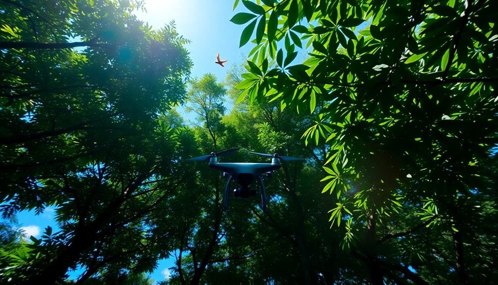
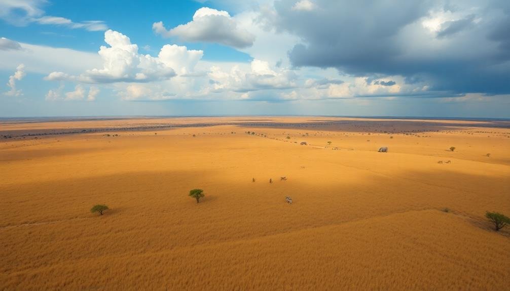
Aerial tracking has revolutionized the way wildlife documentarians capture migratory patterns. You'll find that drones and helicopters equipped with high-resolution cameras are now essential tools for following large groups of animals across vast distances. These aerial platforms allow you to observe migrations from a bird's-eye view, revealing intricate patterns and behaviors that were previously impossible to document.
When you're planning an aerial tracking shoot, you'll need to take into account factors like flight regulations, weather conditions, and battery life. You'll want to use GPS-enabled drones that can maintain a safe distance from the animals without disturbing them. For longer migrations, you might opt for fixed-wing drones that can cover greater distances.
To capture the best footage, you'll need to master techniques like panning, tracking shots, and altitude adjustments. You'll also want to use stabilization equipment to guarantee smooth footage.
Don't forget to incorporate different perspectives by alternating between wide shots of entire herds and close-ups of individual animals. By combining these techniques, you'll create compelling visuals that showcase the scale and complexity of animal migrations.
Thermal Imaging for Nocturnal Species
You'll find thermal imaging revolutionizes nocturnal wildlife observation by detecting animals' heat signatures.
This technology allows you to see active creatures in complete darkness, revealing their nighttime behavior patterns.
You're able to track movements, identify species, and observe hunting or mating rituals that were previously hidden from view.
Heat Signatures Reveal Activity
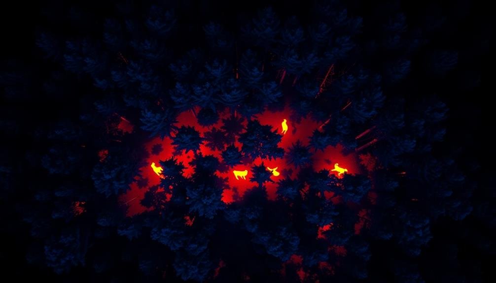
Thermal imaging technology has revolutionized wildlife documentaries, especially for capturing nocturnal species. When you're filming at night, heat signatures can reveal a wealth of animal activity that would otherwise remain hidden. You'll see warm-blooded creatures glowing against cooler backgrounds, allowing you to track their movements and behaviors with unprecedented clarity.
As you scan the landscape, you'll notice how different animals emit varying levels of heat. Large mammals like elephants and rhinos appear as bright, unmistakable shapes, while smaller creatures like rodents show up as tiny, moving hotspots.
You can even detect cold-blooded animals like snakes and lizards as they absorb warmth from rocks or logs.
Heat signatures also help you identify specific activities. You'll observe predators stalking prey, nocturnal feeders foraging, and animals huddling for warmth.
Nighttime Behavior Patterns Exposed
Through thermal imaging, nighttime behavior patterns of nocturnal species are vividly exposed.
You'll witness the hidden world of animals that thrive in darkness, revealing their secretive habits and interactions. Thermal cameras detect heat signatures, allowing you to observe creatures that would otherwise remain invisible to the naked eye.
You can track the movements of nocturnal predators as they stalk their prey, revealing hunting techniques and territorial behaviors.
Observe small mammals foraging for food, their body heat contrasting against the cooler environment. You'll see bats in flight, their warm bodies standing out against the night sky as they swoop and dive for insects.
Thermal imaging also exposes nest sites and dens, showing you where animals rest and rear their young.
You can monitor the activity levels of different species throughout the night, identifying peak periods of movement and rest.
This technology allows you to capture mating rituals, social interactions, and even conflicts between rival animals.
Canopy-Level Forest Ecosystem Mapping

Mapping out of and into the forest canopy has revolutionized our understanding of complex ecosystems.
You'll find that advanced drones and high-resolution cameras now allow you to capture detailed images of the uppermost layers of forests. These tools enable you to create 3D models of canopy structures, revealing intricate networks of branches, leaves, and wildlife habitats that were previously hidden from view.
As you explore canopy-level forest ecosystem mapping, you'll discover its numerous applications. It's essential for monitoring biodiversity, tracking species movements, and evaluating the overall health of forest ecosystems.
You can use this data to inform conservation efforts and sustainable forest management practices.
To fully appreciate the impact of canopy-level mapping, consider these emotional aspects:
- The awe of uncovering hidden worlds teeming with life
- The urgency of protecting these fragile ecosystems
- The hope that comes from better understanding and preserving our planet's biodiversity
Documenting Herd Dynamics From Above

You'll find aerial techniques invaluable for documenting herd dynamics.
By capturing migration patterns from above, you can analyze the routes and timing of large-scale animal movements.
You'll also employ specialized methods to estimate herd sizes accurately and observe fascinating predator-prey interactions that might be invisible from ground level.
Aerial Migration Pattern Analysis
Aerial migration pattern analysis revolutionizes wildlife documentaries, offering a bird's-eye view of herd dynamics. You'll capture breathtaking footage of animals on the move, revealing intricate patterns and behaviors invisible from the ground.
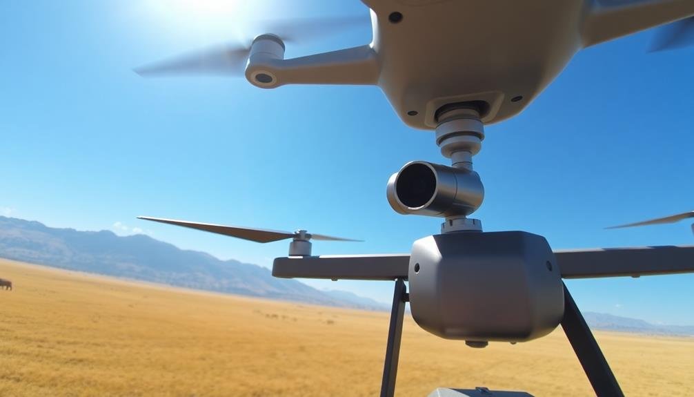
By using drones, helicopters, or small planes, you can track large-scale movements across vast landscapes, providing viewers with a thorough understanding of migration routes.
To effectively analyze migration patterns from above, you'll need to:
- Plan your flight paths carefully, considering the animals' known routes and potential obstacles
- Use high-resolution cameras with powerful zoom capabilities to capture detailed footage
- Employ GPS tracking and mapping software to accurately plot the herd's movements
You'll also want to coordinate with ground teams to correlate aerial observations with on-the-ground data. This combination of perspectives allows you to create a more complete picture of the migration process.
Herd Size Estimation Techniques
In the domain of aerial wildlife documentation, accurate herd size estimation is vital for understanding population dynamics. You'll need to employ various techniques to guarantee precise counts from your aerial vantage point.
Start by using high-resolution cameras with powerful zoom capabilities to capture clear images of the herd. These photos will serve as your primary data source for estimation.
You'll want to divide large herds into smaller, manageable sections for counting. Use natural landmarks or grid overlays on your images to create these divisions.
Employ both manual and automated counting methods to cross-verify your results. Software with machine learning algorithms can help identify and tally individual animals quickly.
For moving herds, you'll need to account for potential double-counting or missed individuals. Use video footage to track movement patterns and adjust your estimates accordingly.
Don't forget to factor in environmental conditions like vegetation cover or terrain that might obscure some animals from view.
Predator-Prey Interactions Observed
While herd size estimation provides valuable data, capturing predator-prey interactions from above offers a unique perspective on ecosystem dynamics. You'll witness the intricate dance of survival as predators stalk their prey across vast landscapes.
From this vantage point, you can observe hunting strategies, escape tactics, and the impact of terrain on these encounters. Aerial footage reveals patterns that aren't visible from the ground.
You'll see how herds react to predator presence, forming defensive formations or scattering in strategic ways. It's possible to track multiple predators simultaneously, observing how they coordinate their attacks or compete for the same prey.
This bird's-eye view also allows you to document the aftermath of successful hunts, including scavenger behavior and the redistribution of nutrients in the ecosystem. By combining this footage with ground-level shots, you'll create a thorough narrative of predator-prey relationships.
To evoke emotion in your audience:
- Capture the heart-pounding moment a cheetah accelerates towards its target
- Show the tender care of a lioness protecting her cubs from hyenas
- Highlight the resilience of prey species as they outwit their pursuers
Underwater Drone Footage Integration
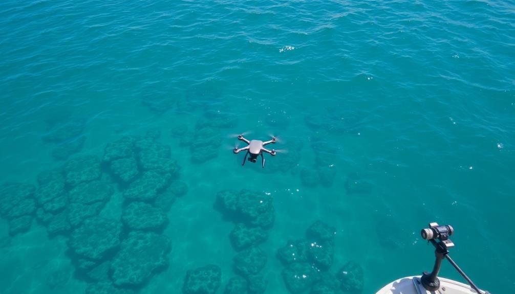
Integrating underwater drone footage has revolutionized wildlife documentary filmmaking, offering unprecedented access to marine ecosystems. You'll find that these drones can capture stunning visuals of underwater life without disturbing the natural behavior of marine creatures.
To effectively use underwater drone footage, you'll need to take into account several factors:
| Consideration | Details |
|---|---|
| Depth Range | Typically 50-100m |
| Battery Life | 2-4 hours |
| Camera Quality | 4K resolution |
| Lighting | Built-in LED arrays |
| Control Range | Up to 1km |
When planning your shoot, you'll want to research the area's marine life and underwater topography. This knowledge will help you position your drone for the best shots. You'll also need to be mindful of currents and water clarity, as these can affect your footage quality.
Post-production is vital when working with underwater drone footage. You'll need to color-correct your footage to compensate for the blue cast that occurs underwater. Additionally, you'll want to stabilize any shaky footage and remove any visible particles in the water to enhance the final product.
Time-Lapse Capture of Seasonal Changes
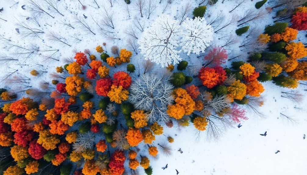
Time-lapse capture of seasonal changes offers a powerful visual storytelling tool for wildlife documentaries. You'll witness nature's grand transformations compressed into mere minutes, revealing patterns and behaviors that might otherwise go unnoticed.
By setting up strategically placed cameras in key locations, you can document the ebb and flow of ecosystems over extended periods.
To effectively capture seasonal changes, you'll need to plan your shots carefully. Choose locations that showcase dramatic shifts, such as deciduous forests, alpine meadows, or tidal zones.
Verify your equipment is weather-resistant and has sufficient power to operate for months. You'll also want to take into account the sun's path throughout the year to maintain consistent lighting.
When editing your time-lapse footage, pay attention to pacing and shifts. Smooth, gradual changes can create a mesmerizing effect, while rapid shifts can emphasize dramatic events.
To evoke emotion in your audience, focus on:
- The fragility of life cycles
- The resilience of nature in the face of harsh conditions
- The interconnectedness of species and their environment
360-Degree Panoramic Habitat Surveys
Panoramic habitat surveys offer a thorough view of wildlife ecosystems, allowing you to capture the full scope of an animal's environment. You'll need specialized equipment to create these 360-degree images, including a panoramic head for your camera and stitching software to combine multiple shots.
When conducting a panoramic survey, you'll want to:
- Choose an elevated position for a clear view
- Use a sturdy tripod to guarantee stability
- Set your camera to manual mode for consistent exposure
- Overlap each shot by 30-50% for seamless stitching
- Capture multiple rows if necessary for vertical coverage
Here's a breakdown of panoramic survey types and their applications:
| Survey Type | Resolution | Field of View | Best Use Case | Challenges |
|---|---|---|---|---|
| Single-row | Medium | 360° x 50° | Open landscapes | Limited vertical coverage |
| Multi-row | High | 360° x 180° | Detailed habitat analysis | Time-consuming |
| Spherical | Very High | 360° x 360° | Immersive experiences | Complex processing |
| Gigapixel | Ultra-High | Varies | Scientific documentation | Large file sizes |
| Aerial | Variable | Wide | Large-scale ecosystems | Requires specialized equipment |
Low-Altitude Behavioral Studies

You'll find low-altitude behavioral studies invaluable for capturing natural animal interactions.
By using tools like drones or camouflaged blinds, you can observe wildlife without causing significant disturbance.
Your goal is to document authentic behaviors while maintaining a respectful distance and minimizing your impact on the animals' environment.
Capturing Natural Interactions
Capturing natural interactions among wildlife at low altitudes presents unique challenges and opportunities for documentary filmmakers. You'll need to balance proximity with minimal disturbance, ensuring your presence doesn't alter animal behavior.
Use long-range lenses and camouflaged hides to maintain distance while still capturing intimate moments. Silent drones can provide aerial perspectives without causing undue stress to the subjects.
When filming, patience is key. You'll often wait hours for a brief moment of action. Anticipate animal movements and behaviors to position yourself strategically.
Learn about the species you're documenting to predict peak activity times and interaction hotspots. Consider using multiple cameras to capture different angles simultaneously, increasing your chances of recording rare or fleeting events.
To evoke emotion in your audience:
- Show nurturing moments between parents and offspring
- Capture the intensity of predator-prey interactions
- Highlight cooperative behaviors among social species
Post-production is vital for crafting a compelling narrative. Carefully select and arrange footage to tell a cohesive story.
Use natural sounds and minimal narration to immerse viewers in the animals' world. By showcasing genuine interactions, you'll create a powerful connection between your audience and wildlife subjects.
Minimizing Animal Disturbance
When conducting low-altitude behavioral studies, minimizing animal disturbance is crucial for obtaining accurate, unbiased data. You'll need to carefully plan your approach to guarantee your presence doesn't alter natural behaviors. Start by researching your target species' sensitivities to noise, movement, and visual stimuli.
Choose quiet, electric-powered drones to reduce sound disturbance. Opt for smaller models that are less likely to be perceived as threats. You'll want to maintain a respectful distance, using high-zoom cameras to capture detailed footage without encroaching on the animals' space.
Time your flights during periods when the animals are most active but least sensitive to disturbances. You should approach gradually, allowing the subjects to acclimate to the drone's presence. If you notice signs of stress or altered behavior, immediately increase your distance or end the session.
Consider using camouflaged drones that blend with the environment. You can also employ thermal imaging for nocturnal studies, minimizing the need for visible light.
Always prioritize the animals' well-being over getting the perfect shot, and be prepared to abort missions if necessary to protect wildlife.
Drone Swarm Synchronized Filming

Increasingly, wildlife documentarians are turning to drone swarm synchronized filming to capture breathtaking aerial footage. You'll find this technique particularly useful for documenting large-scale animal migrations or behaviors that span vast areas. By deploying multiple drones simultaneously, you can create immersive, multi-angle shots that were previously impossible to achieve.
To implement drone swarm filming, you'll need to coordinate your fleet carefully. Confirm each drone is programmed with a specific flight path and camera movement. You'll also want to synchronize their actions to capture seamless, coordinated footage. It's essential to maintain a safe distance from wildlife to avoid disturbing their natural behaviors.
This cutting-edge approach offers several advantages:
- Expanded coverage of expansive habitats
- Ability to track fast-moving animals across long distances
- Creation of dynamic, three-dimensional perspectives
While drone swarm filming presents exciting possibilities, it's not without challenges. You'll need to navigate complex regulations, master advanced piloting skills, and invest in specialized equipment.
However, with practice and dedication, you can harness this technology to produce stunning wildlife documentaries that offer viewers unprecedented insights into animal behavior and ecosystems.
Long-Range Endangered Species Monitoring
Long-range endangered species monitoring represents a crucial frontier in wildlife documentation. You'll find this technique particularly useful when observing elusive or critically endangered animals in their natural habitats without human interference.
By employing high-powered telephoto lenses and advanced camera systems mounted on distant vantage points, you can capture intimate footage of wildlife behavior from afar.
To implement this method, you'll need to scout locations carefully, considering factors like animal movement patterns, terrain, and weather conditions. You might use camouflaged camera traps or remote-controlled cameras to gather footage over extended periods.
Thermal imaging and night vision technologies can expand your filming capabilities to 24/7 monitoring.
Data collected through long-range monitoring isn't just visually compelling; it's scientifically valuable. You'll contribute to research on population dynamics, habitat use, and behavioral patterns of endangered species.
This information can inform conservation efforts and policy decisions.
Frequently Asked Questions
How Do Wildlife Filmmakers Minimize Drone Noise to Avoid Disturbing Animals?
You'll find wildlife filmmakers using quieter drones, flying at higher altitudes, and employing noise-reducing propellers. They'll often keep flights brief, choose less sensitive times, and use zoom lenses to maintain distance while filming animals.
What Safety Precautions Are Taken When Filming Dangerous or Aggressive Species?
You'll need to prioritize safety when filming dangerous species. Use protective gear, maintain a safe distance, and work with experienced handlers. Don't provoke animals, have escape routes planned, and always follow local regulations and expert advice.
How Do Documentarians Handle Unexpected Weather Conditions During Aerial Shoots?
You'll need to be flexible and prepared for weather changes during aerial shoots. You should always have backup plans, monitor forecasts closely, and be ready to adapt your shooting schedule or techniques to maintain safety and capture footage.
What Ethical Considerations Are Involved in Using Drones for Wildlife Photography?
When using drones for wildlife photography, you'll need to take into account animal welfare. Don't disturb habitats or cause stress. Follow local regulations and obtain permits. Be mindful of noise levels and maintain safe distances from wildlife at all times.
How Do Filmmakers Coordinate With Local Authorities for Permissions and Regulations?
You'll need to contact local wildlife agencies and aviation authorities for permits. Research regulations, submit detailed flight plans, and coordinate with park rangers. It's essential to respect protected areas and adhere to all safety guidelines.
In Summary
You've now seen how sky-high photography is revolutionizing wildlife documentaries. These techniques offer unprecedented views and insights into animal behavior and ecosystems. As technology advances, you'll witness even more innovative approaches to capturing nature's wonders from above. Remember, while these methods provide stunning footage, they must be used responsibly to avoid disturbing wildlife. Next time you're watching a nature documentary, you'll appreciate the incredible aerial perspectives that bring the wild world to your screen.
As educators and advocates for responsible drone use, we’re committed to sharing our knowledge and expertise with aspiring aerial photographers.


Leave a Reply