
To boost your SAR team's efficiency, you'll need five essential collaboration tools. First, invest in a real-time communication platform for instant messaging and calls. Next, utilize mapping and geospatial software to plan operations and track movements. Third, implement a cloud-based data storage solution for seamless access to critical information. Fourth, adopt a mission planning application to streamline task assignments and resource tracking. Finally, incorporate video streaming and analysis tools for live footage transmission and enhanced situational awareness. By integrating these tools, you'll greatly improve your team's coordination and effectiveness in the field. Discover how each tool can revolutionize your SAR operations.
Real-Time Communication Platforms
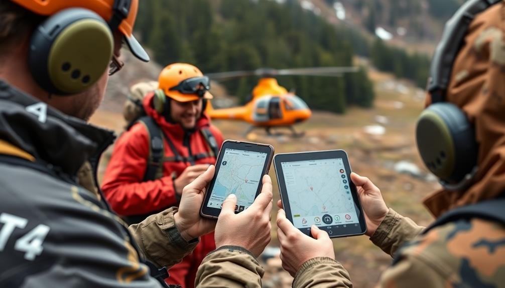
Real-time communication platforms are vital for SAR teams to coordinate efforts and share essential information. These tools enable instant messaging, voice calls, and video conferencing, allowing team members to stay connected regardless of their location.
You'll find that popular platforms like Slack, Microsoft Teams, or Zello offer features tailored for emergency response situations.
When choosing a platform, consider its reliability in areas with poor connectivity. Look for options that work well on mobile devices and can function offline or with limited internet access. Make sure the platform has end-to-end encryption to protect sensitive information during operations.
Many SAR-specific communication tools integrate GPS tracking, allowing you to monitor team members' locations in real-time. This feature is vital for maintaining situational awareness and coordinating search patterns effectively.
Some platforms also offer message prioritization, making certain that urgent communications are highlighted and don't get lost in the flow of information.
To maximize efficiency, train your team on the chosen platform before deployment. Establish clear communication protocols and designate channels for different aspects of the operation, such as logistics, medical support, and command updates.
Regularly test and update your communication systems to make certain they're always ready for action.
Mapping and Geospatial Software
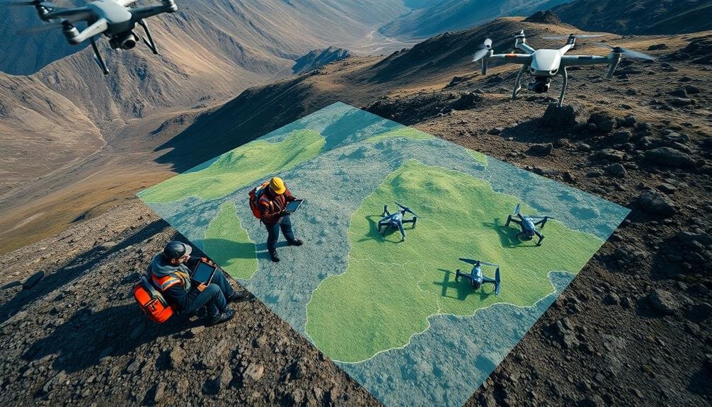
SAR teams' effectiveness hinges on accurate mapping and geospatial software. You'll find these tools indispensable for planning operations, tracking team movements, and identifying potential search areas. Modern geospatial software integrates satellite imagery, topographic data, and real-time GPS information to create all-encompassing, interactive maps.
You'll want to take into account software that offers features like terrain analysis, weather overlays, and the ability to plot search patterns. Many platforms now include mobile apps, allowing field teams to access and update maps in real-time. This connectivity guarantees all team members are working with the most current information.
| Software Feature | Emotional Impact |
|---|---|
| 3D terrain visualization | Confidence |
| Real-time team tracking | Security |
| Weather integration | Preparedness |
When selecting mapping software, prioritize user-friendliness and compatibility with your existing systems. Look for options that support offline functionality, as you may operate in areas with limited connectivity. Training your team to proficiently use these tools is essential. Regular practice scenarios will help members become adept at interpreting geospatial data and making informed decisions in the field.
Cloud-Based Data Storage Solutions

With geospatial data and maps securely in hand, you'll need a reliable way to store and share this information across your SAR team. Cloud-based data storage solutions offer an ideal platform for this purpose. They provide seamless access to critical information from any device, guaranteeing your team can retrieve essential data in the field.
Consider using services like Dropbox, Google Drive, or Microsoft OneDrive for their user-friendly interfaces and robust sharing capabilities. These platforms allow you to organize files into folders, set access permissions, and enable real-time collaboration on documents.
For more specialized needs, you might opt for emergency management-focused solutions like D4H or RespondersCloud, which offer features tailored to SAR operations.
When choosing a cloud storage solution, prioritize security, reliability, and ease of use. Look for end-to-end encryption, two-factor authentication, and regular backups to protect sensitive information.
Confirm the platform integrates well with your existing tools and provides offline access for areas with poor connectivity. Train your team thoroughly on using the chosen platform to maximize its benefits and maintain operational efficiency during critical SAR missions.
Mission Planning Applications
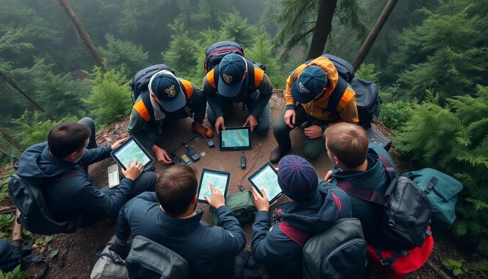
Effective mission planning is essential for successful SAR operations, and specialized applications can streamline this process. You'll find numerous mission planning tools designed specifically for SAR teams, each offering unique features to enhance your team's efficiency.
Look for applications that allow you to create detailed operation plans, assign tasks, and track resources in real-time. These tools should offer mapping capabilities, enabling you to plot search areas, mark key locations, and visualize terrain. Many apps integrate weather data and satellite imagery, helping you anticipate potential challenges and adapt your strategies accordingly.
Consider platforms that facilitate team communication and information sharing during the planning phase. You'll want features like collaborative editing, task checklists, and document storage to guarantee everyone's on the same page.
Some advanced mission planning applications offer scenario modeling and simulation capabilities. These features can help you test different approaches and identify potential bottlenecks before deploying your team.
When selecting a mission planning tool, prioritize user-friendliness and mobile compatibility. Your team should be able to access and update plans easily, even in the field.
Video Streaming and Analysis Tools
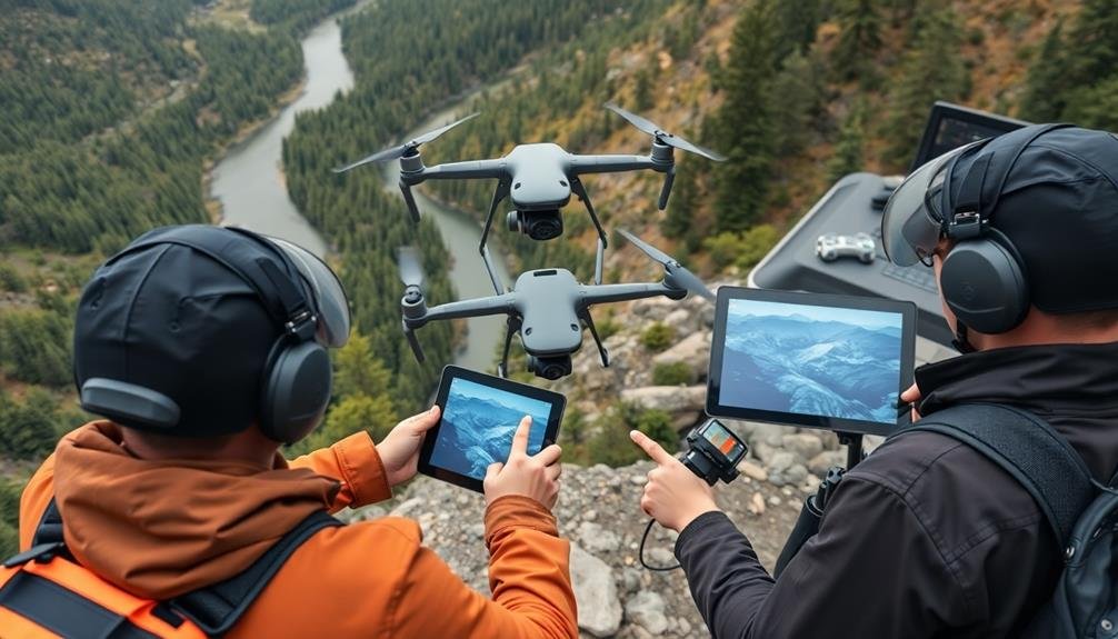
In the domain of modern SAR operations, video streaming and analysis tools have become invaluable assets. These technologies allow you to transmit real-time footage from drones, helicopters, or ground teams to your command center and other units. You'll gain a thorough view of the search area, enabling faster decision-making and more efficient resource allocation.
Live video feeds help you identify potential clues, assess terrain conditions, and track moving targets. You can use advanced analysis software to enhance image quality, detect heat signatures, or apply object recognition algorithms. This helps you spot missing persons or hazards that might be missed by the human eye alone.
Some video analysis tools offer features like automatic geolocation tagging, which pinpoints the exact coordinates of observed objects or persons. You'll also find solutions that integrate with mapping software, allowing you to overlay video data onto topographic maps for better spatial awareness.
When selecting video streaming and analysis tools, consider factors like bandwidth requirements, compatibility with your existing equipment, and ease of use in field conditions.
Training your team to effectively utilize these tools is essential for maximizing their potential in SAR missions.
Frequently Asked Questions
How Can SAR Teams Ensure Data Security When Using Collaboration Tools?
You should use encrypted communication channels, implement multi-factor authentication, and establish strict access controls. Train your team on data security practices, regularly update software, and backup data securely. Consider using specialized SAR-focused platforms with built-in security features.
What Training Is Required for Team Members to Use These Tools Effectively?
You'll need thorough training on tool functionality, data entry protocols, and information sharing best practices. Hands-on practice sessions, regular refresher courses, and ongoing technical support are essential for mastering these tools and ensuring effective team collaboration.
How Do These Tools Integrate With Existing Emergency Management Systems?
You'll find these tools often integrate seamlessly with existing emergency management systems. They'll sync data, share information, and provide real-time updates. You can expect improved communication, resource management, and decision-making across your entire emergency response network.
Are There Offline Capabilities for Areas With Limited Internet Connectivity?
Yes, you'll find many SAR tools offer offline capabilities. They'll allow you to download maps, data, and vital information beforehand. You can sync updates when connectivity's restored, ensuring you're never left without critical resources in remote areas.
What Are the Cost Considerations for Implementing These Tools in SAR Operations?
You'll find costs vary widely depending on the tools you choose. Consider licensing fees, hardware requirements, and training expenses. Don't forget to factor in ongoing maintenance and potential upgrades. Weigh these against the potential benefits to your operations.
In Summary
You've now got the essential tools to boost your SAR team's efficiency. By implementing real-time communication, advanced mapping software, cloud storage, mission planning apps, and video analysis tools, you'll streamline operations and save more lives. Don't hesitate to integrate these technologies into your workflow. Remember, every second counts in search and rescue. Stay up-to-date with the latest advancements and train your team regularly. You're now better equipped to face any SAR challenge head-on.
As educators and advocates for responsible drone use, we’re committed to sharing our knowledge and expertise with aspiring aerial photographers.


Leave a Reply