Mapping golf courses from above offers you a thorough aerial perspective that transforms course management, design, and player experience. You'll gain precise layout visualization, enabling efficient maintenance planning and enhanced gameplay strategies. It allows for detailed environmental impact assessments, soil analysis, and drainage evaluation. You can monitor vegetation health, identify safety risks, and create engaging marketing materials. This bird's-eye view provides invaluable insights for course improvements, resource allocation, and sustainability efforts. By harnessing the power of aerial mapping, you'll reveal a wealth of benefits that can elevate your golf course to new heights. There's so much more to discover about this game-changing approach.
Aerial Perspective Advantages
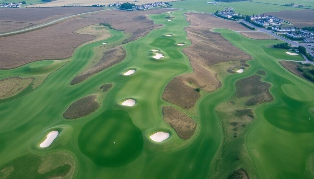
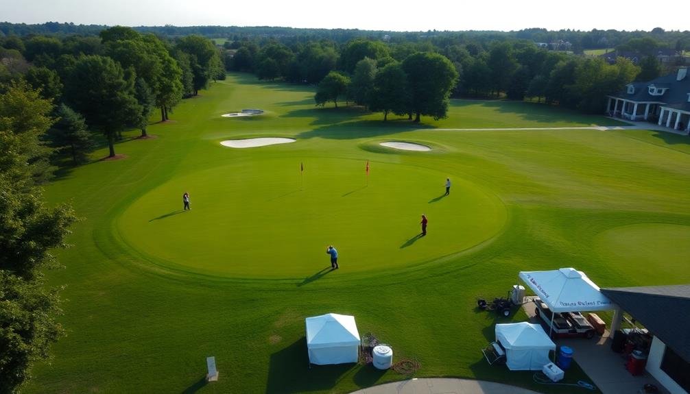
When you map a golf course from above, you're gaining a powerful vantage point. This aerial perspective offers numerous advantages that ground-level mapping simply can't match. You'll see the entire layout at once, allowing you to understand the course's overall design and flow.
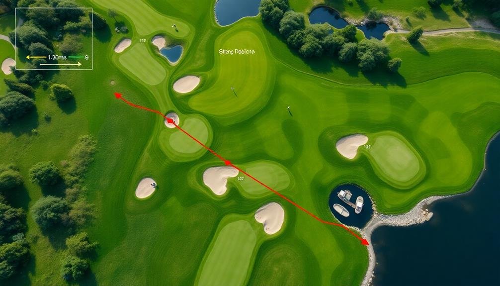
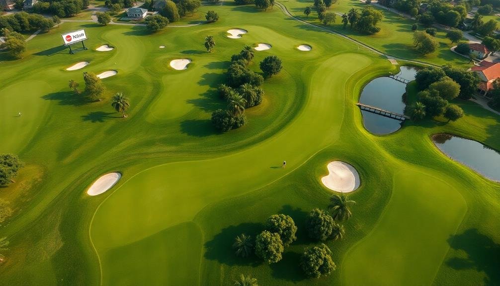
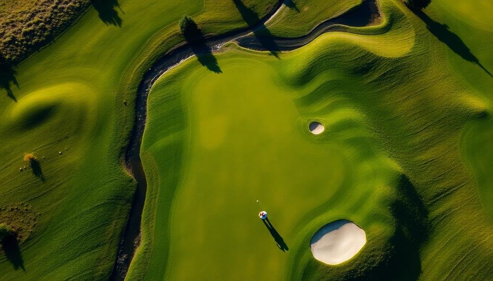
From above, you can easily identify hazards, bunkers, and water features that might be obscured from ground level. You'll also get a clear view of the course's topography, including elevation changes and undulations that affect play. This bird's-eye view helps you spot intricate details like fairway contours and green complexes.
You can accurately measure distances between key points on the course, aiding in strategic planning for both players and course managers. Aerial mapping enables you to create precise, high-resolution images and 3D models of the course. These tools are invaluable for course designers, maintenance teams, and marketing efforts.
You'll be able to track changes in the course over time, monitor turf health, and plan improvements more effectively. The aerial perspective also allows you to assess environmental impacts and manage natural resources more efficiently, ensuring the course's long-term sustainability.
Precise Course Layout Visualization
When you map a golf course, you'll gain a precise visualization of its layout.
You'll see an accurate hole-by-hole representation, allowing you to identify hazards and obstacles easily.
This detailed view also enables precise yardage measurements, enhancing your understanding of the course's challenges and distances.
Accurate Hole-By-Hole Representation
A key benefit of mapping golf courses is the ability to create an accurate hole-by-hole representation. You'll get a precise view of each hole's layout, including its length, shape, and hazards. This detailed information helps you plan your strategy and improve your game.
With an accurate hole-by-hole representation, you can:
| Benefits | Applications |
|---|---|
| Visualize course features | Plan shot strategies |
| Measure exact distances | Choose appropriate clubs |
| Identify hazard locations | Avoid potential penalties |
These representations allow you to study the course before playing, giving you a competitive edge. You'll know exactly where to aim, what obstacles to avoid, and how to navigate each hole effectively.
Moreover, accurate hole-by-hole representations are invaluable for course managers and designers. They can use this information to make informed decisions about course improvements, maintenance, and redesigns. It's also useful for tournament organizers who need to set up challenging pin positions and tee boxes.
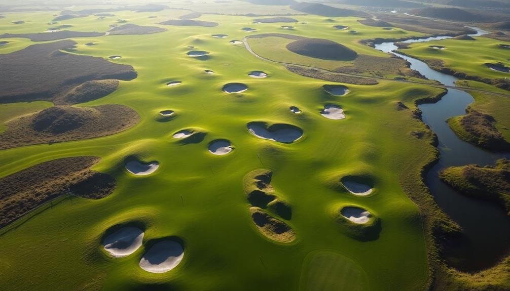
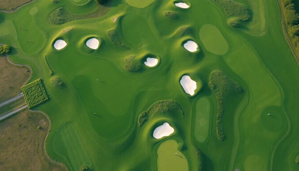
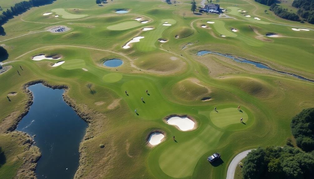
Hazard and Obstacle Identification
Hazard and obstacle identification is a crucial aspect of golf course mapping. When you map a golf course from above, you'll gain an extensive view of all the challenges players face. This bird's-eye perspective allows you to accurately pinpoint and document various hazards and obstacles that mightn't be immediately visible from ground level.
By mapping golf courses, you can:
- Identify water hazards, including ponds, streams, and wetlands
- Locate sand bunkers and their precise contours
- Spot tree lines, wooded areas, and individual trees that may affect play
- Detect out-of-bounds areas and course boundaries
This detailed hazard and obstacle identification helps golfers plan their strategies more effectively. You'll be able to create precise course guides that highlight potential trouble spots, giving players the information they need to make informed decisions during their rounds.
Course managers can also use this data to assess the layout's difficulty and make adjustments if necessary. Additionally, accurate hazard mapping aids in maintenance planning, allowing groundskeepers to efficiently allocate resources and address potential problem areas before they impact play.
Yardage Measurement Precision
Mapping golf courses goes beyond hazard identification to offer unparalleled yardage measurement precision. Aerial mapping allows you to visualize the entire course layout with remarkable accuracy, providing precise distances between key points.
You'll gain access to exact measurements from tee boxes to greens, fairway lengths, and distances to various hazards. This level of precision enhances your game strategy and club selection. You'll know exactly how far you need to hit the ball to reach your target, whether it's clearing a water hazard or landing on the green.
Course managers can use this data to fine-tune their yardage markers and guarantee they're providing players with accurate information. Aerial mapping also allows for detailed analysis of each hole's shape and contours. You can see subtle elevation changes and fairway undulations that mightn't be apparent from ground level.
This information helps you plan your shots more effectively, accounting for slopes and terrain features that could affect ball roll and trajectory. By leveraging this precise course layout visualization, you'll make more informed decisions on the course, potentially shaving strokes off your game.
Efficient Maintenance Planning
Mapping your golf course enables you to plan maintenance tasks with precision.
You'll be able to allocate resources more effectively, design ideal mowing patterns, and gain valuable insights into water usage across the course.
These advantages lead to improved efficiency, reduced costs, and better overall course conditions for your players.
Targeted Resource Allocation
Through targeted resource allocation, golf course managers can greatly improve their maintenance efficiency.
By mapping your course from above, you'll gain a thorough overview of your entire property, allowing you to pinpoint areas that require the most attention and resources. This bird's-eye view enables you to make data-driven decisions about where to focus your efforts and allocate your budget.
With accurate mapping data, you can:
- Identify problem areas that need immediate attention
- Prioritize maintenance tasks based on urgency and impact
- Optimize irrigation systems to reduce water waste
- Allocate staff and equipment more effectively
Optimized Mowing Patterns
Optimizing mowing patterns is a key benefit of mapping your golf course. Aerial imagery and detailed topographical data allow you to plan efficient mowing routes that cover the entire course while minimizing time and fuel consumption.
You'll be able to identify areas that require different mowing frequencies, such as greens, fairways, and rough, and adjust your patterns accordingly.
With accurate maps, you can design mowing patterns that follow the contours of the land, reducing strain on equipment and improving cut quality.
You'll also be able to avoid obstacles like bunkers, water hazards, and trees more effectively, reducing the risk of damage to both the course and machinery.
By analyzing the mapped data, you can determine the ideal direction for mowing stripes, enhancing the visual appeal of your course. This attention to detail can greatly improve the overall aesthetics and playability of your golf course.
Moreover, you can use the maps to train new groundskeepers more efficiently, ensuring consistent mowing practices across your entire staff.
This standardization leads to better course maintenance and a more uniform playing experience for your golfers.
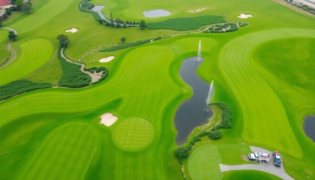
Water Management Insights
Effective water management is another significant advantage of mapping your golf course. By utilizing aerial imagery and mapping technology, you'll gain valuable insights into your course's water usage and distribution patterns. This information allows you to make data-driven decisions about irrigation practices, potentially reducing water consumption and associated costs.
With accurate maps, you can:
- Identify areas of overwatering or underwatering
- Detect leaks or inefficiencies in your irrigation system
- Plan strategic placement of water-conserving features
- Monitor the impact of drainage systems on course conditions
You'll be able to visualize how water flows across your course, helping you pinpoint problem areas that may require additional attention. This knowledge enables you to implement targeted solutions, such as adjusting sprinkler placement or modifying drainage systems.
By optimizing your water management strategies, you'll not only conserve resources but also improve overall course conditions.
Furthermore, mapping your course's water features, such as ponds and streams, allows you to better understand their impact on play and maintenance. You can use this information to enhance the course's aesthetic appeal while ensuring responsible water stewardship.
Enhanced Player Experience
Mapping golf courses leads to a considerably enhanced player experience. You'll gain an all-encompassing view of the entire course layout, allowing you to strategize your game more effectively.
With detailed aerial maps, you can easily identify hazards, bunkers, and water features that mightn't be visible from ground level. This knowledge empowers you to make informed decisions about club selection and shot placement.
You'll also benefit from improved navigation around the course. Accurate maps help you locate tee boxes, greens, and cart paths more efficiently, reducing confusion and saving time. This is especially valuable when playing an unfamiliar course.
Mapped courses often include distance markers and yardage information, enabling you to gauge distances more accurately. You can plan your shots with greater precision, potentially lowering your scores.
Additionally, course maps can highlight unique features or challenging holes, adding excitement to your game. You'll appreciate the course's design and architecture more fully, enhancing your overall golfing experience.
Lastly, digital course maps on mobile devices or golf carts provide real-time information, helping you adapt your strategy as you play. This technology-driven approach modernizes the game and caters to players of all skill levels.
Environmental Impact Assessment

While many golfers focus on improving their game, mapping golf courses serves an important role in environmental impact assessment. You'll find that aerial mapping provides vital data for understanding how golf courses interact with their surrounding ecosystems. By using high-resolution imagery and 3D modeling, you can identify potential environmental concerns and develop strategies to mitigate them.
Mapping golf courses from above allows you to:
- Assess water usage and irrigation efficiency
- Monitor changes in vegetation and wildlife habitats
- Identify areas prone to erosion or drainage issues
- Analyze the impact of course design on local ecosystems
You'll be able to track changes over time, helping course managers make informed decisions about resource allocation and conservation efforts. This data-driven approach enables you to balance the needs of golfers with environmental stewardship.
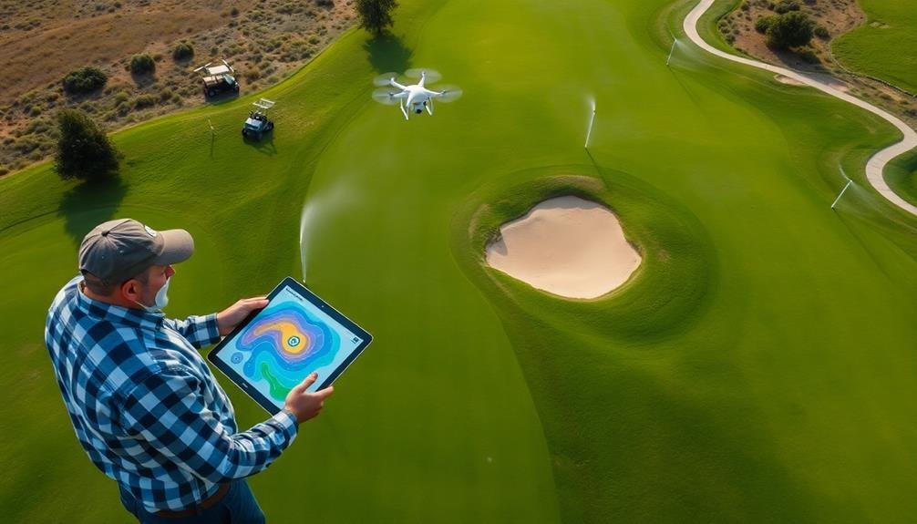
Water Management Optimization
Golf courses are notorious water consumers, but mapping technology can revolutionize how they manage this precious resource. By using aerial mapping and remote sensing, you can identify areas of overwatering, underwatering, and potential water waste. This data allows you to enhance irrigation systems, targeting specific zones that need more or less water.
You'll be able to visualize moisture levels across the entire course, spotting patterns and anomalies that aren't visible from the ground. This information helps you adjust watering schedules and amounts, reducing overall water consumption while maintaining ideal turf health.
You can also detect leaks in irrigation systems more quickly, preventing water loss and potential damage to the course.
Moreover, you'll gain insights into how water flows across the landscape, enabling you to design better drainage systems and water retention areas. This knowledge can help you capture and reuse rainwater, further reducing your reliance on external water sources.
Hazard and Obstacle Identification

Three key benefits emerge when you use mapping technology to identify hazards and obstacles on a golf course.
First, you'll gain a thorough overview of potential risks, allowing for better course management and player safety.
Second, you'll streamline maintenance efforts by pinpointing areas that require attention.
Third, you'll enhance the overall golfing experience by providing accurate information to players.
Aerial mapping technology offers unparalleled accuracy in identifying:
- Sand bunkers and their precise boundaries
- Water hazards, including ponds, streams, and wetlands
- Out-of-bounds areas and property lines
- Natural obstacles like trees, rocks, and steep terrain
By utilizing high-resolution imagery and advanced software, you can create detailed maps that highlight these features with precision.
This information proves invaluable for course designers, groundskeepers, and players alike.
You'll be able to strategically place tee boxes, assess the need for protective measures, and plan maintenance schedules more effectively.
Moreover, accurate hazard identification aids in rule compliance and fair play.
Players can make informed decisions about club selection and shot strategies, leading to a more enjoyable and challenging round of golf.
With this technology, you're not just mapping a course; you're elevating the entire golfing experience.
Modernizing Course Design
Mapping technologies can revolutionize your approach to golf course design.
You'll achieve unparalleled precision in layout planning, allowing you to optimize resource allocation for elements like irrigation and landscaping.
Precision in Layout Planning
Modern technology has revolutionized the way golf course architects approach layout planning. With aerial mapping and advanced software, you'll find that precision in course design has reached new heights. You can now visualize and plan every aspect of a golf course with remarkable accuracy before breaking ground.
This level of precision allows you to:
- Optimize hole placement for challenging yet fair gameplay
- Strategically position hazards and bunkers
- Maximize the use of natural terrain features
- Guarantee proper drainage and irrigation placement
By leveraging these tools, you're able to create more environmentally friendly and sustainable courses. You can minimize land disturbance and preserve native habitats while still designing world-class golf experiences.
The ability to analyze topography, soil conditions, and vegetation from above helps you make informed decisions about course routing and construction.
This precision in layout planning also translates to cost savings. You can identify potential issues early in the design process, reducing expensive modifications during construction.
Additionally, you're able to create more accurate material estimates, streamlining the procurement process and minimizing waste. Ultimately, this technology-driven approach results in golf courses that aren't only more enjoyable to play but also more efficient to build and maintain.
Optimizing Resource Allocation
Building on the precision afforded by modern mapping technology, you can now optimize resource allocation throughout the golf course design process. Aerial mapping allows you to visualize the entire course layout, helping you identify areas that require more attention or resources.
You'll be able to pinpoint where irrigation systems are most needed, reducing water waste and ensuring efficient distribution across the course. By analyzing topographical data, you can determine the best locations for sand traps, water hazards, and other features, minimizing earthwork costs while maximizing playability.
You'll also be able to plan tree placement strategically, considering factors like shade, wind protection, and aesthetic appeal. This data-driven approach helps you allocate your budget more effectively, focusing on areas that will have the greatest impact on the course's overall quality and player experience.
Moreover, mapping technology enables you to identify potential problem areas before construction begins, saving time and money on future repairs. You can also use this information to create more sustainable designs, incorporating natural features and minimizing environmental impact.
Enhancing Player Experience
Elevating the player experience is at the heart of modern golf course design, and mapping technology plays an essential role in this evolution. You'll find that aerial mapping provides designers with a thorough view of the course, allowing them to craft more engaging and challenging layouts.
By leveraging detailed topographic data, designers can create strategically placed hazards, undulating greens, and fairways that blend seamlessly with the natural landscape.
Mapping technology enables you to:
- Visualize different tee box positions for varying skill levels
- Optimize sight lines and create visually stunning vistas
- Plan for improved drainage and reduce maintenance issues
- Identify areas for environmental conservation and wildlife corridors
With accurate 3D models of the course, you can now experience virtual fly-throughs and preview proposed changes before implementation. This technology allows for more efficient and cost-effective redesigns, ensuring that every modification enhances your gameplay.
Additionally, precise mapping data helps in creating detailed yardage books and course guides, giving you a strategic edge during your rounds. By incorporating mapping technology into course design, golf clubs can offer you a more immersive, challenging, and enjoyable experience that keeps you coming back for more.
Marketing and Promotion Opportunities
Leveraging mapped golf course data opens up a wealth of marketing and promotion opportunities for golf clubs and related businesses. You can create visually stunning course guides, brochures, and website content that showcase your course's unique features and layout. These high-quality visuals will attract potential players and help you stand out from competitors.
You'll also be able to highlight specific holes or areas of interest, such as signature par-3s or challenging water hazards. This targeted approach allows you to market your course's strengths and appeal to different player segments.
Additionally, you can use mapped data to create virtual flyovers or interactive hole-by-hole previews, giving potential visitors a taste of what to expect. Mapped course data enables you to develop custom mobile apps or integrate with existing golf platforms, providing players with on-course information and enhancing their overall experience.
This technology-driven approach can position your course as modern and player-friendly. Finally, you can use mapped data to create personalized marketing campaigns, targeting players based on their preferences or skill levels, and offering tailored promotions or packages that align with your course's unique attributes.
Tournament Preparation and Planning
Mapped golf course data comes in handy when you're gearing up for tournaments. It provides a thorough overview of the course layout, allowing you to plan strategically for each hole.
You'll have accurate measurements of distances, hazards, and green contours at your fingertips, enabling you to make informed decisions about club selection and shot placement.
When preparing for a tournament, you can use mapped data to:
- Identify potential trouble spots and plan alternative routes
- Analyze the best positions for pin placements
- Determine ideal spectator and camera locations
- Plan for logistics such as parking and concession areas
With this information, you're better equipped to create detailed course guides for players and caddies. These guides can include precise yardages, elevation changes, and notable features of each hole.
You'll also be able to efficiently plan for course setup, including tee box placements and rough lengths.
Moreover, mapped data helps you anticipate potential bottlenecks in player flow, allowing you to refine tee times and minimize delays.
Soil Analysis and Treatment

While tournament preparation focuses on the course's surface features, understanding what lies beneath is equally important. Soil analysis and treatment are essential for maintaining a healthy, playable golf course. You'll want to map the soil composition across different areas to identify variations that may affect grass growth and drainage.
Using aerial mapping, you can pinpoint areas that require specific treatments or amendments. This data allows you to make informed decisions about fertilization, irrigation, and pest control. You'll be able to address issues like compaction, nutrient deficiencies, or pH imbalances more effectively.
Here's how soil analysis impacts your course management:
| Soil Factor | Impact on Course |
|---|---|
| pH Level | Nutrient availability |
| Texture | Drainage and root growth |
| Organic Matter | Water retention |
| Salinity | Grass stress tolerance |
| Compaction | Aeration needs |
Drainage System Evaluation
You'll gain valuable insights into your golf course's water management by mapping its drainage systems.
By identifying water flow patterns, you can pinpoint areas prone to flooding or erosion, enabling targeted improvements.
Locating problematic drainage areas allows you to address issues proactively, ensuring ideal playability and turf health throughout your course.
Identifying Water Flow Patterns
Identifying water flow patterns on a golf course is vital for effective drainage system evaluation. When you map a course from above, you'll gain valuable insights into how water moves across the landscape. This aerial perspective allows you to spot potential problem areas and enhance drainage solutions.
By analyzing water flow patterns, you can:
- Locate low-lying areas prone to ponding
- Identify natural drainage channels and runoff routes
- Assess the effectiveness of existing drainage infrastructure
- Predict potential erosion hotspots
You'll be able to see how water travels during heavy rainfall events, which helps in planning for proper drainage. This information is essential for maintaining playability and preventing damage to the course.
With aerial mapping, you can easily detect areas where water tends to accumulate, allowing you to address these issues proactively.
Understanding water flow patterns also helps you design more efficient irrigation systems. You'll be able to place sprinklers strategically, ensuring optimal coverage while minimizing water waste.
This knowledge is particularly valuable in regions with water scarcity or strict conservation regulations.
Locating Problematic Drainage Areas
Aerial mapping shines a spotlight on problematic drainage areas throughout the golf course. You'll quickly identify low-lying spots where water tends to accumulate, potentially causing soggy fairways and waterlogged greens. These areas can negatively impact playability and turf health, making them essential targets for improvement.
By analyzing high-resolution imagery, you can pinpoint areas with poor surface drainage, inadequate slope, or compacted soil. You'll also spot locations where existing drainage systems may be failing or insufficient. This birds-eye view allows you to assess the entire course at once, revealing patterns and connections that might be missed from ground level.
Armed with this information, you can prioritize areas for drainage improvements and develop targeted solutions. You might consider installing new drainage pipes, reshaping terrain, or implementing specialized turf management practices in problem spots. The aerial data helps you make informed decisions about where to allocate resources for maximum impact.
Moreover, you can use the mapped data to track changes over time, monitoring the effectiveness of your drainage improvements and adjusting your strategies as needed.
Vegetation Health Monitoring
Vegetation health monitoring is a critical aspect of golf course management. By mapping your course from above, you'll gain valuable insights into the overall health and condition of your turf and other vegetation. This aerial perspective allows you to identify problem areas quickly and efficiently, enabling you to take proactive measures to maintain the pristine conditions golfers expect.
With vegetation health monitoring, you can:
- Detect early signs of disease or pest infestations
- Identify areas of drought stress or overwatering
- Assess the effectiveness of fertilization programs
- Monitor the impact of foot traffic on turf quality
By regularly mapping your course, you'll be able to track changes in vegetation health over time. This data helps you make informed decisions about irrigation schedules, fertilizer applications, and pest control measures.
You'll also be able to pinpoint areas that may require additional attention or specialized treatments.
Aerial mapping technology, such as NDVI (Normalized Difference Vegetation Index) imaging, can provide detailed information about chlorophyll levels and plant vigor. This allows you to address issues before they become visible to the naked eye, maintaining the lush, green appearance that golfers love throughout your course.
Safety and Risk Management
In addition to maintaining course aesthetics, mapping golf courses plays a crucial role in safety and risk management. You'll be able to identify potential hazards and risks more effectively with an aerial view of the entire course. This birds-eye perspective allows you to spot areas that may pose dangers to players, staff, or equipment.
You can use mapping data to:
| Safety Aspect | Risk Management |
|---|---|
| Identify blind spots | Plan emergency routes |
| Locate water hazards | Assess tree health |
| Mark steep slopes | Track wildlife activity |
| Highlight bunkers | Monitor weather impacts |
By analyzing this information, you'll make informed decisions about course improvements and safety measures. You can prioritize areas that need attention, such as installing safety netting or improving signage in high-risk zones. Mapping also helps you plan for emergencies by identifying the quickest routes for first responders to reach any part of the course.
Regular aerial mapping allows you to track changes over time, helping you stay proactive in addressing potential safety issues before they become serious problems. This approach not only enhances player safety but also reduces liability risks for your golf course.
Frequently Asked Questions
How Much Does It Cost to Map a Golf Course From Above?
You'll find costs vary widely for mapping a golf course from above. It typically ranges from $500 to $5,000, depending on the course size, mapping method (drone or satellite), and level of detail required for your project.
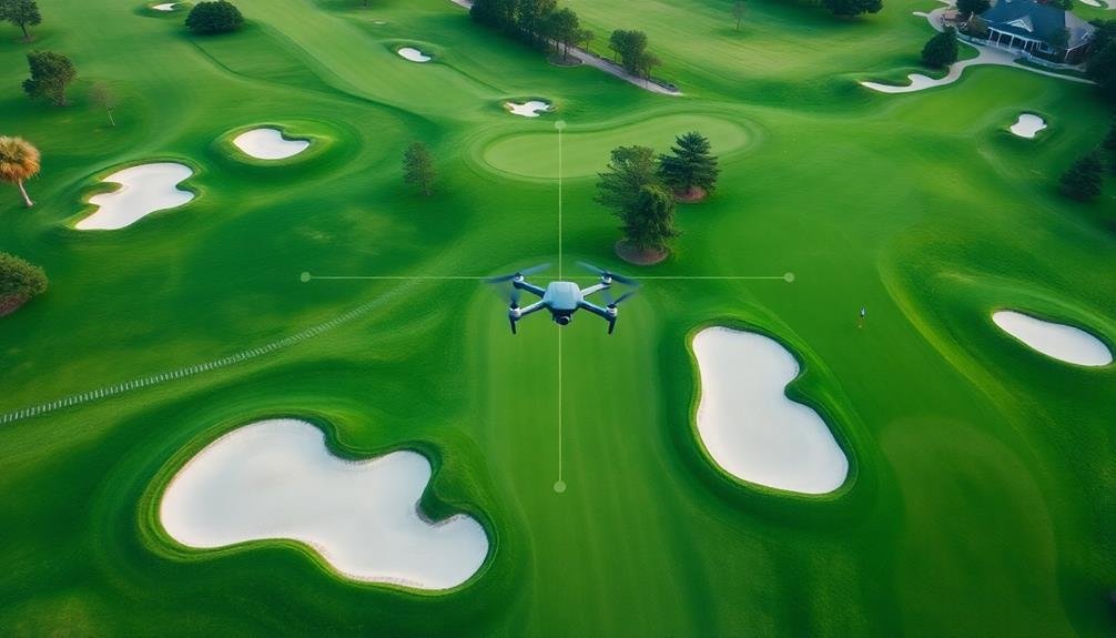
What Equipment Is Needed for Aerial Golf Course Mapping?
You'll need a drone equipped with a high-resolution camera, GPS, and mapping software. Don't forget extra batteries, memory cards, and a tablet or laptop for real-time monitoring. A landing pad's helpful for takeoffs and landings.
How Often Should a Golf Course Be Remapped From Above?
You should remap your golf course from above every 1-2 years. It'll help you track changes, update your course management, and improve player experience. More frequent mapping may be needed if you're making significant renovations or alterations.
Can Aerial Mapping Detect Underground Features Like Irrigation Systems?
Yes, you can detect underground irrigation systems with aerial mapping. You'll need specialized techniques like ground-penetrating radar or thermal imaging. These methods can reveal buried pipes and water flow patterns beneath the surface of golf courses.
Are There Legal Restrictions on Flying Drones Over Golf Courses?
You'll need to check local regulations, as drone restrictions vary. Many golf courses prohibit drone use without permission. It's best to contact the course management directly to avoid legal issues or fines when flying over their property.
In Summary
You've seen how mapping golf courses from above offers numerous benefits. It's not just about creating stunning visuals; it's a powerful tool for course management and player satisfaction. By embracing aerial mapping, you'll improve maintenance efficiency, enhance the golfing experience, and make informed decisions about environmental impact. Whether you're a course manager or an avid golfer, this bird's-eye view will revolutionize your understanding and appreciation of the game. It's time to elevate your perspective on golf course management.
As educators and advocates for responsible drone use, we’re committed to sharing our knowledge and expertise with aspiring aerial photographers.


Leave a Reply